


VERIFIED REVIEWS


About hiring a car in Phoenix
Best Car Rental Deals

Hyundai Venue | Automatic
SMALLor Small similar

Volkswagen Jetta | Automatic
SEDANor Sedan similar
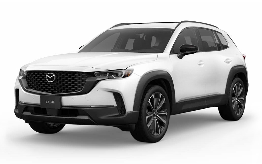
Mazda CX 50 | Automatic
SUVor SUV similar

Audi A6 | Automatic
or SUV similar

Chrysler Pacifica 7 Passengers | Automatic
MINIVANor Minivan similar

Audi A4 | Automatic
LUXURYor Luxury similar

Ford Transit 12 Passengers | Automatic
12 PASSENGERSor 12 Passengers similar
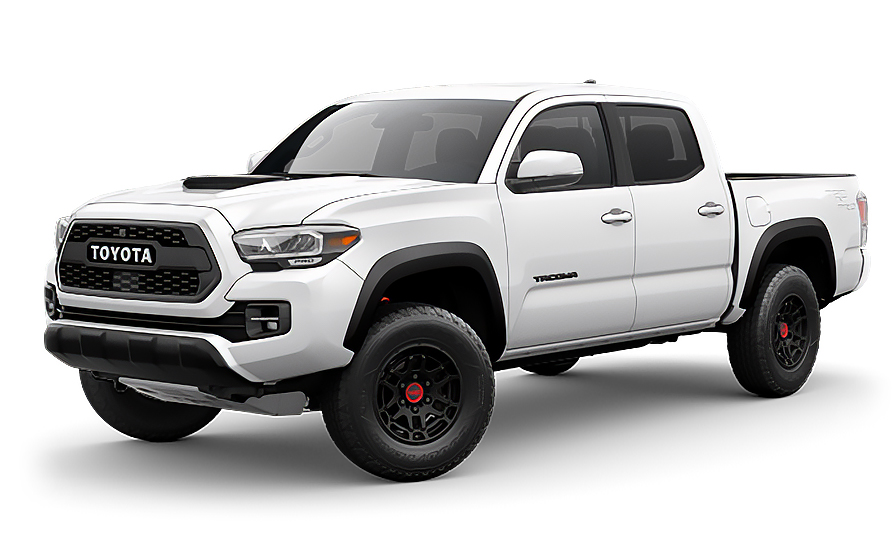
Toyota Tacoma | Automatic
PICKUPor Pickup similar
Traveler Tips & Price Insights
When is the best time to book a rental car in Phoenix?
You should book your rental car approximately 7 days before your trip to get a below-average price.
Price Trend (Last 90 Days)
What is the most popular rental car type in Phoenix?
sedan rental cars (sedan or similar) are the most popular option in Phoenix.
Popular Car Types
Which is the cheapest car rental agency in Phoenix?
In the last 72 hours, the cheapest rental cars were from Budget at /day.
Average Price by Rental Company
Frequently Asked Questions
What does my Hola Car Rentals booking in Phoenix include that other companies don't offer?
Hola Car Rentals is the only premium partner of the top car hire brands operating in Phoenix, giving you exclusive access to our All Inclusive+ rate. This rate includes benefits that no other company can match:
- Free liability coverage starting at US$ 300,000 in case of an accident (applies only to certain rates and itineraries)
- Toll cashback: recover up to 5% of the reservation's total value for toll charges incurred during your hire period
- Premium travel medical assistance providing up to US$ 150,000 in coverage for a maximum of 5 passengers in case of a medical emergency, excluding pre-existing conditions
- No Extra Charges© guarantee: if the counter charges you for something not listed on your confirmation and not an optional add-on you accepted, Hola Car Rentals will work to remove or reimburse the charge after verification
All of this comes at no extra cost, ensuring a fully protected car hire experience and peace of mind throughout your trip in Phoenix.
Will I face unexpected charges at the counter when I hire a car at Phoenix Airport through Hola Car Rentals?
No. With Hola Car Rentals, all costs and charges for your booking at Phoenix Airport are clearly shown at the time of reservation and in your confirmation email, so you know exactly what you are paying before you arrive at the counter.
On top of that, every Hola Car Rentals booking includes the No Extra Charges© guarantee. This is a pricing guarantee (not insurance) that protects you if the counter at Phoenix Airport charges you for something that was not listed on your confirmation and was not an optional add-on you accepted. If that happens, Hola Car Rentals will work with the hire partner to remove or reimburse the charge after verification.
The only costs outside this guarantee are:
- Optional add-ons you choose at the counter (GPS, child seats, prepaid fuel)
- Usage-based charges (tolls, fuel shortfall, traffic fines)
How do I get from Phoenix Sky Harbour terminals to the hire car counter?
All hire car companies serving Phoenix Sky Harbour International Airport (PHX) operate from the Hire Car Centre (HCC), a separate facility located at 1805 E Sky Harbour Circle South. You cannot walk there from the terminals.
After collecting your luggage, follow the overhead signs for the PHX Sky Train. The train is free, runs 24 hours a day, 7 days a week, and departs every 3 to 5 minutes. The journey takes approximately 5 minutes from Terminal 3 and 8 to 10 minutes from Terminal 4.
Once you exit at the Hire Car Centre station, look for the counter logo that matches the brand shown in your booking confirmation. Partners available at the Phoenix HCC include Avis, Budget, Hertz, Alamo, Enterprise, National, Dollar, Thrifty, and Payless.
Allow 15 to 30 minutes in total from baggage reclaim to reaching your counter, and allow extra time during peak travel periods when queues may be longer.
Are there toll roads in Phoenix or anywhere in Arizona?
No, Arizona has no toll roads, so you will not encounter any toll charges while driving in or around Phoenix.
Unlike other US destinations such as Florida, Texas, or California, there are no cashless toll lanes, toll plazas, or electronic toll systems operating anywhere in Arizona. You do not need a transponder, and your rental company will not bill you for tolls for routes driven within the state.
Some rental companies offer optional e-Toll enrolment programmes at the Phoenix counter, but these are unnecessary for driving in Arizona. You can safely decline them without any risk of toll violations or fees.
If your trip includes driving into neighbouring states such as California, toll roads may apply there. In that case, the Tolls Cashback benefit included with your booking allows you to claim up to 5% of your total booking value back for any tolls paid during your hire period.
What documents do I need to pick up a hire car in Phoenix?
To collect your hire car in Phoenix, you must bring the following physical documents:
- A valid, original driving licence in the main driver’s name
- A major credit card with the driver’s name printed on it, for the authorisation hold
- A valid passport or government-issued photo ID
- Your booking confirmation or printed voucher
- Round-trip flight or cruise tickets (required for visitors from outside the US)
If your driving licence is not in English and does not use a Latin (Roman) alphabet, such as Arabic, Chinese, Japanese, or Cyrillic script, an International Driving Permit (IDP) is mandatory. For other non-English licences, an IDP is strongly recommended. The IDP is a translation only and must be carried alongside your original licence.
All documents must be physical. Digital copies shown on a phone or tablet are not accepted at the Phoenix hire desk. Debit and prepaid cards are not accepted for the authorisation hold.
Does my booking include Tolls Cashback if I drive outside Phoenix into toll areas?
Yes, all bookings include the Tolls Cashback benefit, which can be useful if your Phoenix hire takes you into states or regions where toll roads exist.
Since Arizona itself has no toll roads, you will not pay any tolls while driving within Phoenix or anywhere in the state. However, if you drive into neighbouring states such as California, where toll roads are common, you can claim back up to 5% of your total booking value for tolls paid during the hire period.
To claim your cashback after returning the vehicle in Phoenix:
- Email [email protected] within 30 days of vehicle return
- Include your Hola Car Rentals reservation confirmation
- Attach a copy of the hire agreement signed at collection
- Provide a receipt or statement showing the toll charges paid
Refunds are issued to the original payment method used for your booking and typically process within 7 to 10 working days after approval. Late submissions received after 30 days are not accepted.
What is the minimum age to hire a car in Phoenix?
In Phoenix, the minimum age to hire a car without additional surcharges is 25. Drivers aged 21 to 24 can hire but will be subject to a daily young-driver surcharge, and most vehicle classes are restricted to drivers aged 25 and over.
Vehicle classes typically restricted to drivers under 25 include full-size saloons, SUVs, minivans, vans, convertibles, luxury, and premium categories. Drivers aged 21 to 24 are generally limited to economy, compact, medium saloon, standard saloon, compact SUV, and medium SUV categories.
Typical young-driver surcharge amounts at Phoenix counters vary by partner:
- Avis, Budget, and Payless: US$13 per hire day plus taxes, capped at US$65 plus taxes
- Hertz, Dollar, and Thrifty: US$13.50 per hire day plus taxes, capped at US$189 plus taxes
- Alamo, National, and Enterprise: US$15 per day plus taxes
Drivers from Latin America and the Caribbean aged 21 to 24 may qualify for a young-driver fee waiver on eligible Avis and Budget rates booked through Hola Car Rentals. Check your booking confirmation to see if this waiver applies to your Phoenix reservation.
How does the reversible lane system on 7th Street and 7th Avenue work in Phoenix?
Phoenix uses reversible lanes on two major parallel routes into and out of the city centre: 7th Street and 7th Avenue. These lanes switch direction depending on the time of day, typically flowing inbound towards the centre in the morning and outbound in the evening.
This system has been in place for approximately 50 years and can be disorientating if you are not expecting it. Lanes that appear to be heading in one direction during your morning drive may be reversed by the time you return in the evening.
When driving your hire car in Phoenix, pay close attention to posted signage and overhead signals on these routes before entering a reversible lane. Do not rely solely on the general flow of traffic, as local drivers familiar with the system may move quickly through lane changes.
If you are unsure, use parallel surface streets or the motorway network to avoid these routes during peak hours. Phoenix's well-organised grid system, anchored at Central Avenue and Washington Street, makes it straightforward to find alternative routes using numbered streets east of Central and numbered avenues west of Central.
How does the fuel policy work for hires at Phoenix Airport?
Hires picked up at Phoenix Airport follow a Full-to-Full fuel policy. You receive the vehicle with a full tank and must return it full to avoid additional charges.
To avoid fuel fees, follow these steps:
- At pickup, confirm the fuel level with the agent and ensure the starting level is recorded on your hire agreement. Take a photo of the dashboard showing the gauge.
- During your hire, use the correct fuel type as shown in the vehicle documentation.
- Before returning to the Phoenix Sky Harbour Circle South, refuel within approximately 10 miles of the return location so the gauge does not drop below full before you arrive.
- Keep your final fuel receipt showing the date, time, and station address.
If you return the vehicle below the recorded starting level at Phoenix Airport, the hire company may charge you for the fuel shortfall at their own refuelling rate, which is typically higher than retail pump prices, plus an administrative service fee. Refuelling near the Phoenix Airport return location before dropping off the vehicle is the most cost-effective approach.
What are the major motorway interchanges in Phoenix that first-time drivers should know?
Phoenix has several complex multi-level motorway interchanges that can be confusing for drivers unfamiliar with the area. Local traffic reports use specific nicknames for these interchanges, and knowing them helps you navigate confidently in your hire car.
- The Stack: where I-10 and I-17 meet west of the city centre near 19th Avenue and McDowell Road. This symmetrical four-level interchange handles approximately 407,000 vehicles per day and is the busiest in the Phoenix area.
- Mini Stack: where I-10, SR-51, and Loop 202 converge south of McDowell Road. The tight ramps connecting I-10 East to SR-51 North require attention at merging speed.
- The Split: near downtown Phoenix where I-17 ends and routes shift between the Maricopa and Black Canyon Freeways.
- Broadway Curve and Durango Curve: sharp 90-degree bends on I-10 and US-60 in the Tempe and Phoenix border area.
Phoenix radio and navigation apps reference these nicknames regularly. If you are hiring a car in Phoenix without a GPS add-on, downloading an offline map before arrival is a practical precaution for navigating these interchanges confidently.
Does travel assistance cover a breakdown or emergency on Phoenix motorways?
Yes, most bookings include travel assistance through Terrawind Global Protection, which provides support in the event of an emergency during your Phoenix hire, including situations that arise on the city’s busy motorway network.
The travel assistance benefit typically covers:
- Medical cover for up to 5 passengers
- Legal assistance in the event of an accident
- Compensation for luggage lost by the airline
- Flight cancellation insurance
This benefit is designed for travellers hiring abroad and is available to non-North American customers. Residents of the US and Canada do not qualify for this benefit.
If you experience an emergency while driving in Phoenix, contact the assistance line first before incurring expenses, as some reimbursements require prior authorisation:
- Phone (24/7, toll-free): +1 888 980 9992
- WhatsApp: +1 208 910 1001
- Email: [email protected]
Have your Hola Car Rentals confirmation number ready when you call. Note that travel assistance does not cover damage to the hire vehicle itself; that is handled by CDW/LDW cover.
Can I add an additional driver to my Phoenix hire car?
Yes, you can add an additional driver to your Phoenix hire car, either as an included benefit or for a daily fee paid at the counter, depending on your rate.
Check your booking confirmation for the line "Additional driver free of charge." If it appears, the first additional driver is included at no extra cost. If it does not appear, the following fees apply at the Phoenix counter:
- Avis, Budget, and Payless: US$13 per hire day plus taxes, capped at US$65 plus taxes
- Hertz, Dollar, and Thrifty: US$13.50 per hire day plus taxes, capped at US$189 plus taxes
- Alamo, National, and Enterprise: US$15 per day plus taxes
The additional driver must be present at the Phoenix collection point with a valid driving licence and, if required, an International Driving Permit. Both the main driver and the additional driver must sign the hire agreement. Anyone who drives the vehicle without being listed on the agreement is not covered by the hire protections.
For Avis, Budget, and Payless hires in Phoenix, additional drivers must generally be at least 25 years old at the time of collection.
What is the fuel policy for hire cars in Phoenix?
Hire cars in Phoenix follow a Full-to-Full fuel policy by default. You receive the vehicle with a full tank and must return it full to avoid additional charges.
At collection at the Phoenix Hire Car Centre, check the fuel gauge with the agent and confirm the starting level is recorded on your hire agreement. Take a photo of the dashboard showing the odometer and fuel gauge before leaving.
When returning your vehicle to the Phoenix HCC, refuel within approximately 10 miles of the location so the gauge does not drop below full before you arrive. Keep your final fuel receipt showing the date, time, and station address.
If you return the vehicle below the recorded starting level, the hire company may charge:
- A fuel shortfall at the partner's refuelling rate, which is typically higher than retail pump prices
- A refuelling service or administrative fee
For after-hours returns at the Phoenix HCC, leave your fuel receipt in the key drop envelope and keep a photo of the full gauge on your phone as proof. The vehicle is checked the next working day, and you remain responsible until then.
Can I pick up a hire car in Phoenix and return it in a different city?
Yes, one-way hires are possible from Phoenix, but a drop-off fee may apply depending on your destination, the hire company, and the vehicle class.
Common patterns for one-way hires originating in Phoenix:
- Phoenix airport to a centre in downtown Phoenix: often no drop-off fee
- Phoenix to another Arizona city: a drop-off fee usually applies and varies by distance and vehicle class
- Phoenix to a different state: a drop-off fee usually applies and can be significant for long-distance routes
- Cross-border returns (for example, Phoenix to Mexico): often restricted or subject to special authorisation
The drop-off fee is shown during the booking process under the "To pay at destination" section and will also appear on your booking confirmation. This fee cannot be prepaid and is paid directly at the Phoenix counter or return location.
If you change your return location after booking, the hire may be re-priced and the drop-off fee recalculated. Always confirm the fee shown on your confirmation matches what the counter presents at collection in Phoenix.
How does the after-hours return process work at the Phoenix Hire Car Centre?
The Phoenix Hire Car Centre (HCC) is open 24 hours a day, 7 days a week, and most hire company counters operate around the clock. However, if you return your vehicle outside of staffed hours, you can use the after-hours key drop process.
To return your Phoenix hire after hours:
- Drive to the return area of the HCC following posted signs for your hire brand
- Park the vehicle in the designated return bay
- Note the vehicle’s mileage and fuel level and take a photo of the dashboard
- Place the keys in the key drop box located in your brand’s return area
- Keep your fuel receipt and any paperwork as proof of return
After an after-hours drop in Phoenix, the vehicle is inspected the next working day. You remain responsible for the vehicle until the hire company formally checks it in. Any fuel shortfall, damage, or other issues noted at inspection may result in charges to your card on file.
To return to the terminals from the Phoenix HCC, take the PHX Sky Train from the top-level walkway of the HCC back to Terminal 3 or Terminal 4. The train runs 24/7 and is free of charge.
RENTAL CAR LOCATIONS

- Choosing a selection results in a full page refresh.
- Opens in a new window.
Suggested Currencies
- $ USD - United States Dollar
- € EUR - Euro
Other Countries
-
 Albania
-
 Algeria
-
 Andorra
-
 Angola
-
 Antigua & Barbuda
-
 Argentina
-
 Australia
-
 Austria
-
 Bahamas
-
 Bahrain
-
 Bangladesh
-
 Barbados
-
 Belgium
-
 Belize
-
 Benin
Benin
-
 Bermuda
-
 Bolivia
-
 Bosnia & Herzegovina
-
 Botswana
-
 Brazil
-
 British Virgin Islands
-
 Bulgaria
-
 Burkina Faso
-
 Burundi
-
 Cameroon
-
 Canada
-
 Cape Verde
-
 Cayman Islands
-
 Central African Republic
-
 Chad
Chad
-
 Chile
Chile
-
 Colombia
-
 Comoros
-
 Congo - Brazzaville
-
 Congo - Kinshasa
-
 Costa Rica
-
 Côte d’Ivoire
-
 Croatia
-
 Curaçao
-
 Cyprus
-
 Czechia
-
 Denmark
-
 Djibouti
-
 Dominica
-
 Dominican Republic
-
 Ecuador
-
 Egypt
Egypt
-
 El Salvador
-
 Equatorial Guinea
-
 Eritrea
-
 Estonia
-
 Eswatini
-
 Ethiopia
-
 Finland
-
 France
-
 Gabon
Gabon
-
 Gambia
-
 Germany
-
 Ghana
Ghana
-
 Greece
-
 Grenada
-
 Guatemala
-
 Guinea
-
 Guinea-Bissau
-
 Guyana
-
 Haiti
Haiti
-
 Honduras
-
 Hong Kong SAR
-
 Hungary
-
 Iceland
-
 India
India
-
 Iraq
Iraq
-
 Ireland
-
 Israel
-
 Italy
Italy
-
 Jamaica
-
 Japan
Japan
-
 Jordan
-
 Kenya
Kenya
-
 Kuwait
-
 Latvia
-
 Lebanon
-
 Lesotho
-
 Liberia
-
 Libya
Libya
-
 Liechtenstein
-
 Lithuania
-
 Luxembourg
-
 Madagascar
-
 Malawi
-
 Mali
Mali
-
 Malta
Malta
-
 Mauritania
-
 Mauritius
-
 Mexico
-
 Moldova
-
 Monaco
-
 Montenegro
-
 Morocco
-
 Mozambique
-
 Namibia
-
 Netherlands
-
 New Zealand
-
 Nicaragua
-
 Niger
Niger
-
 Nigeria
-
 Norway
-
 Oman
Oman
-
 Palestinian Territories
-
 Panama
-
 Paraguay
-
 Peru
Peru
-
 Philippines
-
 Poland
-
 Portugal
-
 Qatar
Qatar
-
 Romania
-
 Russia
-
 Rwanda
-
 San Marino
-
 São Tomé & Príncipe
-
 Saudi Arabia
-
 Senegal
-
 Serbia
-
 Seychelles
-
 Sierra Leone
-
 Singapore
-
 Sint Maarten
-
 Slovakia
-
 Slovenia
-
 Somalia
-
 South Africa
-
 South Korea
-
 South Sudan
-
 Spain
Spain
-
 St. Lucia
-
 St. Vincent & Grenadines
-
 Sudan
Sudan
-
 Sweden
-
 Switzerland
-
 Taiwan
-
 Tanzania
-
 Togo
Togo
-
 Trinidad & Tobago
-
 Tunisia
-
 Türkiye
-
 Turks & Caicos Islands
-
 Uganda
-
 Ukraine
-
 United Arab Emirates
-
 United Kingdom
-
 United States
-
 Uruguay
-
 Vatican City
-
 Venezuela
-
 Yemen
Yemen
-
 Zambia
-
 Zimbabwe
Driving license from:
-
Albania
-
Algeria
-
Andorra
-
Angola
-
Antigua & Barbuda
-
Argentina
-
Australia
-
Austria
-
Bahamas
-
Bahrain
-
Bangladesh
-
Barbados
-
Belgium
-
Belize
-
Benin
-
Bermuda
-
Bolivia
-
Bosnia & Herzegovina
-
Botswana
-
Brazil
-
British Virgin Islands
-
Bulgaria
-
Burkina Faso
-
Burundi
-
Cameroon
-
Canada
-
Cape Verde
-
Cayman Islands
-
Central African Republic
-
Chad
-
Chile
-
Colombia
-
Comoros
-
Congo - Brazzaville
-
Congo - Kinshasa
-
Costa Rica
-
Côte d’Ivoire
-
Croatia
-
Curaçao
-
Cyprus
-
Czechia
-
Denmark
-
Djibouti
-
Dominica
-
Dominican Republic
-
Ecuador
-
Egypt
-
El Salvador
-
Equatorial Guinea
-
Eritrea
-
Estonia
-
Eswatini
-
Ethiopia
-
Finland
-
France
-
Gabon
-
Gambia
-
Germany
-
Ghana
-
Greece
-
Grenada
-
Guatemala
-
Guinea
-
Guinea-Bissau
-
Guyana
-
Haiti
-
Honduras
-
Hong Kong SAR
-
Hungary
-
Iceland
-
India
-
Iraq
-
Ireland
-
Israel
-
Italy
-
Jamaica
-
Japan
-
Jordan
-
Kenya
-
Kuwait
-
Latvia
-
Lebanon
-
Lesotho
-
Liberia
-
Libya
-
Liechtenstein
-
Lithuania
-
Luxembourg
-
Madagascar
-
Malawi
-
Mali
-
Malta
-
Mauritania
-
Mauritius
-
Mexico
-
Moldova
-
Monaco
-
Montenegro
-
Morocco
-
Mozambique
-
Namibia
-
Netherlands
-
New Zealand
-
Nicaragua
-
Niger
-
Nigeria
-
Norway
-
Oman
-
Palestinian Territories
-
Panama
-
Paraguay
-
Peru
-
Philippines
-
Poland
-
Portugal
-
Qatar
-
Romania
-
Russia
-
Rwanda
-
San Marino
-
São Tomé & Príncipe
-
Saudi Arabia
-
Senegal
-
Serbia
-
Seychelles
-
Sierra Leone
-
Singapore
-
Sint Maarten
-
Slovakia
-
Slovenia
-
Somalia
-
South Africa
-
South Korea
-
South Sudan
-
Spain
-
St. Lucia
-
St. Vincent & Grenadines
-
Sudan
-
Sweden
-
Switzerland
-
Taiwan
-
Tanzania
-
Togo
-
Trinidad & Tobago
-
Tunisia
-
Türkiye
-
Turks & Caicos Islands
-
Uganda
-
Ukraine
-
United Arab Emirates
-
United Kingdom
-
United States
-
Uruguay
-
Vatican City
-
Venezuela
-
Yemen
-
Zambia
-
Zimbabwe