


VERIFIED REVIEWS


About renting a car with Hertz in Providence
Best Car Rental Deals
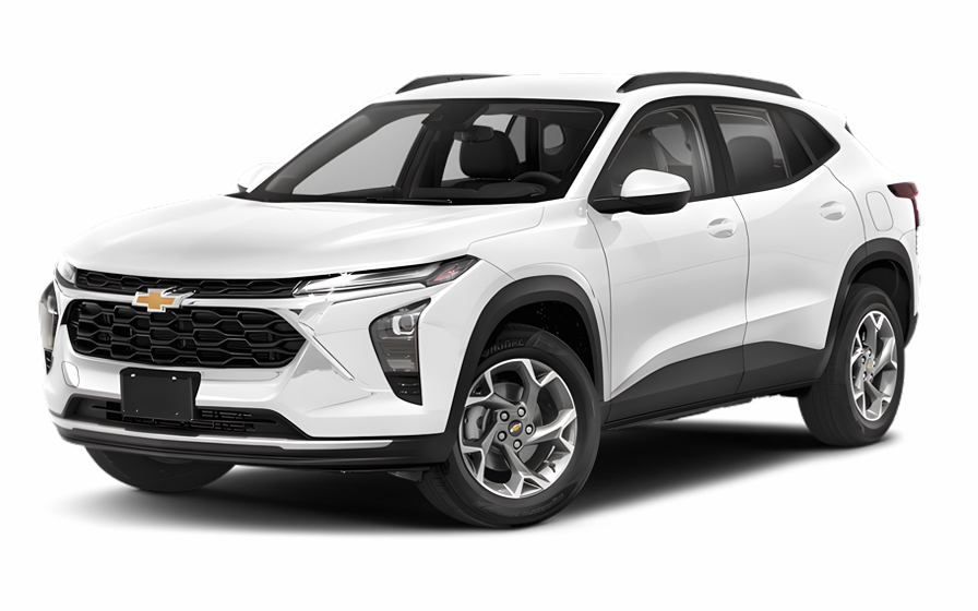
Chevrolet Trax | Automatic
SUVor SUV similar
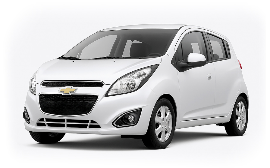
Chevrolet Spark | Automatic
SMALLor Small similar

Audi A6 | Automatic
or Small similar

Kia K4 | Automatic
SEDANor Sedan similar

Ford F150 | Automatic
PICKUPor Pickup similar
Frequently Asked Questions
What does my Hola Car Rentals booking with Hertz in Providence include that other companies don't offer?
Hola Car Rentals is the only premium partner of the top car rental brands operating in Providence, including Hertz, giving you exclusive access to our All Inclusive+ rate. This rate includes benefits that no other company can match:
- Free liability coverage starting at US$ 300,000 in case of an accident (applies only to certain rates and itineraries)
- Toll cashback: recover up to 5% of the reservation's total value for toll charges incurred during your rental period
- Premium travel medical assistance providing up to US$ 150,000 in coverage for a maximum of 5 passengers in case of a medical emergency, excluding pre-existing conditions
- No Extra Charges© guarantee: if the counter charges you for something not listed on your confirmation and not an optional add-on you accepted, Hola Car Rentals will work to remove or reimburse the charge after verification
All of this comes at no extra cost, ensuring a fully protected Hertz rental experience and peace of mind throughout your trip in Providence.
Will I face unexpected charges at the Hertz counter in Providence when I book through Hola Car Rentals?
No. With Hola Car Rentals, all costs and charges for your Hertz booking in Providence are clearly shown at the time of reservation and in your confirmation email, so you know exactly what you are paying before you arrive at the Hertz counter.
On top of that, every Hola Car Rentals booking includes the No Extra Charges© guarantee. This is a pricing guarantee (not insurance) that protects you if the Hertz counter in Providence charges you for something that was not listed on your confirmation and was not an optional add-on you accepted. If that happens, Hola Car Rentals will work with Hertz to remove or reimburse the charge after verification.
The only costs outside this guarantee are:
- Optional add-ons you choose at the counter (GPS, child seats, prepaid fuel)
- Usage-based charges (tolls, fuel shortfall, traffic fines)
Where are the Hertz pickup locations in Providence?
Hertz operates multiple pickup locations in the Providence area, so it is important to confirm which address matches your reservation before you arrive.
- 400 Silver Spring Street, Providence, RI 02904, the main city center neighborhood location
- 100 Gaspee Street, Providence, RI 02904, near the Providence Amtrak Station
- 630 Taunton Avenue, East Providence, RI 02914, a nearby neighborhood option
These are street-level neighborhood counters, not airport facilities. You go directly to the counter at the address on your booking confirmation. There are no airport-style shuttles or consolidated rental centers at these Providence locations. If you are flying into TF Green Airport in Warwick, note that Hertz also operates a separate facility at 700 Jefferson Boulevard near the airport, which has different hours and a different pickup process from the downtown Providence locations.
Always verify the exact address on your Hertz reservation before traveling, as picking up at the wrong Providence location can cause delays.
What documents do I need to pick up a Hertz rental car in Providence?
To collect your Hertz rental in Providence, you must bring all of the following physical documents to the counter:
- A valid, original driver's license in the main driver's name
- A major credit card with the driver's name printed on the card, for the security deposit hold
- A passport or valid government-issued photo ID
- Your booking confirmation or printed voucher
- Round-trip flight or travel tickets if you are visiting from abroad
If your driver's license is not in English and does not use a Latin (Roman) alphabet, such as Arabic, Chinese, Japanese, or Cyrillic script, an International Driving Permit (IDP) is mandatory alongside your original license. For licenses in English or a Latin alphabet, an IDP is recommended but not strictly required at most Hertz counters in Providence.
All documents must be physical originals. Digital copies shown on a phone are not accepted. Debit cards and prepaid cards are not accepted for the security deposit hold at the Hertz counter in Providence.
Are there toll roads near Providence that affect a Hertz rental?
Yes, there are toll roads in the Providence area that can affect your Hertz rental, and understanding how they work will help you avoid unexpected charges.
The main toll facility relevant to passenger car renters is the Claiborne Pell Newport Bridge, which connects Newport to Jamestown. Typical costs for a standard 2-axle car are:
- E-ZPass non-resident rate: US$4.00
- Bill by Mail (no transponder, license plate capture): US$6.00
The RhodeWorks truck toll system operates at 12 locations on I-95, I-295, I-195, and other routes around Providence, but passenger cars pay nothing at those gantries.
Your Hertz vehicle in Providence will come equipped with an electronic toll device. At the counter you can choose an unlimited toll package, typically priced between US$11 and US$25 per rental day depending on the program, or you can opt out and pay tolls individually. If you opt out and drive through a cashless toll, the rental company will bill the toll amount plus an administrative processing fee to your credit card after the rental ends. Toll charges can appear on your statement days or even weeks after you return the vehicle.
Can I get cashback on tolls paid during my Hertz rental in Providence?
Yes, all Hola Car Rentals bookings, including Hertz rentals in Providence, include Tolls Cashback, which reimburses up to 5% of your total booking value for tolls paid during your rental period.
This is especially useful in the Providence area, where driving to Newport means crossing the Claiborne Pell Bridge and paying a toll of US$4.00 to US$6.00 depending on your payment method. Those charges are eligible for the cashback claim.
To claim your reimbursement:
- Email [email protected] within 30 days of returning your Hertz vehicle in Providence
- Use the subject line: Tolls Cashback - HOLA followed by your confirmation number
- Attach your Hola Car Rentals reservation confirmation, the Hertz rental agreement, and a toll receipt or statement showing the charges
The refund is issued to the same payment method used for your original booking and typically processes within 7 to 10 business days after approval. Claims submitted after 30 days are not accepted, so keep your toll receipts from the moment you pick up the Hertz vehicle in Providence.
Does Providence have school zone speed cameras that could affect Hertz renters?
Yes, Providence operates an active school zone speed camera program that visitors driving a Hertz rental should be aware of, as violations result in mailed tickets that can arrive after you have returned home.
Key facts about the Providence speed camera program:
- Cameras are active on school days only, Monday through Friday, from 7 a.m. to 6 p.m.
- A ticket of US$50 is issued for driving 11 mph or more over the posted limit in a school zone
- Cameras rotate to high-violation locations across Providence, so they are not fixed to a single spot
- East Providence, immediately adjacent to Providence, mirrors this system with cameras at five school zones operating from 7 a.m. to 4 p.m. on school days, plus red-light cameras carrying an US$85 fine
If a violation is recorded against the Hertz vehicle's license plate during your Providence rental, the ticket will be forwarded to you by the rental company, typically with an additional administrative processing fee. Slow down in all marked school zones during active hours to avoid these charges on your Hertz rental in Providence.
How do one-way streets in Providence affect navigating a Hertz rental?
Providence has a dense network of one-way streets, particularly in the downtown core, that can be disorienting for first-time visitors driving a Hertz rental in the city.
A few things to keep in mind:
- Many of Providence's one-way streets date from 1950s and 1960s urban renewal and do not follow a predictable alternating grid like some other U.S. cities
- Several streets have recently been converted or are in the process of converting between one-way and two-way traffic as part of the city's Vision Zero pedestrian safety program, so signage can change between visits
- Neighborhood streets are often narrow, ranging from 17 to 34 feet curb to curb, which can feel tight if you are driving a larger Hertz vehicle class
- Protected urban trails on some former roads narrow the available driving lanes further
Before picking up your Hertz rental in Providence, download an up-to-date navigation app and allow it to update its maps. Rely on turn-by-turn directions rather than memory, especially near the downtown core, where recent one-way reversals may not match older printed maps. Drive slowly in residential areas and watch for pedestrian crossings, which are a priority throughout Providence.
Is a credit card required for the Hertz deposit in Providence?
Yes, a physical major credit card in the main driver's name is required at the Hertz counter in Providence to cover the security deposit hold.
The hold is a temporary authorization placed on your card at pickup, not an immediate charge. For a standard vehicle class at a Hertz location in the United States, including Providence, the typical hold is approximately US$300 to US$400, though the exact amount depends on the vehicle class, rental duration, and location policy.
Important points to keep in mind:
- The card must be a major credit card, such as Visa, Mastercard, or American Express, with the driver's name physically printed on it
- Debit cards, prepaid cards, and virtual or digital-only card numbers are not accepted for the deposit hold
- The card must have sufficient available credit to cover the hold in addition to any other charges
- If your primary card is declined at the Hertz counter in Providence, you may present a second credit card in your own name
After you return the vehicle, the hold is released. Your bank controls how quickly the credit becomes available again, which can take up to 15 business days.
What travel assistance is included with a Hertz booking in Providence?
Most Hola Car Rentals bookings, including Hertz rentals in Providence, include travel assistance coverage provided by Terrawind Global Protection at no extra cost. This benefit is designed for situations such as a medical emergency or a breakdown far from the city center during your Rhode Island trip.
Coverage typically includes:
- Travel and medical insurance for up to 5 passengers
- Legal assistance in the event of a road accident
- Compensation for baggage lost by the airline
- Flight cancellation insurance
To reach assistance 24 hours a day, 7 days a week, call +1 888 980 9992 (toll-free) or contact WhatsApp at +1 208 910 1001. Have your Hola Car Rentals confirmation number ready when you call.
Important: this benefit does not apply to customers who are residents of the United States or Canada. It also does not cover damage to the Hertz rental vehicle itself, which is handled separately by CDW or LDW coverage, nor does it cover third-party liability to other drivers or pedestrians in Providence.
Always review your specific booking confirmation to confirm the exact terms and coverage limits that apply to your Hertz rental in Providence.
Can I add an additional driver to my Hertz rental in Providence?
Yes, you can add an additional driver to your Hertz rental in Providence, either as part of your rate or by paying a fee at the counter.
For Hertz in Providence, the additional driver fee when not included in your rate is US$13.50 per rental day, with a maximum cap of US$189 for the rental period, plus applicable taxes. Some Hola Car Rentals rate plans include one additional driver at no extra cost, so check your booking confirmation before arriving at the counter.
Requirements for adding a driver at the Hertz counter in Providence:
- The additional driver must be physically present at pickup
- They must present a valid driver's license and any required ID
- If their license uses a non-Latin alphabet, an International Driving Permit is also required
- They must meet the minimum age requirements for the Providence location
- Both the main driver and the additional driver must sign the rental agreement
Only drivers listed on the Hertz rental agreement in Providence are covered by protections such as CDW and liability coverage. Anyone who drives the vehicle without being named on the contract may void those protections entirely.
Is there a young driver surcharge for under-25 renters at Hertz in Providence?
Yes, drivers under 25 years old are subject to a young-renter surcharge when picking up a Hertz rental in Providence, Rhode Island.
Rhode Island follows the standard U.S. policy for most states outside New York and Michigan. Drivers aged 21 to 24 can rent but will pay an additional daily fee. At Hertz in Providence, this surcharge is US$13.50 per rental day, with a maximum cap of US$189 for the rental period, plus applicable local taxes. The fee is paid at the counter and is not included in your prepaid rate.
Additional restrictions that apply to under-25 renters at Hertz in Providence:
- Many vehicle classes are restricted to drivers aged 25 and older, including full-size, SUV, luxury, premium, convertible, minivan, and van categories
- Drivers aged 20 or younger are generally not eligible to rent at Hertz in Providence under standard policy
- A valid major credit card in the renter's name is still required for the deposit hold
If you are between 21 and 24 and traveling from Latin America or the Caribbean, check your Hola Car Rentals confirmation to see whether an underage fee waiver applies to your specific rate with an eligible partner.
What is the fuel policy for a Hertz rental in Providence?
Hertz rentals in Providence follow a Full-to-Full fuel policy by default. You receive the vehicle with a full tank and must return it full to avoid additional charges.
Steps to follow to avoid fuel charges on your Hertz rental in Providence:
- At pickup, check the fuel gauge with the Hertz agent and confirm the starting level is recorded on the rental agreement
- Take a photo of the dashboard showing the odometer and fuel gauge before leaving the Providence location
- Refuel within approximately 10 miles of the return location so the gauge does not drop before you arrive
- Keep the fuel receipt showing the date, time, and station address
- Show the full gauge to the agent at return, or leave the receipt in the key envelope for after-hours drops
If you return the Hertz vehicle in Providence with less than a full tank, you may be charged for the fuel shortfall at the rental company's refueling rate, which is typically higher than the pump price, plus a refueling service fee. Using the correct fuel type is also important, as wrong-fuel incidents are not covered by the fuel policy and can generate significant additional charges.
Can I pick up a Hertz car in Providence and return it to a different city?
Yes, one-way rentals are possible with Hertz in Providence, but a drop-off fee may apply depending on your return location, and not all routes are permitted.
When booking a one-way Hertz rental from Providence, the drop-off fee is calculated based on the specific route, the vehicle class, the rental dates, and the distance between locations. This fee is shown during the booking process under the section labeled as charges due at the destination, so you can see the exact amount before confirming your reservation.
General patterns for one-way Hertz rentals from Providence:
- Returning to a different city within Rhode Island or a neighboring state typically incurs a drop-off fee
- Long-distance or cross-country one-ways usually carry higher fees and may have limited availability
- Cross-border one-ways, such as returning to Canada, are often restricted or require special authorization
If you change your return location after booking your Hertz rental in Providence, the rate will be repriced and the drop-off fee may increase or a new fee may be added. Always review your updated confirmation after any modification. If the Hertz counter in Providence charges a drop-off fee that was not disclosed on your booking confirmation, keep all paperwork and contact support for assistance.
What insurance coverage is included in a Hertz rental in Providence?
The insurance and protection options included in your Hertz rental in Providence depend on the specific rate plan you selected when booking through Hola Car Rentals.
The two main types of coverage to understand are:
- Collision Damage Waiver or Loss Damage Waiver (CDW/LDW): reduces your financial liability for damage to the Hertz vehicle itself from a collision, theft, or vandalism. A deductible may apply unless your confirmation explicitly states zero deductible. This does not cover damage you cause to other vehicles or people.
- Third-Party Liability (LIS/ALI/SLI): covers bodily injury and property damage you may cause to other people while driving the Hertz rental in Providence. In Rhode Island, state-minimum liability is not automatically guaranteed on all rental agreements, so confirming this coverage is on your contract is important.
Neither CDW/LDW nor LIS covers your personal injuries, which would require Personal Accident Insurance, or your belongings, which would require Personal Effects Coverage.
At the Hertz counter in Providence, review the rental agreement carefully before signing to confirm which protections are active and what deductible amounts apply. Decline any optional add-ons you do not need, and keep a copy of the signed agreement for your records.

- Choosing a selection results in a full page refresh.
- Opens in a new window.
Suggested Currencies
- $ USD - United States Dollar
- € EUR - Euro
Other Countries
-
 Albania
-
 Algeria
-
 Andorra
-
 Angola
-
 Antigua & Barbuda
-
 Argentina
-
 Australia
-
 Austria
-
 Bahamas
-
 Bahrain
-
 Bangladesh
-
 Barbados
-
 Belgium
-
 Belize
-
 Benin
Benin
-
 Bermuda
-
 Bolivia
-
 Bosnia & Herzegovina
-
 Botswana
-
 Brazil
-
 British Virgin Islands
-
 Bulgaria
-
 Burkina Faso
-
 Burundi
-
 Cameroon
-
 Canada
-
 Cape Verde
-
 Cayman Islands
-
 Central African Republic
-
 Chad
Chad
-
 Chile
Chile
-
 Colombia
-
 Comoros
-
 Congo - Brazzaville
-
 Congo - Kinshasa
-
 Costa Rica
-
 Côte d’Ivoire
-
 Croatia
-
 Curaçao
-
 Cyprus
-
 Czechia
-
 Denmark
-
 Djibouti
-
 Dominica
-
 Dominican Republic
-
 Ecuador
-
 Egypt
Egypt
-
 El Salvador
-
 Equatorial Guinea
-
 Eritrea
-
 Estonia
-
 Eswatini
-
 Ethiopia
-
 Finland
-
 France
-
 Gabon
Gabon
-
 Gambia
-
 Germany
-
 Ghana
Ghana
-
 Greece
-
 Grenada
-
 Guatemala
-
 Guinea
-
 Guinea-Bissau
-
 Guyana
-
 Haiti
Haiti
-
 Honduras
-
 Hong Kong SAR
-
 Hungary
-
 Iceland
-
 India
India
-
 Iraq
Iraq
-
 Ireland
-
 Israel
-
 Italy
Italy
-
 Jamaica
-
 Japan
Japan
-
 Jordan
-
 Kenya
Kenya
-
 Kuwait
-
 Latvia
-
 Lebanon
-
 Lesotho
-
 Liberia
-
 Libya
Libya
-
 Liechtenstein
-
 Lithuania
-
 Luxembourg
-
 Madagascar
-
 Malawi
-
 Mali
Mali
-
 Malta
Malta
-
 Mauritania
-
 Mauritius
-
 Mexico
-
 Moldova
-
 Monaco
-
 Montenegro
-
 Morocco
-
 Mozambique
-
 Namibia
-
 Netherlands
-
 New Zealand
-
 Nicaragua
-
 Niger
Niger
-
 Nigeria
-
 Norway
-
 Oman
Oman
-
 Palestinian Territories
-
 Panama
-
 Paraguay
-
 Peru
Peru
-
 Philippines
-
 Poland
-
 Portugal
-
 Qatar
Qatar
-
 Romania
-
 Russia
-
 Rwanda
-
 San Marino
-
 São Tomé & Príncipe
-
 Saudi Arabia
-
 Senegal
-
 Serbia
-
 Seychelles
-
 Sierra Leone
-
 Singapore
-
 Sint Maarten
-
 Slovakia
-
 Slovenia
-
 Somalia
-
 South Africa
-
 South Korea
-
 South Sudan
-
 Spain
Spain
-
 St. Lucia
-
 St. Vincent & Grenadines
-
 Sudan
Sudan
-
 Sweden
-
 Switzerland
-
 Taiwan
-
 Tanzania
-
 Togo
Togo
-
 Trinidad & Tobago
-
 Tunisia
-
 Türkiye
-
 Turks & Caicos Islands
-
 Uganda
-
 Ukraine
-
 United Arab Emirates
-
 United Kingdom
-
 United States
-
 Uruguay
-
 Vatican City
-
 Venezuela
-
 Yemen
Yemen
-
 Zambia
-
 Zimbabwe
Driving license from:
-
Albania
-
Algeria
-
Andorra
-
Angola
-
Antigua & Barbuda
-
Argentina
-
Australia
-
Austria
-
Bahamas
-
Bahrain
-
Bangladesh
-
Barbados
-
Belgium
-
Belize
-
Benin
-
Bermuda
-
Bolivia
-
Bosnia & Herzegovina
-
Botswana
-
Brazil
-
British Virgin Islands
-
Bulgaria
-
Burkina Faso
-
Burundi
-
Cameroon
-
Canada
-
Cape Verde
-
Cayman Islands
-
Central African Republic
-
Chad
-
Chile
-
Colombia
-
Comoros
-
Congo - Brazzaville
-
Congo - Kinshasa
-
Costa Rica
-
Côte d’Ivoire
-
Croatia
-
Curaçao
-
Cyprus
-
Czechia
-
Denmark
-
Djibouti
-
Dominica
-
Dominican Republic
-
Ecuador
-
Egypt
-
El Salvador
-
Equatorial Guinea
-
Eritrea
-
Estonia
-
Eswatini
-
Ethiopia
-
Finland
-
France
-
Gabon
-
Gambia
-
Germany
-
Ghana
-
Greece
-
Grenada
-
Guatemala
-
Guinea
-
Guinea-Bissau
-
Guyana
-
Haiti
-
Honduras
-
Hong Kong SAR
-
Hungary
-
Iceland
-
India
-
Iraq
-
Ireland
-
Israel
-
Italy
-
Jamaica
-
Japan
-
Jordan
-
Kenya
-
Kuwait
-
Latvia
-
Lebanon
-
Lesotho
-
Liberia
-
Libya
-
Liechtenstein
-
Lithuania
-
Luxembourg
-
Madagascar
-
Malawi
-
Mali
-
Malta
-
Mauritania
-
Mauritius
-
Mexico
-
Moldova
-
Monaco
-
Montenegro
-
Morocco
-
Mozambique
-
Namibia
-
Netherlands
-
New Zealand
-
Nicaragua
-
Niger
-
Nigeria
-
Norway
-
Oman
-
Palestinian Territories
-
Panama
-
Paraguay
-
Peru
-
Philippines
-
Poland
-
Portugal
-
Qatar
-
Romania
-
Russia
-
Rwanda
-
San Marino
-
São Tomé & Príncipe
-
Saudi Arabia
-
Senegal
-
Serbia
-
Seychelles
-
Sierra Leone
-
Singapore
-
Sint Maarten
-
Slovakia
-
Slovenia
-
Somalia
-
South Africa
-
South Korea
-
South Sudan
-
Spain
-
St. Lucia
-
St. Vincent & Grenadines
-
Sudan
-
Sweden
-
Switzerland
-
Taiwan
-
Tanzania
-
Togo
-
Trinidad & Tobago
-
Tunisia
-
Türkiye
-
Turks & Caicos Islands
-
Uganda
-
Ukraine
-
United Arab Emirates
-
United Kingdom
-
United States
-
Uruguay
-
Vatican City
-
Venezuela
-
Yemen
-
Zambia
-
Zimbabwe