


About renting a car in Charleston
Best Car Rental Deals
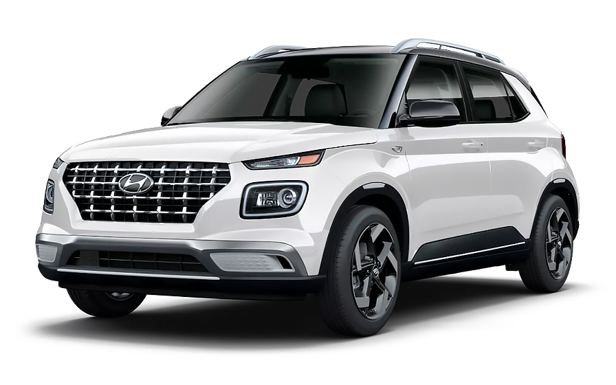
Hyundai Venue | Automatic
SMALLor Small similar
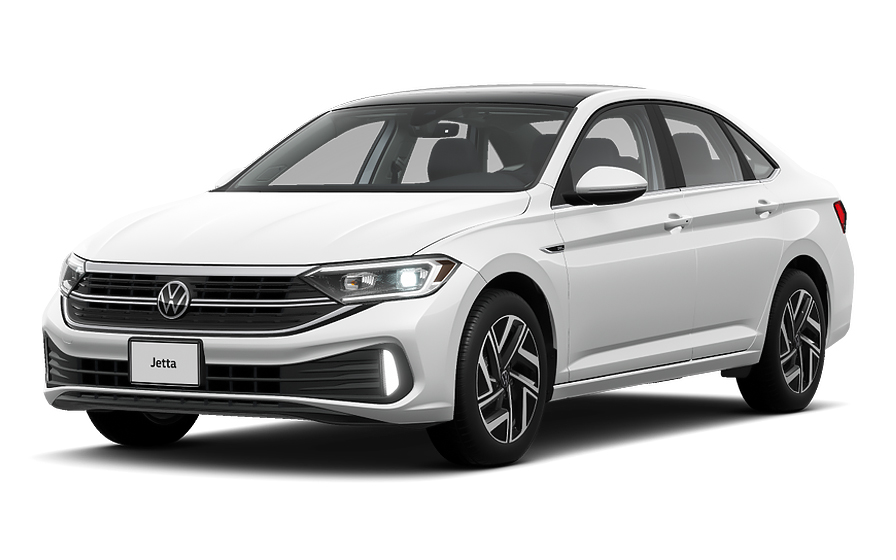
Volkswagen Jetta | Automatic
SEDANor Sedan similar
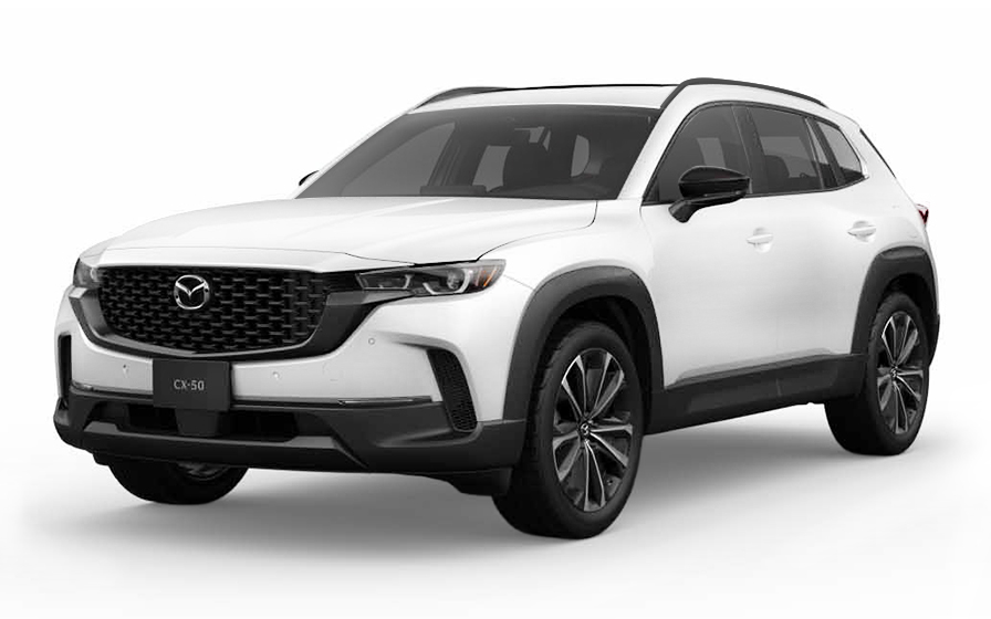
Mazda CX 50 | Automatic
SUVor SUV similar
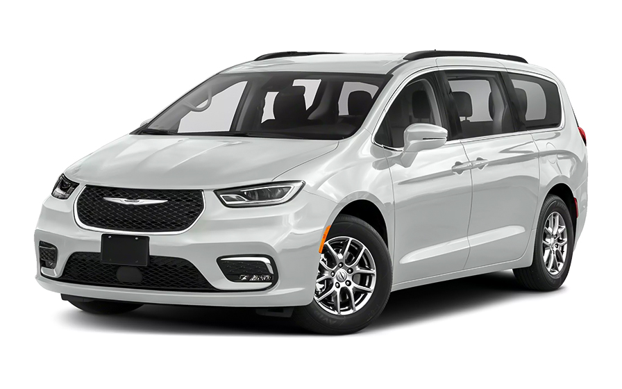
Chrysler Pacifica 7 Passengers | Automatic
MINIVANor Minivan similar

Ford F150 | Automatic
PICKUPor Pickup similar
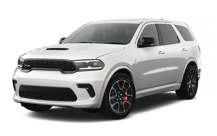
Dodge Durango 7 Passengers | Automatic
7 PASSENGERSor 7 Passengers similar
Traveler Tips & Price Insights
When is the best time to book a rental car in Charleston?
You should book your rental car approximately 7 days before your trip to get a below-average price.
Price Trend (Last 90 Days)
What is the most popular rental car type in Charleston?
sedan rental cars (sedan or similar) are the most popular option in Charleston.
Popular Car Types
Which is the cheapest car rental agency in Charleston?
In the last 72 hours, the cheapest rental cars were from Budget at /day.
Average Price by Rental Company
Frequently Asked Questions
What does my Hola Car Rentals booking in Charleston include that other companies don't offer?
Hola Car Rentals is the only premium partner of the top car rental brands operating in Charleston, giving you exclusive access to our All Inclusive+ rate. This rate includes benefits that no other company can match:
- Free liability coverage starting at US$ 300,000 in case of an accident (applies only to certain rates and itineraries)
- Toll cashback: recover up to 5% of the reservation's total value for toll charges incurred during your rental period
- Premium travel medical assistance providing up to US$ 150,000 in coverage for a maximum of 5 passengers in case of a medical emergency, excluding pre-existing conditions
- No Extra Charges© guarantee: if the counter charges you for something not listed on your confirmation and not an optional add-on you accepted, Hola Car Rentals will work to remove or reimburse the charge after verification
All of this comes at no extra cost, ensuring a fully protected rental experience and peace of mind throughout your trip in Charleston.
Will I face unexpected charges at the counter when I rent a car in Charleston through Hola Car Rentals?
No. With Hola Car Rentals, all costs and charges for your booking in Charleston are clearly shown at the time of reservation and in your confirmation email, so you know exactly what you are paying before you arrive at the counter.
On top of that, every Hola Car Rentals booking includes the No Extra Charges© guarantee. This is a pricing guarantee (not insurance) that protects you if the counter in Charleston charges you for something that was not listed on your confirmation and was not an optional add-on you accepted. If that happens, Hola Car Rentals will work with the rental partner to remove or reimburse the charge after verification.
The only costs outside this guarantee are:
- Optional add-ons you choose at the counter (GPS, child seats, prepaid fuel)
- Usage-based charges (tolls, fuel shortfall, traffic fines)
Where do I pick up my rental car at Charleston International Airport?
At Charleston International Airport (CHS), rental car counters are located inside the terminal, past Baggage Claim at the end of the arrivals hall. There is no shuttle or consolidated rental car center to reach, so you simply walk from baggage claim directly to the rental desks.
Specific brand locations at Charleston include National Car Rental at 5500 International Blvd, Suite 119, and Hertz at 6060 S Aviation Ave in North Charleston. Most major partners represented at Charleston Airport follow the same in-terminal counter setup.
For vehicle return at Charleston, drive to Level 1 of the five-tier parking deck adjacent to the terminal. Covered walkways connect the deck to the terminal, making it easy to reach your departure gate after dropping off the car.
Plan for roughly 20 to 45 minutes from landing to driving away, accounting for baggage claim, the short walk to the desks, paperwork, and vehicle retrieval.
Can I pick up a rental car in downtown Charleston instead of the airport?
Yes, you can pick up a rental car in downtown Charleston at 390 Meeting St (at the corner of Meeting Street and Mary Street), which serves brands including Avis and Budget and is also convenient for cruise port arrivals.
This downtown Charleston location is approximately 0.73 miles from the city center. You will need to arrange your own transport to reach it, as it is a street-level counter rather than an airport facility.
Counter hours at the downtown Charleston location are typically Monday through Friday 8:00 AM to 6:00 PM, Saturday 8:00 AM to 2:00 PM, and Sunday 10:00 AM to 2:00 PM. There are no after-hours pickup options at this location. If you need to return the car outside of business hours, a key drop box may be available, but you remain responsible for the vehicle and any damage or theft until the next business day when staff check it in.
If you are flying into Charleston, the airport counter is more convenient. If you are arriving by cruise ship or staying in the city center, the downtown location at 390 Meeting St may better suit your itinerary.
Are there toll roads near Charleston, South Carolina?
There are no toll roads in or immediately around Charleston itself. South Carolina has only one toll road statewide: the Southern Connector on Interstate 185, which runs approximately 16 miles near Greenville and connects I-185 to I-385. This road is well outside the Charleston area.
If your Charleston rental takes you inland toward Greenville, you may encounter the Southern Connector. That road uses the PalPass (also called Palmetto Pass) electronic toll system, and also accepts cash and credit or debit cards at mainline plazas. Typical costs range from US$0.075 to US$3.00 for the full 16-mile stretch.
There are no congestion charges, emissions zones, or city-center fees in Charleston or anywhere in South Carolina.
If you do drive through a toll without enrolling in a rental company toll program, the rental company will bill the toll at the highest undiscounted rate plus an administrative fee, which can be US$15 per toll event. To avoid this, you can enroll in the rental company's electronic toll program at the Charleston pickup counter, typically priced at US$3.95 to US$4.95 per day.
How does Tolls Cashback work for a Charleston rental?
All Hola Car Rentals bookings include Tolls Cashback, which reimburses up to 5% of your total booking value for tolls paid during your Charleston rental.
While Charleston itself has no local toll roads, you may encounter the Southern Connector near Greenville if you drive inland, or toll roads in neighboring states if your Charleston rental takes you across state lines. Any tolls you pay during the rental period are eligible for the cashback.
To claim your refund after returning the car in Charleston:
- Email [email protected] within 30 days of vehicle return
- Use the subject line: Tolls Cashback - Reservation [Your Confirmation Number]
- Attach your Hola Car Rentals reservation confirmation, the signed rental agreement, and a receipt or statement showing the toll charges paid
- Include your full name, travel dates, and the last 4 digits of the card used for the booking
Refunds are processed to the original payment method and typically arrive within 7 to 10 business days after approval. Claims submitted after 30 days are not accepted.
What documents do I need to pick up a rental car in Charleston?
To pick up a rental car in Charleston, you must present all documents in physical form. Digital copies are not accepted at the counter.
- A valid, original driver's license in the main driver's name
- A physical major credit card with the driver's name printed on the card, used for the security deposit hold
- A passport or valid government-issued photo ID
- Your booking confirmation or printed voucher
- Round-trip flight tickets or cruise tickets if you are visiting Charleston from abroad
If your driver's license is not in English and does not use a Latin (Roman) alphabet, such as Arabic, Chinese, Japanese, or Cyrillic script, an International Driving Permit (IDP) is mandatory. For licenses in other non-English scripts, an IDP is strongly recommended. The IDP is a translation only and must be carried alongside your original license.
Debit cards and prepaid cards are not accepted for the security deposit at Charleston rental counters, even if you prepaid your booking online. Bring a backup credit card in your name in case your primary card is declined.
Is a credit card required to rent a car in Charleston?
Yes, a physical major credit card in the main driver's name is required to rent a car in Charleston. The card must have the driver's name printed on it and must have sufficient available credit to cover the security deposit hold.
Debit cards, prepaid cards, and virtual or single-use card numbers are not accepted for the deposit at Charleston rental counters. This applies even if you have already prepaid your booking online.
The security deposit hold in the United States is typically around US$300 to US$400 for a standard vehicle, though the exact amount varies by rental brand, vehicle class, and location. The hold is a temporary authorization, not a charge, and is released after you return the car. Your bank controls how quickly the funds become available again, which can take up to 15 business days.
A few tips for your Charleston pickup:
- Notify your bank before traveling so the in-person authorization is not flagged as suspicious
- Bring a backup credit card in your name in case your primary card is declined
- Confirm the hold amount with the counter agent before signing
Do I need an International Driving Permit to rent a car in Charleston?
An International Driving Permit (IDP) is not always mandatory to rent a car in Charleston, but it depends on your license.
If your driver's license uses a non-Latin alphabet, such as Arabic, Chinese, Japanese, or Cyrillic (Russian), an IDP is required at Charleston rental counters. Without it, the counter agent may refuse to hand over the vehicle.
If your license is in English or uses the Latin alphabet but is issued by a non-English-speaking country, an IDP is strongly recommended but not strictly mandatory. Some Charleston rental partners may still request one as a translation aid.
Important points to keep in mind:
- The IDP is a translation document only. It is not a standalone license and must always be carried together with your original driver's license
- You must obtain your IDP in your home country before traveling to Charleston. US-based organizations such as AAA do not issue IDPs to holders of non-US licenses
- All documents presented at the Charleston counter must be physical originals. Digital copies are not accepted
What travel assistance is included with a Charleston car rental booking?
Most Hola Car Rentals bookings include travel assistance provided by Terrawind Global Protection, which can be especially useful if something goes wrong during your Charleston trip or while driving in South Carolina.
Coverage typically includes:
- Travel insurance with medical coverage for up to 5 passengers
- Legal assistance in the event of a road accident
- Compensation for luggage lost by the airline
- Flight cancellation insurance
This benefit does not cover damage to the rental car itself (that is handled by CDW/LDW) or third-party liability to others (covered by LIS/ALI/SLI).
To use the assistance during your Charleston rental, contact Terrawind 24 hours a day, 7 days a week at +1 888 980 9992 (toll-free). You can also reach them via WhatsApp at +1 208 910 1001 or by email at [email protected]. Have your Hola Car Rentals confirmation number ready when you call.
Please note: this coverage applies only to non-North American customers. Residents of the United States and Canada do not qualify for this benefit. Check your booking confirmation for the exact terms and coverage limits that apply to your Charleston reservation.
Can I return a rental car after hours in Charleston?
Yes, after-hours returns are possible at some Charleston locations, but the rules differ depending on where you picked up the car.
At Charleston International Airport (CHS), vehicle returns go to Level 1 of the five-tier parking deck, which has covered walkways to the terminal. Some brands at the airport offer after-hours key drop facilities. Check your rental agreement for the specific instructions for your brand.
At the downtown Charleston location at 390 Meeting St, there is no staffed after-hours service. A key drop box may be available, but if you use it, you remain fully responsible for the vehicle, including any damage or theft, until a staff member checks it in the next business day. If you need to avoid this liability, consider changing your return to the airport location (note that a one-way or drop-off fee may apply) or adjusting your return time to fall within business hours.
Downtown Charleston counter hours are Monday through Friday 8:00 AM to 6:00 PM, Saturday 8:00 AM to 2:00 PM, and Sunday 10:00 AM to 2:00 PM. Plan your return accordingly to avoid unexpected charges.
Can I pick up a rental car in Charleston and return it in another city?
Yes, one-way rentals are available from Charleston, allowing you to return the car at a different location, such as another South Carolina city or a different state.
A drop-off fee may apply depending on your route. This fee is set by the rental partner and varies by destination, vehicle class, and season. You will see the drop-off fee listed under the "To pay at destination" section during the booking process on the Hola Car Rentals website, so there are no surprises at the Charleston counter.
A few things to keep in mind for one-way rentals from Charleston:
- Same-city returns (for example, Charleston Airport to downtown Charleston) often carry no drop-off fee
- Returns to other South Carolina cities or out-of-state locations typically do carry a fee
- Cross-border one-ways (for example, Charleston to Canada) may be restricted or require prior approval from the rental partner
- Changing your return location after booking may reprice the rental and recalculate the drop-off fee
If the counter charges a drop-off fee that was not shown on your booking confirmation, keep all paperwork and contact support after the rental ends.
What is the minimum age to rent a car in Charleston?
The minimum age to rent a car in Charleston without a young-driver surcharge is 25. Drivers aged 21 to 24 can rent in Charleston but will be charged a daily young-renter surcharge at the counter.
Typical surcharge amounts at Charleston rental counters vary by brand:
- Avis, Budget, and Payless: US$13 per rental day, capped at US$65
- Hertz, Thrifty, and Dollar: US$13.50 per rental day, capped at US$189
- Alamo, National, and Enterprise: US$15 per day (no stated cap)
Drivers under 25 in Charleston are also restricted from renting certain vehicle classes. Premium, luxury, full-size SUV, minivan, and convertible categories are generally limited to renters aged 25 and older. Economy, compact, and intermediate vehicles are typically available to younger drivers.
South Carolina is not one of the states (New York and Michigan are the exceptions) that require rental companies to serve drivers under 21, so the minimum age at Charleston counters is 21 for most brands.
A valid driver's license and a physical major credit card in the main driver's name are required regardless of age.
How does the fuel policy work for rental cars in Charleston?
Rental cars in Charleston follow a Full-to-Full fuel policy. You receive the car with a full tank and must return it full to avoid fuel charges.
At pickup at the Charleston counter, check the fuel gauge with the agent and confirm the starting level is recorded on the rental agreement. Take a photo of the dashboard showing the odometer and fuel gauge before leaving the lot.
When returning your car in Charleston, refuel within approximately 10 miles of the return location, whether that is Charleston International Airport or the downtown location at 390 Meeting St. Keep your final fuel receipt showing the date, time, and station address.
If you return the car below the recorded starting level, the rental company will charge you for the fuel shortfall at their own refueling rate, which is typically higher than pump prices, plus a service fee. To avoid this:
- Refuel close to the Charleston return point, not miles away
- Take a photo of the full gauge before handing over the keys
- For after-hours returns at Charleston Airport, leave the receipt in the key envelope and keep a photo of the gauge
The fuel policy applies to gasoline and diesel vehicles. If you rent a hybrid in Charleston, the same rule applies to the gas tank.
How do I add an additional driver to my Charleston rental?
Yes, you can add an additional driver to your Charleston rental, either at no cost if your rate includes it or for a daily fee paid at the counter.
Check your booking confirmation before arriving at the Charleston counter. If it states "Additional driver free of charge" or "Additional driver included," the first extra driver costs nothing. If it is not included, the daily fees at Charleston counters are:
- Avis, Budget, and Payless: US$13 per day, capped at US$65
- Hertz, Thrifty, and Dollar: US$13.50 per day, capped at US$189
- Alamo, National, and Enterprise: US$15 per day
The additional driver must be present at the Charleston pickup counter. They must bring their own valid driver's license (and an IDP if their license uses a non-Latin alphabet) and sign the rental agreement. A driver who is not listed on the agreement is not covered by CDW/LDW or liability protections.
For Avis, Budget, and Payless rentals in Charleston, additional drivers must generally be at least 25 years old. If the additional driver is under 25, a young-driver surcharge may apply or they may not be accepted, depending on the brand's policy at that location.
Compare car rentals in Charleston

- Choosing a selection results in a full page refresh.
- Opens in a new window.
Suggested Currencies
- $ USD - United States Dollar
- € EUR - Euro
Other Countries
-
 Albania
-
 Algeria
-
 Andorra
-
 Angola
-
 Antigua & Barbuda
-
 Argentina
-
 Australia
-
 Austria
-
 Bahamas
-
 Bahrain
-
 Bangladesh
-
 Barbados
-
 Belgium
-
 Belize
-
 Benin
Benin
-
 Bermuda
-
 Bolivia
-
 Bosnia & Herzegovina
-
 Botswana
-
 Brazil
-
 British Virgin Islands
-
 Bulgaria
-
 Burkina Faso
-
 Burundi
-
 Cameroon
-
 Canada
-
 Cape Verde
-
 Cayman Islands
-
 Central African Republic
-
 Chad
Chad
-
 Chile
Chile
-
 Colombia
-
 Comoros
-
 Congo - Brazzaville
-
 Congo - Kinshasa
-
 Costa Rica
-
 Côte d’Ivoire
-
 Croatia
-
 Curaçao
-
 Cyprus
-
 Czechia
-
 Denmark
-
 Djibouti
-
 Dominica
-
 Dominican Republic
-
 Ecuador
-
 Egypt
Egypt
-
 El Salvador
-
 Equatorial Guinea
-
 Eritrea
-
 Estonia
-
 Eswatini
-
 Ethiopia
-
 Finland
-
 France
-
 Gabon
Gabon
-
 Gambia
-
 Germany
-
 Ghana
Ghana
-
 Greece
-
 Grenada
-
 Guatemala
-
 Guinea
-
 Guinea-Bissau
-
 Guyana
-
 Haiti
Haiti
-
 Honduras
-
 Hong Kong SAR
-
 Hungary
-
 Iceland
-
 India
India
-
 Iraq
Iraq
-
 Ireland
-
 Israel
-
 Italy
Italy
-
 Jamaica
-
 Japan
Japan
-
 Jordan
-
 Kenya
Kenya
-
 Kuwait
-
 Latvia
-
 Lebanon
-
 Lesotho
-
 Liberia
-
 Libya
Libya
-
 Liechtenstein
-
 Lithuania
-
 Luxembourg
-
 Madagascar
-
 Malawi
-
 Mali
Mali
-
 Malta
Malta
-
 Mauritania
-
 Mauritius
-
 Mexico
-
 Moldova
-
 Monaco
-
 Montenegro
-
 Morocco
-
 Mozambique
-
 Namibia
-
 Netherlands
-
 New Zealand
-
 Nicaragua
-
 Niger
Niger
-
 Nigeria
-
 Norway
-
 Oman
Oman
-
 Palestinian Territories
-
 Panama
-
 Paraguay
-
 Peru
Peru
-
 Philippines
-
 Poland
-
 Portugal
-
 Qatar
Qatar
-
 Romania
-
 Russia
-
 Rwanda
-
 San Marino
-
 São Tomé & Príncipe
-
 Saudi Arabia
-
 Senegal
-
 Serbia
-
 Seychelles
-
 Sierra Leone
-
 Singapore
-
 Sint Maarten
-
 Slovakia
-
 Slovenia
-
 Somalia
-
 South Africa
-
 South Korea
-
 South Sudan
-
 Spain
Spain
-
 St. Lucia
-
 St. Vincent & Grenadines
-
 Sudan
Sudan
-
 Sweden
-
 Switzerland
-
 Taiwan
-
 Tanzania
-
 Togo
Togo
-
 Trinidad & Tobago
-
 Tunisia
-
 Türkiye
-
 Turks & Caicos Islands
-
 Uganda
-
 Ukraine
-
 United Arab Emirates
-
 United Kingdom
-
 United States
-
 Uruguay
-
 Vatican City
-
 Venezuela
-
 Yemen
Yemen
-
 Zambia
-
 Zimbabwe
Driving license from:
-
Albania
-
Algeria
-
Andorra
-
Angola
-
Antigua & Barbuda
-
Argentina
-
Australia
-
Austria
-
Bahamas
-
Bahrain
-
Bangladesh
-
Barbados
-
Belgium
-
Belize
-
Benin
-
Bermuda
-
Bolivia
-
Bosnia & Herzegovina
-
Botswana
-
Brazil
-
British Virgin Islands
-
Bulgaria
-
Burkina Faso
-
Burundi
-
Cameroon
-
Canada
-
Cape Verde
-
Cayman Islands
-
Central African Republic
-
Chad
-
Chile
-
Colombia
-
Comoros
-
Congo - Brazzaville
-
Congo - Kinshasa
-
Costa Rica
-
Côte d’Ivoire
-
Croatia
-
Curaçao
-
Cyprus
-
Czechia
-
Denmark
-
Djibouti
-
Dominica
-
Dominican Republic
-
Ecuador
-
Egypt
-
El Salvador
-
Equatorial Guinea
-
Eritrea
-
Estonia
-
Eswatini
-
Ethiopia
-
Finland
-
France
-
Gabon
-
Gambia
-
Germany
-
Ghana
-
Greece
-
Grenada
-
Guatemala
-
Guinea
-
Guinea-Bissau
-
Guyana
-
Haiti
-
Honduras
-
Hong Kong SAR
-
Hungary
-
Iceland
-
India
-
Iraq
-
Ireland
-
Israel
-
Italy
-
Jamaica
-
Japan
-
Jordan
-
Kenya
-
Kuwait
-
Latvia
-
Lebanon
-
Lesotho
-
Liberia
-
Libya
-
Liechtenstein
-
Lithuania
-
Luxembourg
-
Madagascar
-
Malawi
-
Mali
-
Malta
-
Mauritania
-
Mauritius
-
Mexico
-
Moldova
-
Monaco
-
Montenegro
-
Morocco
-
Mozambique
-
Namibia
-
Netherlands
-
New Zealand
-
Nicaragua
-
Niger
-
Nigeria
-
Norway
-
Oman
-
Palestinian Territories
-
Panama
-
Paraguay
-
Peru
-
Philippines
-
Poland
-
Portugal
-
Qatar
-
Romania
-
Russia
-
Rwanda
-
San Marino
-
São Tomé & Príncipe
-
Saudi Arabia
-
Senegal
-
Serbia
-
Seychelles
-
Sierra Leone
-
Singapore
-
Sint Maarten
-
Slovakia
-
Slovenia
-
Somalia
-
South Africa
-
South Korea
-
South Sudan
-
Spain
-
St. Lucia
-
St. Vincent & Grenadines
-
Sudan
-
Sweden
-
Switzerland
-
Taiwan
-
Tanzania
-
Togo
-
Trinidad & Tobago
-
Tunisia
-
Türkiye
-
Turks & Caicos Islands
-
Uganda
-
Ukraine
-
United Arab Emirates
-
United Kingdom
-
United States
-
Uruguay
-
Vatican City
-
Venezuela
-
Yemen
-
Zambia
-
Zimbabwe