


VERIFIED REVIEWS


Rohan Ganesh
"I was a little hesistant before booking as Hola literally quoted me half of what the car rental company was giving me which made me a little suspicious but I went to Avis at LAS airport and the entire process was smooth. I have already booked two more trips through Hola.
Thank you :)"

J Knight
"Fast and cheaper then other sites"

Leslie Miller
"I wish I could give them a 10 awesome customer service process was so so easy and quick renting was so easy highly recommended Lolo Car Rental"

Lou Viramontez
"Sooooo damn easy and fair. I wish I would have known about you 5 years ago."

Maged Zaki
"Service description and price details are very clear
Booking on website is very easy"

Jose Tapia
"Excellent service and very competitive prices."

zashkia ali
"Very easy to rent"

Céline Tibbs Texier
"Great"

Craig Stapleton
"Easy to book with, great value"

Hilary Lyndon
"Really easy to navigate options"

Asad Khalid Yousuf
"Best Prices and value with full insurance rentals. I've compared at least 10 other sites. An update will be done once the actual rental takes place. But i plan on using their service at least 3 times in the near future. So far. Best car rental booking experience as compared to all others that i know of"

Suneet Bhutta
"Great experience booking and car selection"

Ünal AKDOĞAN
"A fantastic booking, it didn't even take a minute, thank you. I hope the same level of care is taken when booking a vehicle."

David Ramires
"Fast and easy, secure easy payment with PayPal"

Andrea Porta
"Quick and very easy to use.
Guarantees the best rental prices for the best companies."

James S. Tsien
"Smooth and efficient booking process. All handled successfully in a few minutes."

Kerri Jarmain
"So easy to book with and full costs provided unlike other websites or rental carriers"

Monideep Dutta
"Great experience"

Alison
"So easy to book and competitive pricing. Excellent choice of vehicles. Insurance and roadside included."

Dorothea Axelson
"so easy! love the free cancellation policy"

Ronald Groenteman
"Very easy to book online,"

Titi Quintana
"I had a problem with Avis; they overcharged me by $576 USD. Thanks to Sofia Padilla from Hola Car Rentals, it was resolved. However, I'm still having issues with Avis! Thank you, Sofia, for your help."

Mark van der Noll
"Super easy to book and a lot included."

Vivek Arora
"Excellent Experience so far."

Mohamed Hussien
"Very fast and easy process"

mr.muscle00
"I had a very positive experience with Hola Car Rentals. The booking process was clear, transparent, and easy to navigate, making it simple to find the right rental option.
What impressed me the most was the customer support. Whenever I had questions, the response time was very fast, and the team was always helpful and professional. Any issues or concerns were handled efficiently and in a customer-friendly manner, which gave me great confidence throughout the rental process.
I highly recommend Hola Car Rentals to anyone looking for a reliable and customer-focused car rental service. I would gladly use their services again in the future."

Mark Dempsey
"Hola were easy to use, gave you all options for car insurance etc. will use again"

Patrice S69
"I rented a vehicle from Hertz Las Vegas through Hola Car. Hertz inadvertently charged me a second time for the rental. Hola Car's customer service reacted quickly and issued a refund."

Oscar Gonzalez
"The booking was effortless, the app is friendly, no hidden rates"

Ben Markman
"Great service, quick and easy"

Tarek Halabi
"It was easy and efficient booking a rental car through Hola Car Rentals."

Steph Storms
"The check out was seamless and easy"

Enrique Yenny
"Good experience and realistic prices"

Cat Kabira Yoga
"Really easy to book online and better rates than what I found elsewhere. Haven't actually picked up and driven the car or returned it- so let's see what happens!"

Shalin Shah
"User friendly, quick and economical"

Gerald Kriknoff
"The website is user-friendly, and the prices are very attractive with all insurances included. I recommend it."

Rein Talvis
"The whole process was quick and easy. Great prices and service. I needed some support from their team and got it superfast. I'm very satisfied with their service quality. I definitely suggest Hola Car Rentals to everyone. Well done!"

Seamus Claffey
"Very straightforward booking with full insurance included from start"

Hocine BELEKENADIL
"Very straight forward booking and unbeatable prices."

ROSS Butcher
"Trust these reviews and put your trust in Hola Car Rentals. Not only , in my experience, did they provide very good quotes on my rental car from Chicago O'Hare (AVIS), indeed it was all inclusive with no unexpected surprises when I collected the car. For some reason, I incurred a charge from AVIS (Tank of gas), which was sorted and all, but Hola rental car were quick to support and help arrange my refund. Brilliant company and I would 100% use them again"

D S
"Great prices, range of cars and easy to use booking process."

Evelyn Cifuentes
"Excellent"

cruz yconchi
"Kindness and speed. Thank you so much!!"

Allan Ragobar
"Customer Support via WhatsApp has been excellent, booking multiple iteneries was fast and straightforward. Excellent service."

Graham Wylie
"Affordable pricing and effortless booking process, thanks"

Hendry
"Fast & easy process, nice car and overall satisfied with this booking"

H.M. F.
"The third party rental car company charged us after returning the car for additional services that we hadn't agreed to. Hola's service team went above and beyond to help us get a refund for these charges.
It’s exemplary for a car rental broker to stand up for its customers like this. We’re grateful and will always book through Hola in the future. Not just because they have very affordable deals and great value for money, but above all because they’re there for their customers! Benchmark!"

Akos Bernat
"Very good prices"

Akshay Baheti
"The reservation experience was very simple and convenient. The website is well designed.
Disclaimer: I still have to actually use the reservation and drive though!"

Lee-Anne Duncan
"Easy to navigate Hola Car Rental site, made choosing a hire hassle free"

orin sae
"friendly user (via web)
low prices
good conditions"

emre k
"great prices, smooth transaction, clear cost breakdown. seems great"

amelie vincent
"Booking on Hola Car Rentals was so easy. Highly recommend!"

Marika Camilleri
"Definitely the cheapest car hire option available in Hawaii"

Kerry Durrant
"Nice and Easy process - got travel insurance too with the booking also !"

Handy Hermawan
"Fast easy and great discounts"

Anant Patel
"Excellent price"

Graham Dopheide
"Easy to use, and makes comparison from different providers easy. Also clearly shows what is, and what isn't included, and rates are good"

Kendal Keung
"Super easy to book. We accidentally booked the wrong car to begin with and with the no cancellation fee it made it easy for us to cancel and book the right car!"

Kerem Camas
"Perfect!"

Ruth. Hwee Yan
"A variety of choices was available. Looking forward to picking up the car!"

Daniel Woods
"Hola Car rentals can’t be faulted. The pricing for an Avis car rental was significantly lower than from the actual Avis rental site. At first I was honestly nervous about booking, but not issue could be found in the entire process.
If booking through Hola, ensure you take the confirmation paperwork with you to provide to the rental car company. Avis’ system didn’t register the additional driver but the confirmation email was used and they added the extra driver saving hundreds.
Toll refunds are swift and instructions can be given using the WhatsApp AI chat bot.
Collection location was Avis LAX
Will be using Hola again"

Okan DOGAN
""Great app and excellent service! I had to change my plans and process refunds several times. Everything worked perfectly on the app, even for last-minute changes. The refund process is very easy and reliable. Thank you, Hola Car!""

Joel Reculard
"Attractive prices and comprehensive insurance"

Anne J Harris
"Good price, easy to use."

Daniel Koh
"The plantform offers a great customer experience. I look forward to a similar experience with the car."

Hadar Blutrich
"Easy, fast, and no hidden fees."

Okan Doğan
"Şöyle yazabilirsin:
> Booking process was smooth and easy. So far, everything looks very good, and the insurance coverage seems strong and clearly explained.
Bir tık daha doğal kısa versiyon:
> Smooth and easy booking process. So far, everything looks very good, and the coverage options seem clear and solid."

Tanner Blair
"Great car"

John Guevara
"Excellent service"

Bj Virtue
"Booking was very easy, excited to cruise around on our holiday"

vasilis ligdas
"Great prices and customer service"

Michael Williamson
"Very easy great price"

Mario Mejia
"An excellent experience, 100% recommended"

micah sioson
"The manager Kent is amazing at this location. Process time was fast, and he even pulled the car around for my grandma."

Keith Semple
"Wow! My first booking with Hola didn’t just meet expectations — they absolutely exceeded them in every possible way. So much so, that I made another rental booking immediately. I’m not usually someone who takes the time to write reviews, but this experience was so exceptional that I felt compelled to share it.
At first, I thought I had secured a great price — but when I carefully reviewed the list of inclusions, I was genuinely blown away. In fact, it almost seemed too good to be true. I found myself double- and triple-checking my bookings, convinced there must have been some sort of system error. But no — everything was exactly as promised, and more - with NO extra cost.
What truly stood out was the reaction from others. When I shared the pricing and inclusions with the Avis desk at the airport, hotel staff, as well as family and friends, they were equally astonished. Several even asked for your details on the spot — which says everything about the incredible value and service you provide.
One thing worthy of note. Avis offered upgrades which I refused on the grounds that it might change the underlying agreement and result in added costs - be careful of adding extras at the point of collection. Regardless, the vehicles reserved were excellent.
You have now become my absolute first choice — my go-to destination for rentals without hesitation. Experiences like this are rare, and you’ve set a new benchmark for excellence.
Please keep up the outstanding work — you’ve gained a loyal customer for life."

Carla Ocampo
"Company with very good prices. Easy and quick booking process."

Annanii Garcia
"The rental process was very simple. We got Hertz; the pickup is on Sunday, let's see how it is. It has very good reviews."

Shreya Bollineni
"It was seamless and I’m yet to see how it goes when I present my hola booking at the airport."

s rajora
"Easy booking easy handling and self explanatory app"

Asher Wagner
"It was an excellent experience to rent a car via HOLA the service was super."

Valérie
"Competitive rates and guarantees.
A reliable and responsive company."

mindaugas liumpa
"Easy to book"

RICCARDO CARAMASCHI
"Great deals and easy booking!
Highly recommended"

Lynne Mathias
"Booking online was a streamline process, competitive prices and good choice of vehicles"

Tif Shukla
"Very easy and straight forward"

Harri Hakovirta
"Booking is very easy😊"

Tomáš Kreitl
"We had a great experience renting a car here. The whole process was quick, smooth, and very efficient. The staff was professional and helpful, and the quality of the service exceeded our expectations. Everything was handled promptly, which made our trip much more comfortable. We would definitely recommend this service and use it again in the future."

Neil Flavin
"Quick hassle free booking with Hola.
Always a pleasure 👍"

Jenny Phillips
"Booking with Hola was easy and they offered more cars and variety and cheaper compared to other rental car sites."

SERGIO BIAGETTI
"The WhatsApp service is excellent and personalized. When you arrive at the rental agency, they try to sell you a bunch of extras that are already included, but when you show them you booked through Hola, they don't offer anything else; they just give you the vehicle and you don't pay anything. Renting a car through them is a guarantee."

Erik Carle
"Hola Car Rentals company is best car rental company,
and website is great."

Sant Ub
"Very easy to use, good deal can be obtained!!!"

Kiran Sedoo
"Excellent prices and value for money. Top notch customer service and response time."

Hesham Mohamed
"All done smoothly"

Michael Parrish
"The selection of cars and location was great. Prices very reasonable, especially considering that insurance was included (a huge part of rental expenses if you don't have US car insurance). I liked that it was easy to use different pick-up and drop-off points."

Oguzhan Cengiz
"Absolutely the best price."

Esther Ng
"Hops makes everything easy and convenient. I like the free travel insurance given too."

Nathaniel Rosen
"Quick, clear and easy to understand."

Joseph
"Booking went smoothly"

Brigitte Willems-Haman
"Arranged so quickly and easily, top service..!!!"

Richard Gardiner
"booking process good, seems to have lots of inclusions"

Phillip Moody
"Very easy process and added extras were well appreciated"

Tedesco Pablo Nicolas
"Personalized attention via WhatsApp, prices better than the car rental companies themselves."

David Garciarena
"Easy to rent, best prices"

Jose J Rivera Indio Joe
"Easy and convenient, plus low prices"

denis dadoun
"Very good. Easy."

Shaunte Meyers
"Very easy and accommodating"

ju
"Unbeatable price and very easy to book. Clear information."

Sonia Walls
"Very easy to book and competitive prices."

sara l.
"Super smooth experience with booking and afterwards! I had to make a smaller adjustment to the booking which was swiftly resolved by Simon via whatsapp."

Samantha de León
"Accessing and booking vehicles is very easy; we'll just have to see how everything goes with the booking, but so far, so good :)"

Alexandra Robertson
"Found this site, all very straightforward and great price. Will let you know how it goes when I come back from Calgary, CA. Thank you"

Judy Winkin
"Easy and good deal"

Patrick Brophy
"So far so good"

Nacho Zarco
"Everything is very intuitive and easy when managing reservations.
The only thing is that it doesn't work with Hotmail emails."

Cristian Barbero
"The website format and information are very clear and accessible, with many options.
I've checked several websites, and the price with all the coverage is excellent."

amadeo aguilar
"EASY AND FAST."

mrbstube
"Use easy to use and a great range of cars... Fingers crossed for the experience on arrival being as good as experience online"

Theo Pieters
"Best ever service I've experienced !
Well done !!!"

Roman “Xriuk” Hudylko
"The website is simple but essential, and most importantly, it works. They send you a voucher from the rental company."

Robert Agati
"So quick so simple and unbelievably inexpensive. Wish I’d known about Hola sooner!!"

Darren Storey
"Very easy to book etc, made it all so much better"

Cristian Francisco Pastore
"Highly recommended, practical and straightforward. I will definitely use HOLA CAR RENTALS again."

Artie Divin
"Very easy to book and very cheap"

teyo castro
"Everything was very quick and clear."

Ole Alnes
"It was easy to book and clear information about what was included in the price. Good prices and informative chat service."

Rania Yaqout
"Excellent experience"

Ara Bermúdez
"Making my reservation on the website was super easy, and I received my confirmation immediately. The site is very user-friendly and even cheaper than the official website of the dealership where my car will be delivered."

K_Cantona95
"Excellent value for money!"

JOSE LUIS MORA
"Excellent process, very easy"

Emily Edwards
"Awesome service"

Jonne Miettinen
"Easy"

Hong-Anh Ha
"Looks good to me eith the inclusive rate. I hope I don’t get any unexpected additional costs upon pick up!"

amarthi rivera
"👌 EXCELLENT"

Jean-Francois WILMOTTE
"Perfect, no problems at all and a very attractive price."

Mike Purkins
"So easy to book and a great price"

HaYoung Son
"Good price I like that they have all the insurance and additional driver included"

Wheeling and dealing Uk
"Cheap and easy to use covers all insurances etc seems to have been made easy"

차Mihye
"As a Korean, I used the app to rent a car in California. The Dollar Rent-a-Car employee at the San Francisco branch was rude and insisted I purchase additional insurance ($25 per day) because the insurance I purchased through the Hola app was inadequate. However, Hola insisted that the full coverage policy applied and helped me cancel the additional insurance I had purchased at the Dollar Rent-a-Car location. I'm satisfied with Hola's customer service, but I think the Dollar Rent-a-Car employee's practice of selling additional insurance needs to be addressed."

Nadav
"Easy to use, great prices, all inclusive"

Daniel Garcia
"Good car and price"

Oliver Streatfeild
"Quick an easy booking option with the best prices, even better than booking direct. Plus you get add extras included - win / win situation."

Damien DE SOUSA
"Easy and fast booking process"

Alejandro Arenal
"Hola is amazing, has everything you need.
Thanks"

constanza cecchi
"The app is great and reliable. Although they try to add extra insurance when you arrive to pick up the car, you just have to insist and say no. Otherwise, everything is fine."

Holger Pfarr
"By far cheaper than all rental car offers."

Natalia Vazquez Sotelo
"I highly recommend Hola Car for their excellent service and great price. We arrived many hours late and were worried, but they answered all my questions immediately, even though it was a Sunday. Thank you so much for your help!"

Chris Burnham
"great prices easy to book definitely use again"

Sharon Radford
"Quick and easy"

Steve Hornby
"Very easy to book
Very easy to pay
And the best deal I could find by quite a long way
Added price of mind was the 4.8 stars on trust pilot with 3000+ ratings"

Bill Harshbarger
"I really liked the reservation screen for pickup times...side by side let's you easy match pick-up drop off.
The vehicles were the best price (discounted prices for European travelers in the US at thus writing), otherwise rental car prices are rather high these days.
Insurance is about peace of mind. Hola is over the top covering many of those extras the agent wants you to buy.
And toll coverage up to 5%. Super. Without human attendants anymore, it's complicated in the Bay Area and particularly expensive in Miami (!) Auto companies see it as an opportunity to sell you lots of Toll coverage.
Finally, what I did not notice was, "not knowing what I was renting" which is often noticed just before you press 'book'. The question did not enter my mind, that's a good thing.
Their AI agent, perfectly better. Very good advice.
And I did have the need to cancel and rebook. With the app, effective and bug free. One refund was credited in a hour. Another may take a few days, but will post. Also the app will display prices in the currency you select.
Looking forward to booking with Hola again"

Dwight Thompson
"The experience was excellent, fast and easy with the least effort required to chose a car. From past experience the counter experience was favourable at Budget Miami Airport with no issues. This was the first time an agent at a rental desk did not try to sell me additional insurance or toll pass.
My only concerns for this booking was the price gap was too high for standard cars compared to the basic cars."

Jason Bishop
"Excellent all round . Great price , great service and the insurance cover etc ticks every box . Customer service for a few odd questions were great and very quick response on what’s app . Highly recommended and will definitely use Hola again .. Thankyou.
Ps … Car was great too 👌🏼👌🏼"

תמיר מורוביץ
"This is not the first time we’ve rented cars through Hola, and each time we’re absolutely satisfied! Their service is excellent — always available, providing immediate responses, quickly solving any issues with kindness, and handling everything directly with the rental companies when needed.
Even when a refund was required, they took care of it fully without any hassle. The personal, reliable, and professional approach makes all the difference.
A fantastic experience every time, and I’ll definitely keep renting through them and highly recommend them to everyone"

mandy hughes
"Unfortunately I had to cancel my booking with Hola Car Rentals for personal reasons. I was assisted by the Sales Manager Karen to do this. After completing the cancellation efficiently and promptly she went above and beyond to help me with several additional questions I had. Based on my experience I would highly recommend Hola Car Rentals Customer service and would definitely use them again. Their rental prices were very competitive too."

carl buckley (BMW R Nine T Scrambler)
"Searching for two weeks car hire in Florida. Hola were very competitive against the group I wanted to book, the website was easy to use and confirmation received immediately"
About renting a car with Hertz in Ohio
Hertz operates at all three of Ohio's major gateway airports — Cleveland Hopkins International Airport (CLE), John Glenn Columbus International Airport (CMH), and Cincinnati/Northern Kentucky International Airport (CVG) — each within a consolidated rental car center. At CLE and CMH, reaching the Hertz counter requires a shuttle from the baggage claim level; the ride runs roughly five to seven minutes. CVG's rental facility connects directly from the terminal, cutting that step out entirely. Ohio's main toll road is the Ohio Turnpike, which runs on the E-ZPass electronic system; Hertz vehicles carry a PlatePass transponder, and using it costs around US$4.95 per day, capped at roughly US$24.75 per rental period, plus the tolls themselves at the undiscounted rate — declining the package can still trigger a per-transaction admin fee for each toll plaza crossed. Fuel across the state averages around US$3.90 per gallon; returning the car short of a full tank triggers Hertz's own refueling rate, which runs well above pump price. Budget for a deposit hold of around US$200 on a credit card in the primary driver's name — a credit card is required at pickup, no debit cards accepted. Drivers under 25 may face a young driver surcharge. If your license uses a non-Latin script such as Arabic, Chinese, or Cyrillic, carry an International Driving Permit alongside the original license.
Best Car Rental Deals
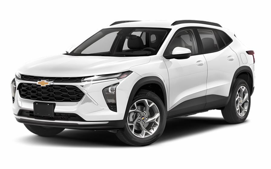
Chevrolet Trax | Automatic
SUVor SUV similar
5
2
Automatic
From
/ day

Kia K5 | Automatic
SEDANor Sedan similar
5
3
Automatic
From
/ day

Chevrolet Spark | Automatic
SMALLor Small similar
4
2
Automatic
From
/ day

Audi A6 | Automatic
or Small similar
5
3
Automatic
From
/ day

Hyundai Santa Fe 7 Passengers | Automatic
7 PASSENGERSor 7 Passengers similar
7
2
Automatic
From
/ day

Chrysler Pacifica 7 Passengers | Automatic
MINIVANor Minivan similar
7
5
Automatic
From
/ day
Frequently Asked Questions
Which pickup area should I follow at Cleveland Hopkins International Airport (CLE) to reach the Hertz counter and the car lot without getting turned around?
Upon arriving at Cleveland Hopkins International Airport, collect your luggage and then look for the overhead signs directing you to "Rental Cars" or "Ground Transportation." CLE has a consolidated rental car facility that houses multiple agencies, including Hertz. You will typically need to board a dedicated shuttle bus for a short ride to this facility. Following the airport's official signage is the most reliable way to navigate, as it will lead you directly to the shuttle pickup zone and then to the correct counter.
If my flight lands late at night at CLE, what’s the easiest way to find the rental return entrance the next morning without relying on perfect GPS timing?
When you pick up your vehicle, take a moment to note the major roads and landmarks near the rental facility entrance, such as the specific exit off the highway. The return area is generally well-marked with signs for "Rental Car Return" as you approach the airport on major routes like the Berea Freeway (Route 237). Making a mental note of the final turn or looking for these dedicated signs can be a great backup to your GPS. This simple observation can make your morning return much smoother and less stressful.
How early should I plan to arrive at the CLE rental car return if I’m flying out during a busy Monday morning rush?
For a busy Monday morning departure, it's wise to build an extra buffer into your travel time. Plan to arrive at the rental car return at least 30 to 45 minutes earlier than you normally would for a flight. This accounts for potential traffic congestion on the highways leading to the airport, the vehicle check-in process, and the shuttle ride back to the terminal. Giving yourself this additional time helps ensure you reach your gate feeling calm and unhurried, even during peak travel hours.
Where can my group wait at CLE while one person handles the rental pickup, without clogging the curb or splitting up too much?
A convenient meeting point is inside the main terminal near the baggage claim carousels after everyone has their luggage. This area offers seating and amenities while being out of the way of active traffic. Alternatively, the group can wait inside the rental car facility's lobby area. Once the rental agreement is complete and the car is ready, the driver can easily circle back to the terminal's passenger pickup curb to collect the rest of the party and their bags.
What’s the least stressful route to drive from CLE to downtown Cleveland if I’m not comfortable with quick lane changes?
The most straightforward route for drivers new to the area is taking I-71 North directly from the airport vicinity. This interstate leads right into the heart of downtown Cleveland. To minimize stress, it's helpful to use a navigation app and review the final few steps of the route before you begin driving. This allows you to anticipate which lane you'll need for your specific exit well in advance, giving you plenty of time to merge safely without last-minute maneuvers.
If I’m staying in Ohio City or Tremont, what’s a simple approach to reach those neighborhoods from the airport without accidentally ending up on the Shoreway or a wrong bridge?
From the airport area, take I-71 North toward downtown. As you approach the city, stay in the middle or right lanes and follow signs for I-90 West. Shortly after merging onto I-90 West, you will see exits for Ohio City and Tremont, such as W 25th Street or Steelyard Drive. This route avoids the more complex interchanges of the Innerbelt Bridge and keeps you on a direct path to these near-west side neighborhoods, preventing confusion with the Shoreway.
What should I know about driving across the Innerbelt Bridge area if I’m heading between downtown Cleveland and the east side during peak traffic?
The Innerbelt Bridge (part of I-90) is a major artery, and it experiences significant congestion during morning and evening commutes. When crossing, be prepared for slower speeds and potential stop-and-go traffic. It's crucial to know your exit in advance, as lane changes can be challenging in heavy traffic. Using a live traffic app can help you anticipate delays and, if necessary, suggest alternate surface street routes to bypass the worst of the slowdowns.
Where are the most common “wrong turn” spots around downtown Cleveland ramps that can send visitors the opposite direction?
A common point of confusion for visitors is the interchange where I-71, I-90, and I-77 converge near downtown. It's easy to accidentally continue on the wrong interstate if you're not in the correct lane early. Specifically, the exits for East 9th Street and the Shoreway (Route 2) can be tricky. To avoid a wrong turn, set your GPS destination before you start driving and pay close attention to the overhead signs, which often list key destinations for each lane.
If I’m visiting the Rock & Roll Hall of Fame, what’s the easiest way to reach the North Coast Harbor area by car without getting trapped in one-way streets?
A simple approach is to take East 9th Street north all the way toward the lakefront. This major thoroughfare leads directly to the North Coast Harbor area where the Rock Hall is located. As you get close, signs will guide you to designated parking areas for the museum and nearby attractions like the Great Lakes Science Center. Using East 9th Street as your primary access road helps you avoid the network of smaller one-way streets closer to the Warehouse District.
When there’s a game or concert at Progressive Field or Rocket Mortgage FieldHouse, how does that typically affect driving and parking near Gateway Plaza?
Events at the Gateway Plaza sports complex significantly increase traffic and parking demand in the surrounding downtown area. Expect street closures, directed traffic patterns, and slower travel times, especially in the hour before and after an event. Major arteries like East 9th Street, Carnegie Avenue, and Ontario Street become very congested. If you're driving in the area during an event, it's wise to allow considerable extra time and consider parking in a garage a few blocks away and walking.
What’s a good plan for seeing both the West Side Market and Edgewater Park in one day by car without backtracking through downtown traffic?
A logical route is to visit the West Side Market in Ohio City first. After your visit, you can easily get on the Cleveland Memorial Shoreway (Route 2) heading west. Edgewater Park has a dedicated exit directly off the Shoreway, making it a quick and scenic drive from the market. This plan keeps you on the west side of the city and uses a major, efficient roadway, allowing you to avoid navigating through downtown's busier streets between these two popular destinations.
If I’m staying near Playhouse Square, what’s the simplest drop-off strategy for luggage without blocking busy streets or confusing valet-only entrances?
When approaching your hotel in the bustling Playhouse Square district, it's best to pull into the hotel's designated passenger loading zone or driveway. These areas are specifically designed for temporary stops to unload luggage and check in. Before you arrive, you can call the hotel to ask for the best street to approach from. This avoids the stress of trying to find a spot on busy streets like Euclid Avenue and ensures you don't accidentally block a valet lane or a through-traffic lane.
How tricky is it to drive to University Circle for the Cleveland Museum of Art on a weekend, and where do visitors usually get slowed down?
Driving to University Circle on a weekend is generally manageable, but the area can be busy due to its concentration of museums and cultural institutions. The primary slowdowns often occur on Euclid Avenue and Martin Luther King Jr. Drive as drivers search for parking. The simplest approach is to decide on a parking garage in advance, such as the museum's own garage, and set your GPS directly to that address. This prevents you from circling the area and getting caught in local traffic.
What’s the easiest way to combine a visit to the Cleveland Botanical Garden and Little Italy in the same trip without fighting for street parking twice?
The best strategy is to park once and walk between the two destinations. A great option is to use the parking garage shared by the Cleveland Museum of Art and the Botanical Garden in University Circle. After visiting the garden, Little Italy is a pleasant and relatively short walk away, just up the hill on Murray Hill Road. This approach saves you the significant hassle of trying to find a second parking spot in the often-crowded, valet-heavy Little Italy neighborhood.
If I’m planning a day at the Cleveland Metroparks Zoo, what should I expect for arrival traffic and parking flow at the main entrance?
On popular days like weekends or holidays, expect a steady flow of traffic leading into the zoo's main entrance off Fulton Parkway. The zoo has a large, dedicated parking lot, and staff are typically on hand to direct cars efficiently to available spaces. To ensure a smooth arrival, it's best to get there early, ideally close to opening time, which helps you avoid the peak entry rush. Following the directional signs and the guidance of the parking attendants is the key to a quick and easy start to your day.
RENTAL CAR LOCATIONS

- Choosing a selection results in a full page refresh.
- Opens in a new window.
Suggested Currencies
- $ USD - United States Dollar
- € EUR - Euro
Other Countries
-
 Albania
-
 Algeria
-
 Andorra
-
 Angola
-
 Antigua & Barbuda
-
 Argentina
-
 Australia
-
 Austria
-
 Bahamas
-
 Bahrain
-
 Bangladesh
-
 Barbados
-
 Belgium
-
 Belize
-
 Benin
Benin
-
 Bermuda
-
 Bolivia
-
 Bosnia & Herzegovina
-
 Botswana
-
 Brazil
-
 British Virgin Islands
-
 Bulgaria
-
 Burkina Faso
-
 Burundi
-
 Cameroon
-
 Canada
-
 Cape Verde
-
 Cayman Islands
-
 Central African Republic
-
 Chad
Chad
-
 Chile
Chile
-
 Colombia
-
 Comoros
-
 Congo - Brazzaville
-
 Congo - Kinshasa
-
 Costa Rica
-
 Côte d’Ivoire
-
 Croatia
-
 Curaçao
-
 Cyprus
-
 Czechia
-
 Denmark
-
 Djibouti
-
 Dominica
-
 Dominican Republic
-
 Ecuador
-
 Egypt
Egypt
-
 El Salvador
-
 Equatorial Guinea
-
 Eritrea
-
 Estonia
-
 Eswatini
-
 Ethiopia
-
 Finland
-
 France
-
 Gabon
Gabon
-
 Gambia
-
 Germany
-
 Ghana
Ghana
-
 Greece
-
 Grenada
-
 Guatemala
-
 Guinea
-
 Guinea-Bissau
-
 Guyana
-
 Haiti
Haiti
-
 Honduras
-
 Hong Kong SAR
-
 Hungary
-
 Iceland
-
 India
India
-
 Iraq
Iraq
-
 Ireland
-
 Israel
-
 Italy
Italy
-
 Jamaica
-
 Japan
Japan
-
 Jordan
-
 Kenya
Kenya
-
 Kuwait
-
 Latvia
-
 Lebanon
-
 Lesotho
-
 Liberia
-
 Libya
Libya
-
 Liechtenstein
-
 Lithuania
-
 Luxembourg
-
 Madagascar
-
 Malawi
-
 Mali
Mali
-
 Malta
Malta
-
 Mauritania
-
 Mauritius
-
 Mexico
-
 Moldova
-
 Monaco
-
 Montenegro
-
 Morocco
-
 Mozambique
-
 Namibia
-
 Netherlands
-
 New Zealand
-
 Nicaragua
-
 Niger
Niger
-
 Nigeria
-
 Norway
-
 Oman
Oman
-
 Palestinian Territories
-
 Panama
-
 Paraguay
-
 Peru
Peru
-
 Philippines
-
 Poland
-
 Portugal
-
 Qatar
Qatar
-
 Romania
-
 Russia
-
 Rwanda
-
 San Marino
-
 São Tomé & Príncipe
-
 Saudi Arabia
-
 Senegal
-
 Serbia
-
 Seychelles
-
 Sierra Leone
-
 Singapore
-
 Sint Maarten
-
 Slovakia
-
 Slovenia
-
 Somalia
-
 South Africa
-
 South Korea
-
 South Sudan
-
 Spain
Spain
-
 St. Lucia
-
 St. Vincent & Grenadines
-
 Sudan
Sudan
-
 Sweden
-
 Switzerland
-
 Taiwan
-
 Tanzania
-
 Togo
Togo
-
 Trinidad & Tobago
-
 Tunisia
-
 Türkiye
-
 Turks & Caicos Islands
-
 Uganda
-
 Ukraine
-
 United Arab Emirates
-
 United Kingdom
-
 United States
-
 Uruguay
-
 Vatican City
-
 Venezuela
-
 Yemen
Yemen
-
 Zambia
-
 Zimbabwe
Driving license from:
-
Albania
-
Algeria
-
Andorra
-
Angola
-
Antigua & Barbuda
-
Argentina
-
Australia
-
Austria
-
Bahamas
-
Bahrain
-
Bangladesh
-
Barbados
-
Belgium
-
Belize
-
Benin
-
Bermuda
-
Bolivia
-
Bosnia & Herzegovina
-
Botswana
-
Brazil
-
British Virgin Islands
-
Bulgaria
-
Burkina Faso
-
Burundi
-
Cameroon
-
Canada
-
Cape Verde
-
Cayman Islands
-
Central African Republic
-
Chad
-
Chile
-
Colombia
-
Comoros
-
Congo - Brazzaville
-
Congo - Kinshasa
-
Costa Rica
-
Côte d’Ivoire
-
Croatia
-
Curaçao
-
Cyprus
-
Czechia
-
Denmark
-
Djibouti
-
Dominica
-
Dominican Republic
-
Ecuador
-
Egypt
-
El Salvador
-
Equatorial Guinea
-
Eritrea
-
Estonia
-
Eswatini
-
Ethiopia
-
Finland
-
France
-
Gabon
-
Gambia
-
Germany
-
Ghana
-
Greece
-
Grenada
-
Guatemala
-
Guinea
-
Guinea-Bissau
-
Guyana
-
Haiti
-
Honduras
-
Hong Kong SAR
-
Hungary
-
Iceland
-
India
-
Iraq
-
Ireland
-
Israel
-
Italy
-
Jamaica
-
Japan
-
Jordan
-
Kenya
-
Kuwait
-
Latvia
-
Lebanon
-
Lesotho
-
Liberia
-
Libya
-
Liechtenstein
-
Lithuania
-
Luxembourg
-
Madagascar
-
Malawi
-
Mali
-
Malta
-
Mauritania
-
Mauritius
-
Mexico
-
Moldova
-
Monaco
-
Montenegro
-
Morocco
-
Mozambique
-
Namibia
-
Netherlands
-
New Zealand
-
Nicaragua
-
Niger
-
Nigeria
-
Norway
-
Oman
-
Palestinian Territories
-
Panama
-
Paraguay
-
Peru
-
Philippines
-
Poland
-
Portugal
-
Qatar
-
Romania
-
Russia
-
Rwanda
-
San Marino
-
São Tomé & Príncipe
-
Saudi Arabia
-
Senegal
-
Serbia
-
Seychelles
-
Sierra Leone
-
Singapore
-
Sint Maarten
-
Slovakia
-
Slovenia
-
Somalia
-
South Africa
-
South Korea
-
South Sudan
-
Spain
-
St. Lucia
-
St. Vincent & Grenadines
-
Sudan
-
Sweden
-
Switzerland
-
Taiwan
-
Tanzania
-
Togo
-
Trinidad & Tobago
-
Tunisia
-
Türkiye
-
Turks & Caicos Islands
-
Uganda
-
Ukraine
-
United Arab Emirates
-
United Kingdom
-
United States
-
Uruguay
-
Vatican City
-
Venezuela
-
Yemen
-
Zambia
-
Zimbabwe