


VERIFIED REVIEWS


About renting a car with Enterprise in Louisville
Best Car Rental Deals
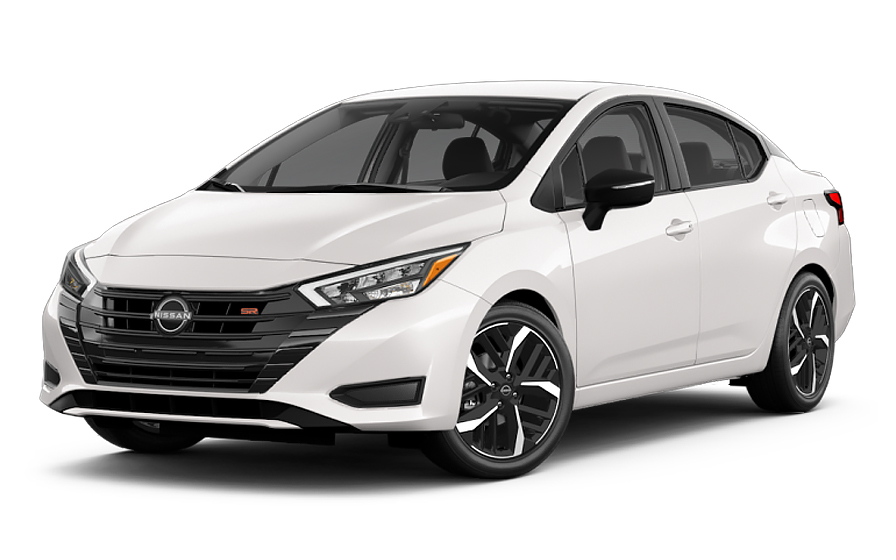
Nissan Versa | Automatic
SMALLor Small similar

Volkswagen Jetta | Automatic
SEDANor Sedan similar
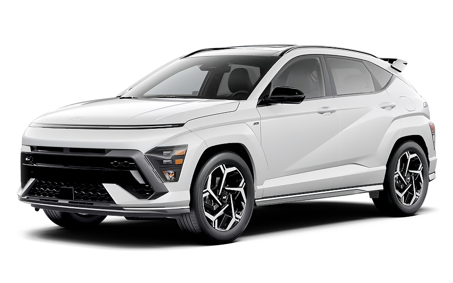
Hyundai Kona | Automatic
SUVor SUV similar

Jeep Gladiator | Automatic
JEEPor Jeep similar
Frequently Asked Questions
What does my Hola Car Rentals booking with Enterprise in Louisville include that other companies don't offer?
Hola Car Rentals is the only premium partner of the top car rental brands operating in Louisville, including Enterprise, giving you exclusive access to our All Inclusive+ rate. This rate includes benefits that no other company can match:
- Free liability coverage starting at US$ 300,000 in case of an accident (applies only to certain rates and itineraries)
- Toll cashback: recover up to 5% of the reservation's total value for toll charges incurred during your rental period
- Premium travel medical assistance providing up to US$ 150,000 in coverage for a maximum of 5 passengers in case of a medical emergency, excluding pre-existing conditions
- No Extra Charges© guarantee: if the counter charges you for something not listed on your confirmation and not an optional add-on you accepted, Hola Car Rentals will work to remove or reimburse the charge after verification
All of this comes at no extra cost, ensuring a fully protected Enterprise rental experience and peace of mind throughout your trip in Louisville.
Will I face unexpected charges at the Enterprise counter in Louisville when I book through Hola Car Rentals?
No. With Hola Car Rentals, all costs and charges for your Enterprise booking in Louisville are clearly shown at the time of reservation and in your confirmation email, so you know exactly what you are paying before you arrive at the Enterprise counter.
On top of that, every Hola Car Rentals booking includes the No Extra Charges© guarantee. This is a pricing guarantee (not insurance) that protects you if the Enterprise counter in Louisville charges you for something that was not listed on your confirmation and was not an optional add-on you accepted. If that happens, Hola Car Rentals will work with Enterprise to remove or reimburse the charge after verification.
The only costs outside this guarantee are:
- Optional add-ons you choose at the counter (GPS, child seats, prepaid fuel)
- Usage-based charges (tolls, fuel shortfall, traffic fines)
Where is the Enterprise counter at Louisville International Airport (SDF)?
The Enterprise counter at Louisville International Airport (SDF) is located inside the terminal on the lower level, directly across from baggage claim C. After collecting your bags, take the elevator or escalator down to the lower level and follow signs to the Enterprise desk.
Once you have completed the paperwork at the counter, your vehicle is within walking distance in the Rental Car Garage on the same level, so no shuttle is needed. The Enterprise counter at Louisville SDF is open daily from 6:00 AM to 11:59 PM.
If you are arriving late, after-hours returns are available: park in the Enterprise-designated space in the return lane and drop your keys in the key drop box located at the counter near baggage claim. After-hours pickup is not available at this Louisville location.
What documents do I need to pick up my Enterprise rental car in Louisville?
To pick up your Enterprise rental car in Louisville, you must present the following physical documents at the counter:
- A valid, original driver's license in the main driver's name
- A major credit card with the driver's name printed on the card, in the main driver's name, for the security deposit hold
- A passport or valid government-issued photo ID
- Your booking confirmation or printed voucher
- Round-trip flight or travel tickets if you are visiting from abroad
If your driver's license is not in English and does not use a Latin (Roman) alphabet, such as Arabic, Chinese, Japanese, or Cyrillic script, an International Driving Permit (IDP) is required alongside your original license. The IDP is a translation only and cannot be used without the original license.
All documents presented at the Enterprise counter in Louisville must be physical originals. Digital copies on a phone or tablet are not accepted. Bring a backup credit card in your name in case your primary card is declined.
How do tolls work for Enterprise rentals in Louisville?
Louisville uses a fully cashless toll system called RiverLink, which covers the bridges connecting Louisville and Southern Indiana, including the John F. Kennedy Memorial, Abraham Lincoln, and Lewis and Clark bridges. There are no toll booths; payment is collected electronically via license plate photography.
Your Enterprise rental vehicle in Louisville will be enrolled in a pay-per-use toll program. Here is how the charges work:
- A daily convenience charge of US$4.95 applies only on days when you actually use a toll road
- The daily charge is capped at US$30 to US$34.65 per rental period
- Actual toll amounts are added on top, billed at the higher of the video toll rate, cash toll rate, or highest undiscounted rate
- Charges are billed to your card on file approximately 4 to 6 weeks after the toll data is received from RiverLink
To avoid the convenience charge entirely, you can use your own personally owned transponder (confirm coverage with your issuer) or use the NextPass app by adding the rental vehicle's license plate directly. If you plan to use a personal transponder, inform the Enterprise counter representative in Louisville at pickup so the vehicle's default device can be deactivated to prevent duplicate charges.
Can I get cashback on RiverLink tolls paid during my Enterprise rental in Louisville?
Yes, you can get cashback on tolls paid during your Enterprise rental in Louisville through the Hola Car Rentals Tolls Cashback benefit, which is included in all bookings.
The benefit reimburses the lesser of the total tolls you paid or up to 5% of your total booking value. For example, if your booking total is US$500, the cap is US$25. If you paid US$18 in RiverLink tolls on the Louisville bridges, you receive US$18 back. If you paid US$40, you receive US$25 (the cap).
To claim your cashback after returning your Enterprise vehicle in Louisville:
- Email [email protected] within 30 days of vehicle return
- Use the subject line: Tolls Cashback - Reservation [Your Confirmation Number]
- Attach your Hola Car Rentals confirmation, the signed rental agreement, and a toll receipt or statement showing charges paid
- Include your full name, travel dates, and the last 4 digits of the card used for the booking
Refunds are issued to your original payment method and typically process within 7 to 10 business days after approval. Late submissions received after 30 days are not accepted.
Is a credit card required to pick up an Enterprise car in Louisville?
Yes, a major credit card in the main driver's name with the driver's name printed on the card is required to pick up your Enterprise rental car in Louisville. The card is used to place a temporary security hold, not a charge, on your available credit at the time of pickup.
For standard vehicles at Enterprise locations in Louisville, the typical hold is approximately US$300 to US$400, though the exact amount is set by the Enterprise counter and may vary by vehicle class or rental duration.
- The card must be physical; virtual cards, digital wallets, and single-use card numbers are not accepted
- Debit cards and prepaid cards are not accepted for the security hold
- The card must be in the main driver's name, even if you prepaid your booking online
After you return the vehicle, Enterprise releases the hold. Your bank controls how quickly the funds appear back on your statement, which can take up to 15 business days. Bring a backup credit card in your name in case your primary card is declined at the Louisville counter.
What is the minimum age to rent a car with Enterprise in Louisville?
The minimum age to rent a car with Enterprise in Louisville, Kentucky is 21. Drivers aged 21 to 24 can rent but will be charged a daily young-renter surcharge on top of the base rental rate. Drivers aged 25 and older are not subject to this fee.
For Enterprise in Louisville, the young-renter surcharge is US$15 per day plus applicable taxes, paid at the counter.
Additional restrictions apply for drivers under 25:
- Most premium, full-size, luxury, SUV, minivan, and specialty vehicle classes are restricted to renters aged 25 and older
- Economy, compact, and intermediate vehicle classes are generally available to renters aged 21 to 24
- Any additional driver under 25 is also subject to the surcharge and the same class restrictions
A valid driver's license and a major credit card in the main driver's name are still required regardless of age. If your license uses a non-Latin alphabet, an International Driving Permit is also required at the Louisville Enterprise counter.
How does the fuel policy work for Enterprise rentals in Louisville?
Enterprise rentals in Louisville follow a Full-to-Full fuel policy by default. You receive the vehicle with a full tank and must return it full to avoid fuel charges.
Here is what to do at each stage of your Louisville rental:
- At pickup: confirm the fuel gauge reads full and ensure the starting level is recorded on the rental agreement. Take a photo of the dashboard showing the gauge and odometer
- During the rental: use the correct fuel type as shown in the vehicle. Keep fuel receipts in case of any dispute
- Before return: refuel within approximately 10 miles or 15 km of the Enterprise return location at Louisville SDF or the downtown location at 433 S 8th St. Refueling too far from the return point risks the gauge dropping below full before you arrive
If you return the Enterprise vehicle in Louisville with less than a full tank, you may be charged for the fuel shortfall at the partner's refueling rate, which is typically higher than the pump price, plus a refueling service fee. Keep your final receipt showing the date, time, and station address as proof of a full tank.
Does Enterprise in Louisville charge extra for an additional driver?
Yes, Enterprise in Louisville charges for an additional driver unless your booking confirmation explicitly states that an additional driver is included at no charge.
The standard Enterprise additional driver fee in Louisville is US$15 per day plus applicable taxes, paid at the counter. There is no published cap for Enterprise, so the fee accumulates for each day of the rental.
To add an additional driver at the Enterprise counter in Louisville:
- The additional driver must be present at pickup with a valid driver's license
- If their license uses a non-Latin alphabet, an International Driving Permit is also required
- Both the main driver and the additional driver must sign the rental agreement
- The additional driver must meet the same minimum age requirements as the main driver
Only drivers listed on the rental agreement are covered by the vehicle's protections such as CDW and liability coverage. Anyone who drives the Enterprise vehicle in Louisville without being named on the contract may void those protections entirely. Check your booking confirmation before arriving at the Louisville counter to confirm whether an additional driver is included in your rate.
What travel assistance is included with my Enterprise booking in Louisville?
Most Hola Car Rentals bookings, including Enterprise rentals in Louisville, include travel assistance coverage provided by Terrawind Global Protection. This benefit is particularly useful if you experience a medical emergency or other travel disruption during your Louisville trip.
Core benefits typically included are:
- Travel insurance with medical coverage for up to 5 passengers
- Legal assistance in case of a road accident
- Compensation for luggage lost by the airline
- Flight cancellation insurance
This coverage is designed for travelers visiting from abroad and does not apply to US or Canadian residents.
If you need assistance during your Enterprise rental in Louisville, contact Terrawind 24 hours a day, 7 days a week:
- Phone (toll-free or collect): +1 888 980 9992
- WhatsApp: +1 208 910 1001
- Email: [email protected]
Have your full name and Hola Car Rentals confirmation number ready when you call. Always contact the assistance line before incurring medical expenses, as some reimbursements require prior authorization. Check your booking confirmation for the exact terms and coverage limits that apply to your Louisville reservation.
Can I pick up my Enterprise car in Louisville and return it to a different city?
Yes, one-way rentals are possible with Enterprise in Louisville, but a drop-off fee may apply depending on your return location.
Whether a fee applies depends on the specific route:
- Returning to a different Enterprise location within Louisville, such as from the airport at SDF to the downtown location at 433 S 8th St, often does not incur a drop-off fee
- Returning to a different city or state typically does incur a one-way drop-off fee, which varies by distance, vehicle class, and season
- Cross-border returns, such as returning to Canada, may be restricted or carry higher fees
The drop-off fee for your Enterprise Louisville reservation is always shown during the booking process under the section labeled as charges due at the destination. It cannot be prepaid and is paid directly to Enterprise at the counter.
If you need to change your return location after booking, contact support before your pickup date, as mid-rental route changes must be approved by the Enterprise location and may increase the fee or affect availability.
What are the one-way street rules I should know when driving an Enterprise rental in Louisville?
Louisville has an unusually extensive network of one-way streets, particularly in the downtown area and surrounding neighborhoods, which can be disorienting for first-time drivers in an Enterprise rental.
Key things to be aware of:
- Many streets in central Louisville run in a single direction only, forcing longer routes to reach nearby destinations
- Examples of one-way eastbound streets include Liberty Street and Bank Street; westbound examples include Muhammad Ali Boulevard and Breckinridge Street
- The city is actively converting some one-way corridors to two-way traffic, including Logan Street, Shelby Street, and sections of 5th Street and Chestnut Street, so navigation apps may not always reflect the most current layout
The best approach when driving your Enterprise rental in Louisville is to use a GPS or navigation app and follow real-time directions rather than relying on memory or printed maps. If your rental does not include a GPS device, your smartphone with a data connection is a reliable alternative. Always obey posted directional signs, as driving the wrong way on a one-way street carries traffic fines in Kentucky.
What insurance coverage is included with my Enterprise rental in Louisville?
The insurance and protection options included with your Enterprise rental in Louisville depend on the rate plan selected when you booked. Check your booking confirmation for the exact coverages listed.
The two main protections to look for are:
- Collision Damage Waiver (CDW) or Loss Damage Waiver (LDW): reduces your financial liability for damage to the Enterprise vehicle from a collision, theft, or vandalism. A deductible may apply unless your confirmation states zero deductible. CDW and LDW do not cover damage to other vehicles or injuries to third parties
- Third-Party Liability (LIS/ALI/SLI): covers bodily injury and property damage you may cause to others while driving the Enterprise rental in Louisville. Some US states require a minimum level of liability; Kentucky does not mandate that rental companies include it by default, so adding supplemental liability coverage is strongly recommended
Neither CDW nor LDW covers personal injuries to you or your passengers, or your personal belongings. Those require separate Personal Accident Insurance (PAI) or Personal Effects Coverage (PEC).
Review your rental agreement carefully at the Enterprise counter in Louisville before signing, and confirm which protections are active and what deductibles apply.
What happens if I return my Enterprise car in Louisville later than scheduled?
If you return your Enterprise rental in Louisville after the agreed drop-off time, a grace period of approximately 30 minutes typically applies before additional charges are triggered. However, this grace period is not guaranteed and varies by location and rental agreement.
If you exceed the grace period at the Louisville Enterprise location:
- You may be charged for additional hours or a full extra day, depending on how late the return is
- A late return fee may also apply on top of the extra time charges
- Charges are billed to the credit card on file from your reservation
If you know in advance that you will need the Enterprise vehicle in Louisville for longer than originally booked, contact Enterprise directly or reach out to support before the scheduled return time to request an extension. Extending in advance is almost always less expensive than being charged for an unplanned late return.
For after-hours returns at Louisville SDF, park in the Enterprise-designated space in the return lane and use the key drop box at the counter near baggage claim. Note that liability for the vehicle may continue until Enterprise formally checks it in the next morning, so document the vehicle's condition with photos before dropping the keys.

- Choosing a selection results in a full page refresh.
- Opens in a new window.
Suggested Currencies
- $ USD - United States Dollar
- € EUR - Euro
Other Countries
-
 Albania
-
 Algeria
-
 Andorra
-
 Angola
-
 Antigua & Barbuda
-
 Argentina
-
 Australia
-
 Austria
-
 Bahamas
-
 Bahrain
-
 Bangladesh
-
 Barbados
-
 Belgium
-
 Belize
-
 Benin
Benin
-
 Bermuda
-
 Bolivia
-
 Bosnia & Herzegovina
-
 Botswana
-
 Brazil
-
 British Virgin Islands
-
 Bulgaria
-
 Burkina Faso
-
 Burundi
-
 Cameroon
-
 Canada
-
 Cape Verde
-
 Cayman Islands
-
 Central African Republic
-
 Chad
Chad
-
 Chile
Chile
-
 Colombia
-
 Comoros
-
 Congo - Brazzaville
-
 Congo - Kinshasa
-
 Costa Rica
-
 Côte d’Ivoire
-
 Croatia
-
 Curaçao
-
 Cyprus
-
 Czechia
-
 Denmark
-
 Djibouti
-
 Dominica
-
 Dominican Republic
-
 Ecuador
-
 Egypt
Egypt
-
 El Salvador
-
 Equatorial Guinea
-
 Eritrea
-
 Estonia
-
 Eswatini
-
 Ethiopia
-
 Finland
-
 France
-
 Gabon
Gabon
-
 Gambia
-
 Germany
-
 Ghana
Ghana
-
 Greece
-
 Grenada
-
 Guatemala
-
 Guinea
-
 Guinea-Bissau
-
 Guyana
-
 Haiti
Haiti
-
 Honduras
-
 Hong Kong SAR
-
 Hungary
-
 Iceland
-
 India
India
-
 Iraq
Iraq
-
 Ireland
-
 Israel
-
 Italy
Italy
-
 Jamaica
-
 Japan
Japan
-
 Jordan
-
 Kenya
Kenya
-
 Kuwait
-
 Latvia
-
 Lebanon
-
 Lesotho
-
 Liberia
-
 Libya
Libya
-
 Liechtenstein
-
 Lithuania
-
 Luxembourg
-
 Madagascar
-
 Malawi
-
 Mali
Mali
-
 Malta
Malta
-
 Mauritania
-
 Mauritius
-
 Mexico
-
 Moldova
-
 Monaco
-
 Montenegro
-
 Morocco
-
 Mozambique
-
 Namibia
-
 Netherlands
-
 New Zealand
-
 Nicaragua
-
 Niger
Niger
-
 Nigeria
-
 Norway
-
 Oman
Oman
-
 Palestinian Territories
-
 Panama
-
 Paraguay
-
 Peru
Peru
-
 Philippines
-
 Poland
-
 Portugal
-
 Qatar
Qatar
-
 Romania
-
 Russia
-
 Rwanda
-
 San Marino
-
 São Tomé & Príncipe
-
 Saudi Arabia
-
 Senegal
-
 Serbia
-
 Seychelles
-
 Sierra Leone
-
 Singapore
-
 Sint Maarten
-
 Slovakia
-
 Slovenia
-
 Somalia
-
 South Africa
-
 South Korea
-
 South Sudan
-
 Spain
Spain
-
 St. Lucia
-
 St. Vincent & Grenadines
-
 Sudan
Sudan
-
 Sweden
-
 Switzerland
-
 Taiwan
-
 Tanzania
-
 Togo
Togo
-
 Trinidad & Tobago
-
 Tunisia
-
 Türkiye
-
 Turks & Caicos Islands
-
 Uganda
-
 Ukraine
-
 United Arab Emirates
-
 United Kingdom
-
 United States
-
 Uruguay
-
 Vatican City
-
 Venezuela
-
 Yemen
Yemen
-
 Zambia
-
 Zimbabwe
Driving license from:
-
Albania
-
Algeria
-
Andorra
-
Angola
-
Antigua & Barbuda
-
Argentina
-
Australia
-
Austria
-
Bahamas
-
Bahrain
-
Bangladesh
-
Barbados
-
Belgium
-
Belize
-
Benin
-
Bermuda
-
Bolivia
-
Bosnia & Herzegovina
-
Botswana
-
Brazil
-
British Virgin Islands
-
Bulgaria
-
Burkina Faso
-
Burundi
-
Cameroon
-
Canada
-
Cape Verde
-
Cayman Islands
-
Central African Republic
-
Chad
-
Chile
-
Colombia
-
Comoros
-
Congo - Brazzaville
-
Congo - Kinshasa
-
Costa Rica
-
Côte d’Ivoire
-
Croatia
-
Curaçao
-
Cyprus
-
Czechia
-
Denmark
-
Djibouti
-
Dominica
-
Dominican Republic
-
Ecuador
-
Egypt
-
El Salvador
-
Equatorial Guinea
-
Eritrea
-
Estonia
-
Eswatini
-
Ethiopia
-
Finland
-
France
-
Gabon
-
Gambia
-
Germany
-
Ghana
-
Greece
-
Grenada
-
Guatemala
-
Guinea
-
Guinea-Bissau
-
Guyana
-
Haiti
-
Honduras
-
Hong Kong SAR
-
Hungary
-
Iceland
-
India
-
Iraq
-
Ireland
-
Israel
-
Italy
-
Jamaica
-
Japan
-
Jordan
-
Kenya
-
Kuwait
-
Latvia
-
Lebanon
-
Lesotho
-
Liberia
-
Libya
-
Liechtenstein
-
Lithuania
-
Luxembourg
-
Madagascar
-
Malawi
-
Mali
-
Malta
-
Mauritania
-
Mauritius
-
Mexico
-
Moldova
-
Monaco
-
Montenegro
-
Morocco
-
Mozambique
-
Namibia
-
Netherlands
-
New Zealand
-
Nicaragua
-
Niger
-
Nigeria
-
Norway
-
Oman
-
Palestinian Territories
-
Panama
-
Paraguay
-
Peru
-
Philippines
-
Poland
-
Portugal
-
Qatar
-
Romania
-
Russia
-
Rwanda
-
San Marino
-
São Tomé & Príncipe
-
Saudi Arabia
-
Senegal
-
Serbia
-
Seychelles
-
Sierra Leone
-
Singapore
-
Sint Maarten
-
Slovakia
-
Slovenia
-
Somalia
-
South Africa
-
South Korea
-
South Sudan
-
Spain
-
St. Lucia
-
St. Vincent & Grenadines
-
Sudan
-
Sweden
-
Switzerland
-
Taiwan
-
Tanzania
-
Togo
-
Trinidad & Tobago
-
Tunisia
-
Türkiye
-
Turks & Caicos Islands
-
Uganda
-
Ukraine
-
United Arab Emirates
-
United Kingdom
-
United States
-
Uruguay
-
Vatican City
-
Venezuela
-
Yemen
-
Zambia
-
Zimbabwe