


VERIFIED REVIEWS


About renting a car with Enterprise in Kentucky
Best Car Rental Deals

Nissan Versa | Automatic
SMALLor Small similar

Hyundai Kona | Automatic
SUVor SUV similar

Volkswagen Jetta | Automatic
SEDANor Sedan similar

Chrysler Pacifica 7 Passengers | Automatic
MINIVANor Minivan similar
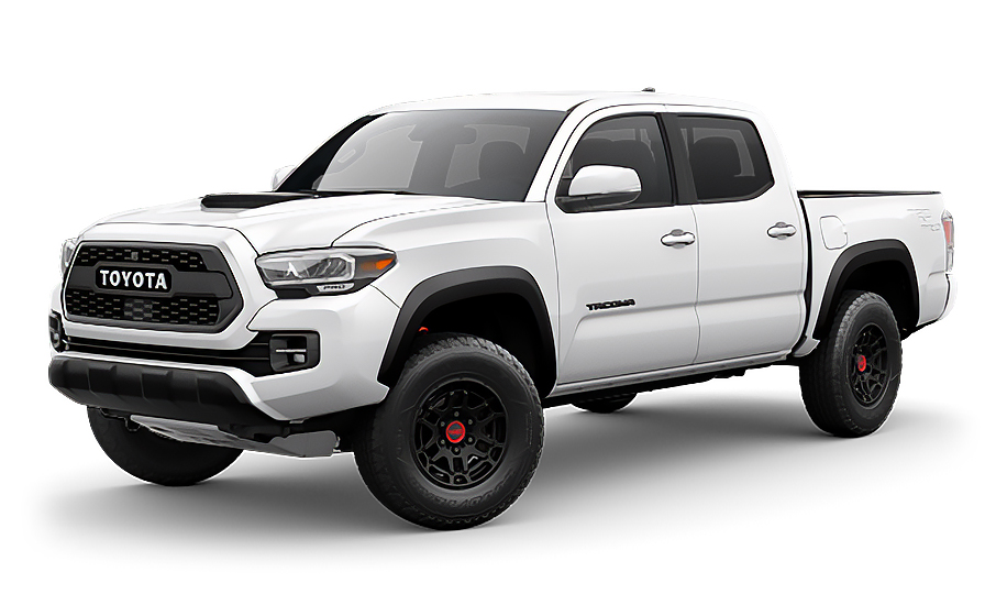
Toyota Tacoma | Automatic
PICKUPor Pickup similar

Jeep Gladiator | Automatic
JEEPor Jeep similar
Frequently Asked Questions
What does my Hola Car Rentals booking with Enterprise in Kentucky include that other companies don't offer?
Hola Car Rentals is the only premium partner of the top car rental brands operating in Kentucky, including Enterprise, giving you exclusive access to our All Inclusive+ rate. This rate includes benefits that no other company can match:
- Free liability coverage starting at US$ 300,000 in case of an accident (applies only to certain rates and itineraries)
- Toll cashback: recover up to 5% of the reservation's total value for toll charges incurred during your rental period
- Premium travel medical assistance providing up to US$ 150,000 in coverage for a maximum of 5 passengers in case of a medical emergency, excluding pre-existing conditions
- No Extra Charges© guarantee: if the counter charges you for something not listed on your confirmation and not an optional add-on you accepted, Hola Car Rentals will work to remove or reimburse the charge after verification
All of this comes at no extra cost, ensuring a fully protected Enterprise rental experience and peace of mind throughout your trip in Kentucky.
Will I face unexpected charges at the Enterprise counter in Kentucky when I book through Hola Car Rentals?
No. With Hola Car Rentals, all costs and charges for your Enterprise booking in Kentucky are clearly shown at the time of reservation and in your confirmation email, so you know exactly what you are paying before you arrive at the Enterprise counter.
On top of that, every Hola Car Rentals booking includes the No Extra Charges© guarantee. This is a pricing guarantee (not insurance) that protects you if the Enterprise counter in Kentucky charges you for something that was not listed on your confirmation and was not an optional add-on you accepted. If that happens, Hola Car Rentals will work with Enterprise to remove or reimburse the charge after verification.
The only costs outside this guarantee are:
- Optional add-ons you choose at the counter (GPS, child seats, prepaid fuel)
- Usage-based charges (tolls, fuel shortfall, traffic fines)
Where is the Enterprise counter at Louisville Muhammad Ali International Airport (SDF) in Kentucky?
The Enterprise counter at Louisville Muhammad Ali International Airport (SDF) in Kentucky is located inside the terminal on the lower level, directly across from baggage claim C. No shuttle is required; the counter is within walking distance of the baggage claim area.
After completing your paperwork at the Enterprise counter, you can walk to the nearby Rental Car Garage to collect your vehicle. When returning, park in the Enterprise return lane on the lower level of the Rental Car Garage and drop your keys in the drop box at the Enterprise counter near baggage claim.
For after-hours returns at this Kentucky location, use the key drop box at the counter. Always confirm your return time against the counter's operating hours before your trip ends.
Where is the Enterprise counter at Cincinnati-Northern Kentucky International Airport (CVG)?
At Cincinnati-Northern Kentucky International Airport (CVG), the Enterprise counter is located on the baggage claim level. Follow the Car Rental signs from the arrivals hall to reach the Enterprise desk directly, without needing a shuttle.
CVG is one of the busiest Enterprise locations in Kentucky, and the counter operates extended hours, including early morning openings and late-night closings on Fridays and Saturdays (approximately 6:00 AM to 11:59 PM on those days). Hours on other days may differ, so confirm your specific pickup time against the counter schedule shown on your booking confirmation.
When returning your vehicle at CVG, follow the Rental Car Return signs to the Enterprise designated spaces and allow time to refuel nearby before dropping off, as the full-to-full fuel policy applies to all Enterprise rentals in Kentucky.
What are the Enterprise counter hours at Kentucky airports?
Enterprise counter hours vary by location across Kentucky airports and neighborhood branches. Here are examples from the research:
- CVG (Cincinnati-Northern Kentucky International Airport): Extended hours, approximately 6:00 AM to 11:59 PM on Fridays and Saturdays
- SDF (Louisville Muhammad Ali International Airport): Counter open during key arrival and departure hours; after-hours key drop available
- OWB (Owensboro-Daviess County Regional Airport): Monday to Thursday 8:00 AM to 5:00 PM; limited or closed on weekends
- PAH (Paducah Barkley Regional Airport): Daily approximately 10:00 AM to 8:00 PM; closed Saturdays
- Neighborhood branches (e.g., Louisville, Lexington): Typically Monday to Friday 8:00 AM to 6:00 PM, Saturday 9:00 AM to 1:00 PM, closed Sunday
Always verify the exact hours for your specific Enterprise location in Kentucky on your booking confirmation, as hours can change on public holidays. If you expect to arrive outside counter hours, check whether a key drop box is available at your chosen Kentucky Enterprise branch.
How do tolls work for Enterprise rentals in Kentucky?
Kentucky uses a fully cashless toll system, meaning there are no toll booths and traffic flows without stopping. Tolls are collected electronically via license plate photography at toll plazas. The main toll system operating in the Louisville area is RiverLink, which covers the bridges connecting Louisville and Southern Indiana, including the John F. Kennedy Memorial, Abraham Lincoln, and Lewis and Clark bridges. RiverLink also accepts E-ZPass and Pay-By-Plate accounts.
When you rent from Enterprise in Kentucky, your vehicle comes equipped with an electronic toll device. You have two main options at the counter:
- Enroll in a pay-per-use toll program: you are charged for each toll incurred, plus a daily convenience fee (approximately US$4.95 per day, capped at around US$30 to US$34.65 per rental period). The daily fee only applies on days you actually use a toll road.
- Use your own personally owned transponder or the NextPass app: add the rental vehicle's license plate to your account to avoid the Enterprise convenience charge.
If you drive through a toll without enrolling in any program, Enterprise will receive the invoice from the toll authority and charge the toll amount plus administrative fees to your card on file, typically within 4 to 6 weeks after the rental ends.
Toll rates for a standard car in Kentucky range from US$2.68 with a transponder to US$5.36 with no account (invoice rate).
Can I get a Tolls Cashback on my Enterprise rental in Kentucky?
Yes, all bookings made through Hola Car Rentals include Tolls Cashback, which applies to Enterprise rentals in Kentucky as well. You can get up to 5% of your total booking value back for tolls you paid during your rental, including any RiverLink charges on the Louisville bridges or other cashless toll roads in Kentucky.
To claim your cashback after returning your Enterprise vehicle in Kentucky:
- Email [email protected] within 30 days of returning the vehicle
- Use the subject line: Tolls Cashback - Reservation [Your Confirmation Number]
- Attach your Hola Car Rentals confirmation, the signed rental agreement from Enterprise, and a receipt or statement showing the toll charges paid
The refund is calculated as the lesser of the actual tolls paid or 5% of your booking total. For example, if your booking total is US$500, the maximum cashback is US$25. If you paid US$18 in Kentucky tolls, you receive US$18 back. Refunds are processed to your original payment method within 7 to 10 business days after approval. Late submissions received after 30 days are not accepted.
What documents do I need to pick up an Enterprise rental car in Kentucky?
To pick up your Enterprise rental car in Kentucky, you must present the following physical documents at the counter:
- A valid, unexpired driver's license (original, not digital) in the main driver's name, valid for the entire rental period
- A major credit card with the driver's name printed on the card, in the main driver's name, for the security deposit hold
- A passport or valid government-issued photo ID
- Your booking confirmation or printed voucher
- Round-trip flight or cruise tickets (required for visitors traveling internationally)
If your driver's license is not in English and does not use a Latin (Roman) alphabet, such as Arabic, Chinese, Japanese, or Cyrillic script, an International Driving Permit (IDP) is mandatory alongside your original license. For licenses in English or using a Latin alphabet, an IDP is recommended but not strictly required at most Enterprise locations in Kentucky.
Debit cards and prepaid cards are not accepted for the security deposit hold at Enterprise in Kentucky. All documents must be physical; digital versions will not be accepted at the counter.
Is a credit card required for the security deposit at Enterprise in Kentucky?
Yes, a physical major credit card in the main driver's name with the driver's name printed on the card is required for the security deposit hold at Enterprise locations in Kentucky. Debit cards, prepaid cards, and virtual or digital wallet payments are not accepted for the deposit.
At Enterprise in Kentucky, the typical security hold for a standard vehicle is approximately US$300 to US$400, though the exact amount varies by location, vehicle class, and season. Premium or specialty vehicles may carry a higher hold.
The hold is a temporary authorization, not a charge. It reduces your available credit until Enterprise releases it after you return the vehicle. Your bank or card issuer controls how quickly the hold disappears from your statement, which can take up to 15 business days after release.
Before your pickup at any Kentucky Enterprise location, notify your bank of your travel plans to prevent the authorization from being flagged as suspicious, and ensure you have sufficient available credit to cover both the hold and any expected charges.
What is the minimum age to rent a car from Enterprise in Kentucky?
At Enterprise locations in Kentucky, the standard minimum age to rent without a surcharge is 25. Drivers aged 21 to 24 can rent from Enterprise in Kentucky but will be charged a daily young-renter surcharge, and most vehicle classes are restricted to renters aged 25 and older.
Vehicle classes typically restricted to renters 25 and older at Enterprise in Kentucky include full-size sedans, full-size SUVs, minivans, vans, convertibles, luxury, and premium vehicles. Younger renters are generally limited to economy, compact, and intermediate categories.
Kentucky is not one of the states (such as New York or Michigan) where law requires rental companies to rent to drivers aged 18 and older. The Enterprise standard policy applies, meaning 21 is the practical minimum age in Kentucky, subject to the young-renter surcharge.
Note that some Enterprise neighborhood locations in Louisville may also apply surcharges to drivers over 70. Always confirm the specific surcharge amount for your age group on your booking confirmation before arriving at the Kentucky counter.
Does Enterprise in Kentucky offer travel assistance if something goes wrong during my rental?
Yes, most bookings made through Hola Car Rentals include travel assistance coverage via Terrawind Global Protection, which applies to Enterprise rentals in Kentucky. This is particularly useful if you experience an emergency while driving on Kentucky highways or in more remote areas of the state.
The travel assistance coverage typically includes:
- Travel insurance with medical coverage for up to 5 passengers
- Legal assistance in the event of a road accident
- Compensation for luggage lost by the airline
- Flight cancellation insurance
To reach the 24/7 assistance line, call +1 888 980 9992 (toll-free) or contact via WhatsApp at +1 208 910 1001. Have your Hola Car Rentals confirmation number ready when you call.
Important: this travel assistance benefit does not apply to residents of the United States or Canada. It is designed for international visitors renting from Enterprise in Kentucky. It also does not cover damage to the rental vehicle itself (that is handled by CDW/LDW) or third-party liability (covered by LIS/ALI/SLI).
How does the fuel policy work for Enterprise rentals in Kentucky?
Enterprise rentals in Kentucky follow a full-to-full fuel policy. You receive the vehicle with a full tank and must return it full to avoid additional charges. If you return the car with less than a full tank, Enterprise will charge you for the fuel shortfall at their refueling rate, which is typically higher than retail pump prices, plus a service fee.
To avoid fuel charges at any Enterprise location in Kentucky:
- Check the fuel gauge with the agent at pickup and confirm the starting level is recorded on the rental agreement
- Take a photo of the dashboard showing the full gauge and odometer at pickup
- Refuel within approximately 10 miles or 15 km of the return location so the gauge does not drop before you arrive
- Keep your final fuel receipt as proof in case of any dispute
If you are returning to a Kentucky airport such as SDF, CVG, or LEX, ask the Enterprise agent at pickup about the nearest fuel stations to the return point, or use a navigation app to locate one on your way back. For after-hours returns at SDF, leave your fuel receipt in the key drop envelope and keep a photo of the full gauge on your phone.
Can I add an additional driver to my Enterprise rental in Kentucky?
Yes, you can add an additional driver to your Enterprise rental in Kentucky, either as part of your rate or by paying a fee at the counter. For Enterprise in Kentucky, the additional driver fee is US$15 per day plus applicable taxes when not included in your rate.
To add an additional driver at any Enterprise location in Kentucky:
- The additional driver must be present at the counter at pickup
- They must present a valid driver's license (and an IDP if their license uses a non-Latin alphabet)
- They must meet the minimum age requirements for Kentucky
- Both the main driver and the additional driver must sign the rental agreement
Only drivers listed on the Enterprise rental agreement in Kentucky are covered by the vehicle's protections, including CDW/LDW and liability coverage. If someone drives who is not named on the contract, coverage may be void and additional charges could apply.
Check your booking confirmation before arriving at the Enterprise counter in Kentucky to see whether your rate already includes one additional driver at no extra cost.
Can I pick up my Enterprise car in one Kentucky city and return it in another?
Yes, one-way rentals are available through Enterprise in Kentucky, allowing you to pick up in one city and return in another, such as picking up in Louisville and dropping off in Lexington. However, a drop-off fee may apply depending on the route, vehicle class, and season.
Enterprise operates over 50 locations across Kentucky, including airports and neighborhood branches in Louisville, Lexington, Bowling Green, Owensboro, Paducah, Covington, Florence, Georgetown, and other cities. This wide network makes one-way rentals within Kentucky practical for many routes.
The drop-off fee for your specific Enterprise route in Kentucky will be shown during the booking process under the To Pay at Destination section of the checkout screen. It will also appear on your booking confirmation. This fee cannot be prepaid and is paid directly to Enterprise at the counter.
If you need to change your drop-off location after booking, be aware that the route may be repriced and the drop-off fee recalculated. Cross-border one-way rentals, such as returning an Enterprise vehicle outside Kentucky to another U.S. state, may carry higher fees or restrictions depending on the route.
What insurance coverage do I need for my Enterprise rental in Kentucky?
When renting from Enterprise in Kentucky, two main types of coverage are worth understanding before you arrive at the counter.
The first is Collision Damage Waiver (CDW) or Loss Damage Waiver (LDW), which reduces your financial liability for damage to the Enterprise vehicle itself from a collision, theft, or vandalism. A deductible may apply unless your confirmation explicitly shows zero deductible. CDW/LDW does not cover damage you cause to other vehicles or people.
The second is Third-Party Liability (LIS/ALI/SLI), which covers bodily injury and property damage you may cause to others while driving the Enterprise rental in Kentucky. Some U.S. states require rental companies to include state-minimum liability, but not all do. Kentucky renters are strongly encouraged to add supplemental liability coverage (up to US$300,000) to their booking for adequate protection on Kentucky roads.
Neither CDW/LDW nor LIS/ALI/SLI covers your personal injuries (that requires PAI) or your belongings (that requires PEC). Always review your Hola Car Rentals booking confirmation to confirm which coverages are included in your selected rate for your Enterprise rental in Kentucky, and verify the details on the rental agreement at the counter before signing.
RENTAL CAR LOCATIONS

- Choosing a selection results in a full page refresh.
- Opens in a new window.
Suggested Currencies
- $ USD - United States Dollar
- € EUR - Euro
Other Countries
-
 Albania
-
 Algeria
-
 Andorra
-
 Angola
-
 Antigua & Barbuda
-
 Argentina
-
 Australia
-
 Austria
-
 Bahamas
-
 Bahrain
-
 Bangladesh
-
 Barbados
-
 Belgium
-
 Belize
-
 Benin
Benin
-
 Bermuda
-
 Bolivia
-
 Bosnia & Herzegovina
-
 Botswana
-
 Brazil
-
 British Virgin Islands
-
 Bulgaria
-
 Burkina Faso
-
 Burundi
-
 Cameroon
-
 Canada
-
 Cape Verde
-
 Cayman Islands
-
 Central African Republic
-
 Chad
Chad
-
 Chile
Chile
-
 Colombia
-
 Comoros
-
 Congo - Brazzaville
-
 Congo - Kinshasa
-
 Costa Rica
-
 Côte d’Ivoire
-
 Croatia
-
 Curaçao
-
 Cyprus
-
 Czechia
-
 Denmark
-
 Djibouti
-
 Dominica
-
 Dominican Republic
-
 Ecuador
-
 Egypt
Egypt
-
 El Salvador
-
 Equatorial Guinea
-
 Eritrea
-
 Estonia
-
 Eswatini
-
 Ethiopia
-
 Finland
-
 France
-
 Gabon
Gabon
-
 Gambia
-
 Germany
-
 Ghana
Ghana
-
 Greece
-
 Grenada
-
 Guatemala
-
 Guinea
-
 Guinea-Bissau
-
 Guyana
-
 Haiti
Haiti
-
 Honduras
-
 Hong Kong SAR
-
 Hungary
-
 Iceland
-
 India
India
-
 Iraq
Iraq
-
 Ireland
-
 Israel
-
 Italy
Italy
-
 Jamaica
-
 Japan
Japan
-
 Jordan
-
 Kenya
Kenya
-
 Kuwait
-
 Latvia
-
 Lebanon
-
 Lesotho
-
 Liberia
-
 Libya
Libya
-
 Liechtenstein
-
 Lithuania
-
 Luxembourg
-
 Madagascar
-
 Malawi
-
 Mali
Mali
-
 Malta
Malta
-
 Mauritania
-
 Mauritius
-
 Mexico
-
 Moldova
-
 Monaco
-
 Montenegro
-
 Morocco
-
 Mozambique
-
 Namibia
-
 Netherlands
-
 New Zealand
-
 Nicaragua
-
 Niger
Niger
-
 Nigeria
-
 Norway
-
 Oman
Oman
-
 Palestinian Territories
-
 Panama
-
 Paraguay
-
 Peru
Peru
-
 Philippines
-
 Poland
-
 Portugal
-
 Qatar
Qatar
-
 Romania
-
 Russia
-
 Rwanda
-
 San Marino
-
 São Tomé & Príncipe
-
 Saudi Arabia
-
 Senegal
-
 Serbia
-
 Seychelles
-
 Sierra Leone
-
 Singapore
-
 Sint Maarten
-
 Slovakia
-
 Slovenia
-
 Somalia
-
 South Africa
-
 South Korea
-
 South Sudan
-
 Spain
Spain
-
 St. Lucia
-
 St. Vincent & Grenadines
-
 Sudan
Sudan
-
 Sweden
-
 Switzerland
-
 Taiwan
-
 Tanzania
-
 Togo
Togo
-
 Trinidad & Tobago
-
 Tunisia
-
 Türkiye
-
 Turks & Caicos Islands
-
 Uganda
-
 Ukraine
-
 United Arab Emirates
-
 United Kingdom
-
 United States
-
 Uruguay
-
 Vatican City
-
 Venezuela
-
 Yemen
Yemen
-
 Zambia
-
 Zimbabwe
Driving license from:
-
Albania
-
Algeria
-
Andorra
-
Angola
-
Antigua & Barbuda
-
Argentina
-
Australia
-
Austria
-
Bahamas
-
Bahrain
-
Bangladesh
-
Barbados
-
Belgium
-
Belize
-
Benin
-
Bermuda
-
Bolivia
-
Bosnia & Herzegovina
-
Botswana
-
Brazil
-
British Virgin Islands
-
Bulgaria
-
Burkina Faso
-
Burundi
-
Cameroon
-
Canada
-
Cape Verde
-
Cayman Islands
-
Central African Republic
-
Chad
-
Chile
-
Colombia
-
Comoros
-
Congo - Brazzaville
-
Congo - Kinshasa
-
Costa Rica
-
Côte d’Ivoire
-
Croatia
-
Curaçao
-
Cyprus
-
Czechia
-
Denmark
-
Djibouti
-
Dominica
-
Dominican Republic
-
Ecuador
-
Egypt
-
El Salvador
-
Equatorial Guinea
-
Eritrea
-
Estonia
-
Eswatini
-
Ethiopia
-
Finland
-
France
-
Gabon
-
Gambia
-
Germany
-
Ghana
-
Greece
-
Grenada
-
Guatemala
-
Guinea
-
Guinea-Bissau
-
Guyana
-
Haiti
-
Honduras
-
Hong Kong SAR
-
Hungary
-
Iceland
-
India
-
Iraq
-
Ireland
-
Israel
-
Italy
-
Jamaica
-
Japan
-
Jordan
-
Kenya
-
Kuwait
-
Latvia
-
Lebanon
-
Lesotho
-
Liberia
-
Libya
-
Liechtenstein
-
Lithuania
-
Luxembourg
-
Madagascar
-
Malawi
-
Mali
-
Malta
-
Mauritania
-
Mauritius
-
Mexico
-
Moldova
-
Monaco
-
Montenegro
-
Morocco
-
Mozambique
-
Namibia
-
Netherlands
-
New Zealand
-
Nicaragua
-
Niger
-
Nigeria
-
Norway
-
Oman
-
Palestinian Territories
-
Panama
-
Paraguay
-
Peru
-
Philippines
-
Poland
-
Portugal
-
Qatar
-
Romania
-
Russia
-
Rwanda
-
San Marino
-
São Tomé & Príncipe
-
Saudi Arabia
-
Senegal
-
Serbia
-
Seychelles
-
Sierra Leone
-
Singapore
-
Sint Maarten
-
Slovakia
-
Slovenia
-
Somalia
-
South Africa
-
South Korea
-
South Sudan
-
Spain
-
St. Lucia
-
St. Vincent & Grenadines
-
Sudan
-
Sweden
-
Switzerland
-
Taiwan
-
Tanzania
-
Togo
-
Trinidad & Tobago
-
Tunisia
-
Türkiye
-
Turks & Caicos Islands
-
Uganda
-
Ukraine
-
United Arab Emirates
-
United Kingdom
-
United States
-
Uruguay
-
Vatican City
-
Venezuela
-
Yemen
-
Zambia
-
Zimbabwe