


About renting a car with Avis in British Columbia
Best Car Rental Deals
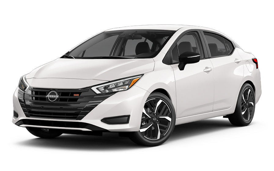
Nissan Versa | Automatic
SMALLor Small similar
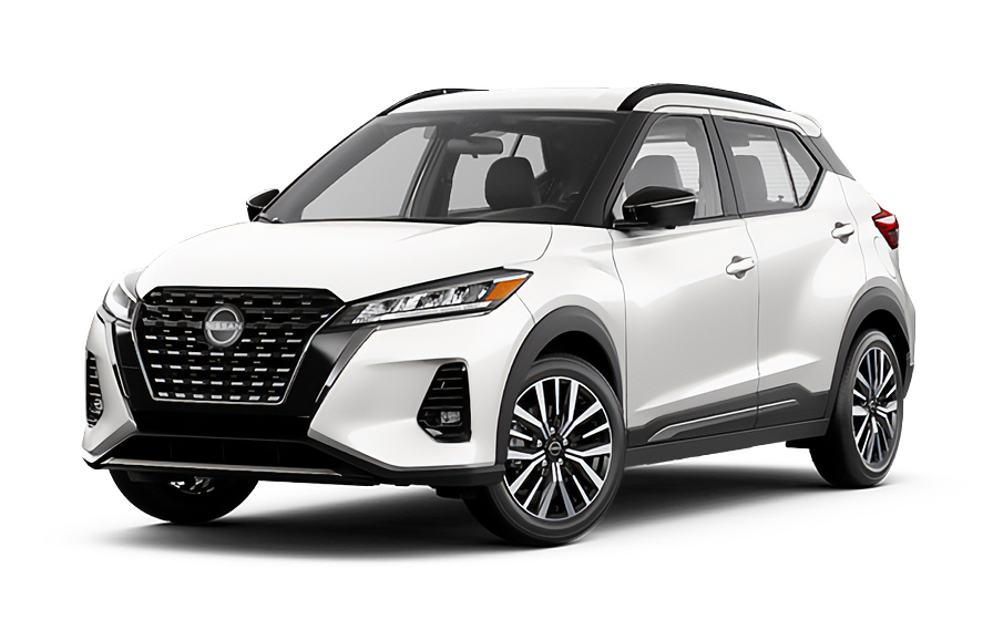
Nissan Kicks | Automatic
SUVor SUV similar
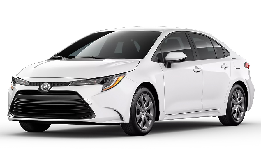
Toyota Corolla | Automatic
SEDANor Sedan similar
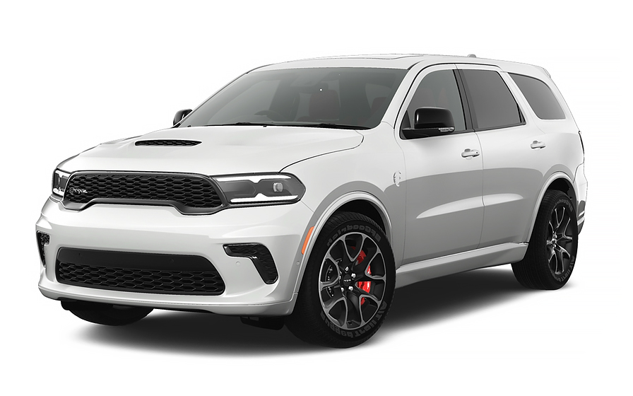
Dodge Durango | Automatic
7 PASSENGERSor 7 Passengers similar

Chrysler Pacifica 7 Passengers | Automatic
MINIVANor Minivan similar
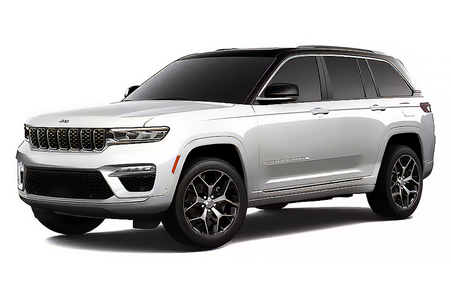
Jeep Grand Cherokee | Automatic
JEEPor Jeep similar
Frequently Asked Questions
What does my Hola Car Rentals booking with Avis in British Columbia include that other companies don't offer?
Hola Car Rentals is a premium partner of the leading car rental companies in British Columbia, including Avis, giving you exclusive access to our All Inclusive+ rate. This rate includes extra benefits that no other company can match:
- Full vehicle coverage with no deductible (applies only for certain rates and itineraries)
- Toll cashback: get back up to 5% of your total booking value for tolls charged during your rental
- Premium travel medical assistance for up to 5 passengers in case of emergency, covering up to CAD 200,000 (pre-existing conditions excluded)
- No Extra Charges© guarantee: if the counter charges you for something not listed on your confirmation and not an optional add-on you accepted, Hola Car Rentals will work to remove or reimburse the charge after verification
All at no additional cost, ensuring a unique Avis rental experience with complete protection and peace of mind during your trip in British Columbia.
Will I face unexpected charges at the Avis counter in British Columbia when I book through Hola Car Rentals?
No. With Hola Car Rentals, all costs and charges for your Avis booking in British Columbia are clearly shown at the time of reservation and in your confirmation email, so you know exactly what you are paying before you arrive at the Avis counter.
On top of that, every Hola Car Rentals booking includes the No Extra Charges© guarantee. This is a pricing guarantee (not insurance) that protects you if the Avis counter in British Columbia charges you for something that was not listed on your confirmation and was not an optional add-on you accepted. If that happens, Hola Car Rentals will work with Avis to remove or reimburse the charge after verification.
The only costs outside this guarantee are:
- Optional add-ons you choose at the counter (GPS, child seats, prepaid fuel)
- Usage-based charges (tolls, fuel shortfall, traffic fines)
Where is the Avis counter at Vancouver International Airport in British Columbia?
The Avis counter at Vancouver International Airport (YVR) in British Columbia is located in the baggage claim area of the main terminal at 3880 Grant McConachie Way, Richmond. The rental vehicles are parked outside the terminal rather than at an on-site garage.
Pickup directions vary by arrival type:
- International arrivals: proceed through the concourse to the parking area, pass public parking, and continue to the Avis booth.
- Domestic arrivals: exit the baggage area, cross the road to the stairway, then walk through public parking to the Avis booth.
Note that airport construction may affect walking routes, so allow extra time. The Avis counter at YVR is open Sunday through Saturday from 6:00 AM to 1:00 AM, and a 24-hour key drop box is available for after-hours returns.
If you are arriving at the South Terminal (YV2) in British Columbia, you will need to take a shuttle from the South Terminal to the main terminal counter, where Avis handles all pickups. South Terminal hours are Monday through Friday 7:00 AM to 8:00 PM and Saturday through Sunday 8:00 AM to 7:00 PM, also with a 24-hour drop box.
Are there toll roads to worry about when renting an Avis car in British Columbia?
Almost all roads in British Columbia are toll-free, but there is one cashless tolled crossing you should know about before driving your Avis rental: the Port Mann Bridge in the Vancouver area.
Key facts about tolls in British Columbia:
- The Port Mann Bridge uses plate-based cashless billing. There are no cash lanes, so you cannot pay at the crossing.
- When you drive through, the toll authority captures your rental vehicle's plate and bills Avis, who then passes the charge to you along with an administrative processing fee.
- Most other major roads in British Columbia, including Highway 1 and the Coquihalla Highway, are toll-free.
- There are no congestion charges, emissions zones, or city-center driving fees anywhere in British Columbia.
To avoid surprise charges, ask the Avis agent at pickup whether a toll program is available for your rental. If you opt into a pay-per-use program, expect the toll amount plus a daily convenience charge. If you do not enroll, Avis will bill the toll plus an administrative fee to your card, often weeks after the rental ends.
Keep your rental agreement and any toll receipts, as these are needed if you want to claim a toll reimbursement later.
What documents do I need to pick up an Avis rental car in British Columbia?
To collect your Avis rental in British Columbia, you must present the following physical documents at the counter:
- A valid, original driver's license in the main driver's name. Foreign licenses are generally accepted in British Columbia; however, if your license uses a non-Latin alphabet (Arabic, Chinese, Japanese, Cyrillic), you must also carry an International Driving Permit (IDP) as a translation alongside your original license.
- A major credit card physically printed with the main driver's name, with enough available credit to cover the security hold (typically CAD 300 to CAD 750 at Avis locations in British Columbia).
- A valid passport or government-issued photo ID.
- Your booking confirmation or printed voucher.
- Round-trip flight or cruise tickets (required for visitors from outside Canada).
Digital documents are not accepted at the Avis counter. All documents must be physical originals. An IDP is a translation only and is invalid without your original license.
If you think you may need an IDP, obtain it in your home country before traveling to British Columbia, as it cannot be issued abroad.
Does Hola Car Rentals offer toll cashback for Avis rentals in British Columbia?
Yes, all bookings made through Hola Car Rentals include Tolls Cashback, which applies to Avis rentals in British Columbia, including any tolls incurred on the Port Mann Bridge near Vancouver.
How the Tolls Cashback benefit works:
- You pay tolls normally during your rental, either through the Avis toll program or billed to your card after return.
- After the rental ends, you can claim back up to 5% of your total Hola Car Rentals booking value for tolls paid.
- Example: if your booking total is US$500, the maximum cashback is US$25. If you paid US$15 in tolls, you receive US$15 back. If you paid US$40, you receive US$25 (the cap).
To claim your cashback after returning your Avis vehicle in British Columbia:
- Email [email protected] within 30 days of vehicle return.
- Use the subject line: Tolls Cashback - HOLA[your confirmation number].
- Attach your Hola Car Rentals confirmation, the Avis rental agreement, and a receipt or statement showing the toll charges.
Refunds are issued to the original payment method and typically process within 7 to 10 business days after approval. Late submissions beyond 30 days are not accepted.
Is there a young driver surcharge for under-25 renters at Avis in British Columbia?
Yes, Avis applies a young driver surcharge in British Columbia for renters aged 21 to 24. The surcharge is CAD 25 per day plus applicable taxes, charged at the counter on top of your prepaid rate.
Key points about underage rentals at Avis in British Columbia:
- The minimum rental age at Avis in British Columbia is 21. Renters aged 21 to 24 can rent but will pay the daily surcharge.
- A major credit card in the renter's name is required at pickup. Debit cards are not accepted at the YVR counter.
- The surcharge applies for every rental day and is taxable locally.
- Renters aged 25 and older are not subject to any age-related surcharge at Avis locations in British Columbia.
If you are adding an additional driver who is under 25, note that Avis in British Columbia requires additional drivers to be at least 25 years old. A driver under that threshold may be denied or subject to the surcharge. Confirm the exact conditions with the Avis agent at pickup, as policies can vary by vehicle class.
The young driver surcharge is a counter charge and is separate from your prepaid booking total.
Can I do a one-way rental with Avis between British Columbia and Alberta?
Yes, one-way rentals between British Columbia and Alberta are available through Avis, but there is an important seasonal restriction you must know before booking.
Avis prohibits one-way rentals between British Columbia and Alberta from December 1 through April 1 each year. This restriction is due to winter driving conditions on mountain routes between the two provinces. If your travel dates fall within this window, a one-way drop-off will not be permitted.
Outside the restricted season, one-way fees between British Columbia and Alberta vary by distance and vehicle class:
- Rentals originating from specific Avis locations such as Vancouver International Airport, the Hornby Street downtown location, or the 9th Avenue site may qualify for a free drop-off to Calgary.
- For other pickup points, a distance-based fee applies. As a general guide, drops of 0 to 300 km may be free, while 301 to 400 km can cost approximately CAD 60 for compact vehicles and CAD 85 for luxury classes.
Drop-off fees are listed under the "To pay at destination" section during the Hola Car Rentals booking process and on your confirmation. These fees exclude taxes. Always verify the exact fee for your specific route at the time of booking, as pricing can change by season and vehicle class.
What is the security deposit amount for an Avis rental in British Columbia?
When you pick up your Avis rental in British Columbia, a temporary hold will be placed on your credit card as a security deposit. The hold is not a charge but reduces your available credit until it is released after the rental ends.
Typical deposit amounts at Avis in British Columbia:
- Most standard vehicles: approximately CAD 300 to CAD 500.
- Some locations, including Vancouver International Airport (YVR), may require a minimum authorization of approximately CAD 750, or the estimated rental charges plus 20%, whichever is greater.
- Premium or specialty vehicles may carry higher holds.
Important requirements at the Avis counter in British Columbia:
- Only a major credit card physically printed with the main driver's name is accepted for the deposit. Debit cards are not accepted at pickup.
- The card must have sufficient available credit to cover the hold plus any expected charges.
- Virtual or prepaid cards are not accepted.
After you return the vehicle, Avis releases the hold, but your bank controls when the funds reappear in your available credit. This can take up to 15 business days. Bring a backup credit card in case your primary card is declined.
What is the fuel policy for Avis car rentals in British Columbia?
Avis operates a Full-to-Full fuel policy for rentals in British Columbia. You receive the vehicle with a full tank and must return it full to avoid additional charges.
Steps to follow to avoid fuel charges on your Avis rental in British Columbia:
- At pickup, check the fuel gauge with the Avis agent and confirm the starting level is recorded on the rental agreement.
- Take a photo of the dashboard showing the odometer and fuel gauge before leaving the lot.
- Refuel within approximately 15 km of the return location so the gauge does not drop before you arrive.
- Keep the final fuel receipt showing the date, time, and station address.
- For after-hours returns at YVR or other Avis locations in British Columbia, leave the receipt in the key drop envelope and keep a photo of the full gauge.
If you return the vehicle below the recorded starting level, Avis will charge you for the fuel shortfall at their refueling rate, which is typically higher than the pump price, plus a refueling service fee.
The Avis counter at some British Columbia locations may offer a prepaid fuel option. If you accept it, the Full-to-Full rule is replaced and any unused fuel is generally non-refundable, so it is usually better value to refuel yourself before returning.
Does travel assistance cover me if I have an emergency in a remote area of British Columbia with an Avis rental?
Yes, most bookings made through Hola Car Rentals include travel assistance coverage provided by Terrawind Global Protection, which can help if you face a medical or legal emergency while driving your Avis rental in British Columbia, including in remote areas far from major cities.
What the travel assistance typically covers:
- Medical coverage for accidents and non-pre-existing illnesses, for up to 5 passengers.
- Legal assistance in the event of an accident.
- Compensation for luggage lost by the airline.
- Flight cancellation insurance.
This coverage does not include damage to the Avis rental vehicle (that is handled by CDW/LDW) or third-party liability to others (handled by LIS/ALI/SLI).
Important eligibility note: this travel assistance benefit applies only to non-North American customers. Canadian and US residents do not qualify for this benefit.
If you need assistance while driving in British Columbia, contact Terrawind 24 hours a day:
- Phone: +1 888 980 9992 (toll-free)
- WhatsApp: +1 208 910 1001
- Email: [email protected]
Have your Hola Car Rentals confirmation number ready when you call. Always check your booking confirmation for the exact coverage limits and conditions that apply to your reservation.
How does the vehicle return process work at Avis locations in British Columbia?
The return process at Avis locations in British Columbia varies slightly by location, but the general steps are straightforward.
At Vancouver International Airport (YVR) in British Columbia:
- Park and lock the vehicle in the designated Avis return area outside the main terminal.
- Place your rental contract and keys in the key drop box.
- Take all personal belongings before leaving.
- Avis applies a 29-minute grace period at YVR. If you return between 30 and 89 minutes late, a three-quarter day charge applies. Returns 90 minutes or more late incur a full extra day charge. Note that the grace period does not apply to protection or fee calculations.
At the South Terminal (YV2) in British Columbia:
- Return the vehicle to the South Terminal area and place the contract and keys in the drop-off box inside the terminal.
At downtown Avis locations in British Columbia such as the Cambie Street branch:
- Bring your parking ticket, keys, and mileage record to the office, located in the P3 basement parking level.
For all Avis locations in British Columbia, refuel the vehicle before returning to comply with the Full-to-Full fuel policy. Keep your final fuel receipt in case of any dispute.
Is third-party liability insurance included in an Avis rental in British Columbia?
Yes, a basic level of third-party liability coverage is included by default when you rent with Avis in British Columbia. Canadian provincial law requires every rental vehicle to carry statutory third-party liability, so this coverage follows the car automatically.
What this means for your Avis rental in British Columbia:
- The statutory liability covers bodily injury and property damage you may cause to other people while driving the rental.
- It does not cover damage to the Avis rental vehicle itself (that requires CDW/LDW) or your own injuries (that requires PAI).
- The statutory minimum may be lower than what you would want in a serious accident. You can purchase supplemental liability insurance (LIS/ALI/SLI) at the Avis counter in British Columbia to increase your coverage limits up to a higher threshold.
If you booked through Hola Car Rentals and selected a rate that includes LIS/ALI/SLI, verify that it appears on your rental agreement at the Avis counter. Only drivers named on the agreement are covered. Entering restricted areas or crossing borders without authorization can void coverage.
Always review the exact limits and conditions in your rental agreement when picking up your Avis vehicle in British Columbia.
Can I add an additional driver to my Avis rental in British Columbia?
Yes, you can add an additional driver to your Avis rental in British Columbia, but the driver must be present at the counter at pickup with a valid driver's license to be added to the rental agreement.
Fee structure for additional drivers at Avis in British Columbia:
- If your Hola Car Rentals booking confirmation states "Additional driver free of charge" or "Additional driver included," the first extra driver is covered at no extra cost.
- If not included, Avis charges CAD 13 per rental day plus taxes, with a maximum cap of CAD 65 plus taxes for the rental period.
Age requirements for additional drivers at Avis in British Columbia:
- Additional drivers must meet the minimum rental age of 21.
- Avis in British Columbia requires additional drivers to be at least 25 years old. Drivers aged 21 to 24 may be denied or subject to the young driver surcharge of CAD 25 per day.
Only drivers listed on the Avis rental agreement in British Columbia are covered by protections such as CDW/LDW and liability insurance. If someone not on the contract drives the vehicle, coverage may be void. Both the main driver and the additional driver must sign the agreement at the counter.
Are there Avis locations in British Columbia outside Vancouver airport?
Yes, Avis operates multiple locations across British Columbia beyond Vancouver International Airport (YVR), giving you flexibility to pick up or drop off at a location that suits your itinerary.
Major Avis locations in British Columbia include:
- Vancouver downtown at 757 Hornby Street and the Cambie Street branch (The Rise).
- North Vancouver at 220-150 West Esplanade Street.
- Burnaby (MetroPointe) and Surrey (Newton).
- Richmond, near YVR but separate from the airport counter.
- Abbotsford International Airport (YXX).
- Victoria International Airport (YYJ) in Sidney.
- Fort St. John Airport in Fort St. John.
Counter hours vary by location. For example, the Avis Hornby Street branch in Vancouver is open Sunday through Saturday from 8:00 AM to 4:30 PM (Friday until 5:00 PM), while the North Vancouver location operates Monday through Friday 8:00 AM to 5:00 PM, Saturday 9:00 AM to 3:00 PM, and Sunday 9:00 AM to 2:00 PM.
Off-airport Avis locations in British Columbia may offer lower base rates than the YVR airport counter, as airport locations typically carry additional concession fees. Always confirm the hours of your chosen Avis location in British Columbia before booking, especially if you plan an early morning or late evening pickup.

- Choosing a selection results in a full page refresh.
- Opens in a new window.
Suggested Currencies
- $ USD - United States Dollar
- € EUR - Euro
Other Countries
-
 Albania
-
 Algeria
-
 Andorra
-
 Angola
-
 Antigua & Barbuda
-
 Argentina
-
 Australia
-
 Austria
-
 Bahamas
-
 Bahrain
-
 Bangladesh
-
 Barbados
-
 Belgium
-
 Belize
-
 Benin
Benin
-
 Bermuda
-
 Bolivia
-
 Bosnia & Herzegovina
-
 Botswana
-
 Brazil
-
 British Virgin Islands
-
 Bulgaria
-
 Burkina Faso
-
 Burundi
-
 Cameroon
-
 Canada
-
 Cape Verde
-
 Cayman Islands
-
 Central African Republic
-
 Chad
Chad
-
 Chile
Chile
-
 Colombia
-
 Comoros
-
 Congo - Brazzaville
-
 Congo - Kinshasa
-
 Costa Rica
-
 Côte d’Ivoire
-
 Croatia
-
 Curaçao
-
 Cyprus
-
 Czechia
-
 Denmark
-
 Djibouti
-
 Dominica
-
 Dominican Republic
-
 Ecuador
-
 Egypt
Egypt
-
 El Salvador
-
 Equatorial Guinea
-
 Eritrea
-
 Estonia
-
 Eswatini
-
 Ethiopia
-
 Finland
-
 France
-
 Gabon
Gabon
-
 Gambia
-
 Germany
-
 Ghana
Ghana
-
 Greece
-
 Grenada
-
 Guatemala
-
 Guinea
-
 Guinea-Bissau
-
 Guyana
-
 Haiti
Haiti
-
 Honduras
-
 Hong Kong SAR
-
 Hungary
-
 Iceland
-
 India
India
-
 Iraq
Iraq
-
 Ireland
-
 Israel
-
 Italy
Italy
-
 Jamaica
-
 Japan
Japan
-
 Jordan
-
 Kenya
Kenya
-
 Kuwait
-
 Latvia
-
 Lebanon
-
 Lesotho
-
 Liberia
-
 Libya
Libya
-
 Liechtenstein
-
 Lithuania
-
 Luxembourg
-
 Madagascar
-
 Malawi
-
 Mali
Mali
-
 Malta
Malta
-
 Mauritania
-
 Mauritius
-
 Mexico
-
 Moldova
-
 Monaco
-
 Montenegro
-
 Morocco
-
 Mozambique
-
 Namibia
-
 Netherlands
-
 New Zealand
-
 Nicaragua
-
 Niger
Niger
-
 Nigeria
-
 Norway
-
 Oman
Oman
-
 Palestinian Territories
-
 Panama
-
 Paraguay
-
 Peru
Peru
-
 Philippines
-
 Poland
-
 Portugal
-
 Qatar
Qatar
-
 Romania
-
 Russia
-
 Rwanda
-
 San Marino
-
 São Tomé & Príncipe
-
 Saudi Arabia
-
 Senegal
-
 Serbia
-
 Seychelles
-
 Sierra Leone
-
 Singapore
-
 Sint Maarten
-
 Slovakia
-
 Slovenia
-
 Somalia
-
 South Africa
-
 South Korea
-
 South Sudan
-
 Spain
Spain
-
 St. Lucia
-
 St. Vincent & Grenadines
-
 Sudan
Sudan
-
 Sweden
-
 Switzerland
-
 Taiwan
-
 Tanzania
-
 Togo
Togo
-
 Trinidad & Tobago
-
 Tunisia
-
 Türkiye
-
 Turks & Caicos Islands
-
 Uganda
-
 Ukraine
-
 United Arab Emirates
-
 United Kingdom
-
 United States
-
 Uruguay
-
 Vatican City
-
 Venezuela
-
 Yemen
Yemen
-
 Zambia
-
 Zimbabwe
Driving license from:
-
Albania
-
Algeria
-
Andorra
-
Angola
-
Antigua & Barbuda
-
Argentina
-
Australia
-
Austria
-
Bahamas
-
Bahrain
-
Bangladesh
-
Barbados
-
Belgium
-
Belize
-
Benin
-
Bermuda
-
Bolivia
-
Bosnia & Herzegovina
-
Botswana
-
Brazil
-
British Virgin Islands
-
Bulgaria
-
Burkina Faso
-
Burundi
-
Cameroon
-
Canada
-
Cape Verde
-
Cayman Islands
-
Central African Republic
-
Chad
-
Chile
-
Colombia
-
Comoros
-
Congo - Brazzaville
-
Congo - Kinshasa
-
Costa Rica
-
Côte d’Ivoire
-
Croatia
-
Curaçao
-
Cyprus
-
Czechia
-
Denmark
-
Djibouti
-
Dominica
-
Dominican Republic
-
Ecuador
-
Egypt
-
El Salvador
-
Equatorial Guinea
-
Eritrea
-
Estonia
-
Eswatini
-
Ethiopia
-
Finland
-
France
-
Gabon
-
Gambia
-
Germany
-
Ghana
-
Greece
-
Grenada
-
Guatemala
-
Guinea
-
Guinea-Bissau
-
Guyana
-
Haiti
-
Honduras
-
Hong Kong SAR
-
Hungary
-
Iceland
-
India
-
Iraq
-
Ireland
-
Israel
-
Italy
-
Jamaica
-
Japan
-
Jordan
-
Kenya
-
Kuwait
-
Latvia
-
Lebanon
-
Lesotho
-
Liberia
-
Libya
-
Liechtenstein
-
Lithuania
-
Luxembourg
-
Madagascar
-
Malawi
-
Mali
-
Malta
-
Mauritania
-
Mauritius
-
Mexico
-
Moldova
-
Monaco
-
Montenegro
-
Morocco
-
Mozambique
-
Namibia
-
Netherlands
-
New Zealand
-
Nicaragua
-
Niger
-
Nigeria
-
Norway
-
Oman
-
Palestinian Territories
-
Panama
-
Paraguay
-
Peru
-
Philippines
-
Poland
-
Portugal
-
Qatar
-
Romania
-
Russia
-
Rwanda
-
San Marino
-
São Tomé & Príncipe
-
Saudi Arabia
-
Senegal
-
Serbia
-
Seychelles
-
Sierra Leone
-
Singapore
-
Sint Maarten
-
Slovakia
-
Slovenia
-
Somalia
-
South Africa
-
South Korea
-
South Sudan
-
Spain
-
St. Lucia
-
St. Vincent & Grenadines
-
Sudan
-
Sweden
-
Switzerland
-
Taiwan
-
Tanzania
-
Togo
-
Trinidad & Tobago
-
Tunisia
-
Türkiye
-
Turks & Caicos Islands
-
Uganda
-
Ukraine
-
United Arab Emirates
-
United Kingdom
-
United States
-
Uruguay
-
Vatican City
-
Venezuela
-
Yemen
-
Zambia
-
Zimbabwe