


Acerca de alugar um carro em Nevada
Melhores Ofertas de Aluguel de Carros
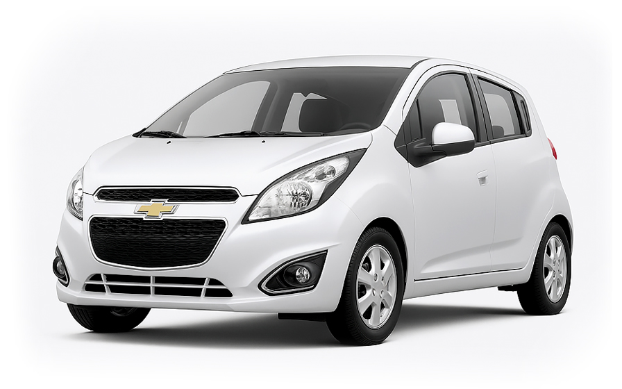
Chevrolet Spark | Automático
PEQUENOou Pequeno similar

Kia K4 | Automático
SEDANou Sedan similar
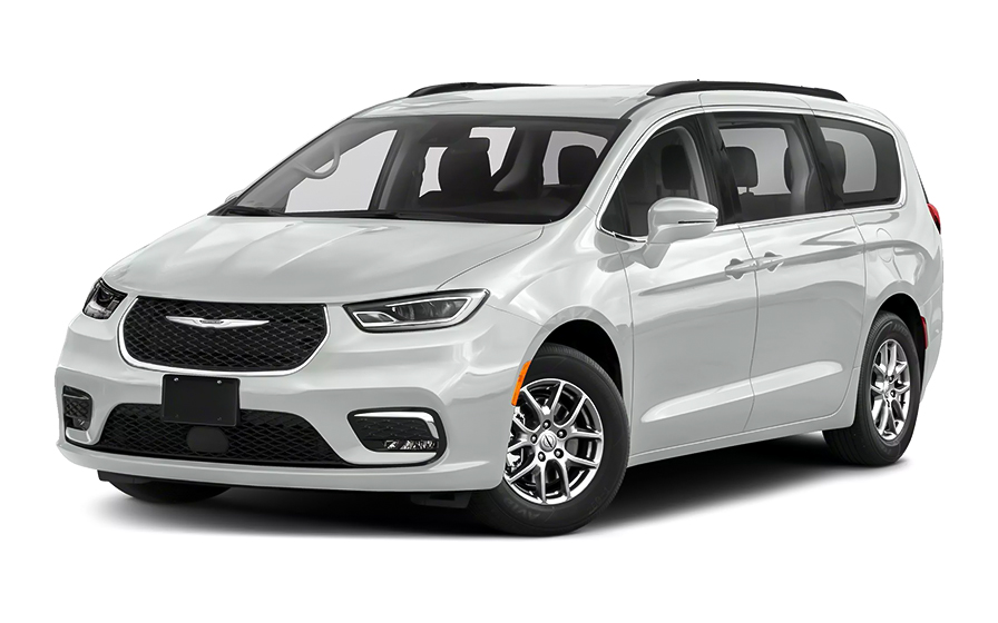
Chrysler Pacifica 7 Passengers | Automático
MINIVANou Minivan similar

Audi A6 | Automático
ou Minivan similar
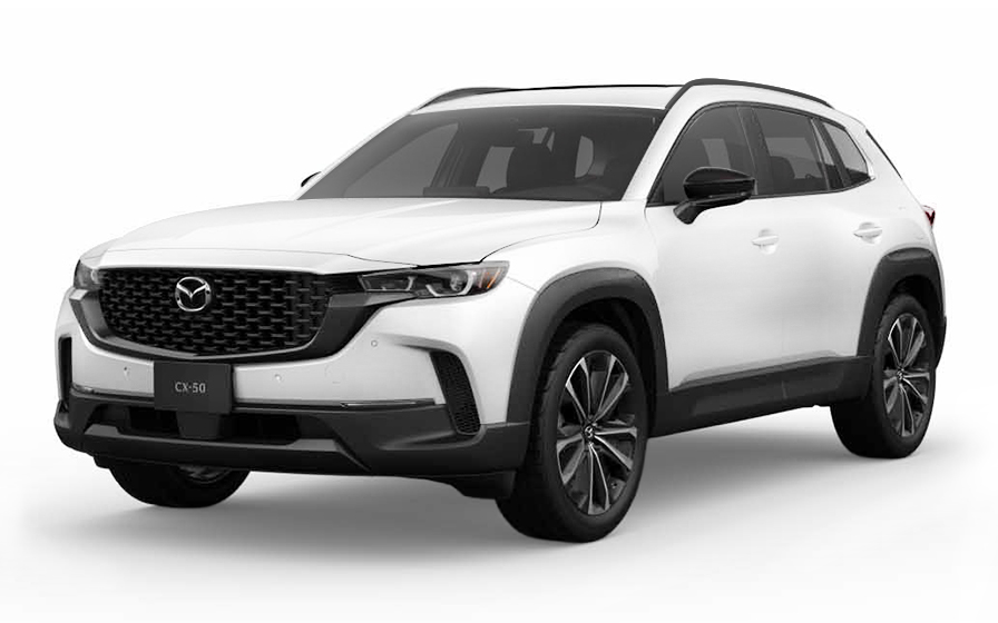
Mazda CX 50 | Automático
SUVou SUV similar
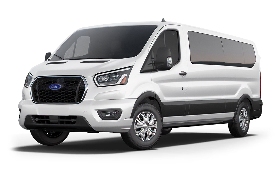
Ford Transit 12 Passengers | Automático
12 PASSENGERSou 12 Passengers similar

Dodge RAM 2500 | Automático
PICKUPou Pickup similar
Dicas para Viajantes e Preços
Qual é o melhor momento para alugar um carro em Nevada?
Você deve reservar seu carro com aproximadamente 7 dias de antecedência para obter um preço abaixo da média.
Tendência de Preços (Últimos 90 Dias)
Qual é o tipo de carro mais popular em Nevada?
Carros do tipo sedan (sedan ou similar) são a opção mais popular em Nevada.
Tipos de Carro Populares
Qual é a locadora mais barata em Nevada?
Nas últimas 72 horas, os carros mais baratos foram da National a /dia.
Preço Médio por Locadora
Perguntas Frequentes
O que inclui minha reserva da Hola Car Rentals em Nevada que outras empresas não oferecem?
A Hola Car Rentals é a única parceira premium das principais marcas de aluguel de carros que operam em Nevada, oferecendo a você acesso exclusivo à nossa tarifa All Inclusive+. Essa tarifa inclui benefícios que nenhuma outra empresa pode igualar:
- Proteção de responsabilidade civil gratuita a partir de US$ 300.000 em caso de acidente (válida apenas para certas tarifas e itinerários)
- Reembolso de pedágios: recupere até 5% do valor total da reserva pelos pedágios incorridos durante o seu período de aluguel
- Assistência médica de viagem premium com cobertura de até US$ 150.000 para no máximo 5 passageiros em caso de emergência médica, excluindo condições pré-existentes
- Garantia No Extra Charges©: se o balcão cobrar algo que não consta na sua confirmação e que não é um adicional opcional aceito por você, a Hola Car Rentals trabalhará para remover ou reembolsar a cobrança após verificação
Tudo isso sem custo adicional, garantindo uma experiência de aluguel completamente protegida e tranquilidade durante toda a sua viagem em Nevada.
Terei cobranças inesperadas no balcão ao alugar um carro em Nevada pela Hola Car Rentals?
Não. Com a Hola Car Rentals, todos os custos e cobranças da sua reserva em Nevada são apresentados claramente no momento da reserva e no e-mail de confirmação, para que você saiba exatamente o que está pagando antes de chegar ao balcão.
Além disso, cada reserva da Hola Car Rentals inclui a garantia No Extra Charges©. Esta é uma garantia de preços (não uma proteção) que protege você caso o balcão em Nevada cobre por algo que não estava listado na sua confirmação e que não era um adicional opcional que você aceitou. Se isso acontecer, a Hola Car Rentals trabalhará com o parceiro de aluguel para remover ou reembolsar a cobrança após verificação.
Os únicos custos fora desta garantia são:
- Adicionais opcionais escolhidos no balcão (GPS, cadeirinhas para crianças, combustível pré-pago)
- Cobranças por uso (pedágios, diferença de combustível, multas de trânsito)
Como funciona o processo de retirada do carro alugado no Aeroporto Internacional Harry Reid em Nevada?
No Aeroporto Internacional Harry Reid (LAS) em Nevada, não há balcões de locadoras dentro dos terminais. Todas as principais marcas operam a partir de um Centro de Aluguel de Carros consolidado localizado na 7135 Gilespie Street, Las Vegas, NV 89119.
Para chegar até lá, siga estes passos após desembarcar:
- Retire sua bagagem na área de baggage claim nos Terminais 1 ou 3
- Siga as placas para "Ground Transportation" ou "Rental Car Shuttle"
- Embarque no transporte gratuito (shuttle) no Terminal 1 (Portas 10 a 11, Nível 1) ou Terminal 3 (Portas 51 a 58, Nível 0)
- Os shuttles operam 24 horas por dia, 7 dias por semana, com saída aproximadamente a cada 5 minutos
- A viagem até o Centro de Aluguel leva de 10 a 15 minutos
Ao chegar ao Centro de Aluguel de Carros, dirija-se ao balcão da sua marca, apresente sua carteira de motorista, cartão de crédito e quaisquer documentos adicionais exigidos, e retire seu veículo. Reserve de 15 a 30 minutos no total, desde a área de baggage claim até sair dirigindo, dependendo do volume de atendimento. Após devolver seu carro alugado em Nevada, um shuttle gratuito leva você de volta aos terminais em cerca de 5 a 10 minutos.
Existem rodovias com pedágio em Nevada?
Não, Nevada não possui rodovias com pedágio. Todas as rodovias públicas, interstates, rotas estaduais e vias locais em Nevada são livres de pedágio, incluindo corredores bastante utilizados como I-15, I-80, US-95 e US-50.
Como Nevada não possui infraestrutura de pedágio, não há necessidade de se inscrever em programas de cobrança de pedágio de locadoras, como PlatePass, Avis e-Toll ou serviços similares ao dirigir dentro do estado. Não há cobranças por transponder, pedágios sem dinheiro ou taxas de congestionamento.
Se sua viagem a Nevada incluir passagem por estados vizinhos, como a Califórnia, aí sim existem rodovias com pedágio. Por exemplo, o Sul da Califórnia possui faixas expressas totalmente sem dinheiro e rodovias com FasTrak em Orange County. Se planeja cruzar para a Califórnia, verifique a situação de pedágios dessa região antes de viajar.
Taxas de entrada em parques estaduais de Nevada, como a taxa por veículo no Valley of Fire State Park, são separadas dos pedágios e devem ser pagas na entrada do parque. Essas taxas não estão cobertas por programas de pedágio de locadoras.
Quais documentos preciso para retirar um carro alugado em Nevada?
Para retirar um carro alugado em Nevada, você deve apresentar no balcão:
- Uma carteira de motorista válida, original e física, em nome do motorista principal
- Um cartão de crédito internacional com o nome do motorista impresso, utilizado para a garantia do depósito
- Passaporte ou documento de identificação com foto emitido pelo governo
- Confirmação de reserva ou voucher impresso
- Passagens de ida e volta ou itinerário de viagem (necessário para visitantes de outros países)
Se sua carteira de motorista não estiver em inglês ou não usar o alfabeto latino (Roman), como árabe, chinês, japonês ou cirílico, é obrigatório apresentar uma Permissão Internacional para Dirigir (PID). Para carteiras em outros alfabetos não latinos, recomenda-se fortemente a PID. Ela é uma tradução apenas e deve ser levada junto à carteira original.
Para retiradas em Nevada em locais fora do aeroporto, como depósitos no centro de Las Vegas, alguns fornecedores também exigem uma conta de serviço público recente ou extrato bancário com seu nome e endereço compatíveis com a carteira de motorista.
Todos os documentos devem ser originais físicos. cópias digitais exibidas em telefone não são aceitas no balcão.
Minha reserva de carro em Nevada inclui Cashback de Pedágios se eu dirigir até a Califórnia?
Sim, todas as reservas da Hola Car Rentals incluem Cashback de Pedágios, que reembolsa até 5% do valor total da reserva referente aos pedágios pagos durante o período de locação.
Como Nevada não possui rodovias com pedágio, esse benefício é relevante se sua locação em Nevada o levar a estados vizinhos, como a Califórnia, onde existem rodovias com pedágio e faixas expressas sem dinheiro. Quaisquer pedágios pagos nessas rotas durante sua locação são elegíveis para o cashback.
Para solicitar o Cashback de Pedágios da sua locação em Nevada:
- Envie um e-mail para [email protected] em até 30 dias após devolver o veículo
- Use o assunto: Cashback de Pedágios, seguido do número da sua reserva
- Anexe a confirmação da reserva, o contrato de locação assinado e um recibo ou extrato mostrando as cobranças de pedágio pagas
O reembolso será processado na mesma forma de pagamento usada na reserva e geralmente chega em até 7 a 10 dias úteis após a aprovação. Reclamações enviadas após 30 dias não serão aceitas.
Quais limites de velocidade e leis de trânsito devo conhecer antes de alugar um carro em Nevada?
Nevada possui algumas regras de trânsito diferentes de estados vizinhos, que é importante conhecer antes de pegar um carro de locadora.
Limites de velocidade em Nevada:
- Interstates rurais: até 80 mph, acima da maioria dos estados vizinhos
- Interstates urbanos: 65 mph
- Rodovias: 70 mph
- Vias residenciais: 25 a 30 mph
- Zonas escolares: 15 a 25 mph
Nevada aplica a Regra de Velocidade Básica, que exige que o motorista dirija a uma velocidade segura para as condições atuais da via e clima, mesmo que isso signifique dirigir abaixo do limite postado. Tempestades de areia e superfícies variáveis são comuns nas rodovias de Nevada.
Dirigir a mais de 30 mph acima do limite é considerado direção perigosa e pode resultar em multa mínima de US$ 1.240, além de possível prisão. Nevada registra mais de 5.100 multas anuais por velocidades superiores a 100 mph.
Outras regras específicas de Nevada:
- Dividir faixa de motocicleta é ilegal em Nevada, ao contrário da Califórnia, onde é permitido
- Uso de celular com as mãos ao dirigir é proibido
- É obrigatório manter uma distância de 3 pés ao ultrapassar ciclistas
O que acontece se meu voo atrasar e eu chegar tarde para retirar meu carro alugado em Nevada?
Se seu voo atrasar e você chegar após o horário agendado de retirada no Aeroporto Internacional Harry Reid em Nevada, as locadoras geralmente mantêm sua reserva por até 24 horas a partir do horário original.
Porém, há detalhes importantes a considerar para retiradas em aeroportos de Nevada:
- Períodos de tolerância variam por fornecedor e não garantem tempo suficiente para sair do terminal, pegar a bagagem e pegar o shuttle até o Centro de Aluguel de Carros
- Se seu horário de retirada era, por exemplo, 23h30 e seu voo pousar logo após meia-noite, sua reserva pode ser considerada no-show antes de você chegar ao balcão
- Incluir seu número de voo na reserva ajuda alguns fornecedores a rastrear atrasos automaticamente
Para proteger sua locação em Nevada em caso de atraso, defina seu horário de retirada para uma estimativa realista após o desembarque, considerando o tempo de retirada de bagagem e o trajeto de 10 a 15 minutos de shuttle até o Centro de Aluguel. Se o atraso passar de 24 horas, entre em contato com o suporte o quanto antes, pois mudanças não são garantidas, mas a equipe ajudará sempre que possível.
Qual é o valor do depósito de segurança para um carro alugado em Nevada?
Ao retirar um carro alugado em Nevada, a locadora faz uma retenção temporária no seu cartão de crédito como garantia. Essa não é uma cobrança, mas reduz seu limite de crédito disponível até a devolução do veículo e a liberação do valor pela sua instituição financeira.
Os valores típicos de retenção nos Estados Unidos, incluindo Nevada, variam de aproximadamente US$ 300 a US$ 400 para categorias padrão. Veículos premium ou especiais podem exigir uma retenção maior. O valor exato é definido pela locadora no momento do aluguel e pode variar conforme a marca, local e categoria do veículo.
Requisitos importantes para o depósito em Nevada:
- Cartão de crédito físico, internacional, com o nome do motorista impresso, é obrigatório
- Cartões de débito, pré-pagos e virtuais não são aceitos para a garantia
- O cartão deve estar no nome do motorista principal e ter crédito disponível suficiente
Após a devolução do veículo, a retenção é liberada. Seu banco controla o tempo para que o valor desapareça do seu extrato, podendo levar até 15 dias úteis. Recomenda-se levar um cartão de crédito adicional, caso o primary seja recusado na Nevada.
Existe sobretaxa para motoristas jovens menores de 25 anos em Nevada?
Sim, motoristas de 21 a 24 anos que alugam carro em Nevada estão sujeitos a uma sobretaxa diária para jovens condutores, paga no balcão na retirada do veículo.
Valores típicos de sobretaxa diária por marca nos EUA, incluindo Nevada:
- Avis, Budget e Payless: US$ 13 por dia, limitado a US$ 65
- Hertz, Thrifty e Dollar: US$ 13,50 por dia, limitado a US$ 189
- Alamo, National e Enterprise: US$ 15 por dia, sem limite declarado
Além da sobretaxa, a maioria das categorias de veículos tem restrição para motoristas com menos de 25 anos em Nevada. Categorias econômicas, compactas e intermediárias geralmente estão disponíveis, enquanto categorias de tamanho completo, SUV, luxo, conversível e vans normalmente exigem que o motorista tenha 25 anos ou mais.
Uma exceção se aplica a motoristas de 21 a 24 anos da América Latina e Caribe que alugam por Hola Car Rentals com Avis ou Budget nos EUA, incluindo Nevada. Quando a isenção estiver claramente indicada na confirmação da reserva, a taxa de jovem condutor é dispensada para o motorista principal em categorias elegíveis. Verifique sua confirmação para saber se essa condição se aplica à sua reserva em Nevada.
Que assistência de viagem está incluída na minha reserva de carro em Nevada?
A maioria das reservas da Hola Car Rentals inclui cobertura de assistência de viagem fornecida pela Terrawind Global Protection, que pode ser útil ao dirigir pelas estradas remotas do deserto de Nevada e áreas rurais longe de centros urbanos.
Benefícios principais normalmente incluídos:
- Cobertura de viagem e assistência médica para até 5 passageiros
- Assistência jurídica em caso de acidente de trânsito
- Compensação por bagagem perdida pela companhia aérea
- Seguro para cancelamento de voo
Essa cobertura é destinada a situações como emergência médica em uma rodovia remota de Nevada ou questões legais após um incidente de trânsito. Para ativar a assistência a qualquer momento, entre em contato com a Terrawind pelo +1 888 980 9992 (ligação gratuita, disponível 24 horas) ou via WhatsApp pelo +1 208 910 1001. Tenha seu número de confirmação da Hola Car Rentals em mãos ao ligar.
Importante: esse benefício de assistência de viagem não se aplica a residentes dos Estados Unidos ou Canadá. É exclusivo para clientes de outros países que alugam em Nevada. Também não cobre danos ao veículo alugado, que são tratados separadamente pela cobertura CDW ou LDW.
Consulte sua confirmação de reserva para os detalhes exatos e limites de cobertura aplicáveis ao seu aluguel em Nevada.
Preciso de Permissão Internacional para Dirigir para alugar um carro em Nevada?
Depende da sua carteira de motorista. Em Nevada, visitantes geralmente podem dirigir com uma carteira estrangeira válida, mas em certas situações pode ser necessária uma Permissão Internacional para Dirigir (PID).
A PID é obrigatória em Nevada se sua carteira usar um alfabeto não-latino, como árabe, chinês, japonês ou cirílico. Nesses casos, a PID funciona como uma tradução certificada e deve estar sempre junto à carteira original.
Recomenda-se fortemente a obtenção da PID, embora não seja estritamente obrigatória, se sua carteira não estiver em inglês e usar um alfabeto latino. Algumas locadoras em Nevada podem solicitar a PID a seu critério.
Pontos principais:
- A PID é um documento de tradução, não uma carteira de motorista independente
- Você deve portar ambos, carteira original e PID, juntos
- Adquira sua PID no seu país de origem antes de viajar para Nevada, pois organizações nos EUA não emitem PID para titulares de carteiras não-americanas
- Todos os documentos apresentados no balcão de Nevada devem ser originais físicos, não cópias digitais
Qual é a política de combustível para carros alugados em Nevada?
Os carros alugados em Nevada seguem, por padrão, a política de abastecimento Full-to-Full. Você recebe o veículo com o tanque cheio e deve devolvê-lo cheio para evitar cobranças adicionais.
Para evitar cobranças de combustível na sua locação em Nevada:
- Verifique o nível de combustível com o atendente na retirada e confirme que o nível inicial foi registrado no contrato
- Faça uma foto do painel mostrando o odômetro e o indicador de combustível
- Reabasteça dentro de aproximadamente 10 milhas ou 15 km do local de devolução, seja no Centro de Aluguel de Carros do Aeroporto Harry Reid ou outro ponto de entrega em Nevada
- Guarde o recibo final de combustível, com data, hora e endereço da estação
Se devolver o veículo com nível inferior ao registrado na retirada, a locadora pode cobrar pelo abastecimento faltante à sua tarifa de reabastecimento, que costuma ser mais alta que o preço na bomba, além de uma taxa administrativa.
Se o veículo não estiver cheio na retirada, peça ao atendente para registrar o nível exato no contrato. Assim, você só precisa devolvê-lo nesse mesmo nível, não necessariamente cheio.
Posso adicionar um motorista adicional ao meu carro alugado em Nevada?
Sim, você pode adicionar um motorista adicional ao seu carro alugado em Nevada, seja como parte da tarifa da reserva ou pagando uma taxa diária no balcão.
Algumas tarifas da Hola Car Rentals incluem um motorista adicional sem custo extra. Verifique sua confirmação de reserva na linha "Motorista adicional gratuito" para saber se isso se aplica à sua reserva em Nevada.
Se o motorista adicional não estiver incluso na tarifa, as taxas diárias típicas nos balcões de Nevada são:
- Avis, Budget e Payless: US$ 13 por dia, limitado a US$ 65
- Hertz, Thrifty e Dollar: US$ 13,50 por dia, limitado a US$ 189
- Alamo, National e Enterprise: US$ 15 por dia
Requisitos para adicionar um motorista em Nevada:
- O motorista adicional deve estar presente no balcão na retirada
- Deve apresentar carteira de motorista válida e qualquer PID exigida
- Deve atender à idade mínima exigida na locação em Nevada
- Para Avis, Budget e Payless, geralmente é necessário ter pelo menos 25 anos
Apenas motoristas listados no contrato de locação estão cobertos pelas proteções do veículo. Quem não estiver listado e dirigir o carro alugado em Nevada pode invalidar a cobertura.
Que cobertura de seguro preciso para um carro alugado em Nevada?
Ao alugar um carro em Nevada, há dois principais tipos de cobertura que vale a pena entender antes de chegar ao balcão.
Proteção contra Danos por Colisão (CDW) ou Proteção contra Perda e Danos (LDW) cobre danos ao veículo alugado em caso de colisão, furto ou vandalismo. Pode haver franquia, a menos que sua confirmação indique explicitamente franquia zero. CDW e LDW não cobrem danos causados a terceiros ou a pessoas.
Responsabilidade Civil a Terceiros (LIS, ALI ou SLI) cobre danos corporais e materiais que você possa causar a terceiros ao dirigir em Nevada. Nem todos os estados dos EUA obrigam as locadoras a incluir cobertura mínima de responsabilidade por padrão. É altamente recomendado que os locatários em Nevada adicionem cobertura adicional de responsabilidade, especialmente ao dirigir em interstates rurais de alta velocidade, onde Nevada permite até 80 mph.
O que essas coberturas não incluem:
- Seus danos pessoais, que requerem Seguro de Acidentes Pessoais (PAI)
- Seus bens pessoais, que requerem Cobertura de Bens Pessoais (PEC)
- Danos por uso proibido, como condução off-road ou sob efeito de álcool ou drogas
Verifique sua confirmação de reserva para confirmar quais coberturas estão incluídas na sua tarifa em Nevada e se há franquia. Em caso de dúvida, adicionar CDW e responsabilidade adicional antes da retirada oferece a proteção mais ampla.
RENTAL CAR LOCATIONS

- Ao escolher uma seleção, a página inteira é atualizada.
- Abre em uma nova janela.
Moedas sugeridas
- $ USD - United States Dollar
- € EUR - Euro
Outros países
-
 África do Sul
-
 Albânia
-
 Alemanha
-
 Andorra
-
 Angola
-
 Antígua e Barbuda
-
 Arábia Saudita
-
 Argélia
-
 Argentina
-
 Austrália
-
 Áustria
-
 Bahamas
-
 Bangladesh
-
 Barbados
-
 Barein
-
 Bélgica
-
 Belize
-
 Benin
Benin
-
 Bermudas
-
 Bolívia
-
 Bósnia e Herzegovina
-
 Botsuana
-
 Brasil
-
 Bulgária
-
 Burquina Faso
-
 Burundi
-
 Cabo Verde
-
 Camarões
-
 Canadá
-
 Catar
Catar
-
 Chade
Chade
-
 Chile
Chile
-
 Chipre
-
 Cidade do Vaticano
-
 Colômbia
-
 Comores
-
 Congo - Kinshasa
-
 Coreia do Sul
-
 Costa Rica
-
 Costa do Marfim
-
 Croácia
-
 Curaçao
-
 Dinamarca
-
 Djibuti
-
 Dominica
-
 Egito
Egito
-
 El Salvador
-
 Emirados Árabes Unidos
-
 Equador
-
 Eritreia
-
 Eslováquia
-
 Eslovênia
-
 Espanha
-
 Essuatíni
-
 Estados Unidos
-
 Estônia
-
 Etiópia
-
 Filipinas
-
 Finlândia
-
 França
-
 Gabão
Gabão
-
 Gâmbia
-
 Gana
Gana
-
 Granada
-
 Grécia
-
 Guatemala
-
 Guiana
-
 Guiné
Guiné
-
 Guiné Equatorial
-
 Guiné-Bissau
-
 Haiti
Haiti
-
 Honduras
-
 Hong Kong, RAE da China
-
 Hungria
-
 Iêmen
Iêmen
-
 Ilhas Cayman
-
 Ilhas Turcas e Caicos
-
 Ilhas Virgens Britânicas
-
 Índia
Índia
-
 Iraque
-
 Irlanda
-
 Islândia
-
 Israel
-
 Itália
-
 Jamaica
-
 Japão
Japão
-
 Jordânia
-
 Kuwait
-
 Lesoto
-
 Letônia
-
 Líbano
-
 Libéria
-
 Líbia
Líbia
-
 Liechtenstein
-
 Lituânia
-
 Luxemburgo
-
 Madagascar
-
 Malaui
-
 Mali
Mali
-
 Malta
Malta
-
 Marrocos
-
 Maurício
-
 Mauritânia
-
 México
-
 Moçambique
-
 Moldávia
-
 Mônaco
-
 Montenegro
-
 Namíbia
-
 Nicarágua
-
 Níger
Níger
-
 Nigéria
-
 Noruega
-
 Nova Zelândia
-
 Omã
Omã
-
 Países Baixos
-
 Panamá
-
 Paraguai
-
 Peru
Peru
-
 Polônia
-
 Portugal
-
 Quênia
-
 Reino Unido
-
 República Centro-Africana
-
 República Dominicana
-
 República do Congo
-
 Romênia
-
 Ruanda
-
 Rússia
-
 San Marino
-
 Santa Lúcia
-
 São Tomé e Príncipe
-
 São Vicente e Granadinas
-
 Seicheles
-
 Senegal
-
 Serra Leoa
-
 Sérvia
-
 Singapura
-
 Sint Maarten
-
 Somália
-
 Sudão
Sudão
-
 Sudão do Sul
-
 Suécia
-
 Suíça
Suíça
-
 Taiwan
-
 Tanzânia
-
 Tchéquia
-
 Territórios palestinos
-
 Togo
Togo
-
 Trinidad e Tobago
-
 Tunísia
-
 Turquia
-
 Ucrânia
-
 Uganda
-
 Uruguai
-
 Venezuela
-
 Zâmbia
-
 Zimbábue
Carteira de motorista de:
-
África do Sul
-
Albânia
-
Alemanha
-
Andorra
-
Angola
-
Antígua e Barbuda
-
Arábia Saudita
-
Argélia
-
Argentina
-
Austrália
-
Áustria
-
Bahamas
-
Bangladesh
-
Barbados
-
Barein
-
Bélgica
-
Belize
-
Benin
-
Bermudas
-
Bolívia
-
Bósnia e Herzegovina
-
Botsuana
-
Brasil
-
Bulgária
-
Burquina Faso
-
Burundi
-
Cabo Verde
-
Camarões
-
Canadá
-
Catar
-
Chade
-
Chile
-
Chipre
-
Cidade do Vaticano
-
Colômbia
-
Comores
-
Congo - Kinshasa
-
Coreia do Sul
-
Costa Rica
-
Costa do Marfim
-
Croácia
-
Curaçao
-
Dinamarca
-
Djibuti
-
Dominica
-
Egito
-
El Salvador
-
Emirados Árabes Unidos
-
Equador
-
Eritreia
-
Eslováquia
-
Eslovênia
-
Espanha
-
Essuatíni
-
Estados Unidos
-
Estônia
-
Etiópia
-
Filipinas
-
Finlândia
-
França
-
Gabão
-
Gâmbia
-
Gana
-
Granada
-
Grécia
-
Guatemala
-
Guiana
-
Guiné
-
Guiné Equatorial
-
Guiné-Bissau
-
Haiti
-
Honduras
-
Hong Kong, RAE da China
-
Hungria
-
Iêmen
-
Ilhas Cayman
-
Ilhas Turcas e Caicos
-
Ilhas Virgens Britânicas
-
Índia
-
Iraque
-
Irlanda
-
Islândia
-
Israel
-
Itália
-
Jamaica
-
Japão
-
Jordânia
-
Kuwait
-
Lesoto
-
Letônia
-
Líbano
-
Libéria
-
Líbia
-
Liechtenstein
-
Lituânia
-
Luxemburgo
-
Madagascar
-
Malaui
-
Mali
-
Malta
-
Marrocos
-
Maurício
-
Mauritânia
-
México
-
Moçambique
-
Moldávia
-
Mônaco
-
Montenegro
-
Namíbia
-
Nicarágua
-
Níger
-
Nigéria
-
Noruega
-
Nova Zelândia
-
Omã
-
Países Baixos
-
Panamá
-
Paraguai
-
Peru
-
Polônia
-
Portugal
-
Quênia
-
Reino Unido
-
República Centro-Africana
-
República Dominicana
-
República do Congo
-
Romênia
-
Ruanda
-
Rússia
-
San Marino
-
Santa Lúcia
-
São Tomé e Príncipe
-
São Vicente e Granadinas
-
Seicheles
-
Senegal
-
Serra Leoa
-
Sérvia
-
Singapura
-
Sint Maarten
-
Somália
-
Sudão
-
Sudão do Sul
-
Suécia
-
Suíça
-
Taiwan
-
Tanzânia
-
Tchéquia
-
Territórios palestinos
-
Togo
-
Trinidad e Tobago
-
Tunísia
-
Turquia
-
Ucrânia
-
Uganda
-
Uruguai
-
Venezuela
-
Zâmbia
-
Zimbábue