


VERIFIED REVIEWS


About renting a car with National in Dayton
Best Car Rental Deals
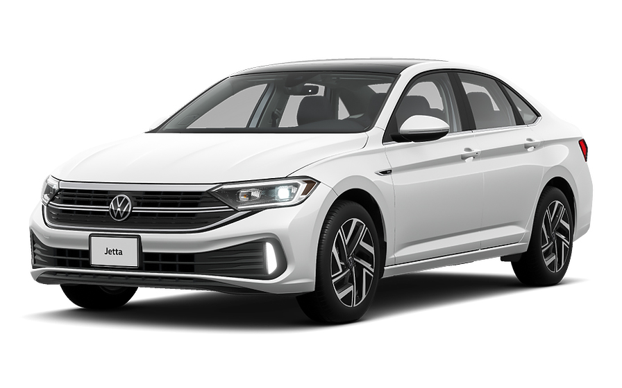
Volkswagen Jetta | Automatic
SEDANor Sedan similar
Frequently Asked Questions
What does my Hola Car Rentals booking with National in Dayton include that other companies don't offer?
Hola Car Rentals is the only premium partner of the top car rental brands operating in Dayton, including National, giving you exclusive access to our All Inclusive+ rate. This rate includes benefits that no other company can match:
- Free liability coverage starting at US$ 300,000 in case of an accident (applies only to certain rates and itineraries)
- Toll cashback: recover up to 5% of the reservation's total value for toll charges incurred during your rental period
- Premium travel medical assistance providing up to US$ 150,000 in coverage for a maximum of 5 passengers in case of a medical emergency, excluding pre-existing conditions
- No Extra Charges© guarantee: if the counter charges you for something not listed on your confirmation and not an optional add-on you accepted, Hola Car Rentals will work to remove or reimburse the charge after verification
All of this comes at no extra cost, ensuring a fully protected National rental experience and peace of mind throughout your trip in Dayton.
Will I face unexpected charges at the National counter in Dayton when I book through Hola Car Rentals?
No. With Hola Car Rentals, all costs and charges for your National booking in Dayton are clearly shown at the time of reservation and in your confirmation email, so you know exactly what you are paying before you arrive at the National counter.
On top of that, every Hola Car Rentals booking includes the No Extra Charges© guarantee. This is a pricing guarantee (not insurance) that protects you if the National counter in Dayton charges you for something that was not listed on your confirmation and was not an optional add-on you accepted. If that happens, Hola Car Rentals will work with National to remove or reimburse the charge after verification.
The only costs outside this guarantee are:
- Optional add-ons you choose at the counter (GPS, child seats, prepaid fuel)
- Usage-based charges (tolls, fuel shortfall, traffic fines)
Where is the National Car Rental counter at Dayton International Airport?
The National Car Rental counter at Dayton International Airport (DAY) is located inside the terminal at 3600 Terminal Rd, Vandalia, OH 45377, directly across from the baggage claim area. No shuttle or tram is required: after collecting your bags, walk to the rental counter, complete your paperwork, and then proceed outside the terminal to the car lot where your vehicle is waiting.
Counter hours at the Dayton airport location run from 07:00 AM to 11:30 PM, seven days a week. After-hours drop-off is available, so you can return the vehicle outside those hours using the designated drop area. If you are arriving on a late flight into Dayton, plan your arrival time against those closing hours to ensure the National desk is still staffed when you reach the counter.
What documents do I need to pick up a National Car Rental in Dayton?
To pick up your National Car Rental in Dayton, you must bring the following physical documents to the counter:
- A valid, original driver's license in the main driver's name
- A major credit card with the driver's name printed on the card, used for the security deposit hold
- A passport or valid government-issued photo ID
- Your booking confirmation or printed voucher
- Round-trip flight or cruise tickets if you are visiting from abroad
If your driver's license uses a non-Latin alphabet (for example, Arabic, Chinese, Japanese, or Cyrillic), an International Driving Permit (IDP) is mandatory at the National counter in Dayton. For licenses in other non-English scripts, an IDP is strongly recommended. The IDP is a translation only and must be carried alongside your original license, never as a standalone document.
All documents must be physical originals. Digital copies shown on a phone or tablet are not accepted at the Dayton pickup counter.
Does National Car Rental in Dayton require a credit card for the deposit?
Yes, a physical major credit card in the main driver's name is required at the National Car Rental counter in Dayton to cover the security deposit hold.
At pickup, National will place a temporary authorization on your card, typically around US$300 to US$400 for a standard vehicle at a Dayton location. This is not a charge; it reduces your available credit until the hold is released after you return the car. Your bank controls the release timeline, which can take up to 15 business days.
- Debit cards are not accepted for the deposit hold
- Prepaid or virtual cards are not accepted
- The card must have the driver's name physically printed on it
- The name on the card must match the rental agreement
It is a good idea to bring a backup credit card in your name in case your primary card is declined, and to notify your bank of your travel plans to prevent fraud blocks on the authorization at the Dayton counter.
How do tolls work when renting from National Car Rental in Dayton, and can I get cashback?
When driving a National Car Rental vehicle from Dayton, the main toll road you may encounter is the Ohio Turnpike (I-76, I-80, I-90), which runs east-west across northern Ohio and connects to routes toward Cleveland, Toledo, and Akron. The Ohio Turnpike accepts E-ZPass electronically and cash or credit card at staffed plazas. A full westbound crossing costs approximately US$27.75 by cash or US$19.00 with E-ZPass; eastbound is approximately US$23.50 cash or US$16.00 with E-ZPass.
Your National rental vehicle in Dayton comes equipped with an electronic toll device. At the counter you can choose between:
- An unlimited toll package at a fixed daily rate (approximately US$11 to US$25 per day depending on the program)
- A pay-per-use option where actual tolls plus administrative processing fees are charged to your card after the rental
If you opt out of the National toll program, you can pay Ohio Turnpike tolls manually at cash plazas or online, but unpaid tolls will result in administrative fees billed to your card.
All Hola Car Rentals bookings include Tolls Cashback: you can recover up to 5% of your total booking value for tolls paid during your Dayton rental. Email [email protected] within 30 days of returning the vehicle with your rental agreement and toll receipts to claim.
What is the minimum age to rent from National Car Rental in Dayton?
The minimum age to rent from National Car Rental in Dayton without a surcharge is 25. Drivers aged 21 to 24 can rent but will be charged a daily young-renter surcharge, and most vehicle classes are restricted to renters 25 and older.
Vehicle classes typically restricted to drivers under 25 at the Dayton location include full-size sedans, full-size SUVs, minivans, vans, convertibles, luxury, and premium categories. Drivers aged 21 to 24 are generally limited to economy, compact, intermediate, and compact SUV classes.
- National charges US$15 per day plus taxes for the young-renter surcharge at Dayton
- Ohio is not New York or Michigan, so there is no state law requiring rentals to drivers under 21
- The minimum age at the Dayton National counter is 21
All standard requirements still apply regardless of age: a valid driver's license, a major credit card in the driver's name for the deposit, and any applicable IDP if your license uses a non-Latin alphabet.
Can I add an additional driver to my National Car Rental booking in Dayton?
Yes, you can add an additional driver to your National Car Rental in Dayton, either at no cost if your rate includes it or for a fee paid at the counter.
When the additional driver is not included in your rate, National charges US$15 per day plus applicable taxes for each extra driver added at the Dayton counter. Check your booking confirmation for the line that reads "Additional driver free of charge" to know whether it is already covered.
Requirements for adding a driver at the Dayton National counter:
- The additional driver must be physically present at pickup
- They must present a valid driver's license and any required IDP
- They must sign the rental agreement
- They must meet the minimum age requirement (21 at the Dayton location)
Only drivers listed on the rental agreement are covered by the vehicle's protections such as CDW and liability coverage. Anyone not named on the contract who drives the National vehicle in Dayton may void those coverages entirely.
What fuel policy applies to National Car Rental vehicles in Dayton?
National Car Rental in Dayton uses a Full-to-Full fuel policy. You receive the vehicle with a full tank and must return it full to avoid additional charges.
Steps to follow for a smooth fuel return at the Dayton location:
- At pickup, confirm the fuel level with the agent and ensure it is recorded on the rental agreement
- Take a photo of the dashboard showing the full gauge
- Refuel within approximately 10 miles of the Dayton return location before dropping off the car
- Keep your final fuel receipt as proof in case of any dispute
If you return the National vehicle in Dayton with less than a full tank, you may be charged for the fuel shortfall at the partner's refueling rate, which is typically higher than the pump price, plus a refueling service fee. For after-hours returns at Dayton International Airport, leave the receipt in the drop envelope and keep a photo of the full gauge on your phone.
Does National Car Rental in Dayton offer after-hours vehicle return?
Yes, after-hours vehicle return is available at the National Car Rental location at Dayton International Airport (DAY), 3600 Terminal Rd, Vandalia, OH 45377.
The National counter at Dayton airport closes at 11:30 PM, but the 24-hour drop-off option allows you to return the vehicle outside staffed hours. When returning after hours at the Dayton airport location:
- Return the car to the same lot outside the terminal where you picked it up
- Leave your fuel receipt in the drop envelope provided
- Take photos of the vehicle condition and fuel gauge before walking away
- Keep your rental agreement and all paperwork until the final receipt is issued
Note that city-center National or affiliated locations in Dayton, such as off-airport branches, typically do not offer after-hours returns. If your reservation is at an off-airport address, confirm return hours directly, as those locations generally close earlier and do not have key-drop facilities.
What travel assistance is included with a National Car Rental booking in Dayton?
Most Hola Car Rentals bookings, including those for National Car Rental in Dayton, include travel assistance coverage provided by Terrawind Global Protection. This benefit is designed for situations such as a medical emergency or a highway breakdown far from the Dayton area during your trip.
Core benefits typically included:
- Travel and medical coverage for up to 5 passengers
- Legal assistance in the event of a road accident
- Compensation for baggage lost by the airline
- Flight cancellation insurance
To reach assistance 24 hours a day, call +1 888 980 9992 (toll-free) or contact WhatsApp at +1 208 910 1001. Have your Hola Car Rentals confirmation number ready when you call.
Important: this travel assistance benefit does not apply to residents of the United States or Canada. If you are a US or Canadian resident renting a National vehicle in Dayton, this coverage is not available to you. It also does not cover damage to the rental car itself; that is handled separately by CDW or LDW coverage.
Do I need an International Driving Permit to rent from National Car Rental in Dayton?
An International Driving Permit (IDP) is mandatory at the National Car Rental counter in Dayton if your driver's license uses a non-Latin alphabet, such as Arabic, Chinese, Japanese, or Cyrillic script. For all other non-English licenses, an IDP is strongly recommended but not strictly required.
Key points to keep in mind for your Dayton pickup:
- The IDP is a translation booklet only; it is not a standalone license and must be carried alongside your original license
- Obtain your IDP in your home country before traveling to Dayton, as US organizations such as AAA do not issue IDPs to non-US license holders
- All documents presented at the National counter must be physical originals; digital versions are not accepted
If you are unsure whether your license requires an IDP for the National rental in Dayton, check with your home country's automobile association before your trip. Arriving without the required IDP may result in the National desk refusing to hand over the vehicle.
Can I pick up a National Car Rental in Dayton and return it to a different city?
Yes, one-way rentals are possible with National Car Rental from Dayton, but a drop-off fee may apply depending on your return location and the route you select.
How the drop-off fee works for a Dayton National one-way rental:
- Same-city returns (for example, Dayton airport to a Dayton city branch) often carry no drop-off fee
- Returns to a different Ohio city or a different state typically incur a one-way fee that varies by distance, vehicle class, and season
- Cross-border returns (for example, from Dayton to Canada) may be restricted or carry significantly higher fees
The drop-off fee, if applicable, will be shown during the booking process under the "To pay at destination" section and will also appear on your confirmation. This fee cannot be prepaid and is paid directly to National at the Dayton pickup counter or at return.
If you change your return location after booking, the rental will be repriced and the drop-off fee may increase. Always verify the fee on your confirmation before picking up the vehicle in Dayton.
What airport fees and taxes apply to a National Car Rental at Dayton International Airport?
When picking up a National Car Rental at Dayton International Airport (DAY), several local taxes and airport-related fees are added to the base rental rate. These are standard charges applied to all rental companies operating at the Dayton airport and are not set by National or Hola Car Rentals.
Typical fees you may see on your Dayton rental agreement include:
- Airport concession recovery fee (ACRF): a percentage charged by the airport for operating on its premises
- Customer facility charge (CFC): a per-day fee that funds the airport's rental car facilities
- Ohio state and local rental taxes
Whether these fees are prepaid in your booking or due at the Dayton counter depends on your rate. Check your booking confirmation under "Taxes and Fees: Included" or "Total to pay at destination" to understand what is already covered. If your confirmation shows taxes as included and the National counter in Dayton still charges them separately, the No Extra Charges© guarantee may apply. Contact Hola Car Rentals support after completing the rental with your agreement and receipts.
What insurance options should I consider for a National Car Rental in Dayton?
When renting from National Car Rental in Dayton, two main types of protection are worth reviewing before you arrive at the counter.
Collision Damage Waiver (CDW) or Loss Damage Waiver (LDW) covers damage to the National rental vehicle itself from a collision, theft, or vandalism. A deductible may apply unless your confirmation explicitly states zero excess. CDW and LDW do not cover damage you cause to other vehicles or people.
Third-Party Liability (LIS or SLI) covers bodily injury and property damage you may cause to others while driving the National vehicle in Dayton and surrounding areas. Ohio does not mandate a specific minimum liability level for rental companies in all cases, so coverage levels can vary. Adding supplemental liability up to US$300,000 is strongly recommended.
- CDW or LDW: protects the rental car
- LIS or SLI: protects against claims from third parties
- Neither covers your personal belongings or your own medical costs
Review your Hola Car Rentals booking confirmation for the Dayton National rental to confirm which protections are already included in your rate before deciding whether to add anything at the counter.

- Choosing a selection results in a full page refresh.
- Opens in a new window.
Suggested Currencies
- $ USD - United States Dollar
- € EUR - Euro
Other Countries
-
 Albania
-
 Algeria
-
 Andorra
-
 Angola
-
 Antigua & Barbuda
-
 Argentina
-
 Australia
-
 Austria
-
 Bahamas
-
 Bahrain
-
 Bangladesh
-
 Barbados
-
 Belgium
-
 Belize
-
 Benin
Benin
-
 Bermuda
-
 Bolivia
-
 Bosnia & Herzegovina
-
 Botswana
-
 Brazil
-
 British Virgin Islands
-
 Bulgaria
-
 Burkina Faso
-
 Burundi
-
 Cameroon
-
 Canada
-
 Cape Verde
-
 Cayman Islands
-
 Central African Republic
-
 Chad
Chad
-
 Chile
Chile
-
 Colombia
-
 Comoros
-
 Congo - Brazzaville
-
 Congo - Kinshasa
-
 Costa Rica
-
 Côte d’Ivoire
-
 Croatia
-
 Curaçao
-
 Cyprus
-
 Czechia
-
 Denmark
-
 Djibouti
-
 Dominica
-
 Dominican Republic
-
 Ecuador
-
 Egypt
Egypt
-
 El Salvador
-
 Equatorial Guinea
-
 Eritrea
-
 Estonia
-
 Eswatini
-
 Ethiopia
-
 Finland
-
 France
-
 Gabon
Gabon
-
 Gambia
-
 Germany
-
 Ghana
Ghana
-
 Greece
-
 Grenada
-
 Guatemala
-
 Guinea
-
 Guinea-Bissau
-
 Guyana
-
 Haiti
Haiti
-
 Honduras
-
 Hong Kong SAR
-
 Hungary
-
 Iceland
-
 India
India
-
 Iraq
Iraq
-
 Ireland
-
 Israel
-
 Italy
Italy
-
 Jamaica
-
 Japan
Japan
-
 Jordan
-
 Kenya
Kenya
-
 Kuwait
-
 Latvia
-
 Lebanon
-
 Lesotho
-
 Liberia
-
 Libya
Libya
-
 Liechtenstein
-
 Lithuania
-
 Luxembourg
-
 Madagascar
-
 Malawi
-
 Mali
Mali
-
 Malta
Malta
-
 Mauritania
-
 Mauritius
-
 Mexico
-
 Moldova
-
 Monaco
-
 Montenegro
-
 Morocco
-
 Mozambique
-
 Namibia
-
 Netherlands
-
 New Zealand
-
 Nicaragua
-
 Niger
Niger
-
 Nigeria
-
 Norway
-
 Oman
Oman
-
 Palestinian Territories
-
 Panama
-
 Paraguay
-
 Peru
Peru
-
 Philippines
-
 Poland
-
 Portugal
-
 Qatar
Qatar
-
 Romania
-
 Russia
-
 Rwanda
-
 San Marino
-
 São Tomé & Príncipe
-
 Saudi Arabia
-
 Senegal
-
 Serbia
-
 Seychelles
-
 Sierra Leone
-
 Singapore
-
 Sint Maarten
-
 Slovakia
-
 Slovenia
-
 Somalia
-
 South Africa
-
 South Korea
-
 South Sudan
-
 Spain
Spain
-
 St. Lucia
-
 St. Vincent & Grenadines
-
 Sudan
Sudan
-
 Sweden
-
 Switzerland
-
 Taiwan
-
 Tanzania
-
 Togo
Togo
-
 Trinidad & Tobago
-
 Tunisia
-
 Türkiye
-
 Turks & Caicos Islands
-
 Uganda
-
 Ukraine
-
 United Arab Emirates
-
 United Kingdom
-
 United States
-
 Uruguay
-
 Vatican City
-
 Venezuela
-
 Yemen
Yemen
-
 Zambia
-
 Zimbabwe
Driving license from:
-
Albania
-
Algeria
-
Andorra
-
Angola
-
Antigua & Barbuda
-
Argentina
-
Australia
-
Austria
-
Bahamas
-
Bahrain
-
Bangladesh
-
Barbados
-
Belgium
-
Belize
-
Benin
-
Bermuda
-
Bolivia
-
Bosnia & Herzegovina
-
Botswana
-
Brazil
-
British Virgin Islands
-
Bulgaria
-
Burkina Faso
-
Burundi
-
Cameroon
-
Canada
-
Cape Verde
-
Cayman Islands
-
Central African Republic
-
Chad
-
Chile
-
Colombia
-
Comoros
-
Congo - Brazzaville
-
Congo - Kinshasa
-
Costa Rica
-
Côte d’Ivoire
-
Croatia
-
Curaçao
-
Cyprus
-
Czechia
-
Denmark
-
Djibouti
-
Dominica
-
Dominican Republic
-
Ecuador
-
Egypt
-
El Salvador
-
Equatorial Guinea
-
Eritrea
-
Estonia
-
Eswatini
-
Ethiopia
-
Finland
-
France
-
Gabon
-
Gambia
-
Germany
-
Ghana
-
Greece
-
Grenada
-
Guatemala
-
Guinea
-
Guinea-Bissau
-
Guyana
-
Haiti
-
Honduras
-
Hong Kong SAR
-
Hungary
-
Iceland
-
India
-
Iraq
-
Ireland
-
Israel
-
Italy
-
Jamaica
-
Japan
-
Jordan
-
Kenya
-
Kuwait
-
Latvia
-
Lebanon
-
Lesotho
-
Liberia
-
Libya
-
Liechtenstein
-
Lithuania
-
Luxembourg
-
Madagascar
-
Malawi
-
Mali
-
Malta
-
Mauritania
-
Mauritius
-
Mexico
-
Moldova
-
Monaco
-
Montenegro
-
Morocco
-
Mozambique
-
Namibia
-
Netherlands
-
New Zealand
-
Nicaragua
-
Niger
-
Nigeria
-
Norway
-
Oman
-
Palestinian Territories
-
Panama
-
Paraguay
-
Peru
-
Philippines
-
Poland
-
Portugal
-
Qatar
-
Romania
-
Russia
-
Rwanda
-
San Marino
-
São Tomé & Príncipe
-
Saudi Arabia
-
Senegal
-
Serbia
-
Seychelles
-
Sierra Leone
-
Singapore
-
Sint Maarten
-
Slovakia
-
Slovenia
-
Somalia
-
South Africa
-
South Korea
-
South Sudan
-
Spain
-
St. Lucia
-
St. Vincent & Grenadines
-
Sudan
-
Sweden
-
Switzerland
-
Taiwan
-
Tanzania
-
Togo
-
Trinidad & Tobago
-
Tunisia
-
Türkiye
-
Turks & Caicos Islands
-
Uganda
-
Ukraine
-
United Arab Emirates
-
United Kingdom
-
United States
-
Uruguay
-
Vatican City
-
Venezuela
-
Yemen
-
Zambia
-
Zimbabwe