


About renting a car with National in Calgary
Best Car Rental Deals
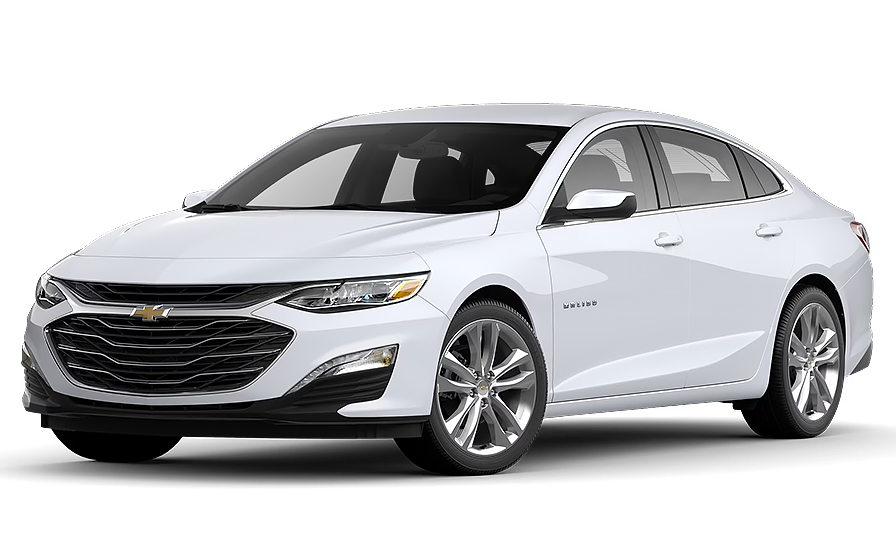
Chevrolet Malibu | Automatic
SEDANor Sedan similar
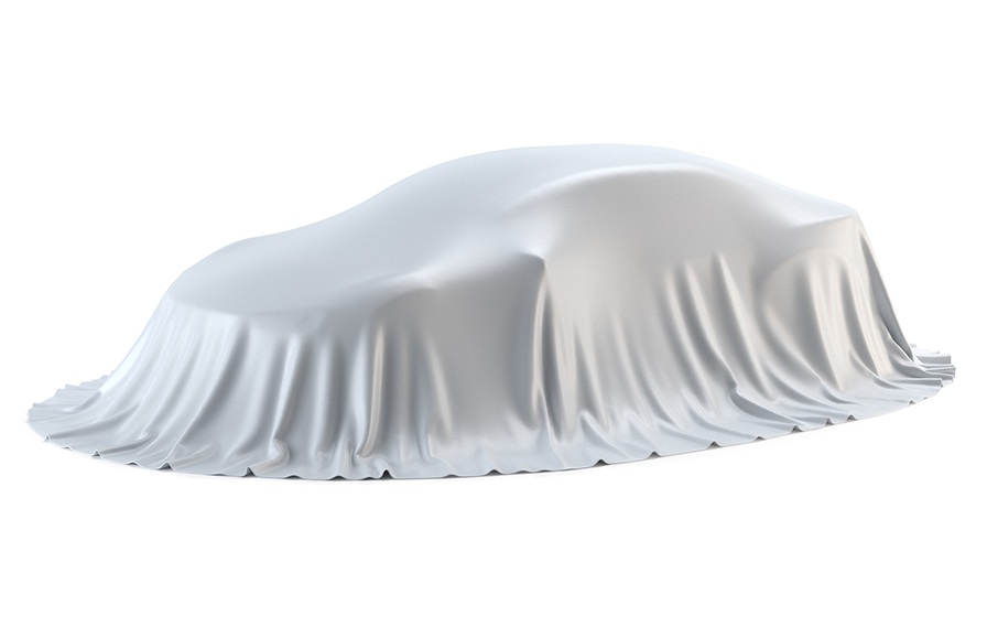
MAZDA CX90 OR SIMILAR | Automatic
SMALLor Small similar
Frequently Asked Questions
What does my Hola Car Rentals booking with National in Calgary include that other companies don't offer?
Hola Car Rentals is a premium partner of the leading car rental companies in Calgary, including National, giving you exclusive access to our All Inclusive+ rate. This rate includes extra benefits that no other company can match:
- Full vehicle coverage with no deductible (applies only for certain rates and itineraries)
- Toll cashback: get back up to 5% of your total booking value for tolls charged during your rental
- Premium travel medical assistance for up to 5 passengers in case of emergency, covering up to CAD 200,000 (pre-existing conditions excluded)
- No Extra Charges© guarantee: if the counter charges you for something not listed on your confirmation and not an optional add-on you accepted, Hola Car Rentals will work to remove or reimburse the charge after verification
All at no additional cost, ensuring a unique National rental experience with complete protection and peace of mind during your trip in Calgary.
Will I face unexpected charges at the National counter in Calgary when I book through Hola Car Rentals?
No. With Hola Car Rentals, all costs and charges for your National booking in Calgary are clearly shown at the time of reservation and in your confirmation email, so you know exactly what you are paying before you arrive at the National counter.
On top of that, every Hola Car Rentals booking includes the No Extra Charges© guarantee. This is a pricing guarantee (not insurance) that protects you if the National counter in Calgary charges you for something that was not listed on your confirmation and was not an optional add-on you accepted. If that happens, Hola Car Rentals will work with National to remove or reimburse the charge after verification.
The only costs outside this guarantee are:
- Optional add-ons you choose at the counter (GPS, child seats, prepaid fuel)
- Usage-based charges (tolls, fuel shortfall, traffic fines)
Where is the National car rental counter at Calgary Airport (YYC)?
The National car rental counter at Calgary International Airport (YYC) is located inside the terminal at 2000 Airport Rd NE. After clearing the secured area, follow signs toward baggage claim in the Arrivals Hall. The car rental counters, including National, are situated across from the baggage carousels, so you do not need to take a shuttle or leave the terminal building to reach the desk.
Once you have collected your luggage, walk toward the rental counters, present your booking confirmation, driver's license, and a major credit card in your name, and the National agent will finalize your Calgary rental agreement. Vehicles are available in the parking area connected to the rental center.
If you are arriving on an international flight, proceed through customs and immigration first, then follow Arrivals Hall signage toward baggage claim to locate the National counter.
Are there toll roads in Calgary or anywhere in Alberta that affect a National rental?
No, there are no toll roads in Calgary or anywhere in Alberta. The entire province is toll-free, meaning you will not encounter any toll plazas, cashless gantries, transponder requirements, or congestion charges while driving your National rental car in Calgary or on any Alberta highway.
This includes major routes such as Deerfoot Trail, the Calgary Ring Road (Stoney Trail, Highway 201), the Trans-Canada Highway (16 Avenue N), and all other provincial roads. There are no systems equivalent to Ontario's 407 ETR, no city-center emissions zones, and no plans announced to introduce tolls in Alberta.
If you plan to drive your National rental car from Calgary into a neighboring province that does have toll roads, such as British Columbia on certain routes, any tolls incurred there would be billed separately by the rental partner. Keep your receipts, as Hola Car Rentals includes Tolls Cashback on all bookings, allowing you to claim up to 5% of your total booking value back for tolls paid during your rental period.
What documents do I need to pick up my National rental car in Calgary?
To pick up your National rental car in Calgary, you must bring the following physical documents. Digital copies are not accepted at the counter.
- A valid, original driver's license in the main driver's name. If your license is not in English and does not use a Latin alphabet (for example, Arabic, Chinese, Japanese, or Cyrillic script), you must also carry an International Driving Permit (IDP) alongside your original license.
- A major credit card with the driver's name printed on the card, in the main driver's name, for the security deposit hold. Debit and prepaid cards are not accepted for the deposit.
- A valid passport or government-issued photo ID.
- Your booking confirmation or printed voucher.
- Round-trip flight or cruise tickets if you are visiting Calgary from abroad.
The IDP is a translation document only and cannot be used without your original license. If you think you may need one, obtain it in your home country before traveling to Calgary, as it cannot be issued abroad.
All named drivers must be present at the National counter in Calgary at pickup and must show their own valid license.
How does the Tolls Cashback benefit work for a National rental in Calgary?
All bookings made through Hola Car Rentals, including National rentals in Calgary, include Tolls Cashback. This benefit lets you claim up to 5% of your total booking value back for any tolls you pay during your rental period.
Because Calgary and all of Alberta have no toll roads, you are unlikely to incur toll charges while driving locally. However, if you drive your National rental car from Calgary into a province or region that does have tolls, such as certain routes in British Columbia, the Tolls Cashback benefit applies to those charges.
To claim your cashback after returning the vehicle:
- Email [email protected] within 30 days of returning the car.
- Use the subject line: Tolls Cashback, followed by your reservation number.
- Attach your Hola Car Rentals booking confirmation, the signed rental agreement from the National counter in Calgary, and a receipt or statement showing the toll charges paid.
Refunds are processed to the original payment method used for your booking and typically take 7 to 10 business days after approval. Submissions received after 30 days are not accepted.
What is the security deposit amount for a National rental in Calgary?
When you pick up your National rental car in Calgary, the counter will place a temporary authorization hold on your credit card as a security deposit. For rentals in Canada, this hold is typically in the range of CAUS$ 300 to CAUS$ 500, though some Calgary locations may require a minimum authorization of approximately CAUS$ 750. The exact amount varies depending on the vehicle class, rental duration, and the specific National location.
This hold is not a charge. It temporarily reduces your available credit and is released after you return the vehicle. Your bank or card issuer controls how quickly the hold disappears from your statement, which can take up to 15 business days after the rental closes.
- You must present a physical major credit card with your name printed on the card. Debit cards, prepaid cards, and virtual cards are not accepted for the deposit.
- Make sure your card has sufficient available credit to cover both the hold and any expected charges.
- Notify your bank of your travel to Calgary to prevent fraud blocks on the authorization.
- Bring a backup credit card in your name in case your primary card is declined.
Hola Car Rentals cannot confirm the exact deposit amount in advance, as final deposit rules are set by the National desk in Calgary.
Does driving in Calgary have any unique rules that could affect my National rental?
Yes, driving in Calgary has several features that can catch first-time visitors off guard and are worth knowing before you take your National rental car onto local roads.
The Calgary Ring Road (Stoney Trail, Highway 201) is a 101-kilometer free-flow freeway that encircles the city entirely. Unlike ring roads in many other cities, it does not feed into the downtown core, so relying on it to reach central Calgary can lead you to miss key interchanges. Major connections include Highway 2 (Deerfoot Trail) and Airport Road near YYC.
Downtown Calgary features a dense network of one-way avenues, and some residential streets have temporary one-way conversions due to ongoing construction projects. Pay close attention to signage, especially in the southwest quadrant.
Calgary also operates Reversible Lane Control Systems on certain corridors such as the 5 Avenue Connector (Bow Trail). These lanes switch direction based on peak traffic flow and are managed by automated signals and gates. Drivers must watch for overhead signs indicating which lanes are open in which direction, as the system is unique in Canada and can be disorienting if you are unfamiliar with it.
Deerfoot Trail, the main north-south arterial through Calgary, carries high volumes of traffic and does not have full freeway status throughout the city, meaning signalized intersections appear in some sections. Plan your route in your National rental car accordingly.
Can I add an additional driver to my National rental in Calgary?
Yes, you can add an additional driver to your National rental in Calgary, either as part of your rate or by paying a fee at the counter.
For National rentals in Calgary, the additional driver fee is CAUS$ 15 per day plus applicable taxes when not included in your rate. Check your booking confirmation before arriving at the counter, as some Hola Car Rentals rates include one additional driver free of charge.
Requirements for adding a driver at the National counter in Calgary:
- The additional driver must be physically present at pickup and show a valid driver's license.
- If their license is not in English or uses a non-Latin alphabet, they must also carry an International Driving Permit.
- Both the main driver and the additional driver must sign the rental agreement.
- The additional driver must meet the minimum age requirements applicable in Calgary.
Only drivers listed on the rental agreement are covered by protections such as CDW and liability coverage. If someone not named on the contract drives the National vehicle in Calgary, coverage may be void and additional charges could apply. If you need to add a driver after pickup, visit a National branch to update the agreement.
What fuel policy applies to National car rentals in Calgary?
National car rentals in Calgary follow a Full-to-Full fuel policy by default. This means you receive the vehicle with a full tank and must return it full to avoid additional charges.
At pickup, check the fuel gauge with the National agent and confirm the starting level is recorded on your rental agreement. Take a photo of the dashboard showing both the odometer and the fuel gauge before leaving the Calgary location.
When returning your National rental in Calgary:
- Refuel within approximately 10 to 15 kilometers of the return location so the gauge does not drop before you arrive.
- Keep your fuel receipt showing the date, time, and station address.
- Show the gauge at full to the agent, or leave the receipt in the drop envelope for after-hours returns.
If you return the vehicle below the recorded starting level, National may charge you for the fuel shortfall at their own refueling rate, which is typically higher than pump prices, plus a refueling service fee. Using the correct fuel type is also important, as wrong-fuel incidents are not covered by the fuel policy and may generate separate charges.
Ask the National agent in Calgary for the nearest gas station to the return location when you pick up the car, or use a navigation app to find one close to YYC or your drop-off point.
Is third-party liability insurance included with a National rental in Calgary?
Yes, third-party liability coverage is included by default with National car rentals in Calgary. Canadian provincial law requires every vehicle on the road to carry third-party liability insurance, so this statutory coverage is included when you rent in Canada through Hola Car Rentals.
This coverage protects you against bodily injury and property damage you may cause to other people while driving the National vehicle in Calgary and throughout Canada. It applies only to drivers listed on the rental agreement who are driving within permitted areas and in compliance with the rental terms.
You can also purchase higher supplemental liability limits at the National counter in Calgary if you want additional protection beyond the statutory minimum. This is worth considering if you plan to drive long distances or into areas with higher traffic volumes, such as on Deerfoot Trail or the Trans-Canada Highway through Calgary.
Third-party liability does not cover damage to the National rental vehicle itself. For that, you need Collision Damage Waiver (CDW) or Loss Damage Waiver (LDW), which is a separate protection. Review your booking confirmation to confirm which coverages are included in your rate before arriving at the Calgary counter.
What travel assistance is included with my National rental booking in Calgary?
Most bookings made through Hola Car Rentals, including National rentals in Calgary, include travel assistance coverage provided by Terrawind Global Protection. This benefit is designed to support you if an unexpected situation arises during your trip, such as a medical emergency, a vehicle breakdown on one of Calgary's major routes like the Ring Road or Deerfoot Trail, or a flight cancellation affecting your travel to or from Calgary.
Core benefits typically included are:
- Travel insurance with medical coverage for up to 5 passengers.
- Legal assistance in the event of an accident.
- Compensation for luggage lost by the airline.
- Flight cancellation insurance.
To reach assistance 24 hours a day, call +1 888 980 9992 (toll-free) or contact WhatsApp at +1 208 910 1001. Have your Hola Car Rentals confirmation number ready when you call.
Important: this travel assistance benefit applies only to non-North American customers. Canadian residents and US residents do not qualify for this coverage. If you are renting a National vehicle in Calgary as a Canadian resident, this benefit does not apply to you. Always review your booking confirmation for the exact terms and coverage limits applicable to your itinerary.
Can I pick up a National car in Calgary and drop it off in another city?
Yes, one-way rentals are possible with National in Calgary, but a drop-off fee may apply depending on your return location. The fee is route-specific and varies based on the cities involved, the distance, the vehicle class, and the season.
Common patterns for one-way rentals from Calgary:
- Returning to another National location within Alberta may or may not incur a drop-off fee depending on the specific route.
- Returning to a location in another province, such as Vancouver or Edmonton, typically carries a one-way fee.
- Cross-border one-way rentals, for example returning a National vehicle from Calgary to a US city, may be restricted or subject to higher fees. Confirm with the partner before booking.
When booking through Hola Car Rentals, any applicable drop-off fee for your Calgary National rental will be shown on the rate details page under the section labeled as charges due at the destination. This fee cannot be prepaid and is settled at the counter.
If you need to change your drop-off location after booking, contact support as soon as possible, as changes may reprice the rental and affect fee amounts. Mid-rental route changes must be approved directly by the National location in Calgary or your return branch.
What happens if my flight to Calgary is delayed and I miss my National pickup time?
If your flight to Calgary is delayed, National will generally hold your reservation for up to 24 hours from the original scheduled pickup time, provided you arrive during the counter's operating hours.
Here is what to expect depending on the length of the delay:
- Delay of less than 24 hours: your National booking in Calgary should be held. Make sure you arrive while the counter is open, as after-hours arrivals may require advance arrangements.
- Delay of more than 24 hours: contact Hola Car Rentals support as soon as possible via WhatsApp at +1 (786) 999-8312 or by email at [email protected]. Changes are not guaranteed but the team will assist where possible.
It is a good idea to check the operating hours for the National counter at Calgary International Airport (YYC) before your travel date, especially if you are arriving on a late-night flight. Counter hours can vary and may be affected by holidays.
If you arrive outside of operating hours and no after-hours arrangement has been made, the booking may be forfeited without a refund. Planning your Calgary arrival time carefully and keeping your confirmation number accessible will help you resolve any delay situation quickly.
Does the Calgary Ring Road affect how I navigate in my National rental car?
Yes, the Calgary Ring Road (Stoney Trail, Highway 201) is one of the most important routes to understand before driving a National rental car in Calgary, and it frequently surprises first-time visitors.
The Ring Road is a 101-kilometer free-flow freeway that encircles Calgary entirely. Unlike ring roads in many other cities that feed traffic into the downtown core, Calgary's Ring Road bypasses the city center completely. This means that if you are trying to reach downtown Calgary, the central business district, or neighborhoods close to the core, you will need to exit the Ring Road and use signal-controlled arterials such as Deerfoot Trail or 16 Avenue N (Trans-Canada Highway) to continue your journey.
Key things to know when driving a National rental car on Calgary's road network:
- The Ring Road connects to Calgary International Airport (YYC) via Airport Road, making it the primary route between YYC and the rest of the city.
- Deerfoot Trail is the main north-south corridor through Calgary but does not have full freeway status throughout, so expect signalized intersections in some sections.
- Downtown Calgary has a dense network of one-way avenues. Some streets have temporary one-way conversions due to ongoing construction.
- Reversible lane systems operate on certain corridors such as Bow Trail. Watch overhead signals carefully, as lane directions change based on peak traffic flow.
Using a GPS or navigation app is strongly recommended for all National rental car drivers new to Calgary.

- Choosing a selection results in a full page refresh.
- Opens in a new window.
Suggested Currencies
- $ USD - United States Dollar
- € EUR - Euro
Other Countries
-
 Albania
-
 Algeria
-
 Andorra
-
 Angola
-
 Antigua & Barbuda
-
 Argentina
-
 Australia
-
 Austria
-
 Bahamas
-
 Bahrain
-
 Bangladesh
-
 Barbados
-
 Belgium
-
 Belize
-
 Benin
Benin
-
 Bermuda
-
 Bolivia
-
 Bosnia & Herzegovina
-
 Botswana
-
 Brazil
-
 British Virgin Islands
-
 Bulgaria
-
 Burkina Faso
-
 Burundi
-
 Cameroon
-
 Canada
-
 Cape Verde
-
 Cayman Islands
-
 Central African Republic
-
 Chad
Chad
-
 Chile
Chile
-
 Colombia
-
 Comoros
-
 Congo - Brazzaville
-
 Congo - Kinshasa
-
 Costa Rica
-
 Côte d’Ivoire
-
 Croatia
-
 Curaçao
-
 Cyprus
-
 Czechia
-
 Denmark
-
 Djibouti
-
 Dominica
-
 Dominican Republic
-
 Ecuador
-
 Egypt
Egypt
-
 El Salvador
-
 Equatorial Guinea
-
 Eritrea
-
 Estonia
-
 Eswatini
-
 Ethiopia
-
 Finland
-
 France
-
 Gabon
Gabon
-
 Gambia
-
 Germany
-
 Ghana
Ghana
-
 Greece
-
 Grenada
-
 Guatemala
-
 Guinea
-
 Guinea-Bissau
-
 Guyana
-
 Haiti
Haiti
-
 Honduras
-
 Hong Kong SAR
-
 Hungary
-
 Iceland
-
 India
India
-
 Iraq
Iraq
-
 Ireland
-
 Israel
-
 Italy
Italy
-
 Jamaica
-
 Japan
Japan
-
 Jordan
-
 Kenya
Kenya
-
 Kuwait
-
 Latvia
-
 Lebanon
-
 Lesotho
-
 Liberia
-
 Libya
Libya
-
 Liechtenstein
-
 Lithuania
-
 Luxembourg
-
 Madagascar
-
 Malawi
-
 Mali
Mali
-
 Malta
Malta
-
 Mauritania
-
 Mauritius
-
 Mexico
-
 Moldova
-
 Monaco
-
 Montenegro
-
 Morocco
-
 Mozambique
-
 Namibia
-
 Netherlands
-
 New Zealand
-
 Nicaragua
-
 Niger
Niger
-
 Nigeria
-
 Norway
-
 Oman
Oman
-
 Palestinian Territories
-
 Panama
-
 Paraguay
-
 Peru
Peru
-
 Philippines
-
 Poland
-
 Portugal
-
 Qatar
Qatar
-
 Romania
-
 Russia
-
 Rwanda
-
 San Marino
-
 São Tomé & Príncipe
-
 Saudi Arabia
-
 Senegal
-
 Serbia
-
 Seychelles
-
 Sierra Leone
-
 Singapore
-
 Sint Maarten
-
 Slovakia
-
 Slovenia
-
 Somalia
-
 South Africa
-
 South Korea
-
 South Sudan
-
 Spain
Spain
-
 St. Lucia
-
 St. Vincent & Grenadines
-
 Sudan
Sudan
-
 Sweden
-
 Switzerland
-
 Taiwan
-
 Tanzania
-
 Togo
Togo
-
 Trinidad & Tobago
-
 Tunisia
-
 Türkiye
-
 Turks & Caicos Islands
-
 Uganda
-
 Ukraine
-
 United Arab Emirates
-
 United Kingdom
-
 United States
-
 Uruguay
-
 Vatican City
-
 Venezuela
-
 Yemen
Yemen
-
 Zambia
-
 Zimbabwe
Driving license from:
-
Albania
-
Algeria
-
Andorra
-
Angola
-
Antigua & Barbuda
-
Argentina
-
Australia
-
Austria
-
Bahamas
-
Bahrain
-
Bangladesh
-
Barbados
-
Belgium
-
Belize
-
Benin
-
Bermuda
-
Bolivia
-
Bosnia & Herzegovina
-
Botswana
-
Brazil
-
British Virgin Islands
-
Bulgaria
-
Burkina Faso
-
Burundi
-
Cameroon
-
Canada
-
Cape Verde
-
Cayman Islands
-
Central African Republic
-
Chad
-
Chile
-
Colombia
-
Comoros
-
Congo - Brazzaville
-
Congo - Kinshasa
-
Costa Rica
-
Côte d’Ivoire
-
Croatia
-
Curaçao
-
Cyprus
-
Czechia
-
Denmark
-
Djibouti
-
Dominica
-
Dominican Republic
-
Ecuador
-
Egypt
-
El Salvador
-
Equatorial Guinea
-
Eritrea
-
Estonia
-
Eswatini
-
Ethiopia
-
Finland
-
France
-
Gabon
-
Gambia
-
Germany
-
Ghana
-
Greece
-
Grenada
-
Guatemala
-
Guinea
-
Guinea-Bissau
-
Guyana
-
Haiti
-
Honduras
-
Hong Kong SAR
-
Hungary
-
Iceland
-
India
-
Iraq
-
Ireland
-
Israel
-
Italy
-
Jamaica
-
Japan
-
Jordan
-
Kenya
-
Kuwait
-
Latvia
-
Lebanon
-
Lesotho
-
Liberia
-
Libya
-
Liechtenstein
-
Lithuania
-
Luxembourg
-
Madagascar
-
Malawi
-
Mali
-
Malta
-
Mauritania
-
Mauritius
-
Mexico
-
Moldova
-
Monaco
-
Montenegro
-
Morocco
-
Mozambique
-
Namibia
-
Netherlands
-
New Zealand
-
Nicaragua
-
Niger
-
Nigeria
-
Norway
-
Oman
-
Palestinian Territories
-
Panama
-
Paraguay
-
Peru
-
Philippines
-
Poland
-
Portugal
-
Qatar
-
Romania
-
Russia
-
Rwanda
-
San Marino
-
São Tomé & Príncipe
-
Saudi Arabia
-
Senegal
-
Serbia
-
Seychelles
-
Sierra Leone
-
Singapore
-
Sint Maarten
-
Slovakia
-
Slovenia
-
Somalia
-
South Africa
-
South Korea
-
South Sudan
-
Spain
-
St. Lucia
-
St. Vincent & Grenadines
-
Sudan
-
Sweden
-
Switzerland
-
Taiwan
-
Tanzania
-
Togo
-
Trinidad & Tobago
-
Tunisia
-
Türkiye
-
Turks & Caicos Islands
-
Uganda
-
Ukraine
-
United Arab Emirates
-
United Kingdom
-
United States
-
Uruguay
-
Vatican City
-
Venezuela
-
Yemen
-
Zambia
-
Zimbabwe