


VERIFIED REVIEWS


About renting a car with Hertz in Calgary
Best Car Rental Deals
A6 COMPACT OR LARGER OR SIMILAR | Automatic
SMALLor Small similar
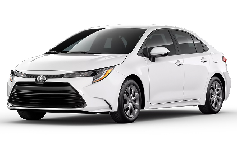
Toyota Corolla | Automatic
SEDANor Sedan similar
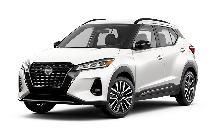
Nissan Kicks | Automatic
SUVor SUV similar
Frequently Asked Questions
What does my Hola Car Rentals booking with Hertz in Calgary include that other companies don't offer?
Hola Car Rentals is a premium partner of the leading car rental companies in Calgary, including Hertz, giving you exclusive access to our All Inclusive+ rate. This rate includes extra benefits that no other company can match:
- Full vehicle coverage with no deductible (applies only for certain rates and itineraries)
- Toll cashback: get back up to 5% of your total booking value for tolls charged during your rental
- Premium travel medical assistance for up to 5 passengers in case of emergency, covering up to CAD 200,000 (pre-existing conditions excluded)
- No Extra Charges© guarantee: if the counter charges you for something not listed on your confirmation and not an optional add-on you accepted, Hola Car Rentals will work to remove or reimburse the charge after verification
All at no additional cost, ensuring a unique Hertz rental experience with complete protection and peace of mind during your trip in Calgary.
Will I face unexpected charges at the Hertz counter in Calgary when I book through Hola Car Rentals?
No. With Hola Car Rentals, all costs and charges for your Hertz booking in Calgary are clearly shown at the time of reservation and in your confirmation email, so you know exactly what you are paying before you arrive at the Hertz counter.
On top of that, every Hola Car Rentals booking includes the No Extra Charges© guarantee. This is a pricing guarantee (not insurance) that protects you if the Hertz counter in Calgary charges you for something that was not listed on your confirmation and was not an optional add-on you accepted. If that happens, Hola Car Rentals will work with Hertz to remove or reimburse the charge after verification.
The only costs outside this guarantee are:
- Optional add-ons you choose at the counter (GPS, child seats, prepaid fuel)
- Usage-based charges (tolls, fuel shortfall, traffic fines)
Where is the Hertz counter at Calgary International Airport (YYC)?
The Hertz location serving Calgary International Airport (YYC) is at 2000 Airport Road NE, Calgary. This is an off-terminal facility, and off-site rental companies at YYC provide courtesy shuttles to their locations, with passenger pickup at Bus Bay 22 on the Arrivals roadway.
The Hertz Calgary Airport counter operates daily from 7:00 AM to 11:59 PM, making it well suited for most flight arrivals. If your flight lands close to midnight, confirm your arrival time falls within those hours before booking.
When you land, follow signs to the Arrivals roadway, locate Bus Bay 22, and board the shuttle to the Hertz facility. Allow extra time for the shuttle ride and counter processing before you are on the road.
What are the Hertz Calgary downtown location hours?
Hertz operates a downtown Calgary location at 927 6th Avenue SW. The operating hours are as follows:
- Monday to Friday: 7:30 AM to 6:00 PM
- Saturday: 9:00 AM to 1:00 PM
- Sunday: 10:00 AM to 4:00 PM
These hours are significantly more limited than the Hertz Calgary Airport location at 2000 Airport Road NE, which is open daily from 7:00 AM to 11:59 PM. If you are arriving by plane and need a vehicle outside downtown business hours, the airport location is the better option.
A second city location at 114 5th Avenue SE, Calgary, operates Monday to Friday from 8:00 AM to 4:30 PM and Saturday from 9:00 AM to 1:00 PM. Always confirm current hours directly with the Hertz branch before your pickup, as hours can change on public holidays.
Are there toll roads for a Hertz rental in Calgary or anywhere in Alberta?
No, there are no toll roads anywhere in Alberta, including Calgary. Hertz rental drivers in Calgary will not encounter any toll booths, cashless toll lanes, transponder requirements, or congestion charges during their rental.
Unlike some other Canadian provinces or US states, Alberta has no toll infrastructure at all. There are no programs similar to Ontario's 407 ETR, no city-center emissions zones, and no highway surcharges. Every road in and around Calgary is completely free to drive.
This means you will not need to purchase a toll package at the Hertz counter in Calgary, and you will not receive any post-rental toll invoices for driving within Alberta. If your trip takes you into a neighboring province that does have tolls, standard toll billing rules would apply for that portion of your journey.
Can I get cashback on tolls with my Hertz rental in Calgary?
Yes, Tolls Cashback is included on all bookings, including your Hertz rental in Calgary. Even though Alberta has no toll roads, this benefit applies if you drive your Calgary rental into a neighboring province or region where tolls exist.
The benefit reimburses up to 5% of your total booking value for tolls paid during the rental period. Here is how it works:
- If your booking total is US$500, the maximum cashback is US$25
- If you paid US$18 in tolls, you receive US$18 back
- If you paid US$40 in tolls, you receive US$25 (the cap)
To claim, email [email protected] within 30 days of returning the Hertz vehicle in Calgary or at your final drop-off point. Include your reservation confirmation, the signed rental agreement, and a receipt or statement showing the toll charges. Refunds are processed to your original payment method within 7 to 10 business days after approval.
What documents do I need to pick up a Hertz rental car in Calgary?
When collecting your Hertz rental in Calgary, you must present the following physical documents at the counter:
- Your original, unexpired driver's license in the main driver's name
- A major credit card with the driver's name printed on the physical card, for the security deposit hold
- A valid passport or government-issued photo ID
- Your booking confirmation or printed voucher
- Round-trip flight or cruise tickets (required for visitors from abroad)
If your driver's license is not in English and does not use a Latin alphabet (for example, Arabic, Chinese, Japanese, or Cyrillic script), an International Driving Permit (IDP) is mandatory alongside your original license. For licenses in other non-English scripts, an IDP is strongly recommended. The IDP is a translation only and is not valid without your original license.
All documents must be physical originals. Digital copies or photos on a phone are not accepted at the Hertz Calgary counter. Obtain your IDP in your home country before traveling, as it cannot be issued abroad.
How much is the security deposit for a Hertz rental in Calgary?
When you pick up your Hertz rental in Calgary, a temporary authorization hold is placed on your credit card. For rentals in Canada, the typical hold is approximately CAUS$ 300 to CAUS$ 500, though some Calgary locations may require a minimum authorization of around CAUS$ 750 depending on the vehicle class or season.
A few important points to keep in mind:
- The hold is not a charge. It temporarily reduces your available credit and is released after you return the vehicle
- Your bank controls how quickly the hold disappears after release, which can take up to 15 business days
- Debit cards, prepaid cards, and virtual cards are not accepted for the deposit at the Hertz Calgary counter
- The card must be a major credit card with the driver's name printed on it
Bring a backup credit card in your name in case your primary card is declined. It is also a good idea to notify your bank of your travel plans to prevent the authorization from being flagged as suspicious.
Can I add an additional driver to my Hertz rental in Calgary?
Yes, you can add an additional driver to your Hertz rental in Calgary, but the extra driver must be present at the counter at the time of pickup with their own valid driver's license.
For Hertz in Calgary, the additional driver fee is US$13.50 per rental day plus applicable taxes, with a maximum charge of US$189 plus taxes if your rate does not include a free additional driver. Check your booking confirmation before arriving, as some rates include one additional driver at no extra cost.
Key requirements for adding a driver at the Hertz Calgary counter:
- The additional driver must appear in person at pickup
- They must present a valid driver's license (and an IDP if their license uses a non-Latin alphabet)
- They must meet the minimum age requirements for Calgary rentals
- Both the main driver and the additional driver must sign the rental agreement
Only drivers listed on the Hertz rental agreement are covered by the vehicle's protections. Anyone who drives without being named on the contract may void coverage entirely.
Can I pick up a Hertz car in Calgary and return it in another city?
Yes, one-way rentals are possible with Hertz in Calgary, but a drop-off fee may apply depending on your return location. This fee is route-specific and varies by destination, vehicle class, and season.
Common patterns for Calgary one-way rentals:
- Calgary Airport to downtown Calgary (or vice versa): often no drop-off fee
- Calgary to another Alberta city: a drop-off fee typically applies
- Calgary to another province: a drop-off fee usually applies and cross-border rules may restrict certain vehicle classes
The drop-off fee is always shown during the booking process under the section labeled as charges due at the destination. It cannot be prepaid and is paid directly to Hertz at the Calgary pickup counter or at the return location.
If you need to change your return location after booking, be aware that this may reprice your entire rental and recalculate the drop-off fee. Always confirm the updated total before confirming any change.
Does Hertz in Calgary include liability insurance with the rental?
Yes, under Canadian provincial law, every rental vehicle in Calgary must carry third-party liability coverage, and this statutory liability is included by default when you rent through Hertz in Calgary. This means basic protection against bodily injury and property damage you may cause to others is built into the rental.
However, the included statutory minimum may not be sufficient for all situations. You can purchase supplemental liability insurance (LIS/ALI/SLI) to increase your coverage limits, which is available as an add-on at the Hertz Calgary counter or during the booking process.
It is also important to understand what liability coverage does not include:
- Damage to the Hertz rental vehicle itself (that requires CDW/LDW)
- Your own personal injuries (that requires PAI)
- Your personal belongings (that requires PEC)
Review your booking confirmation to see which protections are already included in your rate, and confirm the details on the rental agreement at the Hertz Calgary counter before signing.
What is the fuel policy for Hertz rentals in Calgary?
Hertz rentals in Calgary follow a Full-to-Full fuel policy. You receive the vehicle with a full tank and must return it full to avoid additional charges.
Steps to follow for a smooth fuel return in Calgary:
- At pickup, check the fuel gauge with the Hertz agent and confirm the starting level is recorded on the rental agreement
- Take a photo of the dashboard showing the odometer and fuel gauge
- Refuel within approximately 10 to 15 km of the Hertz return location in Calgary before dropping off
- Keep your final fuel receipt as proof of a full tank
If you return the Hertz vehicle in Calgary with less than a full tank, you may be charged for the fuel shortfall at the partner's refueling rate, which is typically higher than the pump price, plus a refueling service fee.
Calgary has numerous fuel stations near both the airport and downtown locations, so finding a station close to your return point should not be difficult. Ask the Hertz agent at pickup to recommend the nearest station to the return location.
Is travel assistance included with a Hertz booking in Calgary?
Most bookings include travel assistance coverage provided by Terrawind Global Protection, and this applies to Hertz rentals in Calgary as well. However, this benefit is available only to non-North American customers. Canadian and US residents do not qualify for this coverage.
For eligible travelers, the travel assistance included with a Calgary Hertz rental typically covers:
- Medical coverage for up to 5 passengers during the trip
- Legal assistance in the event of a road accident in Calgary or elsewhere in Canada
- Compensation for luggage lost by the airline
- Flight cancellation insurance
This coverage does not apply to damage to the Hertz rental vehicle (that is CDW/LDW) or third-party liability (that is LIS/ALI/SLI). Pre-existing medical conditions are also excluded.
If you need assistance during your Calgary rental, contact Terrawind 24 hours a day at +1 888 980 9992 or via WhatsApp at +1 208 910 1001. Have your Hola Car Rentals confirmation number ready when you call.
What does CDW insurance cover on a Hertz rental in Calgary?
Collision Damage Waiver (CDW) or Loss Damage Waiver (LDW) on your Hertz rental in Calgary reduces your financial liability if the rental vehicle is damaged or stolen during your rental period.
CDW/LDW on a Calgary Hertz rental typically covers:
- Collision damage to the rental vehicle
- Theft and vandalism
- Other covered incidents named in the rental agreement
It does not cover:
- Third-party liability (injuries or damage to others), which requires separate LIS/ALI/SLI coverage
- Tires, wheels, undercarriage, or roof damage unless specifically included
- Damage caused by prohibited use such as off-road driving, DUI, or unauthorized drivers
- Incidents not reported promptly to Hertz
A deductible or excess may apply unless your Calgary booking confirmation explicitly states zero deductible. Check your confirmation before arriving at the Hertz counter in Calgary, and verify the deductible amount on the rental agreement before signing. Only drivers listed on the agreement are covered.
What happens if my flight is delayed and I miss my Hertz pickup in Calgary?
If your flight is delayed and you arrive later than your scheduled Hertz pickup time in Calgary, the rental will generally be held for up to 24 hours from the original pickup time, provided you arrive during the counter's operating hours.
The Hertz Calgary Airport location at 2000 Airport Road NE is open daily from 7:00 AM to 11:59 PM, which covers most flight arrivals. The downtown Calgary location at 927 6th Avenue SW has more limited hours, so a late arrival there is more likely to cause an issue.
What to do if your flight to Calgary is delayed:
- If the delay is less than 24 hours, proceed to the Hertz counter as soon as you land, making sure you arrive within operating hours
- If the delay is greater than 24 hours, contact support via WhatsApp at +1 (786) 999-8312 or email [email protected] as soon as possible
- Bookings not collected within 24 hours of the original pickup time may be forfeited with no refund
Always keep your flight details handy when contacting support about a delayed arrival at your Calgary Hertz location.

- Choosing a selection results in a full page refresh.
- Opens in a new window.
Suggested Currencies
- $ USD - United States Dollar
- € EUR - Euro
Other Countries
-
 Albania
-
 Algeria
-
 Andorra
-
 Angola
-
 Antigua & Barbuda
-
 Argentina
-
 Australia
-
 Austria
-
 Bahamas
-
 Bahrain
-
 Bangladesh
-
 Barbados
-
 Belgium
-
 Belize
-
 Benin
Benin
-
 Bermuda
-
 Bolivia
-
 Bosnia & Herzegovina
-
 Botswana
-
 Brazil
-
 British Virgin Islands
-
 Bulgaria
-
 Burkina Faso
-
 Burundi
-
 Cameroon
-
 Canada
-
 Cape Verde
-
 Cayman Islands
-
 Central African Republic
-
 Chad
Chad
-
 Chile
Chile
-
 Colombia
-
 Comoros
-
 Congo - Brazzaville
-
 Congo - Kinshasa
-
 Costa Rica
-
 Côte d’Ivoire
-
 Croatia
-
 Curaçao
-
 Cyprus
-
 Czechia
-
 Denmark
-
 Djibouti
-
 Dominica
-
 Dominican Republic
-
 Ecuador
-
 Egypt
Egypt
-
 El Salvador
-
 Equatorial Guinea
-
 Eritrea
-
 Estonia
-
 Eswatini
-
 Ethiopia
-
 Finland
-
 France
-
 Gabon
Gabon
-
 Gambia
-
 Germany
-
 Ghana
Ghana
-
 Greece
-
 Grenada
-
 Guatemala
-
 Guinea
-
 Guinea-Bissau
-
 Guyana
-
 Haiti
Haiti
-
 Honduras
-
 Hong Kong SAR
-
 Hungary
-
 Iceland
-
 India
India
-
 Iraq
Iraq
-
 Ireland
-
 Israel
-
 Italy
Italy
-
 Jamaica
-
 Japan
Japan
-
 Jordan
-
 Kenya
Kenya
-
 Kuwait
-
 Latvia
-
 Lebanon
-
 Lesotho
-
 Liberia
-
 Libya
Libya
-
 Liechtenstein
-
 Lithuania
-
 Luxembourg
-
 Madagascar
-
 Malawi
-
 Mali
Mali
-
 Malta
Malta
-
 Mauritania
-
 Mauritius
-
 Mexico
-
 Moldova
-
 Monaco
-
 Montenegro
-
 Morocco
-
 Mozambique
-
 Namibia
-
 Netherlands
-
 New Zealand
-
 Nicaragua
-
 Niger
Niger
-
 Nigeria
-
 Norway
-
 Oman
Oman
-
 Palestinian Territories
-
 Panama
-
 Paraguay
-
 Peru
Peru
-
 Philippines
-
 Poland
-
 Portugal
-
 Qatar
Qatar
-
 Romania
-
 Russia
-
 Rwanda
-
 San Marino
-
 São Tomé & Príncipe
-
 Saudi Arabia
-
 Senegal
-
 Serbia
-
 Seychelles
-
 Sierra Leone
-
 Singapore
-
 Sint Maarten
-
 Slovakia
-
 Slovenia
-
 Somalia
-
 South Africa
-
 South Korea
-
 South Sudan
-
 Spain
Spain
-
 St. Lucia
-
 St. Vincent & Grenadines
-
 Sudan
Sudan
-
 Sweden
-
 Switzerland
-
 Taiwan
-
 Tanzania
-
 Togo
Togo
-
 Trinidad & Tobago
-
 Tunisia
-
 Türkiye
-
 Turks & Caicos Islands
-
 Uganda
-
 Ukraine
-
 United Arab Emirates
-
 United Kingdom
-
 United States
-
 Uruguay
-
 Vatican City
-
 Venezuela
-
 Yemen
Yemen
-
 Zambia
-
 Zimbabwe
Driving license from:
-
Albania
-
Algeria
-
Andorra
-
Angola
-
Antigua & Barbuda
-
Argentina
-
Australia
-
Austria
-
Bahamas
-
Bahrain
-
Bangladesh
-
Barbados
-
Belgium
-
Belize
-
Benin
-
Bermuda
-
Bolivia
-
Bosnia & Herzegovina
-
Botswana
-
Brazil
-
British Virgin Islands
-
Bulgaria
-
Burkina Faso
-
Burundi
-
Cameroon
-
Canada
-
Cape Verde
-
Cayman Islands
-
Central African Republic
-
Chad
-
Chile
-
Colombia
-
Comoros
-
Congo - Brazzaville
-
Congo - Kinshasa
-
Costa Rica
-
Côte d’Ivoire
-
Croatia
-
Curaçao
-
Cyprus
-
Czechia
-
Denmark
-
Djibouti
-
Dominica
-
Dominican Republic
-
Ecuador
-
Egypt
-
El Salvador
-
Equatorial Guinea
-
Eritrea
-
Estonia
-
Eswatini
-
Ethiopia
-
Finland
-
France
-
Gabon
-
Gambia
-
Germany
-
Ghana
-
Greece
-
Grenada
-
Guatemala
-
Guinea
-
Guinea-Bissau
-
Guyana
-
Haiti
-
Honduras
-
Hong Kong SAR
-
Hungary
-
Iceland
-
India
-
Iraq
-
Ireland
-
Israel
-
Italy
-
Jamaica
-
Japan
-
Jordan
-
Kenya
-
Kuwait
-
Latvia
-
Lebanon
-
Lesotho
-
Liberia
-
Libya
-
Liechtenstein
-
Lithuania
-
Luxembourg
-
Madagascar
-
Malawi
-
Mali
-
Malta
-
Mauritania
-
Mauritius
-
Mexico
-
Moldova
-
Monaco
-
Montenegro
-
Morocco
-
Mozambique
-
Namibia
-
Netherlands
-
New Zealand
-
Nicaragua
-
Niger
-
Nigeria
-
Norway
-
Oman
-
Palestinian Territories
-
Panama
-
Paraguay
-
Peru
-
Philippines
-
Poland
-
Portugal
-
Qatar
-
Romania
-
Russia
-
Rwanda
-
San Marino
-
São Tomé & Príncipe
-
Saudi Arabia
-
Senegal
-
Serbia
-
Seychelles
-
Sierra Leone
-
Singapore
-
Sint Maarten
-
Slovakia
-
Slovenia
-
Somalia
-
South Africa
-
South Korea
-
South Sudan
-
Spain
-
St. Lucia
-
St. Vincent & Grenadines
-
Sudan
-
Sweden
-
Switzerland
-
Taiwan
-
Tanzania
-
Togo
-
Trinidad & Tobago
-
Tunisia
-
Türkiye
-
Turks & Caicos Islands
-
Uganda
-
Ukraine
-
United Arab Emirates
-
United Kingdom
-
United States
-
Uruguay
-
Vatican City
-
Venezuela
-
Yemen
-
Zambia
-
Zimbabwe