


VERIFIED REVIEWS


About hiring a car with Dollar in Mobile
Best Car Rental Deals
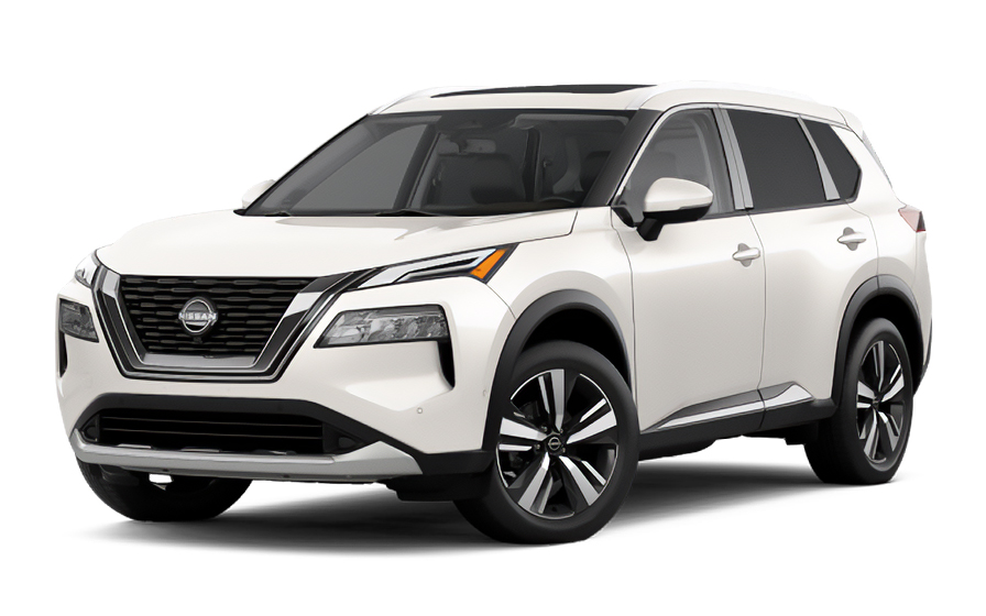
Nissan Rogue | Automatic
SUVor SUV similar
Frequently Asked Questions
What does my Hola Car Rentals booking with Dollar in Mobile include that other companies don't offer?
Hola Car Rentals is the only premium partner of the top car hire brands operating in Mobile, giving you exclusive access to our All Inclusive+ rate. This rate includes benefits that no other company can match:
- Free liability coverage starting at US$ 300,000 in case of an accident (applies only to certain rates and itineraries)
- Toll cashback: recover up to 5% of the reservation's total value for toll charges incurred during your hire period
- Premium travel medical assistance providing up to US$ 150,000 in coverage for a maximum of 5 passengers in case of a medical emergency, excluding pre-existing conditions
- No Extra Charges© guarantee: if the counter charges you for something not listed on your confirmation and not an optional add-on you accepted, Hola Car Rentals will work to remove or reimburse the charge after verification
All of this comes at no extra cost, ensuring a fully protected car hire experience and peace of mind throughout your trip in Mobile.
Will I face unexpected charges at the Dollar counter in Mobile when I book through Hola Car Rentals?
No. With Hola Car Rentals, all costs and charges for your booking in Mobile are clearly shown at the time of reservation and in your confirmation email, so you know exactly what you are paying before you arrive at the counter.
On top of that, every Hola Car Rentals booking includes the No Extra Charges© guarantee. This is a pricing guarantee (not insurance) that protects you if the counter in Mobile charges you for something that was not listed on your confirmation and was not an optional add-on you accepted. If that happens, Hola Car Rentals will work with the hire partner to remove or reimburse the charge after verification.
The only costs outside this guarantee are:
- Optional add-ons you choose at the counter (GPS, child seats, prepaid fuel)
- Usage-based charges (tolls, fuel shortfall, traffic fines)
Where is the Dollar counter at Mobile Regional Airport?
The Dollar counter at Mobile Regional Airport (MOB) is located inside the terminal at 8400 Airport Blvd, Mobile, AL 36608. No shuttle or tram is needed: after collecting your bags, simply follow the car hire signs inside the terminal and walk directly to the Dollar desk. The counter is approximately 0.1 miles from the runway, making it one of the most convenient walk-up setups in Mobile.
Counter hours at Mobile Regional Airport are daily from 07:00 to 23:30. If your flight arrives close to closing time, plan accordingly, as after-hours pickup details are not guaranteed. Allow roughly 10 to 30 minutes from arrival to driving away, depending on queue length and document verification.
If you are picking up from one of Dollar's off-airport locations in Mobile, such as the South Beltline branch at 1107 E Interstate 65 Service Rd S or the West Mobile branch at 312 Schillinger Rd S, note that those sites have shorter hours and are not connected to the airport terminal.
What documents do I need to pick up a Dollar hire car in Mobile?
To pick up a Dollar hire car in Mobile, you must present the following physical documents at the counter:
- A valid, original driver's licence in the main driver's name
- A major credit card with the driver's name printed on the card, used for the authorisation hold
- A passport or valid government photo ID (required for international visitors)
- Your booking confirmation or printed voucher
- Round-trip flight or cruise tickets if you are visiting from abroad
If your driver's licence is not in English and does not use a Latin alphabet (for example, Arabic, Chinese, Japanese, or Cyrillic script), an International Driving Permit (IDP) is mandatory alongside your original licence at the Dollar counter in Mobile. For licences in other non-English scripts, an IDP is strongly recommended. The IDP is a translation only and is never valid without your original licence.
All documents must be physical. Digital copies shown on a phone are not accepted at the Dollar counter in Mobile or at any other hire location.
Does Dollar in Mobile require a credit card for the security deposit?
Yes, Dollar in Mobile requires a physical major credit card in the main driver's name to place an authorisation hold at pickup. Debit cards, prepaid cards, and digital wallets such as Apple Pay or Google Pay are not accepted for the deposit.
For standard vehicles hired in the United States, the typical hold is around US$300 to US$400, though the exact amount at the Dollar counter in Mobile is set by the branch and may vary by vehicle class or season. The hold reduces your available credit temporarily and is released after you return the car, though your bank may take up to 15 business days to reflect the release.
- Bring a backup credit card in your name in case your primary card is declined
- Notify your bank of your travel plans to avoid fraud blocks on in-person authorisations
- Even if you prepaid your booking, a physical credit card is still required at the Dollar counter in Mobile
How do tolls work for Dollar hire cars in Mobile and Alabama?
Alabama operates several toll roads managed through the Alabama Freedom Pass system. Dollar hire vehicles in Mobile come equipped with an electronic toll device, and you have two main options at the counter:
- Purchase an unlimited toll package, typically priced between US$11 and US$25 per day, which covers all tolls during your hire
- Opt out and pay tolls as you go, in which case Dollar will charge the toll amount plus an administrative processing fee to your credit card after the hire ends
Common toll roads you may encounter when driving from Mobile include the Foley Beach Express Toll Bridge at US$2.75 for a standard vehicle, the Montgomery Expressway Bridge at US$1.50, and the Tuscaloosa Bypass at US$1.50. Alabama toll booths accept cash, credit or debit cards, and the Alabama Freedom Pass transponder, so cashless-only constraints are less of a concern than in some other states.
Dollar also offers PlatePass, a plate-based billing programme for tolls. Review the hire agreement carefully before signing to understand which programme applies to your Mobile hire and whether daily caps apply. Toll charges can appear on your card days or even weeks after you return the vehicle.
Can I get cashback on tolls paid during my Dollar hire in Mobile?
Yes, all bookings made through Hola Car Rentals include Tolls Cashback, which reimburses up to 5% of your total booking value for tolls paid during your Dollar hire in Mobile or anywhere else you drive in Alabama.
For example, if your booking total is US$400, the maximum cashback is US$20. If you paid US$14 in tolls on Alabama roads during your Mobile hire, you receive US$14 back. If you paid US$30, you receive the US$20 cap.
To claim your cashback after returning the Dollar vehicle in Mobile:
- Email [email protected] within 30 days of vehicle return
- Use the subject line: Tolls Cashback - HOLA followed by your confirmation number
- Attach your Hola Car Rentals confirmation, the signed hire agreement, and a toll receipt or statement showing charges paid
Refunds are issued to the original payment method used for your reservation and typically process within 7 to 10 business days after approval. Late submissions received after 30 days are not accepted.
What is the minimum age to hire a Dollar car in Mobile, Alabama?
The minimum age to hire a Dollar in Mobile without a young-driver surcharge is 25. Drivers aged 21 to 24 can hire but will be charged a daily underage fee at the Dollar counter in Mobile. The fee for Dollar, which belongs to the Hertz brand family, is US$13.50 per rental day plus taxes, with a maximum cap of US$189 plus taxes.
Drivers under 21 are generally not permitted to hire from Dollar in Mobile. Alabama does not have the same exceptions as New York or Michigan, where state law requires hires to drivers aged 18 and older.
- Drivers aged 21 to 24 are also restricted from hiring certain vehicle classes such as full-size SUVs, luxury, premium, convertible, and minivan categories
- Economy, compact, and intermediate SUV classes are typically available to younger drivers
- A valid driver's licence and a major credit card in the hirer's name are still required regardless of age
If you are between 21 and 24 and hiring a Dollar vehicle in Mobile, Budget for the daily surcharge when comparing rates.
Can I add an additional driver to my Dollar hire in Mobile?
Yes, you can add an additional driver to your Dollar hire in Mobile, either as part of your rate or for a fee paid at the counter.
When the additional driver is not included in your booking, Dollar (part of the Hertz brand family) charges US$13.50 per rental day plus taxes, with a maximum cap of US$189 plus taxes for the Mobile hire period. Check your booking confirmation to see whether an additional driver is already included in your rate.
Requirements for adding a driver at the Dollar counter in Mobile:
- The additional driver must be present at pickup with a valid driver's licence
- If their licence uses a non-Latin alphabet, an IDP is required
- They must meet the minimum age requirements for Mobile (21 minimum, with a surcharge for drivers under 25)
- Both the main driver and the additional driver must sign the hire agreement
Only drivers listed on the Dollar hire agreement in Mobile are covered by protections such as CDW and liability cover. Never allow an unlisted person to drive the vehicle.
What fuel policy applies to Dollar hires in Mobile?
Dollar hires in Mobile follow a Full-to-Full fuel policy. You receive the vehicle with a full tank and must return it full to avoid additional charges at the Mobile branch.
- At pickup, check the fuel gauge with the Dollar agent and confirm the starting level is recorded on the hire agreement
- Take a photo of the dashboard showing the odometer and fuel gauge
- Refuel within approximately 10 miles of the return location in Mobile so the gauge does not drop before you arrive
- Keep your final fuel receipt showing the date, time, and station address
If you return the Dollar vehicle in Mobile with less than a full tank, you may be charged for the fuel shortfall at the partner's refuelling rate, which is typically higher than retail pump prices, plus a refuelling service fee.
Some Dollar counter locations in Mobile may offer a prepaid fuel option at pickup. If you accept it, any unused fuel is generally non-refundable, so the Full-to-Full approach is usually the better value for most hirers.
Does Dollar in Mobile offer travel assistance if something goes wrong during my trip?
Yes, most bookings made through Hola Car Rentals include travel assistance provided by Terrawind Global Protection, which can be useful if you experience a medical emergency or other covered incident while driving your Dollar hire in Mobile or elsewhere in Alabama.
Core benefits typically include:
- Travel insurance with medical coverage for up to 5 passengers
- Legal assistance in the event of an accident
- Compensation for luggage lost by the airline
- Flight cancellation insurance
This coverage is designed for international visitors and does not apply to residents of the United States or Canada. If you are a US or Canadian resident hiring a Dollar vehicle in Mobile, this benefit is not available to you.
To reach assistance 24 hours a day, 7 days a week:
- Call: +1 888 980 9992 (toll-free)
- WhatsApp: +1 208 910 1001
- Email: [email protected]
Always check your Hola Car Rentals booking confirmation for the exact terms and coverage limits that apply to your Dollar hire in Mobile.
Can I pick up a Dollar car in Mobile and return it to a different city?
Yes, Dollar allows one-way hires within the United States, meaning you can pick up in Mobile and return the vehicle to a different city or airport. However, a drop-off fee typically applies and the amount varies by route, vehicle class, and season.
When booking a one-way Dollar hire from Mobile through Hola Car Rentals, the drop-off fee will be shown on the rate details page under the section labelled "To pay at destination" before you complete your reservation. This fee cannot be prepaid and is paid directly at the Dollar counter.
- Same-city routes (for example, Mobile Regional Airport to a Mobile neighbourhood branch) often carry no drop-off fee
- Routes between Mobile and other Alabama cities or out-of-state destinations typically include a drop-off fee
- Cross-border one-ways (for example, Mobile to Mexico or Canada) are generally restricted or require special authorisation
If the Dollar counter in Mobile charges a drop-off fee that differs from what your confirmation shows, keep all paperwork and contact support. The No Extra Charges© guarantee may apply if the fee was not disclosed during booking.

- Choosing a selection results in a full page refresh.
- Opens in a new window.
Suggested Currencies
- $ USD - United States Dollar
- € EUR - Euro
Other Countries
-
 Albania
-
 Algeria
-
 Andorra
-
 Angola
-
 Antigua & Barbuda
-
 Argentina
-
 Australia
-
 Austria
-
 Bahamas
-
 Bahrain
-
 Bangladesh
-
 Barbados
-
 Belgium
-
 Belize
-
 Benin
Benin
-
 Bermuda
-
 Bolivia
-
 Bosnia & Herzegovina
-
 Botswana
-
 Brazil
-
 British Virgin Islands
-
 Bulgaria
-
 Burkina Faso
-
 Burundi
-
 Cameroon
-
 Canada
-
 Cape Verde
-
 Cayman Islands
-
 Central African Republic
-
 Chad
Chad
-
 Chile
Chile
-
 Colombia
-
 Comoros
-
 Congo - Brazzaville
-
 Congo - Kinshasa
-
 Costa Rica
-
 Côte d’Ivoire
-
 Croatia
-
 Curaçao
-
 Cyprus
-
 Czechia
-
 Denmark
-
 Djibouti
-
 Dominica
-
 Dominican Republic
-
 Ecuador
-
 Egypt
Egypt
-
 El Salvador
-
 Equatorial Guinea
-
 Eritrea
-
 Estonia
-
 Eswatini
-
 Ethiopia
-
 Finland
-
 France
-
 Gabon
Gabon
-
 Gambia
-
 Germany
-
 Ghana
Ghana
-
 Greece
-
 Grenada
-
 Guatemala
-
 Guinea
-
 Guinea-Bissau
-
 Guyana
-
 Haiti
Haiti
-
 Honduras
-
 Hong Kong SAR
-
 Hungary
-
 Iceland
-
 India
India
-
 Iraq
Iraq
-
 Ireland
-
 Israel
-
 Italy
Italy
-
 Jamaica
-
 Japan
Japan
-
 Jordan
-
 Kenya
Kenya
-
 Kuwait
-
 Latvia
-
 Lebanon
-
 Lesotho
-
 Liberia
-
 Libya
Libya
-
 Liechtenstein
-
 Lithuania
-
 Luxembourg
-
 Madagascar
-
 Malawi
-
 Mali
Mali
-
 Malta
Malta
-
 Mauritania
-
 Mauritius
-
 Mexico
-
 Moldova
-
 Monaco
-
 Montenegro
-
 Morocco
-
 Mozambique
-
 Namibia
-
 Netherlands
-
 New Zealand
-
 Nicaragua
-
 Niger
Niger
-
 Nigeria
-
 Norway
-
 Oman
Oman
-
 Palestinian Territories
-
 Panama
-
 Paraguay
-
 Peru
Peru
-
 Philippines
-
 Poland
-
 Portugal
-
 Qatar
Qatar
-
 Romania
-
 Russia
-
 Rwanda
-
 San Marino
-
 São Tomé & Príncipe
-
 Saudi Arabia
-
 Senegal
-
 Serbia
-
 Seychelles
-
 Sierra Leone
-
 Singapore
-
 Sint Maarten
-
 Slovakia
-
 Slovenia
-
 Somalia
-
 South Africa
-
 South Korea
-
 South Sudan
-
 Spain
Spain
-
 St. Lucia
-
 St. Vincent & Grenadines
-
 Sudan
Sudan
-
 Sweden
-
 Switzerland
-
 Taiwan
-
 Tanzania
-
 Togo
Togo
-
 Trinidad & Tobago
-
 Tunisia
-
 Türkiye
-
 Turks & Caicos Islands
-
 Uganda
-
 Ukraine
-
 United Arab Emirates
-
 United Kingdom
-
 United States
-
 Uruguay
-
 Vatican City
-
 Venezuela
-
 Yemen
Yemen
-
 Zambia
-
 Zimbabwe
Driving license from:
-
Albania
-
Algeria
-
Andorra
-
Angola
-
Antigua & Barbuda
-
Argentina
-
Australia
-
Austria
-
Bahamas
-
Bahrain
-
Bangladesh
-
Barbados
-
Belgium
-
Belize
-
Benin
-
Bermuda
-
Bolivia
-
Bosnia & Herzegovina
-
Botswana
-
Brazil
-
British Virgin Islands
-
Bulgaria
-
Burkina Faso
-
Burundi
-
Cameroon
-
Canada
-
Cape Verde
-
Cayman Islands
-
Central African Republic
-
Chad
-
Chile
-
Colombia
-
Comoros
-
Congo - Brazzaville
-
Congo - Kinshasa
-
Costa Rica
-
Côte d’Ivoire
-
Croatia
-
Curaçao
-
Cyprus
-
Czechia
-
Denmark
-
Djibouti
-
Dominica
-
Dominican Republic
-
Ecuador
-
Egypt
-
El Salvador
-
Equatorial Guinea
-
Eritrea
-
Estonia
-
Eswatini
-
Ethiopia
-
Finland
-
France
-
Gabon
-
Gambia
-
Germany
-
Ghana
-
Greece
-
Grenada
-
Guatemala
-
Guinea
-
Guinea-Bissau
-
Guyana
-
Haiti
-
Honduras
-
Hong Kong SAR
-
Hungary
-
Iceland
-
India
-
Iraq
-
Ireland
-
Israel
-
Italy
-
Jamaica
-
Japan
-
Jordan
-
Kenya
-
Kuwait
-
Latvia
-
Lebanon
-
Lesotho
-
Liberia
-
Libya
-
Liechtenstein
-
Lithuania
-
Luxembourg
-
Madagascar
-
Malawi
-
Mali
-
Malta
-
Mauritania
-
Mauritius
-
Mexico
-
Moldova
-
Monaco
-
Montenegro
-
Morocco
-
Mozambique
-
Namibia
-
Netherlands
-
New Zealand
-
Nicaragua
-
Niger
-
Nigeria
-
Norway
-
Oman
-
Palestinian Territories
-
Panama
-
Paraguay
-
Peru
-
Philippines
-
Poland
-
Portugal
-
Qatar
-
Romania
-
Russia
-
Rwanda
-
San Marino
-
São Tomé & Príncipe
-
Saudi Arabia
-
Senegal
-
Serbia
-
Seychelles
-
Sierra Leone
-
Singapore
-
Sint Maarten
-
Slovakia
-
Slovenia
-
Somalia
-
South Africa
-
South Korea
-
South Sudan
-
Spain
-
St. Lucia
-
St. Vincent & Grenadines
-
Sudan
-
Sweden
-
Switzerland
-
Taiwan
-
Tanzania
-
Togo
-
Trinidad & Tobago
-
Tunisia
-
Türkiye
-
Turks & Caicos Islands
-
Uganda
-
Ukraine
-
United Arab Emirates
-
United Kingdom
-
United States
-
Uruguay
-
Vatican City
-
Venezuela
-
Yemen
-
Zambia
-
Zimbabwe