


About renting a car with Budget in Calgary
Best Car Rental Deals
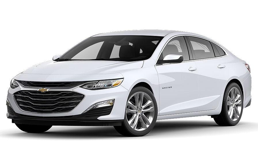
Chevrolet Malibu | Automatic
SEDANor Sedan similar
Frequently Asked Questions
What does my Hola Car Rentals booking with Budget in Calgary include that other companies don't offer?
Hola Car Rentals is a premium partner of the leading car rental companies in Calgary, including Budget, giving you exclusive access to our All Inclusive+ rate. This rate includes extra benefits that no other company can match:
- Full vehicle coverage with no deductible (applies only for certain rates and itineraries)
- Toll cashback: get back up to 5% of your total booking value for tolls charged during your rental
- Premium travel medical assistance for up to 5 passengers in case of emergency, covering up to CAD 200,000 (pre-existing conditions excluded)
- No Extra Charges© guarantee: if the counter charges you for something not listed on your confirmation and not an optional add-on you accepted, Hola Car Rentals will work to remove or reimburse the charge after verification
All at no additional cost, ensuring a unique Budget rental experience with complete protection and peace of mind during your trip in Calgary.
Will I face unexpected charges at the Budget counter in Calgary when I book through Hola Car Rentals?
No. With Hola Car Rentals, all costs and charges for your Budget booking in Calgary are clearly shown at the time of reservation and in your confirmation email, so you know exactly what you are paying before you arrive at the Budget counter.
On top of that, every Hola Car Rentals booking includes the No Extra Charges© guarantee. This is a pricing guarantee (not insurance) that protects you if the Budget counter in Calgary charges you for something that was not listed on your confirmation and was not an optional add-on you accepted. If that happens, Hola Car Rentals will work with Budget to remove or reimburse the charge after verification.
The only costs outside this guarantee are:
- Optional add-ons you choose at the counter (GPS, child seats, prepaid fuel)
- Usage-based charges (tolls, fuel shortfall, traffic fines)
Where is the Budget car rental counter at Calgary Airport (YYC)?
The Budget car rental counter at Calgary International Airport (YYC) is located inside the terminal building. After collecting your baggage, follow the car rental signs to the counter. Once your contract is signed at the Budget desk, your vehicle is parked in the designated lot directly behind the car rental center, a short walk from the terminal.
There is no shuttle required for Budget at Calgary Airport. The entire process from counter to car is on foot, which typically makes the Budget pickup at YYC faster than off-airport alternatives that require a shuttle transfer.
Plan for roughly 20 to 45 minutes from arriving at the Budget counter to driving away, depending on queue length and how quickly the contract is completed.
Are there toll roads to worry about when driving a Budget rental car in Calgary?
No, there are no toll roads anywhere in Alberta, so driving your Budget rental car in and around Calgary is completely toll-free. You will not encounter any toll booths, cashless toll gantries, transponder requirements, or congestion charges on any road in the province, including Calgary's ring road system and all major highways.
There are also no emissions zones or city-center driving fees similar to those found in London or other European cities. Alberta has no plans to introduce tolls, even with ongoing highway expansion projects such as improvements to Deerfoot Trail.
If your Budget rental takes you to other Canadian provinces that do have toll roads, Hola Car Rentals includes Tolls Cashback on every booking, reimbursing up to 5% of your total booking value for tolls paid during the rental period. Keep your toll receipts and submit a claim within 30 days of returning the vehicle.
What documents do I need to pick up a Budget rental car in Calgary?
To pick up your Budget rental car in Calgary, you must present the following physical documents at the counter:
- Your original, unexpired driver's license in the main driver's name
- A major credit card with the driver's name printed on the card, used for the security deposit hold
- Your passport or valid government-issued photo ID
- Your booking confirmation or printed voucher
- Round-trip flight or cruise tickets (required for visitors from outside Canada)
If your driver's license is not in English and does not use a Latin alphabet (for example, Arabic, Chinese, Japanese, or Cyrillic script), an International Driving Permit (IDP) is mandatory alongside your original license. For licenses in English or using a Latin alphabet, an IDP is recommended but not strictly required at most Budget locations in Calgary.
All documents must be physical originals. Digital copies shown on a phone or tablet are not accepted at the Budget counter. Debit cards and prepaid cards are not accepted for the security deposit hold.
How does the Tolls Cashback benefit work for a Budget rental in Calgary?
Every Budget booking made through Hola Car Rentals includes Tolls Cashback, even though Calgary and all of Alberta have no toll roads. This benefit becomes relevant if your Budget rental takes you to other Canadian provinces or regions where toll roads exist.
Hola Car Rentals will reimburse the lesser of the total tolls you paid or up to 5% of your total booking value. For example, if your Calgary booking totals CAD 600, the maximum cashback is CAD 30.
To claim your cashback after returning your Budget vehicle:
- Email [email protected] within 30 days of vehicle return
- Use the subject line: Tolls Cashback, followed by your reservation number
- Attach your Hola Car Rentals booking confirmation, the signed rental agreement, and a receipt or statement showing toll charges paid
Refunds are issued to the original payment method used for your Calgary reservation and typically process within 7 to 10 business days after approval. Late submissions received after 30 days are not accepted.
What airport fees and surcharges appear on a Budget rental agreement at Calgary Airport?
When picking up a Budget rental car at Calgary International Airport (YYC), your rental agreement will typically include several mandatory airport-related fees in addition to the base rate. These commonly include:
- Concession Recovery Fee or Concession Recoupment Fee, charged by Budget to offset the airport's concession obligations
- Customer Facility Charge (CFC), a per-day or per-rental fee tied to the airport's car rental facilities
- Vehicle Licensing Recovery Fee (VLRF), covering fleet registration costs
- Applicable provincial and local sales taxes
- A Frequent Traveler Surcharge if you are earning miles or loyalty credits in Canada
These fees are standard at on-airport Budget locations and are generally higher than what you would pay at an off-airport Calgary rental site, because on-airport operators pay concession fees to the airport authority.
If your Hola Car Rentals booking confirmation shows taxes and fees as included, you should not be billed separately for those items at the Budget counter. If you are charged for something not disclosed on your confirmation, the No Extra Charges© guarantee may apply.
How do I return a Budget rental car at Calgary Airport after hours?
Budget at Calgary International Airport (YYC) accommodates after-hours vehicle returns. If you are returning your Budget rental car outside of counter operating hours, follow these steps:
- Drive to the car rental return area at YYC, following airport signs for car rental returns, which lead to the same parking lot behind the car rental center used for pickup
- Park and lock the vehicle in the designated Budget return area
- Record the mileage and fuel level on your rental agreement
- Place your keys and the completed rental contract in the drop box located at the kiosk
If you are enrolled in Budget Fastbreak, you can use the dedicated Budget Fastbreak return box. Your final agreement will be mailed to you within approximately 48 hours after the Calgary return is processed.
Before an after-hours return in Calgary, refuel the vehicle within roughly 15 km of the airport to comply with the full-to-full fuel policy. Keep your fuel receipt as proof in case a fuel charge appears on your final bill.
What is the grace period for returning a Budget rental car late in Calgary?
Budget at Calgary Airport (YYC) enforces a strict grace period for vehicle returns. The standard grace period is 30 minutes beyond your scheduled return time. If you return your Budget rental car more than 30 minutes late in Calgary, you may be charged for an additional three-quarter day. If the return is more than 90 minutes past the scheduled time, a full extra day charge can apply.
This policy is enforced more rigidly at Calgary Airport than at many other rental locations, so it is important to plan your return carefully, especially if you have a flight to catch or are navigating Calgary's ring road system for the first time.
No grace period applies to optional surcharges or equipment fees. If your flight is delayed and you expect to arrive more than 24 hours after your original Budget pickup time in Calgary, contact support as soon as possible, since the booking hold window is 24 hours from the original scheduled pickup.
How much is the security deposit for a Budget rental car in Calgary?
When you pick up your Budget rental car in Calgary, the counter will place a temporary authorization hold on your credit card as a security deposit. For standard vehicles rented in Canada, this hold is typically in the range of CAD 300 to CAD 500, though some Calgary locations may require a hold of approximately CAD 750 depending on the vehicle class, season, or specific Budget location policies.
The hold is not a charge. It temporarily reduces your available credit and is released after you return the vehicle. Your bank or card issuer controls how quickly the hold disappears from your statement, which can take up to 15 business days after the Budget return in Calgary is processed.
Important requirements for the deposit at the Budget counter in Calgary:
- The credit card must be a major credit card (not debit or prepaid) in the main driver's name, with the driver's name printed on the physical card
- Digital wallets and virtual card numbers are not accepted
- Bring a backup credit card in case your primary card is declined
What travel assistance is included with a Budget rental booking in Calgary?
Most Budget bookings made through Hola Car Rentals include travel assistance coverage provided by Terrawind Global Protection. This benefit is particularly useful if something unexpected happens during your Calgary rental, such as a medical emergency or a flight cancellation before or after your trip.
Coverage typically includes:
- Travel and medical insurance for up to 5 passengers
- Legal assistance in the event of a road accident
- Compensation for baggage lost by the airline
- Flight cancellation insurance
If you need assistance during your Calgary rental, contact Terrawind 24 hours a day at +1 888 980 9992 (toll-free) or via WhatsApp at +1 208 910 1001. Have your Hola Car Rentals confirmation number ready when you call.
Please note that this travel assistance benefit does not apply to Canadian or US residents. It is designed for visitors traveling internationally. It also does not cover damage to the Budget rental vehicle itself (that is handled by CDW/LDW) or third-party liability (covered by LIS/SLI).
Can I add an additional driver to my Budget rental in Calgary?
Yes, you can add an additional driver to your Budget rental in Calgary, but a fee applies unless your Hola Car Rentals booking confirmation explicitly states that an additional driver is included at no charge.
For Budget in Calgary, the additional driver fee is CAD 13 per rental day, with a maximum charge of CAD 65 plus applicable taxes. Exemptions may apply for company or employer-sponsored rentals or for drivers with certain disabilities.
To add an additional driver at the Budget counter in Calgary:
- The additional driver must be physically present at the counter at the time of pickup
- They must present a valid driver's license and any required ID
- If their license is not in English or does not use a Latin alphabet, an IDP is required
- Both the main driver and the additional driver must sign the rental agreement
- For Budget in Calgary, the additional driver must be at least 25 years old
Only drivers listed on the Budget rental agreement are covered by the vehicle's protections. Anyone not named on the contract who drives the car may void coverage.
Can I pick up a Budget rental in Calgary and return it in a different city?
Yes, one-way rentals are possible with Budget in Calgary, but a drop-off fee may apply depending on your return location. This fee is route-specific and varies based on the distance between Calgary and your chosen return city, the vehicle class, and the season.
When booking a one-way Budget rental from Calgary on the Hola Car Rentals website, the drop-off fee will be displayed on the rate details page under the section labeled as amounts due at the destination. It is not shown on the search results page, so review the full rate details before confirming.
Key points to keep in mind:
- Same-city returns (for example, Calgary Airport to a Calgary downtown location) often carry no drop-off fee
- Returns to other Alberta cities or other Canadian provinces typically incur a one-way fee
- Cross-border one-way rentals (for example, Calgary to a US city) may be restricted or carry higher fees depending on Budget's policies
- The drop-off fee cannot be prepaid and is not covered by No Extra Charges© unless it was not disclosed during booking
What insurance coverage is included with a Budget rental car in Calgary?
When renting a Budget car in Calgary through Hola Car Rentals, the coverage included depends on the rate plan selected. Canada-based bookings typically fall under the Canada All Inclusive rate, which bundles key protections into the prepaid price.
Standard coverage elements to look for on your Budget booking confirmation include:
- Collision Damage Waiver (CDW) or Loss Damage Waiver (LDW), which reduces your financial liability for damage to the Budget vehicle, subject to any applicable deductible
- Third-party liability coverage, which is required by provincial law in Alberta and is included by default when renting in Canada. This covers bodily injury and property damage you may cause to others while driving the Budget rental in Calgary
CDW and LDW do not cover third-party liability on their own, and third-party liability does not cover damage to the Budget vehicle itself. They are separate protections that work together.
Coverage does not include personal accident insurance, personal effects, or damage caused by prohibited use such as off-road driving. Always review your Budget rental agreement at the Calgary counter to confirm exactly what is active on your contract before driving away.
Are there any confusing road layouts in Calgary that Budget rental drivers should know about?
Yes, Calgary has some road features that can catch first-time visitors off guard, especially when driving a Budget rental car unfamiliar with the local road network.
Calgary completed its 101 km ring road (Stoney Trail) in December 2023, and the system includes several non-standard interchange designs:
- A basket weave interchange at Highway 8, where lanes cross over each other in an unusual pattern
- Partial cloverleaf interchanges at locations such as Bow Trail
- Half interchanges on Highway 1 (Trans-Canada) east of Old Banff Coach Road, which provide access in only one direction, forcing detours for westbound drivers
- Multiple roundabouts within short distances on newer sections of the ring road
The ring road transitions between 6 to 8 lane freeways and expressway segments with abrupt changes, and steep grades exist on the west Calgary segment between Highway 8 and Old Banff Coach Road. Visitors in Budget rental cars who are used to simpler grid or perimeter road systems in other cities may find these transitions confusing.
Using a GPS or navigation app is strongly recommended when driving your Budget rental around Calgary, particularly if you are heading toward newer neighborhoods west of Valley Ridge or Crestmont.

- Choosing a selection results in a full page refresh.
- Opens in a new window.
Suggested Currencies
- $ USD - United States Dollar
- € EUR - Euro
Other Countries
-
 Albania
-
 Algeria
-
 Andorra
-
 Angola
-
 Antigua & Barbuda
-
 Argentina
-
 Australia
-
 Austria
-
 Bahamas
-
 Bahrain
-
 Bangladesh
-
 Barbados
-
 Belgium
-
 Belize
-
 Benin
Benin
-
 Bermuda
-
 Bolivia
-
 Bosnia & Herzegovina
-
 Botswana
-
 Brazil
-
 British Virgin Islands
-
 Bulgaria
-
 Burkina Faso
-
 Burundi
-
 Cameroon
-
 Canada
-
 Cape Verde
-
 Cayman Islands
-
 Central African Republic
-
 Chad
Chad
-
 Chile
Chile
-
 Colombia
-
 Comoros
-
 Congo - Brazzaville
-
 Congo - Kinshasa
-
 Costa Rica
-
 Côte d’Ivoire
-
 Croatia
-
 Curaçao
-
 Cyprus
-
 Czechia
-
 Denmark
-
 Djibouti
-
 Dominica
-
 Dominican Republic
-
 Ecuador
-
 Egypt
Egypt
-
 El Salvador
-
 Equatorial Guinea
-
 Eritrea
-
 Estonia
-
 Eswatini
-
 Ethiopia
-
 Finland
-
 France
-
 Gabon
Gabon
-
 Gambia
-
 Germany
-
 Ghana
Ghana
-
 Greece
-
 Grenada
-
 Guatemala
-
 Guinea
-
 Guinea-Bissau
-
 Guyana
-
 Haiti
Haiti
-
 Honduras
-
 Hong Kong SAR
-
 Hungary
-
 Iceland
-
 India
India
-
 Iraq
Iraq
-
 Ireland
-
 Israel
-
 Italy
Italy
-
 Jamaica
-
 Japan
Japan
-
 Jordan
-
 Kenya
Kenya
-
 Kuwait
-
 Latvia
-
 Lebanon
-
 Lesotho
-
 Liberia
-
 Libya
Libya
-
 Liechtenstein
-
 Lithuania
-
 Luxembourg
-
 Madagascar
-
 Malawi
-
 Mali
Mali
-
 Malta
Malta
-
 Mauritania
-
 Mauritius
-
 Mexico
-
 Moldova
-
 Monaco
-
 Montenegro
-
 Morocco
-
 Mozambique
-
 Namibia
-
 Netherlands
-
 New Zealand
-
 Nicaragua
-
 Niger
Niger
-
 Nigeria
-
 Norway
-
 Oman
Oman
-
 Palestinian Territories
-
 Panama
-
 Paraguay
-
 Peru
Peru
-
 Philippines
-
 Poland
-
 Portugal
-
 Qatar
Qatar
-
 Romania
-
 Russia
-
 Rwanda
-
 San Marino
-
 São Tomé & Príncipe
-
 Saudi Arabia
-
 Senegal
-
 Serbia
-
 Seychelles
-
 Sierra Leone
-
 Singapore
-
 Sint Maarten
-
 Slovakia
-
 Slovenia
-
 Somalia
-
 South Africa
-
 South Korea
-
 South Sudan
-
 Spain
Spain
-
 St. Lucia
-
 St. Vincent & Grenadines
-
 Sudan
Sudan
-
 Sweden
-
 Switzerland
-
 Taiwan
-
 Tanzania
-
 Togo
Togo
-
 Trinidad & Tobago
-
 Tunisia
-
 Türkiye
-
 Turks & Caicos Islands
-
 Uganda
-
 Ukraine
-
 United Arab Emirates
-
 United Kingdom
-
 United States
-
 Uruguay
-
 Vatican City
-
 Venezuela
-
 Yemen
Yemen
-
 Zambia
-
 Zimbabwe
Driving license from:
-
Albania
-
Algeria
-
Andorra
-
Angola
-
Antigua & Barbuda
-
Argentina
-
Australia
-
Austria
-
Bahamas
-
Bahrain
-
Bangladesh
-
Barbados
-
Belgium
-
Belize
-
Benin
-
Bermuda
-
Bolivia
-
Bosnia & Herzegovina
-
Botswana
-
Brazil
-
British Virgin Islands
-
Bulgaria
-
Burkina Faso
-
Burundi
-
Cameroon
-
Canada
-
Cape Verde
-
Cayman Islands
-
Central African Republic
-
Chad
-
Chile
-
Colombia
-
Comoros
-
Congo - Brazzaville
-
Congo - Kinshasa
-
Costa Rica
-
Côte d’Ivoire
-
Croatia
-
Curaçao
-
Cyprus
-
Czechia
-
Denmark
-
Djibouti
-
Dominica
-
Dominican Republic
-
Ecuador
-
Egypt
-
El Salvador
-
Equatorial Guinea
-
Eritrea
-
Estonia
-
Eswatini
-
Ethiopia
-
Finland
-
France
-
Gabon
-
Gambia
-
Germany
-
Ghana
-
Greece
-
Grenada
-
Guatemala
-
Guinea
-
Guinea-Bissau
-
Guyana
-
Haiti
-
Honduras
-
Hong Kong SAR
-
Hungary
-
Iceland
-
India
-
Iraq
-
Ireland
-
Israel
-
Italy
-
Jamaica
-
Japan
-
Jordan
-
Kenya
-
Kuwait
-
Latvia
-
Lebanon
-
Lesotho
-
Liberia
-
Libya
-
Liechtenstein
-
Lithuania
-
Luxembourg
-
Madagascar
-
Malawi
-
Mali
-
Malta
-
Mauritania
-
Mauritius
-
Mexico
-
Moldova
-
Monaco
-
Montenegro
-
Morocco
-
Mozambique
-
Namibia
-
Netherlands
-
New Zealand
-
Nicaragua
-
Niger
-
Nigeria
-
Norway
-
Oman
-
Palestinian Territories
-
Panama
-
Paraguay
-
Peru
-
Philippines
-
Poland
-
Portugal
-
Qatar
-
Romania
-
Russia
-
Rwanda
-
San Marino
-
São Tomé & Príncipe
-
Saudi Arabia
-
Senegal
-
Serbia
-
Seychelles
-
Sierra Leone
-
Singapore
-
Sint Maarten
-
Slovakia
-
Slovenia
-
Somalia
-
South Africa
-
South Korea
-
South Sudan
-
Spain
-
St. Lucia
-
St. Vincent & Grenadines
-
Sudan
-
Sweden
-
Switzerland
-
Taiwan
-
Tanzania
-
Togo
-
Trinidad & Tobago
-
Tunisia
-
Türkiye
-
Turks & Caicos Islands
-
Uganda
-
Ukraine
-
United Arab Emirates
-
United Kingdom
-
United States
-
Uruguay
-
Vatican City
-
Venezuela
-
Yemen
-
Zambia
-
Zimbabwe