


About hiring a car in Manitoba
Best Car Rental Deals
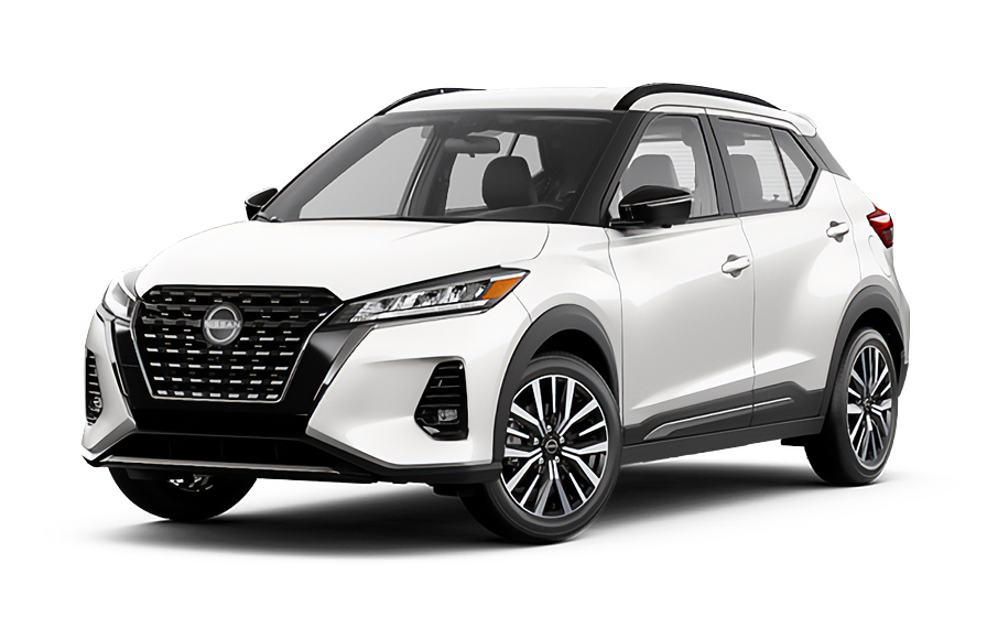
Nissan Kicks | Automatic
SUVor SUV similar
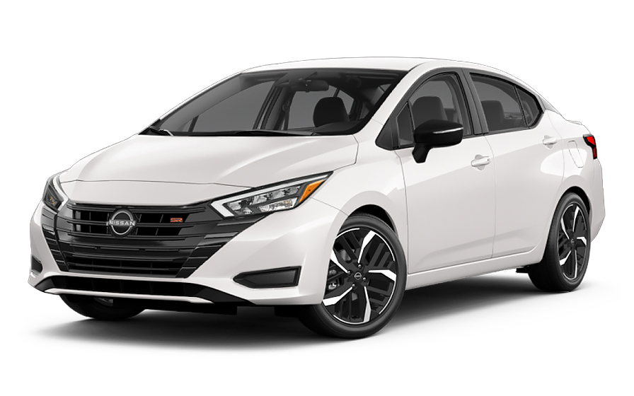
Nissan Versa | Automatic
SMALLor Small similar
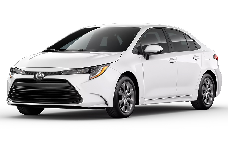
Toyota Corolla | Automatic
SEDANor Sedan similar
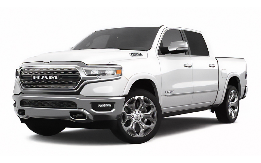
Dodge Ram 1500 | Automatic
PICKUPor Pickup similar
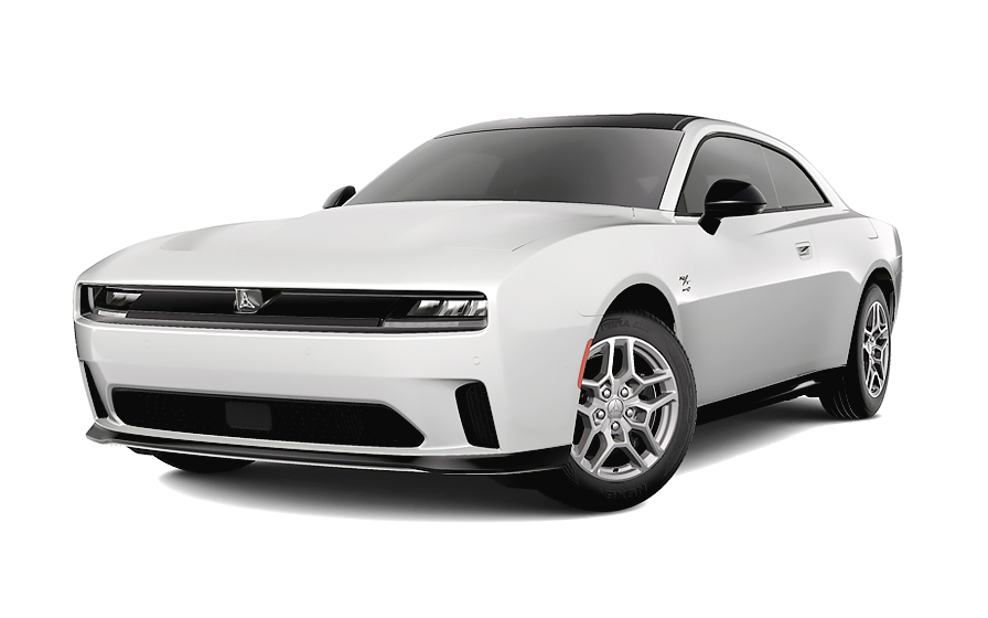
Dodge Charger | Automatic
SPORTSor Sports similar
Traveler Tips & Price Insights
When is the best time to book a rental car in Manitoba?
You should book your rental car approximately 7 days before your trip to get a below-average price.
Price Trend (Last 90 Days)
What is the most popular rental car type in Manitoba?
sedan rental cars (sedan or similar) are the most popular option in Manitoba.
Popular Car Types
Which is the cheapest car rental agency in Manitoba?
In the last 72 hours, the cheapest rental cars were from Avis at /day.
Average Price by Rental Company
Frequently Asked Questions
What does my Hola Car Rentals booking in Manitoba include that other companies don't offer?
Hola Car Rentals is a premium partner of the leading car hire companies in Manitoba, giving you exclusive access to our All Inclusive+ rate. This rate includes extra benefits that no other company can match:
- Full vehicle coverage with no excess (applies only to certain rates and itineraries)
- Toll cashback: get back up to 5% of your total booking value for tolls charged during your hire
- Premium travel medical assistance for up to 5 passengers in case of emergency, covering up to CAD 200,000 (pre-existing conditions excluded)
- No Extra Charges© guarantee: if the counter charges you for something not listed on your confirmation and not an optional add-on you accepted, Hola Car Rentals will work to remove or reimburse the charge after verification
All at no additional cost, ensuring a unique hire experience with complete protection and peace of mind during your trip in Manitoba.
Will I face unexpected charges at the counter when I hire a car in Manitoba through Hola Car Rentals?
No. With Hola Car Rentals, all costs and charges for your booking in Manitoba are clearly shown at the time of reservation and in your confirmation email, so you know exactly what you are paying before you arrive at the counter.
On top of that, every Hola Car Rentals booking includes the No Extra Charges© guarantee. This is a pricing guarantee (not insurance) that protects you if the counter in Manitoba charges you for something that was not listed on your confirmation and was not an optional add-on you accepted. If that happens, Hola Car Rentals will work with the hire partner to remove or reimburse the charge after verification.
The only costs outside this guarantee are:
- Optional add-ons you choose at the counter (GPS, child seats, prepaid fuel)
- Usage-based charges (tolls, fuel shortfall, traffic fines)
What documents do I need to pick up a hire car in Manitoba?
To pick up a hire car in Manitoba, you must present a set of physical, original documents at the counter. Digital copies are not accepted.
- A valid, unexpired driver’s licence in the main driver’s name
- A major credit card with the driver’s name printed on the physical card (debit and prepaid cards are not accepted for the authorisation hold)
- A valid passport or government-issued photo ID
- Your booking confirmation or printed voucher
- Round-trip flight or cruise tickets if you are visiting from abroad
If your driver’s licence is not in English and does not use a Latin alphabet (for example, Arabic, Chinese, Japanese, or Cyrillic script), an International Driving Permit (IDP) is mandatory in Manitoba. For licences in other non-English scripts, an IDP is strongly recommended. The IDP is a translation only and must be carried alongside your original licence.
All named drivers must be present at the Manitoba counter with their own valid licence and, if applicable, their own IDP.
Is a credit card required to hire a car in Manitoba?
Yes, a major credit card is required to hire a car in Manitoba. The card must be in the main driver’s name with the driver’s name physically printed on the card, and it must be presented in person at the counter.
The hire partner will place a temporary authorisation hold on your card at pickup. For Manitoba hires, typical holds range from approximately GBP 200 to GBP 300, though some locations may authorise up to GBP 500 depending on the vehicle class and hire company. This hold reduces your available credit until your bank releases it after the vehicle is returned, which can take up to 15 business days.
- Debit cards are not accepted for the excess
- Prepaid or virtual cards are not accepted
- The card must belong to the main driver, not a third party
Even if you prepaid your Manitoba booking online, you must still present a physical major credit card at the counter. Bringing a backup credit card is strongly recommended in case your primary card is declined.
Do I need an International Driving Permit to hire a car in Manitoba?
It depends on your licence. In Manitoba, visitors can generally drive with a valid foreign licence. However, an International Driving Permit (IDP) is mandatory if your licence uses a non-Latin alphabet, such as Arabic, Chinese, Japanese, or Cyrillic script. For licences in other non-English languages, an IDP is strongly recommended even if not strictly required by every hire partner.
The IDP is a translation document only. It is not a standalone licence and will not be accepted at the Manitoba counter without your original driver’s licence. You must carry both together.
Important: obtain your IDP in your home country before travelling to Manitoba. It cannot be issued to foreign licence holders once you are already in Canada.
If you are unsure whether your licence requires an IDP for your Manitoba hire, check with the specific hire partner listed on your booking confirmation before you travel.
How does the Tolls Cashback benefit work for a Manitoba hire?
All Hola Car Rentals bookings include Tolls Cashback, which reimburses up to 5% of your total booking value for tolls paid during your Manitoba hire period.
Manitoba itself has no toll roads, but if your trip takes you beyond the province into other parts of Canada or across into the United States, you may encounter toll charges. The Tolls Cashback benefit applies to any tolls paid during the hire period shown on your reservation.
To claim your cashback after returning the vehicle:
- Email [email protected] within 30 days of returning the car
- Use the subject line: Tolls Cashback, followed by your reservation number (for example, HOLA1000000)
- Attach your Hola Car Rentals booking confirmation, the signed hire agreement, and a receipt or statement showing the toll charges paid
The refund is issued to the same payment method used for your Manitoba booking and typically processes within 7 to 10 business days after approval. Claims submitted after 30 days will not be accepted.
Is there a young driver surcharge for renters under 25 in Manitoba?
Yes, renters under 25 years old may be subject to a young driver surcharge when picking up a hire car in Manitoba. The exact fee varies by hire company and location.
The minimum age to hire without any additional surcharge at most Manitoba locations is 25. Drivers between the ages of 21 and 24 are generally permitted to hire but will typically pay a daily young driver fee on top of the base hire rate. Some hire partners may set a higher minimum age or apply stricter conditions for certain vehicle classes.
The same age rules apply to additional drivers added to a Manitoba hire agreement. For example, Avis, Budget, and Payless require additional drivers to be at least 25 years old at the time of pickup.
The young driver surcharge is paid directly at the counter in Manitoba and is not included in your prepaid booking total. Check your booking confirmation for the specific partner’s age policy before you travel.
What is the fuel policy for hire cars in Manitoba?
The standard fuel policy for hire cars in Manitoba is Full-to-Full. You receive the vehicle with a full tank and must return it full to avoid additional charges.
At pickup in Manitoba, check the fuel gauge with the hire agent and confirm the starting level is recorded on the hire agreement. Take a photo of the dashboard showing both the odometer and the fuel gauge before leaving the lot.
When returning your Manitoba hire:
- Refuel within approximately 10 miles or 15 km of the return location so the gauge does not drop below full before you arrive
- Keep your fuel receipt showing the date, time, and station address
- Take a photo of the full gauge at the pump as evidence
If you return the vehicle below the recorded starting level, the hire company may charge you for the fuel shortfall at their own refuelling rate, which is typically higher than the pump price, plus an administrative service fee. Returning the car full is always the most cost-effective option for your Manitoba hire.
What insurance coverage is included in a Manitoba hire?
Manitoba law requires every hire vehicle to carry third-party liability insurance, so this statutory cover is included by default when you hire a car in Manitoba through Hola Car Rentals. You can also purchase higher supplemental liability limits if you want additional protection.
Collision Damage Waiver (CDW) or Loss Damage Waiver (LDW) reduces your financial liability for damage to the hire vehicle itself. Whether CDW/LDW is included depends on the specific rate you selected. Check your booking confirmation to see what is covered and whether a deductible applies.
CDW/LDW in Manitoba does not cover:
- Damage or injury caused to third parties (covered by liability insurance)
- Prohibited use such as off-road driving, racing, or driving under the influence
- Tires, undercarriage, or roof damage unless specifically included
For personal medical coverage during your Manitoba trip, Travel Assistance is included with most Hola Car Rentals bookings through Terrawind Global Protection. Note that this benefit does not apply to Canadian or US residents.
Can I pick up a hire car earlier than scheduled in Manitoba?
Yes, you may be able to pick up your Manitoba hire car earlier than the scheduled time, but it depends on vehicle availability at the specific location on that day.
Early pickup in Manitoba is not guaranteed. If a vehicle is available when you arrive ahead of your reservation time, the hire partner may accommodate the request. However, changing your official pickup time may reprice your booking, as rates are calculated based on the specific dates and times in your reservation.
If you know in advance that you need an earlier pickup time in Manitoba, the best approach is to modify your reservation before you travel rather than requesting the change at the counter. This gives you a confirmed time and avoids any last-minute availability issues.
Keep in mind that hire counters at Manitoba locations have set operating hours. Arriving outside those hours, even slightly early, may mean the counter is not yet open. Always confirm counter hours on your booking confirmation before your travel day.
Does Travel Assistance cover me during a Manitoba hire?
Yes, Travel Assistance is included with most Hola Car Rentals bookings, and it applies during your Manitoba hire period. However, this benefit does not apply to Canadian or US residents. It is designed for travellers visiting Manitoba from outside North America.
The coverage is provided by Terrawind Global Protection and includes:
- Travel insurance with medical coverage for up to 5 passengers
- Legal assistance in the event of an accident
- Compensation for luggage lost by the airline
- Flight cancellation insurance
If you need assistance during your Manitoba hire, for example after a road incident or a medical situation while driving in the province, contact Terrawind 24 hours a day, 7 days a week:
- Phone: +1 888 980 9992 (toll-free)
- WhatsApp: +1 208 910 1001
- Email: [email protected]
When you call, have your full name and your Hola Car Rentals confirmation number ready. Follow the coordinator's instructions and keep all receipts and reports for any reimbursement claim related to your Manitoba trip.
Can I add an additional driver to my Manitoba hire?
Yes, you can add an additional driver to your Manitoba hire, either as part of your rate or by paying a fee at the counter.
Some Hola Car Rentals rates include one additional driver at no extra cost. Check your booking confirmation for the line that reads "Additional driver free of charge" to confirm whether this applies to your Manitoba reservation. If it is not included, the daily fees charged at the counter vary by partner:
- Avis, Budget, and Payless: GBP 10 per hire day, capped at GBP 50
- Hertz, Thrifty, and Dollar: GBP 11 per hire day, capped at GBP 154
- Alamo, National, and Enterprise: GBP 13 per day
The additional driver must be present at the Manitoba pickup counter with a valid driver’s licence and, if applicable, an International Driving Permit. They must sign the hire agreement. Anyone who drives the vehicle without being listed on the agreement will not be covered by CDW/LDW or liability insurance.
For Avis, Budget, and Payless hires in Manitoba, additional drivers must be at least 25 years old at the time of pickup.
What happens if I return my Manitoba hire late?
If you return your Manitoba hire vehicle after the agreed drop-off time, the hire partner may charge you for the extra time. Most locations allow a grace period of approximately 30 minutes, but this is not guaranteed at every Manitoba location and varies by hire company.
If you exceed the grace period, you may be charged for additional hours or a full extra day, plus a late return fee depending on the partner’s policy. These charges are applied directly by the hire company and are separate from your prepaid booking total.
If you know you will be returning your Manitoba hire later than planned, contact the hire partner as early as possible using the number on your hire agreement. You can also request a formal extension through your booking, which locks in a rate for the additional time rather than leaving you subject to walk-up late fees.
For after-hours returns at Manitoba locations, follow the key-drop instructions provided in your hire agreement. Note that your liability for the vehicle may continue until the hire company officially checks it in the next business day.
Can I pick up a car in Manitoba and drop it off in another province or city?
Yes, one-way hires are possible in Manitoba, but a drop-off fee may apply depending on your return location and the hire partner.
When you search for a Manitoba hire with a different return location, the booking system will show any applicable drop-off fee under the "To pay at destination" section before you confirm. This fee is set by the hire partner and varies based on the route, distance, vehicle class, and season.
Common patterns for Manitoba one-way hires:
- Returning within the same city or metropolitan area: often no drop-off fee
- Returning to a different city within the same province: a drop-off fee usually applies
- Cross-border returns (Manitoba to the United States): may be restricted or carry higher fees depending on the partner
The drop-off fee cannot be prepaid and is not covered by No Extra Charges© unless it was not disclosed during booking. If the fee at the Manitoba counter differs from what your confirmation shows, keep all paperwork and contact support after the hire is complete.
Where do I find my hire car counter when arriving in Manitoba?
When arriving in Manitoba, your hire counter location depends on the partner brand shown on your booking confirmation and the specific pickup location you selected.
At Winnipeg Richardson International Airport, the main arrival point for Manitoba hires, hire car counters are located within or directly adjacent to the terminal. Follow the "Car Hire" signs after collecting your baggage. Your booking confirmation will show the operating brand name, which you should match to the signage at the Manitoba airport.
Steps to find your counter in Manitoba:
- Confirm the hire brand on your booking confirmation before you land
- Follow "Car Hire" directional signs from the baggage claim area
- If the counter is off-site, look for a branded shuttle bus at the designated pickup zone outside the terminal
- If the counter appears closed or unstaffed, use the courtesy phone at the hire area or contact the number listed on your hire agreement
For city locations in Manitoba outside the airport, your confirmation will include the exact address. Call the branch at least two hours in advance if you need a pickup service from a non-airport location in Manitoba.

- Choosing a selection results in a full page refresh.
- Opens in a new window.
Suggested Currencies
- $ USD - United States Dollar
- € EUR - Euro
Other Countries
-
 Albania
-
 Algeria
-
 Andorra
-
 Angola
-
 Antigua & Barbuda
-
 Argentina
-
 Australia
-
 Austria
-
 Bahamas
-
 Bahrain
-
 Bangladesh
-
 Barbados
-
 Belgium
-
 Belize
-
 Benin
Benin
-
 Bermuda
-
 Bolivia
-
 Bosnia & Herzegovina
-
 Botswana
-
 Brazil
-
 British Virgin Islands
-
 Bulgaria
-
 Burkina Faso
-
 Burundi
-
 Cameroon
-
 Canada
-
 Cape Verde
-
 Cayman Islands
-
 Central African Republic
-
 Chad
Chad
-
 Chile
Chile
-
 Colombia
-
 Comoros
-
 Congo - Brazzaville
-
 Congo - Kinshasa
-
 Costa Rica
-
 Côte d’Ivoire
-
 Croatia
-
 Curaçao
-
 Cyprus
-
 Czechia
-
 Denmark
-
 Djibouti
-
 Dominica
-
 Dominican Republic
-
 Ecuador
-
 Egypt
Egypt
-
 El Salvador
-
 Equatorial Guinea
-
 Eritrea
-
 Estonia
-
 Eswatini
-
 Ethiopia
-
 Finland
-
 France
-
 Gabon
Gabon
-
 Gambia
-
 Germany
-
 Ghana
Ghana
-
 Greece
-
 Grenada
-
 Guatemala
-
 Guinea
-
 Guinea-Bissau
-
 Guyana
-
 Haiti
Haiti
-
 Honduras
-
 Hong Kong SAR
-
 Hungary
-
 Iceland
-
 India
India
-
 Iraq
Iraq
-
 Ireland
-
 Israel
-
 Italy
Italy
-
 Jamaica
-
 Japan
Japan
-
 Jordan
-
 Kenya
Kenya
-
 Kuwait
-
 Latvia
-
 Lebanon
-
 Lesotho
-
 Liberia
-
 Libya
Libya
-
 Liechtenstein
-
 Lithuania
-
 Luxembourg
-
 Madagascar
-
 Malawi
-
 Mali
Mali
-
 Malta
Malta
-
 Mauritania
-
 Mauritius
-
 Mexico
-
 Moldova
-
 Monaco
-
 Montenegro
-
 Morocco
-
 Mozambique
-
 Namibia
-
 Netherlands
-
 New Zealand
-
 Nicaragua
-
 Niger
Niger
-
 Nigeria
-
 Norway
-
 Oman
Oman
-
 Palestinian Territories
-
 Panama
-
 Paraguay
-
 Peru
Peru
-
 Philippines
-
 Poland
-
 Portugal
-
 Qatar
Qatar
-
 Romania
-
 Russia
-
 Rwanda
-
 San Marino
-
 São Tomé & Príncipe
-
 Saudi Arabia
-
 Senegal
-
 Serbia
-
 Seychelles
-
 Sierra Leone
-
 Singapore
-
 Sint Maarten
-
 Slovakia
-
 Slovenia
-
 Somalia
-
 South Africa
-
 South Korea
-
 South Sudan
-
 Spain
Spain
-
 St. Lucia
-
 St. Vincent & Grenadines
-
 Sudan
Sudan
-
 Sweden
-
 Switzerland
-
 Taiwan
-
 Tanzania
-
 Togo
Togo
-
 Trinidad & Tobago
-
 Tunisia
-
 Türkiye
-
 Turks & Caicos Islands
-
 Uganda
-
 Ukraine
-
 United Arab Emirates
-
 United Kingdom
-
 United States
-
 Uruguay
-
 Vatican City
-
 Venezuela
-
 Yemen
Yemen
-
 Zambia
-
 Zimbabwe
Driving license from:
-
Albania
-
Algeria
-
Andorra
-
Angola
-
Antigua & Barbuda
-
Argentina
-
Australia
-
Austria
-
Bahamas
-
Bahrain
-
Bangladesh
-
Barbados
-
Belgium
-
Belize
-
Benin
-
Bermuda
-
Bolivia
-
Bosnia & Herzegovina
-
Botswana
-
Brazil
-
British Virgin Islands
-
Bulgaria
-
Burkina Faso
-
Burundi
-
Cameroon
-
Canada
-
Cape Verde
-
Cayman Islands
-
Central African Republic
-
Chad
-
Chile
-
Colombia
-
Comoros
-
Congo - Brazzaville
-
Congo - Kinshasa
-
Costa Rica
-
Côte d’Ivoire
-
Croatia
-
Curaçao
-
Cyprus
-
Czechia
-
Denmark
-
Djibouti
-
Dominica
-
Dominican Republic
-
Ecuador
-
Egypt
-
El Salvador
-
Equatorial Guinea
-
Eritrea
-
Estonia
-
Eswatini
-
Ethiopia
-
Finland
-
France
-
Gabon
-
Gambia
-
Germany
-
Ghana
-
Greece
-
Grenada
-
Guatemala
-
Guinea
-
Guinea-Bissau
-
Guyana
-
Haiti
-
Honduras
-
Hong Kong SAR
-
Hungary
-
Iceland
-
India
-
Iraq
-
Ireland
-
Israel
-
Italy
-
Jamaica
-
Japan
-
Jordan
-
Kenya
-
Kuwait
-
Latvia
-
Lebanon
-
Lesotho
-
Liberia
-
Libya
-
Liechtenstein
-
Lithuania
-
Luxembourg
-
Madagascar
-
Malawi
-
Mali
-
Malta
-
Mauritania
-
Mauritius
-
Mexico
-
Moldova
-
Monaco
-
Montenegro
-
Morocco
-
Mozambique
-
Namibia
-
Netherlands
-
New Zealand
-
Nicaragua
-
Niger
-
Nigeria
-
Norway
-
Oman
-
Palestinian Territories
-
Panama
-
Paraguay
-
Peru
-
Philippines
-
Poland
-
Portugal
-
Qatar
-
Romania
-
Russia
-
Rwanda
-
San Marino
-
São Tomé & Príncipe
-
Saudi Arabia
-
Senegal
-
Serbia
-
Seychelles
-
Sierra Leone
-
Singapore
-
Sint Maarten
-
Slovakia
-
Slovenia
-
Somalia
-
South Africa
-
South Korea
-
South Sudan
-
Spain
-
St. Lucia
-
St. Vincent & Grenadines
-
Sudan
-
Sweden
-
Switzerland
-
Taiwan
-
Tanzania
-
Togo
-
Trinidad & Tobago
-
Tunisia
-
Türkiye
-
Turks & Caicos Islands
-
Uganda
-
Ukraine
-
United Arab Emirates
-
United Kingdom
-
United States
-
Uruguay
-
Vatican City
-
Venezuela
-
Yemen
-
Zambia
-
Zimbabwe