Quick Summary:
- Check Caltrans road conditions and district alerts before starting Highway 1.
- Choose inland detours via US-101 when slides close Big Sur sections.
- Avoid narrow, unpaved mountain roads that violate many rental terms.
- Add two to four hours buffer for return time near airports.
Highway 1 is one of California’s defining drives, but it is also exposed to landslides, rockfall, washouts and storm damage. Closures can last hours, days, or longer, and the tricky part for car hire travellers is that a closure rarely happens exactly where you expect it. You might be happily cruising the coast and then meet a hard closure with no through route, limited turning options, and patchy mobile signal. This guide explains how to check closure status properly, pick realistic detours (inland versus backtrack), and avoid ending up on unsuitable roads in a rental.
If your trip starts or ends at a major airport, it also helps to plan your return window with a landslide scenario in mind. For example, if you are collecting or returning around Los Angeles, start with your pickup location details at car rental California LAX. If you are flying from San Diego, check logistics for car rental airport San Diego SAN. Northern California drives often connect to Sacramento, so it can be useful to review car rental Sacramento SMF and, if you need more space for luggage, SUV rental Sacramento SMF. These pages help you understand where you need to be and when, which matters when you are adding detours.
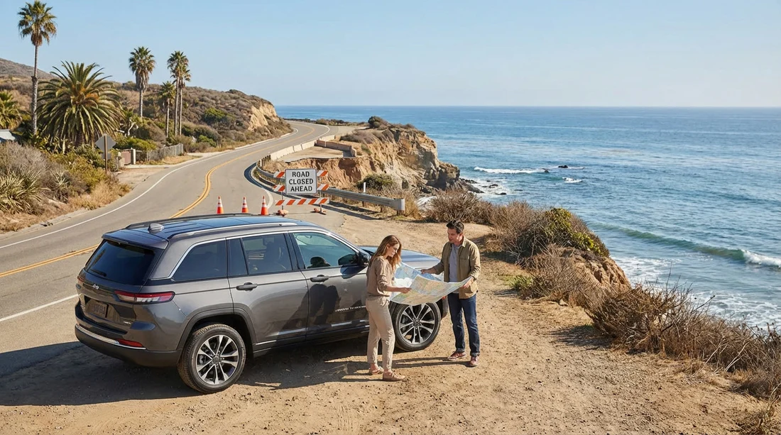
Why Highway 1 closures affect car hire planning more than you expect
On maps, Highway 1 looks like a simple coastal ribbon. In reality, closures often sever the route with no parallel coastal alternative, especially around Big Sur. When a slide closes the road, you usually have two practical choices: backtrack to the last major junction, or cut inland to a higher-capacity road such as US-101. Both options can add significant time, and both can change the type of road you are driving on, from winding cliffs to foggy inland valleys or mountain passes.
For car hire, the biggest risk is improvising a “shortcut” that is unsuitable. Some navigation apps will propose narrow county roads, steep single-lane mountain routes, or unpaved segments. Even if technically legal to drive, these roads can be unsafe in poor weather, stressful with an unfamiliar vehicle, and in some cases inconsistent with typical rental conditions around off-road use or undercarriage damage. The safest approach is to plan detours that keep you on numbered state highways and interstates wherever possible.
How to check closure status, the reliable way
Before you set off, rely on official sources first, then use apps for context. In California, Caltrans is the key authority for state highways. Look for posted closures, one-way traffic control, chain requirements (in winter inland), and estimated reopening times. Landslide updates can change quickly, so do a second check on the morning you drive, and again when you stop for fuel or food.
When reading closure notices, pay attention to the precise postmile or landmark description. “Big Sur” is a broad label, and a closure north of Lucia is a very different problem from a closure near Bixby Creek Bridge. If the closure is between your current location and your destination, identify the last reliable turnaround point. Plan to have enough fuel and daylight to return to that point without stress.
Also watch for “soft closures” such as intermittent one-way traffic control or pilot car operations. These can keep the route technically open while adding delays that are easy to underestimate. If you have a timed return to an airport, treat these delays the same way you would treat a full closure. They can create queues, and queues create missed flights and late-return anxiety.
Inland detour versus backtrack, how to choose
The right detour depends on where you are on Highway 1, what time of day it is, and how flexible your plans are. A simple rule helps: if the closure is ahead and you are still close to a major junction with US-101, choose an inland detour early. If you have already committed deep into the coast with limited connectors, backtracking may be the safer and faster choice.
Inland detour strengths include better road capacity, more services, and more predictable travel times. US-101 is usually the workhorse route that keeps you moving. Backtracking strengths include familiarity, avoiding mountain passes at night, and reducing the risk of being funnelled onto tiny connector roads by your satnav.
Ask yourself three questions before choosing. First, is it still daylight for the most winding segments? Second, does the inland route keep you on major highways, or does it funnel you onto minor roads? Third, how many hours do you truly have before you must be at your accommodation or return location? If you are uncertain, choose the route with more services and simpler navigation.
Practical detour patterns for common Highway 1 closure zones
Closures around Big Sur often require you to reroute inland via Monterey or Carmel in the north, or via Morro Bay, San Luis Obispo, or Cambria in the south, depending on the closure location. In many cases, the realistic through option is: return to a junction that connects to US-101, travel inland, then rejoin Highway 1 farther along where it is open. This can feel like “missing the best bit”, but it is usually the safest way to keep your trip on paved, well-maintained roads.
North of San Francisco, closures can happen after heavy winter storms, and detours may involve moving between Highway 1 and US-101 via state routes. Again, favour numbered routes and avoid anything that looks like a tiny coastal lane on the map. If you are travelling with a larger vehicle, this matters even more, because width restrictions, sharp hairpins, and limited passing places turn a scenic lane into a slow, stressful crawl.
If your navigation app suggests a road that is unpaved or described locally as “seasonal”, do not treat it as a normal detour. Seasonal roads can have washouts, fallen branches, or no shoulder. When in doubt, switch your route to avoid ferries, avoid unpaved roads, and avoid “shortest” routing. Aim for “fastest” using highways and main state routes.
Avoiding unsuitable roads in a rental vehicle
Most car hire drivers get into trouble when they treat every grey line on the map as equal. Coastal and mountain counties have roads that are technically public but not suitable for low-clearance cars, unfamiliar drivers, or wet-weather travel. In addition, many rental agreements expect you to take reasonable care to avoid avoidable damage. That is not about memorising every clause, it is about staying on sensible roads.
Use these filters before committing to a detour. Is the road clearly paved and maintained? Does it have regular junction signage and route numbers? Does it show consistent mobile coverage in populated areas, or are you heading into a blank spot? Are there services within the next 30 to 60 minutes? If the answer is “no” to several, choose a different route.
Vehicle choice also influences your comfort margin. A standard car is fine for most main-road detours, but if your plan includes rural viewpoints and you will be travelling in winter or heavy rain, consider the stability and visibility of a higher-riding vehicle. If you are carrying multiple passengers and luggage, avoid cramming and overloading, because it increases braking distances and fatigue on twisty roads.
Return-time planning, buffers that actually work
Highway 1 disruptions are not just about distance, they are about unpredictability. Build a buffer that matches the risk. For a routine day with no closure alerts, add at least one extra hour if you have an airport return. If there are active closure warnings, recent storms, or one-way traffic control, add two to four hours, depending on how far you are from an inland alternative.
Plan your final night accordingly. If your flight is early, avoid staying deep on the coast the night before unless you have a proven, open route that morning. Many travellers try to squeeze in “one last sunrise stop” and end up rushing a long drive, which increases stress and the chance of a mistake. It is usually better to move closer to the return location the day before, then enjoy local sights without a ticking clock.
Also remember the return process: refuelling, finding the correct rental return lane, unloading, and shuttle time to the terminal. Congestion near major airports can easily add 30 to 60 minutes on top of your driving time. If you are returning near peak periods, treat that as part of your buffer, not a separate problem.
On-the-day driving tactics when conditions change
Even with good planning, you may meet a closure unexpectedly. When you do, prioritise safe decision-making. Pull into a safe turnout or service area with space and signal. Check the official closure notice, then compare two route options: a backtrack plan to the last major junction, and an inland plan to US-101 or an interstate. Choose the route that keeps you on the biggest roads with the fewest decision points.
Do not rely on a single app estimate. Travel-time predictions can be wrong when everyone is being diverted at once. If you see heavy congestion building, leave earlier than you think you need to. If you are travelling with others, agree on a decision deadline such as “if we have not cleared the closure zone by midday, we go inland.” Clear triggers prevent second-guessing at every viewpoint stop.
Finally, manage fatigue. Highway 1 is beautiful but demanding, with constant steering corrections and frequent braking. Add a closure detour and you may be driving longer than planned. Swap drivers if possible, stop before you feel tired, and avoid night driving on unfamiliar winding roads when an inland highway option exists.
FAQ
How do I check if Highway 1 is closed due to a landslide? Use Caltrans road condition updates and closure notices for the specific highway segment, then recheck on the morning you travel and at major stops.
Is it better to detour inland or backtrack on Highway 1 closures? Inland detours via major routes like US-101 are usually more predictable. Backtracking can be best if you are already far along the coast with limited connectors.
Will my satnav always pick a safe detour for a rental car? No. Some apps suggest narrow or unpaved roads to save distance. Choose routes that stay on numbered highways and avoid unpaved or seasonal roads.
How much extra time should I allow to return a car hire near an airport? Add at least one hour on normal days. With active closures or recent storms, add two to four hours plus time for fuel, congestion, and the return process.
What should I do if I reach a closure with poor mobile signal? Turn around at the last safe point, head to the nearest town or service area for signal, then confirm the closure details and route options before continuing.


