


VERIFIED REVIEWS


About renting a car with Enterprise in Kansas
Best Car Rental Deals
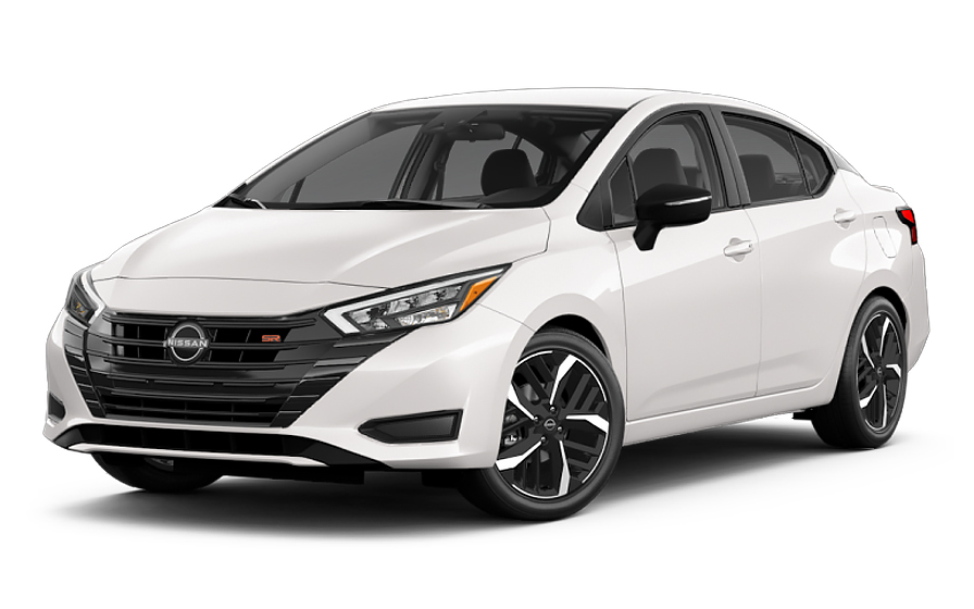
Nissan Versa | Automatic
SMALLor Small similar
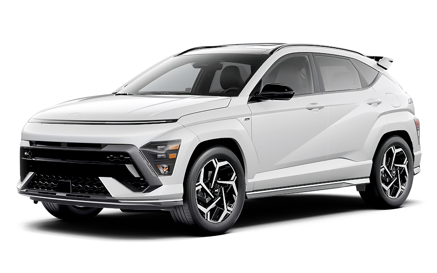
Hyundai Kona | Automatic
SUVor SUV similar
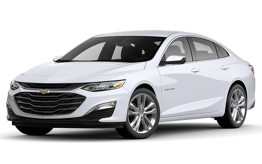
Chevrolet Malibu | Automatic
SEDANor Sedan similar

Ford F150 | Automatic
PICKUPor Pickup similar

Dodge Durango 7 Passengers | Automatic
7 PASSENGERSor 7 Passengers similar

Jeep Gladiator | Automatic
JEEPor Jeep similar

Audi A4 | Automatic
LUXURYor Luxury similar
Frequently Asked Questions
What does my Hola Car Rentals booking with Enterprise in Kansas include that other companies don't offer?
Hola Car Rentals is the only premium partner of the top car rental brands operating in Kansas, including Enterprise, giving you exclusive access to our All Inclusive+ rate. This rate includes benefits that no other company can match:
- Free liability coverage starting at US$ 300,000 in case of an accident (applies only to certain rates and itineraries)
- Toll cashback: recover up to 5% of the reservation's total value for toll charges incurred during your rental period
- Premium travel medical assistance providing up to US$ 150,000 in coverage for a maximum of 5 passengers in case of a medical emergency, excluding pre-existing conditions
- No Extra Charges© guarantee: if the counter charges you for something not listed on your confirmation and not an optional add-on you accepted, Hola Car Rentals will work to remove or reimburse the charge after verification
All of this comes at no extra cost, ensuring a fully protected Enterprise rental experience and peace of mind throughout your trip in Kansas.
Will I face unexpected charges at the Enterprise counter in Kansas when I book through Hola Car Rentals?
No. With Hola Car Rentals, all costs and charges for your Enterprise booking in Kansas are clearly shown at the time of reservation and in your confirmation email, so you know exactly what you are paying before you arrive at the Enterprise counter.
On top of that, every Hola Car Rentals booking includes the No Extra Charges© guarantee. This is a pricing guarantee (not insurance) that protects you if the Enterprise counter in Kansas charges you for something that was not listed on your confirmation and was not an optional add-on you accepted. If that happens, Hola Car Rentals will work with Enterprise to remove or reimburse the charge after verification.
The only costs outside this guarantee are:
- Optional add-ons you choose at the counter (GPS, child seats, prepaid fuel)
- Usage-based charges (tolls, fuel shortfall, traffic fines)
What documents do I need to pick up my Enterprise rental car in Kansas?
To pick up your Enterprise rental car in Kansas, you must bring the following physical documents to the counter:
- A valid, unexpired driver's license with a photo (original, not digital)
- A major credit card in the main driver's name, with the driver's name printed on the card, for the security deposit hold
- A passport or valid government-issued photo ID
- Your booking confirmation
- Round-trip flight or travel tickets if you are visiting from abroad
If your driver's license uses a non-Latin alphabet (for example, Arabic, Chinese, Japanese, or Cyrillic), you must also carry an International Driving Permit (IDP) as a translation. The IDP is not a standalone document and must be presented alongside your original license. Digital documents are not accepted at any Enterprise counter in Kansas.
Note that Enterprise requires renters to be at least 21 years old in Kansas. Drivers aged 21 to 24 may be subject to a young-renter surcharge, which varies by location.
Does Enterprise in Kansas require a credit card for the deposit?
Yes, Enterprise in Kansas requires a physical major credit card in the main driver's name, with the driver's name printed on the card, to place a security hold at pick-up.
The hold is a temporary authorization, not a charge, and reduces your available credit until it is released after you return the vehicle. Typical holds for standard vehicles in the United States range from US$300 to US$400, though the exact amount is set by the Enterprise counter and may vary by vehicle class or location within Kansas.
- Debit cards and prepaid cards are not accepted for the deposit hold
- Virtual or digital card numbers are not accepted; you must present the physical card
- The card must belong to the main driver, not a third party
- Bring a backup credit card in case your primary card is declined
Even if you prepaid your booking, Enterprise will still place a hold on your credit card at the Kansas counter. After you return the car, your bank controls how quickly the hold is released, which can take up to 15 business days.
How do toll roads work for Enterprise rental cars in Kansas?
Kansas has one main toll road system: the Kansas Turnpike, which runs the length of the state from the Oklahoma border in the south to the Nebraska border in the north, passing through Wichita, Topeka, and Lawrence. If you drive this route in your Enterprise rental car in Kansas, tolls will apply.
At most Kansas Turnpike plazas, payment options include cash, major credit cards, and K-Tag (Kansas's electronic transponder). E-ZPass is not accepted on the Kansas Turnpike. One important exception is Exit 53A in Wichita, which is cashless and requires either a K-Tag or an online payment by license plate within 10 days.
For your Enterprise rental in Kansas, you have two main options:
- Enroll in Enterprise's TollPass program, which costs US$4.95 per day (maximum US$34.65 per rental) plus the actual toll charges billed separately to your card approximately 4 to 8 weeks after the rental
- Pay tolls manually at cash or self-pay lanes using US cash or a major credit card, and receive a ticket on entry to pay on exit
If you drive through a cashless lane without a transponder and without enrolling, you may receive a mailed bill or face violation rates. All Hola Car Rentals bookings include Tolls Cashback, which reimburses up to 5% of your total booking value for tolls paid on the Kansas Turnpike or elsewhere during your rental.
Can I get Tolls Cashback on my Enterprise rental in Kansas?
Yes, all Hola Car Rentals bookings include Tolls Cashback, which means you can get up to 5% of your total booking value reimbursed for tolls you pay during your Enterprise rental in Kansas.
This is especially useful if you plan to drive the Kansas Turnpike, which runs from the Oklahoma border through Wichita and Topeka to the Nebraska border and charges distance-based tolls depending on your entry and exit points.
To claim your cashback after returning your Enterprise vehicle in Kansas:
- Email [email protected] within 30 days of returning the car
- Use the subject line: Tolls Cashback - Reservation [Your Confirmation Number]
- Attach your Hola Car Rentals booking confirmation, the signed rental agreement from Enterprise, and a receipt or statement showing the toll charges paid
- Include your full name, travel dates, and the last 4 digits of the card used for your booking
The refund is issued to the same payment method used for your reservation and typically processes within 7 to 10 business days after approval. Claims submitted after 30 days are not accepted. Note that Tolls Cashback reimburses toll charges only, not administrative or program fees charged by Enterprise.
What is the minimum age to rent a car from Enterprise in Kansas?
The minimum age to rent a car from Enterprise in Kansas is 21 years old. Drivers aged 21 to 24 can rent but will be charged a daily young-renter surcharge on top of the base rental rate. The specific surcharge amount varies by Enterprise location within Kansas.
For Enterprise in Kansas, the additional driver fee structure is US$15 per day plus taxes for drivers who are not the main renter. If an additional driver is also under 25, a young-renter surcharge may apply to them as well.
Vehicle class restrictions also apply to under-25 renters. Categories such as full-size SUVs, luxury, premium, minivans, and convertibles are typically restricted to drivers aged 25 and older. Renters aged 21 to 24 are generally limited to economy, compact, intermediate, and compact SUV classes at Enterprise locations in Kansas.
- Minimum age: 21 years old
- No surcharge: 25 years old and above
- Young-renter surcharge: applies to drivers aged 21 to 24 (amount varies by Kansas location)
- Vehicle class restrictions: most premium and large categories require age 25 or older
Always confirm the exact surcharge amount directly with the Enterprise counter at your Kansas pickup location, as amounts are not standardized across all locations in the state.
Is an International Driving Permit required for Enterprise rentals in Kansas?
No, an International Driving Permit (IDP) is not strictly required to rent from Enterprise in Kansas, but it is strongly recommended in certain situations.
You can drive in Kansas using your valid home-country driver's license as long as it is unexpired and includes a photograph. However, an IDP is mandatory if your license uses a non-Latin alphabet, such as Arabic, Chinese, Japanese, or Cyrillic script. In that case, Enterprise in Kansas will require the IDP as a translation alongside your original license.
- License in English or Latin alphabet: IDP recommended but not required
- License in a non-Latin alphabet: IDP required at the Enterprise counter in Kansas
- The IDP is a translation only and cannot be used as a standalone document
- You must obtain your IDP in your home country before traveling to Kansas
If you hold a Mexican driver's license, Enterprise may also ask you to present a valid voter registration card from Mexico. All documents presented at the Enterprise counter in Kansas must be physical originals. Digital licenses are not accepted.
Where are Enterprise rental car locations in Kansas?
Enterprise operates both airport and neighborhood locations across Kansas, giving you flexibility depending on where you arrive or need a vehicle.
Airport locations in Kansas include:
- Wichita Eisenhower National Airport (ICT), located at 2280 S Eisenhower Airport Parkway
- Manhattan Regional Airport (MHK), located at 5500 Fort Riley Boulevard
- Garden City Regional Airport (GCK)
- Salina Airport (SLN)
Enterprise also maintains neighborhood and downtown locations throughout Kansas, including Downtown Wichita (300 Washington S), Downtown Topeka (333 SW Topeka Boulevard), Lawrence, Leavenworth, Hutchinson, Hays, Emporia, Junction City, Garden City, and several Kansas City area locations.
Counter hours vary by location. The Downtown Wichita Enterprise location is open Monday through Friday 7:30 AM to 6:00 PM and Saturday 8:00 AM to 2:00 PM, closed Sundays. The Downtown Topeka Enterprise location is open Monday through Friday 7:30 AM to 5:00 PM, Saturday 9:00 AM to 12:00 PM, and Sunday 10:00 AM to 2:00 PM. Always confirm hours for your specific Kansas Enterprise location before arrival, as holiday hours may differ.
What insurance coverage do I need for my Enterprise rental in Kansas?
When renting from Enterprise in Kansas, your base rental rate does not automatically include full insurance coverage. You should consider two main types of protection:
Collision Damage Waiver (CDW) or Loss Damage Waiver (LDW) covers damage to the Enterprise rental vehicle itself from a collision, theft, or vandalism. A deductible may apply unless your confirmation explicitly states zero deductible. CDW and LDW do not cover damage to other vehicles or injuries to other people.
Third-Party Liability (LIS/ALI/SLI) covers bodily injury and property damage you may cause to others while driving your Enterprise rental in Kansas. Some U.S. states require rental companies to include a state-minimum liability amount, but this is not universal. Hola Car Rentals strongly recommends adding supplemental liability coverage up to US$300,000 for your Kansas rental.
- CDW/LDW: protects the Enterprise vehicle you are driving
- LIS/ALI/SLI: protects third parties you may injure or whose property you may damage
- Neither covers your personal injuries (that requires PAI) or your belongings (that requires PEC)
- Only named drivers on the Enterprise rental agreement are covered
Check your booking confirmation to see which coverages are included in your selected rate before picking up your Enterprise vehicle in Kansas.
What happens if I return my Enterprise rental car late in Kansas?
If you return your Enterprise rental car in Kansas after the agreed drop-off time, a grace period of approximately 30 minutes typically applies, though this is not guaranteed at every location. If you exceed the grace period, Enterprise may charge you for additional hours or an extra rental day, plus a potential late fee.
To avoid late return charges on your Enterprise rental in Kansas:
- Plan your return time to account for refueling near the drop-off location before returning the vehicle
- If you need more time, contact Enterprise directly to extend your rental before the scheduled return time
- Check your rental agreement for the exact grace period and late fee structure at your specific Kansas location
If you need to extend your Enterprise rental while already in Kansas, you can request additional days through the rental counter or by contacting support. Note that extending mid-rental may reprice your booking based on current availability and rates.
For after-hours returns at Kansas Enterprise locations, confirm key-drop procedures with the counter at pick-up, as policies vary by location. Keep in mind that liability for the vehicle may continue until the counter formally checks it in the next business day.
Can I add an additional driver to my Enterprise rental in Kansas?
Yes, you can add an additional driver to your Enterprise rental in Kansas, but the additional driver must be present at the counter at pick-up with a valid driver's license and must sign the rental agreement.
For Enterprise in Kansas, the additional driver fee is US$15 per day plus applicable taxes when not included in your rate. Check your booking confirmation to see if an additional driver is already included at no extra charge.
- The additional driver must appear in person at the Enterprise counter in Kansas at pick-up
- They must present a valid, unexpired driver's license (and an IDP if their license uses a non-Latin alphabet)
- Both the main driver and the additional driver must sign the rental agreement
- Only drivers listed on the agreement are covered by CDW/LDW and liability protections
If the additional driver in Kansas is under 25, a young-renter surcharge may also apply on top of the additional driver fee. Anyone who drives the Enterprise vehicle in Kansas without being listed on the rental agreement is considered an unauthorized driver, which can void your coverage and result in additional charges.
What is the fuel policy for Enterprise rentals in Kansas?
Enterprise in Kansas uses a Full-to-Full fuel policy by default. This means you receive the vehicle with a full tank and must return it full to avoid fuel charges.
To avoid fuel charges on your Enterprise rental in Kansas:
- Check the fuel gauge with the Enterprise agent at pick-up and confirm the starting level is recorded on the rental agreement
- Take a photo of the dashboard showing the odometer and fuel gauge at pick-up
- Refuel within approximately 10 miles of the return location so the gauge does not drop before you arrive
- Keep your final fuel receipt showing the date, time, and station address
- Show the full gauge to the Enterprise agent at return, or leave the receipt in the key-drop envelope for after-hours returns
If you return the Enterprise vehicle in Kansas with less than a full tank, you may be charged for the fuel shortfall at the partner's refueling rate, which is typically higher than retail pump prices, plus a refueling service fee. Using the wrong fuel type (gasoline versus diesel) is not covered by the fuel policy and may generate additional charges. Always confirm the correct fuel type for your specific Enterprise vehicle in Kansas at pick-up.
Can I pick up an Enterprise car in Kansas and drop it off in another state?
Yes, one-way rentals are generally possible with Enterprise in Kansas, allowing you to pick up in Kansas and drop off in a different state, but a drop-off fee may apply depending on your specific route.
The drop-off fee is route-specific and varies based on the cities involved, the distance, the vehicle class, and the season. For example, a one-way rental from Wichita to a city in a neighboring state will typically carry a drop-off fee, while same-city routes between an airport and a downtown Enterprise location may not.
- The drop-off fee is listed under the "To pay at destination" section during the Hola Car Rentals booking process
- This fee cannot be prepaid and is paid directly to Enterprise at the counter in Kansas or at the drop-off location
- Changing your drop-off location after booking may reprice the rental and recalculate the fee
- Cross-border rentals (for example, driving into Mexico or Canada) are generally restricted and require prior approval from Enterprise
Always review your booking confirmation to confirm whether a drop-off fee applies to your Kansas Enterprise rental before you travel. If the fee shown at the Enterprise counter differs from what your confirmation states, keep all paperwork and contact support.
Is travel assistance included with my Enterprise rental booking in Kansas?
Yes, most Hola Car Rentals bookings include travel assistance coverage provided by Terrawind Global Protection, and this applies to your Enterprise rental in Kansas as well. However, this benefit does not apply to residents of the United States or Canada.
If you are traveling to Kansas from outside North America and something unexpected happens during your Enterprise rental, such as a medical emergency on the Kansas Turnpike or in a remote part of the state, this coverage can help with:
- Medical coverage for up to 5 passengers for accidents and non-pre-existing illnesses
- Legal assistance in the event of a road accident
- Compensation for luggage lost by the airline
- Flight cancellation insurance
To get assistance 24 hours a day, 7 days a week, call +1 888 980 9992 (toll-free) or contact Terrawind via WhatsApp at +1 208 910 1001. Have your Hola Car Rentals confirmation number ready when you call.
This travel assistance does not cover damage to the Enterprise rental vehicle (that is CDW/LDW) or liability to third parties (that is LIS/ALI/SLI). Always check your booking confirmation for the exact terms and coverage limits that apply to your Kansas Enterprise rental.

- Choosing a selection results in a full page refresh.
- Opens in a new window.
Suggested Currencies
- $ USD - United States Dollar
- € EUR - Euro
Other Countries
-
 Albania
-
 Algeria
-
 Andorra
-
 Angola
-
 Antigua & Barbuda
-
 Argentina
-
 Australia
-
 Austria
-
 Bahamas
-
 Bahrain
-
 Bangladesh
-
 Barbados
-
 Belgium
-
 Belize
-
 Benin
Benin
-
 Bermuda
-
 Bolivia
-
 Bosnia & Herzegovina
-
 Botswana
-
 Brazil
-
 British Virgin Islands
-
 Bulgaria
-
 Burkina Faso
-
 Burundi
-
 Cameroon
-
 Canada
-
 Cape Verde
-
 Cayman Islands
-
 Central African Republic
-
 Chad
Chad
-
 Chile
Chile
-
 Colombia
-
 Comoros
-
 Congo - Brazzaville
-
 Congo - Kinshasa
-
 Costa Rica
-
 Côte d’Ivoire
-
 Croatia
-
 Curaçao
-
 Cyprus
-
 Czechia
-
 Denmark
-
 Djibouti
-
 Dominica
-
 Dominican Republic
-
 Ecuador
-
 Egypt
Egypt
-
 El Salvador
-
 Equatorial Guinea
-
 Eritrea
-
 Estonia
-
 Eswatini
-
 Ethiopia
-
 Finland
-
 France
-
 Gabon
Gabon
-
 Gambia
-
 Germany
-
 Ghana
Ghana
-
 Greece
-
 Grenada
-
 Guatemala
-
 Guinea
-
 Guinea-Bissau
-
 Guyana
-
 Haiti
Haiti
-
 Honduras
-
 Hong Kong SAR
-
 Hungary
-
 Iceland
-
 India
India
-
 Iraq
Iraq
-
 Ireland
-
 Israel
-
 Italy
Italy
-
 Jamaica
-
 Japan
Japan
-
 Jordan
-
 Kenya
Kenya
-
 Kuwait
-
 Latvia
-
 Lebanon
-
 Lesotho
-
 Liberia
-
 Libya
Libya
-
 Liechtenstein
-
 Lithuania
-
 Luxembourg
-
 Madagascar
-
 Malawi
-
 Mali
Mali
-
 Malta
Malta
-
 Mauritania
-
 Mauritius
-
 Mexico
-
 Moldova
-
 Monaco
-
 Montenegro
-
 Morocco
-
 Mozambique
-
 Namibia
-
 Netherlands
-
 New Zealand
-
 Nicaragua
-
 Niger
Niger
-
 Nigeria
-
 Norway
-
 Oman
Oman
-
 Palestinian Territories
-
 Panama
-
 Paraguay
-
 Peru
Peru
-
 Philippines
-
 Poland
-
 Portugal
-
 Qatar
Qatar
-
 Romania
-
 Russia
-
 Rwanda
-
 San Marino
-
 São Tomé & Príncipe
-
 Saudi Arabia
-
 Senegal
-
 Serbia
-
 Seychelles
-
 Sierra Leone
-
 Singapore
-
 Sint Maarten
-
 Slovakia
-
 Slovenia
-
 Somalia
-
 South Africa
-
 South Korea
-
 South Sudan
-
 Spain
Spain
-
 St. Lucia
-
 St. Vincent & Grenadines
-
 Sudan
Sudan
-
 Sweden
-
 Switzerland
-
 Taiwan
-
 Tanzania
-
 Togo
Togo
-
 Trinidad & Tobago
-
 Tunisia
-
 Türkiye
-
 Turks & Caicos Islands
-
 Uganda
-
 Ukraine
-
 United Arab Emirates
-
 United Kingdom
-
 United States
-
 Uruguay
-
 Vatican City
-
 Venezuela
-
 Yemen
Yemen
-
 Zambia
-
 Zimbabwe
Driving license from:
-
Albania
-
Algeria
-
Andorra
-
Angola
-
Antigua & Barbuda
-
Argentina
-
Australia
-
Austria
-
Bahamas
-
Bahrain
-
Bangladesh
-
Barbados
-
Belgium
-
Belize
-
Benin
-
Bermuda
-
Bolivia
-
Bosnia & Herzegovina
-
Botswana
-
Brazil
-
British Virgin Islands
-
Bulgaria
-
Burkina Faso
-
Burundi
-
Cameroon
-
Canada
-
Cape Verde
-
Cayman Islands
-
Central African Republic
-
Chad
-
Chile
-
Colombia
-
Comoros
-
Congo - Brazzaville
-
Congo - Kinshasa
-
Costa Rica
-
Côte d’Ivoire
-
Croatia
-
Curaçao
-
Cyprus
-
Czechia
-
Denmark
-
Djibouti
-
Dominica
-
Dominican Republic
-
Ecuador
-
Egypt
-
El Salvador
-
Equatorial Guinea
-
Eritrea
-
Estonia
-
Eswatini
-
Ethiopia
-
Finland
-
France
-
Gabon
-
Gambia
-
Germany
-
Ghana
-
Greece
-
Grenada
-
Guatemala
-
Guinea
-
Guinea-Bissau
-
Guyana
-
Haiti
-
Honduras
-
Hong Kong SAR
-
Hungary
-
Iceland
-
India
-
Iraq
-
Ireland
-
Israel
-
Italy
-
Jamaica
-
Japan
-
Jordan
-
Kenya
-
Kuwait
-
Latvia
-
Lebanon
-
Lesotho
-
Liberia
-
Libya
-
Liechtenstein
-
Lithuania
-
Luxembourg
-
Madagascar
-
Malawi
-
Mali
-
Malta
-
Mauritania
-
Mauritius
-
Mexico
-
Moldova
-
Monaco
-
Montenegro
-
Morocco
-
Mozambique
-
Namibia
-
Netherlands
-
New Zealand
-
Nicaragua
-
Niger
-
Nigeria
-
Norway
-
Oman
-
Palestinian Territories
-
Panama
-
Paraguay
-
Peru
-
Philippines
-
Poland
-
Portugal
-
Qatar
-
Romania
-
Russia
-
Rwanda
-
San Marino
-
São Tomé & Príncipe
-
Saudi Arabia
-
Senegal
-
Serbia
-
Seychelles
-
Sierra Leone
-
Singapore
-
Sint Maarten
-
Slovakia
-
Slovenia
-
Somalia
-
South Africa
-
South Korea
-
South Sudan
-
Spain
-
St. Lucia
-
St. Vincent & Grenadines
-
Sudan
-
Sweden
-
Switzerland
-
Taiwan
-
Tanzania
-
Togo
-
Trinidad & Tobago
-
Tunisia
-
Türkiye
-
Turks & Caicos Islands
-
Uganda
-
Ukraine
-
United Arab Emirates
-
United Kingdom
-
United States
-
Uruguay
-
Vatican City
-
Venezuela
-
Yemen
-
Zambia
-
Zimbabwe