


VERIFIED REVIEWS


About renting a car with Alamo in Charlotte
Best Car Rental Deals

Toyota Camry Hybrid | Automatic
SEDANor Sedan similar
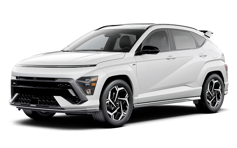
Hyundai Kona | Automatic
SUVor SUV similar
Frequently Asked Questions
What does my Hola Car Rentals booking with Alamo in Charlotte include that other companies don't offer?
Hola Car Rentals is the only premium partner of the top car rental brands operating in Charlotte, including Alamo, giving you exclusive access to our All Inclusive+ rate. This rate includes benefits that no other company can match:
- Free liability coverage starting at US$ 300,000 in case of an accident (applies only to certain rates and itineraries)
- Toll cashback: recover up to 5% of the reservation's total value for toll charges incurred during your rental period
- Premium travel medical assistance providing up to US$ 150,000 in coverage for a maximum of 5 passengers in case of a medical emergency, excluding pre-existing conditions
- No Extra Charges© guarantee: if the counter charges you for something not listed on your confirmation and not an optional add-on you accepted, Hola Car Rentals will work to remove or reimburse the charge after verification
All of this comes at no extra cost, ensuring a fully protected Alamo rental experience and peace of mind throughout your trip in Charlotte.
Will I face unexpected charges at the Alamo counter in Charlotte when I book through Hola Car Rentals?
No. With Hola Car Rentals, all costs and charges for your Alamo booking in Charlotte are clearly shown at the time of reservation and in your confirmation email, so you know exactly what you are paying before you arrive at the Alamo counter.
On top of that, every Hola Car Rentals booking includes the No Extra Charges© guarantee. This is a pricing guarantee (not insurance) that protects you if the Alamo counter in Charlotte charges you for something that was not listed on your confirmation and was not an optional add-on you accepted. If that happens, Hola Car Rentals will work with Alamo to remove or reimburse the charge after verification.
The only costs outside this guarantee are:
- Optional add-ons you choose at the counter (GPS, child seats, prepaid fuel)
- Usage-based charges (tolls, fuel shortfall, traffic fines)
Where is the Alamo counter at Charlotte Douglas International Airport?
The Alamo counter at Charlotte Douglas International Airport (CLT) is located inside the main terminal building, with no shuttle or consolidated rental center required to reach it.
From baggage claim, take the elevator up to level 5, walk across the skybridge, then take the elevator down to level 2. The Alamo counter is located in the main lobby on that level.
Alamo at Charlotte also offers a touch-screen kiosk check-in option, which lets you skip the counter line, print a receipt-sized rental agreement, and proceed directly to your assigned vehicle on the lot. At the exit booth, present your rental agreement and driver's license to drive away.
The Alamo counter at Charlotte Douglas operates daily from 00:00 to 01:45 and from 04:00 to 23:59. If you are arriving outside those hours, confirm after-hours drop-off and pickup options directly with Alamo before your trip.
What documents do I need to pick up my Alamo rental car in Charlotte?
To collect your Alamo rental car in Charlotte, you must bring the following physical documents to the counter:
- A valid, original driver's license in the main driver's name
- A major credit card with the driver's name printed on the card, in the main driver's name, for the security deposit hold
- A passport or valid government-issued photo ID
- Your booking confirmation or printed voucher
- Round-trip flight or cruise tickets (required for international visitors)
If your driver's license is not in English and does not use a Latin (Roman) alphabet, such as Arabic, Chinese, Japanese, or Cyrillic script, an International Driving Permit (IDP) is mandatory at the Alamo counter in Charlotte. For licenses in English or a Latin alphabet, an IDP is recommended but not strictly required.
All documents must be physical originals. Digital copies shown on a phone or tablet are not accepted by Alamo or any other rental partner. Make sure all names match across your license, passport, and credit card to avoid issues at the Charlotte counter.
Are there toll roads near Charlotte that Alamo renters should know about?
Yes, there are toll roads in the Charlotte region and broader North Carolina area that Alamo renters should be aware of before driving.
North Carolina operates fully electronic, cashless tolling with no traditional toll booths. The two main toll roads relevant to drivers based in Charlotte are:
- Monroe Expressway (US Highway 74): a standard 2-axle vehicle pays up to US$2.66 electronically or up to US$4.10 if billed by mail
- Triangle Expressway (connecting Raleigh and Durham, approximately 19 miles): up to US$3.60 electronically for a 2-axle vehicle, with rates increasing from January 2026 for NC Quick Pass holders
Payment is accepted via NC Quick Pass, E-ZPass, SunPass, or Peach Pass. Cash is not accepted on any North Carolina toll road. If you do not have a compatible transponder, the toll agency photographs your license plate and mails an invoice to the registered vehicle owner, which in this case is Alamo. Alamo will then pass the toll charge plus an administrative processing fee to your credit card after the rental ends.
At the Alamo counter in Charlotte, you can opt into an unlimited toll package (typically US$11 to US$25 per day) to simplify billing, or pay per use and accept the administrative fees that apply.
Can I get cashback on tolls paid during my Alamo rental in Charlotte?
Yes, all bookings include Tolls Cashback, which reimburses you up to 5% of your total booking value for tolls paid during your Alamo rental in Charlotte.
North Carolina uses fully cashless tolling, so if you drive on roads like the Monroe Expressway near Charlotte or the Triangle Expressway toward Raleigh, you will incur toll charges either through a transponder program or a bill-by-mail invoice. Tolls Cashback helps offset those costs.
To claim your cashback after returning your Alamo vehicle in Charlotte:
- Email [email protected] within 30 days of vehicle return
- Use the subject line: Tolls Cashback - Reservation [Your Confirmation Number]
- Attach your Hola Car Rentals confirmation, the signed rental agreement from Alamo, and a receipt or statement showing the toll charges paid
The refund is issued to the same payment method used for your booking and typically processes within 7 to 10 business days after approval. Claims submitted after 30 days are not accepted. This benefit does not mean tolls are prepaid; you still pay them normally and claim reimbursement afterward.
How does the security deposit work for Alamo rentals in Charlotte?
When you pick up your Alamo rental car in Charlotte, the counter agent will place a temporary authorization hold on your credit card. This is not a charge; it reduces your available credit until Alamo releases it after you return the vehicle.
For Alamo rentals in the United States, including Charlotte, the typical hold is approximately US$300 to US$400 for a standard vehicle. The exact amount can vary based on the vehicle class, rental duration, and location policies. Premium or specialty vehicles may carry a higher hold.
Important requirements for the deposit at the Alamo counter in Charlotte:
- The card must be a major credit card (Visa, Mastercard, Amex, etc.) with the driver's name printed on the physical card
- Debit cards, prepaid cards, and virtual cards are not accepted for the security hold
- The card must be in the main driver's name
- You must have sufficient available credit to cover the hold plus any expected charges
After you return the Alamo vehicle in Charlotte and the contract closes, the hold is released. Your bank or card issuer controls how quickly it appears back on your available credit, which can take up to 15 business days. Bring a backup credit card in case your primary card is declined.
Can I add an additional driver to my Alamo rental in Charlotte?
Yes, you can add an additional driver to your Alamo rental in Charlotte, either as part of your rate or by paying a fee at the counter.
For Alamo in Charlotte, the additional driver fee is US$15 per day plus applicable taxes when it is not included in your rate. Check your booking confirmation to see whether your rate already includes one free additional driver.
Requirements for adding an additional driver at the Alamo counter in Charlotte:
- The additional driver must be physically present at the counter at pickup
- They must present a valid driver's license (and an IDP if their license uses a non-Latin alphabet)
- They must meet the minimum age requirements for Charlotte
- Both the main driver and the additional driver must sign the rental agreement
Only drivers listed on the Alamo rental agreement are covered by protections such as CDW/LDW. If someone not named on the contract drives the vehicle in Charlotte, coverage may be void and additional charges could apply. You cannot add a driver remotely by phone or chat alone; the person must be present at the Charlotte counter.
What is the minimum age to rent a car with Alamo in Charlotte?
The minimum age to rent a car with Alamo in Charlotte without a young-renter surcharge is 25. Drivers aged 21 to 24 can rent but will be charged an additional daily underage fee at the Charlotte counter.
North Carolina is not one of the states (like New York or Michigan) that mandates rentals to drivers aged 18 and older, so the standard Alamo policy applies in Charlotte: 21 is the minimum age, with a surcharge for drivers under 25.
Additional restrictions for under-25 renters at Alamo in Charlotte:
- Many vehicle classes are restricted to drivers aged 25 and older, including full-size SUVs, minivans, premium, luxury, and convertible categories
- Economy, compact, and intermediate vehicles are typically available to younger renters
- A valid major credit card in the main driver's name is still required for the deposit
If you are between 21 and 24 and renting with Alamo in Charlotte, Budget for the daily young-renter surcharge and select an eligible vehicle class when booking. If you are unsure whether your chosen vehicle class is available for your age, contact customer service before completing your reservation.
What travel assistance is included with my Alamo booking in Charlotte?
Most bookings include travel assistance through Terrawind Global Protection, which can be valuable if something goes wrong during your Alamo rental in Charlotte or while traveling to and from the city.
Core benefits typically included are:
- Travel and medical coverage for up to 5 passengers
- Legal assistance in the event of a road accident
- Compensation for baggage lost by the airline
- Flight cancellation insurance
This coverage is particularly useful if you experience a medical emergency or need legal support after an incident on Charlotte-area roads. It does not cover damage to the Alamo rental vehicle itself (that is handled by CDW/LDW) or third-party liability to others (covered by LIS/SLI).
To reach assistance 24 hours a day, 7 days a week: call +1 888 980 9992 (toll-free), contact WhatsApp at +1 208 910 1001, or email [email protected]. Have your Hola Car Rentals confirmation number ready when you call.
Important: this travel assistance benefit applies only to non-North American customers. Residents of the United States and Canada do not qualify for this coverage, regardless of where they pick up their Alamo vehicle in Charlotte.
What is the fuel policy for Alamo rentals at Charlotte Douglas Airport?
Alamo rentals at Charlotte Douglas Airport follow a Full-to-Full fuel policy. You receive the vehicle with a full tank and must return it full to avoid additional charges.
Steps to follow for fuel at your Alamo rental in Charlotte:
- At pickup, check the fuel gauge with the agent and confirm the starting level is recorded on the rental agreement
- Take a photo of the dashboard showing the odometer and fuel gauge
- Refuel within approximately 10 miles of the Charlotte Douglas Airport return facility before dropping off the vehicle
- Keep your final fuel receipt showing the date, time, and station address
If you return the Alamo vehicle in Charlotte with less than a full tank, you may be charged for the fuel shortfall at the partner's refueling rate, which is typically higher than retail pump prices, plus an administrative service fee.
For after-hours returns at Charlotte Douglas, leave your fuel receipt in the key drop envelope and keep a photo of the full gauge on your phone as evidence. The Alamo return facility is located at 5509 R C Josh Birmingham Pkwy, in the same area as the pickup location.
How do I return my Alamo car after hours at Charlotte Douglas Airport?
Yes, after-hours vehicle return is available at the Alamo facility at Charlotte Douglas International Airport in Charlotte.
The Alamo return location is at 5509 R C Josh Birmingham Pkwy, Charlotte, NC 28214, in the same area as the pickup facility. The Alamo counter at Charlotte Douglas operates from 00:00 to 01:45 and from 04:00 to 23:59 daily, so there is a brief window in the early morning when the counter is closed.
For an after-hours drop-off of your Alamo rental in Charlotte:
- Refuel the vehicle before arriving at the airport, keeping your receipt as proof of a full tank
- Park the vehicle in the designated Alamo return area on the lot
- Place your keys and any required paperwork in the after-hours key drop box
- Keep a photo of the fuel gauge showing a full tank and a photo of the vehicle condition
- Retain your fuel receipt with the date, time, and station address
Note that liability for the vehicle may continue until Alamo formally checks it in during staffed hours. If you have any concerns about the return process, confirm the exact after-hours procedure with the Alamo counter in Charlotte at the time of pickup.
Does Alamo in Charlotte accept debit cards for the rental deposit?
No, Alamo in Charlotte does not accept debit cards, prepaid cards, or virtual cards for the security deposit hold at pickup.
You must present a physical major credit card (such as Visa, Mastercard, or American Express) with the driver's name printed on the card. The card must be in the main driver's name and have sufficient available credit to cover the hold, which is typically US$300 to US$400 for a standard vehicle at Alamo in Charlotte.
Even if you have already prepaid your booking in full, you are still required to present a physical credit card at the Alamo counter in Charlotte for the security authorization. The hold is temporary and is released after you return the vehicle, though your bank may take up to 15 business days to reflect the release.
Practical tips before arriving at Charlotte Douglas:
- Notify your bank of your travel dates to prevent fraud blocks on the authorization
- Bring a backup credit card in your name in case your primary card is declined
- Confirm your card has enough available credit beyond what you expect to spend during the trip
Does Alamo in Charlotte include insurance, or do I need to add coverage?
Your Alamo booking in Charlotte may include Collision Damage Waiver (CDW) or Loss Damage Waiver (LDW) depending on the rate plan you selected, but third-party liability coverage is separate and may not be included by default.
CDW/LDW covers damage to the Alamo rental vehicle itself from a collision, theft, or vandalism, subject to any deductible shown on your confirmation. It does not cover:
- Injuries or property damage you cause to other people or vehicles (third-party liability)
- Tires, undercarriage, roof, or keys unless specifically included
- Incidents involving unauthorized drivers or prohibited use
For third-party liability in Charlotte, you may want to add Liability Insurance Supplementary (LIS/SLI). Some U.S. states require rental companies to include state-minimum liability, but not all do. North Carolina renters are strongly encouraged to confirm whether LIS/SLI is included in their Alamo rate or to add it at checkout.
Check your booking confirmation carefully before arriving at the Alamo counter in Charlotte. If CDW/LDW or LIS/SLI is listed as included, verify it appears on the rental agreement at pickup. If you are charged for coverage that was already included in your rate, keep all paperwork and contact support after the rental ends.
Can I pick up an Alamo car in Charlotte and drop it off in another city?
Yes, one-way rentals are available with Alamo, allowing you to pick up in Charlotte and return the vehicle in a different city, though a drop-off fee may apply depending on the route.
The drop-off fee is route-specific and varies based on the destination city, distance, vehicle class, and season. For example:
- Short routes between nearby cities in the same region may carry a modest fee or sometimes no fee at all
- Long-distance or cross-state routes typically carry a higher one-way fee
- Premium and large vehicle classes often have higher repositioning fees
When booking your Alamo rental from Charlotte, the drop-off fee (if applicable) will be shown on the rate details page under the section labeled as charges due at destination. It will not appear on the search results page. Review your confirmation to verify the fee before pickup.
Cross-border one-way rentals (for example, from Charlotte to Canada) are often restricted or require prior approval from Alamo. Always confirm cross-border permissions on your rental agreement before driving across state or National borders.
If the Alamo counter in Charlotte charges a drop-off fee that was not disclosed in your confirmation, keep all paperwork and contact support after the rental is complete.

- Choosing a selection results in a full page refresh.
- Opens in a new window.
Suggested Currencies
- $ USD - United States Dollar
- € EUR - Euro
Other Countries
-
 Albania
-
 Algeria
-
 Andorra
-
 Angola
-
 Antigua & Barbuda
-
 Argentina
-
 Australia
-
 Austria
-
 Bahamas
-
 Bahrain
-
 Bangladesh
-
 Barbados
-
 Belgium
-
 Belize
-
 Benin
Benin
-
 Bermuda
-
 Bolivia
-
 Bosnia & Herzegovina
-
 Botswana
-
 Brazil
-
 British Virgin Islands
-
 Bulgaria
-
 Burkina Faso
-
 Burundi
-
 Cameroon
-
 Canada
-
 Cape Verde
-
 Cayman Islands
-
 Central African Republic
-
 Chad
Chad
-
 Chile
Chile
-
 Colombia
-
 Comoros
-
 Congo - Brazzaville
-
 Congo - Kinshasa
-
 Costa Rica
-
 Côte d’Ivoire
-
 Croatia
-
 Curaçao
-
 Cyprus
-
 Czechia
-
 Denmark
-
 Djibouti
-
 Dominica
-
 Dominican Republic
-
 Ecuador
-
 Egypt
Egypt
-
 El Salvador
-
 Equatorial Guinea
-
 Eritrea
-
 Estonia
-
 Eswatini
-
 Ethiopia
-
 Finland
-
 France
-
 Gabon
Gabon
-
 Gambia
-
 Germany
-
 Ghana
Ghana
-
 Greece
-
 Grenada
-
 Guatemala
-
 Guinea
-
 Guinea-Bissau
-
 Guyana
-
 Haiti
Haiti
-
 Honduras
-
 Hong Kong SAR
-
 Hungary
-
 Iceland
-
 India
India
-
 Iraq
Iraq
-
 Ireland
-
 Israel
-
 Italy
Italy
-
 Jamaica
-
 Japan
Japan
-
 Jordan
-
 Kenya
Kenya
-
 Kuwait
-
 Latvia
-
 Lebanon
-
 Lesotho
-
 Liberia
-
 Libya
Libya
-
 Liechtenstein
-
 Lithuania
-
 Luxembourg
-
 Madagascar
-
 Malawi
-
 Mali
Mali
-
 Malta
Malta
-
 Mauritania
-
 Mauritius
-
 Mexico
-
 Moldova
-
 Monaco
-
 Montenegro
-
 Morocco
-
 Mozambique
-
 Namibia
-
 Netherlands
-
 New Zealand
-
 Nicaragua
-
 Niger
Niger
-
 Nigeria
-
 Norway
-
 Oman
Oman
-
 Palestinian Territories
-
 Panama
-
 Paraguay
-
 Peru
Peru
-
 Philippines
-
 Poland
-
 Portugal
-
 Qatar
Qatar
-
 Romania
-
 Russia
-
 Rwanda
-
 San Marino
-
 São Tomé & Príncipe
-
 Saudi Arabia
-
 Senegal
-
 Serbia
-
 Seychelles
-
 Sierra Leone
-
 Singapore
-
 Sint Maarten
-
 Slovakia
-
 Slovenia
-
 Somalia
-
 South Africa
-
 South Korea
-
 South Sudan
-
 Spain
Spain
-
 St. Lucia
-
 St. Vincent & Grenadines
-
 Sudan
Sudan
-
 Sweden
-
 Switzerland
-
 Taiwan
-
 Tanzania
-
 Togo
Togo
-
 Trinidad & Tobago
-
 Tunisia
-
 Türkiye
-
 Turks & Caicos Islands
-
 Uganda
-
 Ukraine
-
 United Arab Emirates
-
 United Kingdom
-
 United States
-
 Uruguay
-
 Vatican City
-
 Venezuela
-
 Yemen
Yemen
-
 Zambia
-
 Zimbabwe
Driving license from:
-
Albania
-
Algeria
-
Andorra
-
Angola
-
Antigua & Barbuda
-
Argentina
-
Australia
-
Austria
-
Bahamas
-
Bahrain
-
Bangladesh
-
Barbados
-
Belgium
-
Belize
-
Benin
-
Bermuda
-
Bolivia
-
Bosnia & Herzegovina
-
Botswana
-
Brazil
-
British Virgin Islands
-
Bulgaria
-
Burkina Faso
-
Burundi
-
Cameroon
-
Canada
-
Cape Verde
-
Cayman Islands
-
Central African Republic
-
Chad
-
Chile
-
Colombia
-
Comoros
-
Congo - Brazzaville
-
Congo - Kinshasa
-
Costa Rica
-
Côte d’Ivoire
-
Croatia
-
Curaçao
-
Cyprus
-
Czechia
-
Denmark
-
Djibouti
-
Dominica
-
Dominican Republic
-
Ecuador
-
Egypt
-
El Salvador
-
Equatorial Guinea
-
Eritrea
-
Estonia
-
Eswatini
-
Ethiopia
-
Finland
-
France
-
Gabon
-
Gambia
-
Germany
-
Ghana
-
Greece
-
Grenada
-
Guatemala
-
Guinea
-
Guinea-Bissau
-
Guyana
-
Haiti
-
Honduras
-
Hong Kong SAR
-
Hungary
-
Iceland
-
India
-
Iraq
-
Ireland
-
Israel
-
Italy
-
Jamaica
-
Japan
-
Jordan
-
Kenya
-
Kuwait
-
Latvia
-
Lebanon
-
Lesotho
-
Liberia
-
Libya
-
Liechtenstein
-
Lithuania
-
Luxembourg
-
Madagascar
-
Malawi
-
Mali
-
Malta
-
Mauritania
-
Mauritius
-
Mexico
-
Moldova
-
Monaco
-
Montenegro
-
Morocco
-
Mozambique
-
Namibia
-
Netherlands
-
New Zealand
-
Nicaragua
-
Niger
-
Nigeria
-
Norway
-
Oman
-
Palestinian Territories
-
Panama
-
Paraguay
-
Peru
-
Philippines
-
Poland
-
Portugal
-
Qatar
-
Romania
-
Russia
-
Rwanda
-
San Marino
-
São Tomé & Príncipe
-
Saudi Arabia
-
Senegal
-
Serbia
-
Seychelles
-
Sierra Leone
-
Singapore
-
Sint Maarten
-
Slovakia
-
Slovenia
-
Somalia
-
South Africa
-
South Korea
-
South Sudan
-
Spain
-
St. Lucia
-
St. Vincent & Grenadines
-
Sudan
-
Sweden
-
Switzerland
-
Taiwan
-
Tanzania
-
Togo
-
Trinidad & Tobago
-
Tunisia
-
Türkiye
-
Turks & Caicos Islands
-
Uganda
-
Ukraine
-
United Arab Emirates
-
United Kingdom
-
United States
-
Uruguay
-
Vatican City
-
Venezuela
-
Yemen
-
Zambia
-
Zimbabwe