


VERIFIED REVIEWS


About hiring an SUV in Winnipeg
Best Car Rental Deals
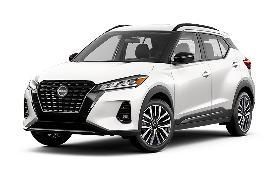
Nissan Kicks | Automatic
SUVor SUV similar
Traveler Tips & Price Insights
When is the best time to book a rental car in Winnipeg?
You should book your rental car approximately 7 days before your trip to get a below-average price.
Price Trend (Last 90 Days)
What is the most popular rental car type in Winnipeg?
suv rental cars (suv or similar) are the most popular option in Winnipeg.
Popular Car Types
Which is the cheapest car rental agency in Winnipeg?
In the last 72 hours, the cheapest rental cars were from Budget at /day.
Average Price by Rental Company
Frequently Asked Questions
What does my SUV hire in Winnipeg through Hola Car Rentals include that other companies don't offer?
Hola Car Rentals is a premium partner of the leading car hire companies in Winnipeg, giving you exclusive access to our All Inclusive+ rate. This rate includes extra benefits that no other company can match:
- Full vehicle coverage with no excess (applies only to certain rates and itineraries)
- Toll cashback: get back up to 5% of your total booking value for tolls charged during your hire
- Premium travel medical assistance for up to 5 passengers in case of emergency, covering up to CAD 200,000 (pre-existing conditions excluded)
- No Extra Charges© guarantee: if the counter charges you for something not listed on your confirmation and not an optional add-on you accepted, Hola Car Rentals will work to remove or reimburse the charge after verification
All at no additional cost, ensuring a unique hire experience with complete protection and peace of mind during your trip in Winnipeg.
Will I face unexpected charges when I hire an SUV in Winnipeg through Hola Car Rentals?
No. With Hola Car Rentals, all costs and charges for your booking in Winnipeg are clearly shown at the time of reservation and in your confirmation email, so you know exactly what you are paying before you arrive at the counter.
On top of that, every Hola Car Rentals booking includes the No Extra Charges© guarantee. This is a pricing guarantee (not insurance) that protects you if the counter in Winnipeg charges you for something that was not listed on your confirmation and was not an optional add-on you accepted. If that happens, Hola Car Rentals will work with the hire partner to remove or reimburse the charge after verification.
The only costs outside this guarantee are:
- Optional add-ons you choose at the counter (GPS, child seats, prepaid fuel)
- Usage-based charges (tolls, fuel shortfall, traffic fines)
Where do I collect my SUV hire at Winnipeg Airport?
Winnipeg James Armstrong Richardson International Airport (YWG) has hire car counters on the ground level car park directly opposite the terminal, where brands such as Avis and Alamo are located. Follow signs from the baggage reclaim area to reach these on-site counters.
Several other companies operate from off-airport lots a short drive away and provide shuttle service to collect you after you land. Key off-airport addresses for your Winnipeg SUV pickup include:
- Fox Rent A Car: 1700 Sargent Ave, Winnipeg MB R3H 0C2
- Driving Force: 1750 Sargent Avenue, Winnipeg MB R3H 0C7
- Dollar and Hertz: 1577 Erin St, Winnipeg MB R3E 2T2
- Budget: 1970 Wellington Ave P1-113A, Winnipeg MB R3H 0E3
For off-airport brands, wait at the designated shuttle stop outside arrivals. Shuttles run during business hours, so if you are arriving late, confirm counter hours with your specific brand before travel. Allow 30 to 60 minutes from landing to driving away in your SUV, accounting for baggage, the shuttle ride, and paperwork.
What are the counter hours for SUV hire locations in Winnipeg?
Counter hours for SUV hire locations in Winnipeg vary by brand and whether the location is at the airport or in the city. Based on available information, typical hours are:
- Fox Rent A Car (Sargent Ave): Monday to Thursday and Friday 8:00 AM to 5:30 PM, Saturday and Sunday 9:00 AM to 5:30 PM
- Driving Force (Sargent Ave): Monday to Friday 7:30 AM to 4:30 PM, closed on holidays
- Budget (Wellington Ave): airport-adjacent location with hours tied to flight schedules
- Avis downtown (234 York Ave): check your booking confirmation for current hours
None of the Winnipeg SUV hire locations listed offer confirmed after-hours collection. If your flight arrives outside business hours, contact your hire brand directly before travel to confirm whether a late collection can be arranged or whether a next-day collection is required.
Your booking confirmation will show the specific counter hours for your chosen brand. Always verify hours around public holidays, as some Winnipeg locations close or reduce service on those days.
Are there toll roads I need to worry about when hiring an SUV in Winnipeg?
No, there are no toll roads in Winnipeg or anywhere in Manitoba. You will not encounter any toll booths, cashless toll lanes, transponder requirements, or congestion charges while driving your SUV hire in Winnipeg or on provincial highways throughout Manitoba.
There are also no emissions zones or city-centre driving fees of any kind in Winnipeg, so your SUV hire costs will not include any toll-related charges from the hire company.
If your trip takes you beyond Manitoba into provinces that do have tolled roads, such as Ontario's Highway 407 (407 ETR), toll charges and any associated hire company processing fees would apply for those portions of your journey. Keep receipts for any tolls paid outside Winnipeg, as Hola Car Rentals includes Tolls Cashback on all bookings, allowing you to claim back up to 5% of your total booking value for tolls paid during your hire period.
What documents do I need to collect my SUV hire in Winnipeg?
To collect your SUV hire in Winnipeg, you must present the following physical documents at the counter:
- A valid, original driver's licence in the main driver's name
- A major credit card with the driver's name printed on the physical card, for the authorisation hold
- A passport or valid government-issued photo ID
- Your booking confirmation or printed voucher
- Round-trip flight or cruise tickets if you are visiting from outside Canada
If your driver's licence uses a non-Latin alphabet, such as Arabic, Chinese, Japanese, or Cyrillic script, you must also carry an International Driving Permit (IDP) alongside your original licence. The IDP is a translation only and is not valid without the original licence.
Visitors from countries whose licences are in English or use a Latin alphabet can generally drive in Winnipeg on their foreign licence without an IDP, though carrying one is always recommended. Obtain your IDP in your home country before travelling, as it cannot be issued abroad.
All documents must be physical originals. Digital copies or photos on a phone are not accepted at any Winnipeg SUV hire counter.
How much is the security deposit for an SUV hire in Winnipeg?
When you collect your SUV hire in Winnipeg, the hire company will place a temporary authorisation hold on your credit card as a security deposit. For Canada, typical holds range from GBP 200 to GBP 300, though some Winnipeg locations may require a minimum authorisation of approximately GBP 400, particularly for larger SUV classes.
The hold is not a charge. It temporarily reduces your available credit and is released after you return the vehicle with no outstanding charges. Your bank controls how quickly the hold disappears from your statement, which can take up to 15 business days after the hire ends.
- You must present a physical, major credit card in the main driver's name with the name printed on the card
- Debit cards, prepaid cards, and virtual cards are not accepted for the deposit
- Bring a backup credit card in case your primary card is declined
- Notify your bank of your travel plans to prevent fraud blocks on the authorisation
The exact hold amount for your Winnipeg SUV hire is set by the hire company at the counter and may vary by brand, vehicle class, and season.
Does hiring an SUV at Winnipeg Airport cost more than hiring downtown?
Yes, hiring an SUV at Winnipeg Airport typically costs more than hiring from a downtown or off-airport location in Winnipeg, due to mandatory airport-related fees that apply at the terminal.
Airport SUV hires at Winnipeg James Armstrong Richardson International Airport (YWG) include fees that off-airport locations do not charge, such as:
- Airport concession recovery fee: approximately 10% of the base rate
- Customer facility charge: approximately 8%
- Manitoba retail sales tax (RST): 8% applied to the total including fees
These add-ons can total roughly 26% above the base rate for an airport SUV pickup in Winnipeg. Off-airport locations on Sargent Avenue, Erin Street, or Wellington Avenue avoid the concession fee, which can represent savings of 15% to 25% on the overall hire cost.
The trade-off is convenience. Airport counters or shuttles are immediately accessible after you land, while off-airport locations require a taxi or rideshare to reach them. Your booking confirmation will show which fees are included in your prepaid rate and which are due at the Winnipeg counter.
Is third-party liability insurance included with my SUV hire in Winnipeg?
Yes, basic third-party liability insurance is included by law with every SUV hire in Winnipeg. Canadian provincial law requires all hire vehicles to carry statutory third-party liability cover, so this protection follows the car automatically when you hire in Winnipeg through Hola Car Rentals.
This statutory cover meets the minimum required by Manitoba law. However, if you want higher liability limits for greater financial protection while driving your SUV in Winnipeg, you can add supplementary liability insurance (LIS/ALI/SLI) at the counter. This covers bodily injury and property damage you may cause to other people or their vehicles beyond the statutory minimum.
It is important to understand what each cover does:
- Statutory liability (included): covers third parties up to the provincial minimum
- Supplemental liability (optional add-on): increases the limit, often up to US$300,000
- CDW/LDW (separate): covers damage to the hire SUV itself, not third parties
Review your booking confirmation to confirm which coverages are included in your Winnipeg SUV rate before you arrive at the counter.
Can I get tolls cashback on my SUV hire in Winnipeg?
Yes, Tolls Cashback is included on all Hola Car Rentals bookings, including your SUV hire in Winnipeg. Because Manitoba has no toll roads, you will not pay any tolls while driving your SUV within Winnipeg or anywhere in the province.
However, if your trip takes you into neighbouring provinces where toll roads exist, such as Ontario's Highway 407 (407 ETR), you can claim back up to 5% of your total booking value for tolls paid during the hire period.
To claim your Tolls Cashback after returning your Winnipeg SUV hire:
- Email [email protected] within 30 days of returning the vehicle
- Use the subject line: Tolls Cashback - HOLA followed by your confirmation number
- Attach your Hola Car Rentals booking confirmation, the signed hire agreement, and a receipt or statement showing the toll charges paid
Refunds are issued to the original payment method used for your reservation and typically process within 7 to 10 business days after approval. Late submissions received after 30 days are not accepted.
What is the fuel policy for SUV hires in Winnipeg?
The standard fuel policy for SUV hires in Winnipeg is Full-to-Full. You receive the SUV with a full tank and must return it full to avoid additional charges.
At pickup, check the fuel gauge with the agent and confirm the starting level is recorded on your hire agreement. Take a photo of the dashboard showing the gauge and odometer before leaving the Winnipeg counter.
At return, refuel within approximately 15 km of the return location so the gauge does not drop below full during the drive back. Keep your final fuel receipt showing the date, time, and station address.
If you return the SUV in Winnipeg with less than a full tank, the hire company may charge:
- A fuel shortfall at the partner's refuelling rate, which is typically higher than the pump price
- A refuelling service or administrative fee on top of the fuel cost
Manitoba's retail sales tax (RST) applies to fuel charges, so returning the SUV full is always the most cost-effective option. Some Winnipeg counter locations may offer a prepaid fuel option; if you accept it, any unused fuel is generally non-refundable.
Do I need an International Driving Permit to hire an SUV in Winnipeg?
It depends on your licence. For most visitors hiring an SUV in Winnipeg, a valid foreign driver's licence is sufficient. Canada accepts licences from countries that participated in the 1949 Geneva Convention on Road Traffic, as well as licences from the United States and many other nations.
An International Driving Permit (IDP) is required in Winnipeg if your driver's licence uses a non-Latin alphabet, such as:
- Arabic script
- Chinese or Japanese characters
- Cyrillic (Russian) script
In these cases, the IDP serves as an official translation and must be carried alongside your original licence at all times. The IDP is a translation only and will not be accepted without the original licence.
Even if your licence is in a Latin alphabet, carrying an IDP is recommended as a precaution, particularly if your licence is not in English. Obtain your IDP in your home country before travelling to Winnipeg, as it cannot be issued once you have left your country of licence.
All documents presented at the Winnipeg SUV hire counter must be physical originals. Digital copies are not accepted.
Can I add an additional driver to my SUV hire in Winnipeg?
Yes, you can add an additional driver to your SUV hire in Winnipeg, either as part of your rate or for a fee paid at the counter.
Check your booking confirmation first. If your rate includes an additional driver, it will be stated explicitly. If it is not included, the daily fees for Winnipeg SUV hires vary by brand:
- Avis, Budget, and Payless: GBP 10 per hire day plus taxes, capped at GBP 50 plus taxes
- Hertz, Thrifty, and Dollar: GBP 11 per hire day plus taxes, capped at GBP 150 plus taxes
- Alamo, National, and Enterprise: GBP 12 per day plus taxes, with no stated cap
The additional driver must be present at the Winnipeg counter at pickup with their own valid driver's licence and any required documents, including an IDP if their licence uses a non-Latin alphabet. They must sign the hire agreement to be covered by the vehicle's protections such as CDW/LDW.
For Avis, Budget, and Payless, the additional driver must be at least 25 years old at the time of pickup. Anyone who drives the SUV in Winnipeg without being listed on the agreement is not covered, and protections may be voided.
What winter driving rules affect my SUV hire in Winnipeg?
Winnipeg has specific winter regulations that directly affect SUV hire drivers, particularly around snow events and residential street access.
Rotating residential parking bans are enforced across designated zones (labelled A through V) during and after snowfall. These bans typically run for approximately 48-hour periods and require all vehicles, including hire SUV units, to be removed from residential streets. Violations are detected automatically using Automated Licence Plate Recognition (ALPR) cameras, and fines are approximately GBP 150 per violation.
Key points for SUV hire drivers in Winnipeg during winter:
- Monitor active snow ban zones before parking on any residential street
- Overnight parking on designated winter routes is generally permitted but suspended during active bans
- Large SUV vehicles face a one-hour maximum on-street parking limit citywide, even outside snow ban periods
- Residential driveways have restrictions on the number of large vehicles permitted
Winnipeg winters are severe, and an SUV with all-wheel drive is a practical choice for the conditions. However, being aware of these bylaws will help you avoid unexpected fines during your Winnipeg hire.
Does travel assistance cover me during my SUV hire in Winnipeg?
Travel assistance provided by Terrawind Global Protection is included with most Hola Car Rentals bookings. However, this benefit does not apply to residents of Canada or the United States. If you are visiting Winnipeg from outside North America and hiring an SUV here, you are likely eligible for this cover.
If you experience a medical emergency, accident, or other covered event while driving your SUV in Winnipeg or on Manitoba roads, the travel assistance benefit typically includes:
- Medical cover for up to 5 passengers
- Legal assistance in the event of an accident
- Compensation for baggage lost by the airline
- Flight cancellation insurance
To activate assistance during your Winnipeg SUV hire, contact Terrawind 24 hours a day, 7 days a week:
- Phone (toll-free or collect): +1 888 980 9992
- WhatsApp: +1 208 910 1001
- Email: [email protected]
Provide your full name, your Hola Car Rentals confirmation number (format: HOLA followed by your number), your current location in Winnipeg, and a description of the situation. This cover does not replace CDW/LDW for damage to the SUV itself.

- Choosing a selection results in a full page refresh.
- Opens in a new window.
Suggested Currencies
- $ USD - United States Dollar
- € EUR - Euro
Other Countries
-
 Albania
-
 Algeria
-
 Andorra
-
 Angola
-
 Antigua & Barbuda
-
 Argentina
-
 Australia
-
 Austria
-
 Bahamas
-
 Bahrain
-
 Bangladesh
-
 Barbados
-
 Belgium
-
 Belize
-
 Benin
Benin
-
 Bermuda
-
 Bolivia
-
 Bosnia & Herzegovina
-
 Botswana
-
 Brazil
-
 British Virgin Islands
-
 Bulgaria
-
 Burkina Faso
-
 Burundi
-
 Cameroon
-
 Canada
-
 Cape Verde
-
 Cayman Islands
-
 Central African Republic
-
 Chad
Chad
-
 Chile
Chile
-
 Colombia
-
 Comoros
-
 Congo - Brazzaville
-
 Congo - Kinshasa
-
 Costa Rica
-
 Côte d’Ivoire
-
 Croatia
-
 Curaçao
-
 Cyprus
-
 Czechia
-
 Denmark
-
 Djibouti
-
 Dominica
-
 Dominican Republic
-
 Ecuador
-
 Egypt
Egypt
-
 El Salvador
-
 Equatorial Guinea
-
 Eritrea
-
 Estonia
-
 Eswatini
-
 Ethiopia
-
 Finland
-
 France
-
 Gabon
Gabon
-
 Gambia
-
 Germany
-
 Ghana
Ghana
-
 Greece
-
 Grenada
-
 Guatemala
-
 Guinea
-
 Guinea-Bissau
-
 Guyana
-
 Haiti
Haiti
-
 Honduras
-
 Hong Kong SAR
-
 Hungary
-
 Iceland
-
 India
India
-
 Iraq
Iraq
-
 Ireland
-
 Israel
-
 Italy
Italy
-
 Jamaica
-
 Japan
Japan
-
 Jordan
-
 Kenya
Kenya
-
 Kuwait
-
 Latvia
-
 Lebanon
-
 Lesotho
-
 Liberia
-
 Libya
Libya
-
 Liechtenstein
-
 Lithuania
-
 Luxembourg
-
 Madagascar
-
 Malawi
-
 Mali
Mali
-
 Malta
Malta
-
 Mauritania
-
 Mauritius
-
 Mexico
-
 Moldova
-
 Monaco
-
 Montenegro
-
 Morocco
-
 Mozambique
-
 Namibia
-
 Netherlands
-
 New Zealand
-
 Nicaragua
-
 Niger
Niger
-
 Nigeria
-
 Norway
-
 Oman
Oman
-
 Palestinian Territories
-
 Panama
-
 Paraguay
-
 Peru
Peru
-
 Philippines
-
 Poland
-
 Portugal
-
 Qatar
Qatar
-
 Romania
-
 Russia
-
 Rwanda
-
 San Marino
-
 São Tomé & Príncipe
-
 Saudi Arabia
-
 Senegal
-
 Serbia
-
 Seychelles
-
 Sierra Leone
-
 Singapore
-
 Sint Maarten
-
 Slovakia
-
 Slovenia
-
 Somalia
-
 South Africa
-
 South Korea
-
 South Sudan
-
 Spain
Spain
-
 St. Lucia
-
 St. Vincent & Grenadines
-
 Sudan
Sudan
-
 Sweden
-
 Switzerland
-
 Taiwan
-
 Tanzania
-
 Togo
Togo
-
 Trinidad & Tobago
-
 Tunisia
-
 Türkiye
-
 Turks & Caicos Islands
-
 Uganda
-
 Ukraine
-
 United Arab Emirates
-
 United Kingdom
-
 United States
-
 Uruguay
-
 Vatican City
-
 Venezuela
-
 Yemen
Yemen
-
 Zambia
-
 Zimbabwe
Driving license from:
-
Albania
-
Algeria
-
Andorra
-
Angola
-
Antigua & Barbuda
-
Argentina
-
Australia
-
Austria
-
Bahamas
-
Bahrain
-
Bangladesh
-
Barbados
-
Belgium
-
Belize
-
Benin
-
Bermuda
-
Bolivia
-
Bosnia & Herzegovina
-
Botswana
-
Brazil
-
British Virgin Islands
-
Bulgaria
-
Burkina Faso
-
Burundi
-
Cameroon
-
Canada
-
Cape Verde
-
Cayman Islands
-
Central African Republic
-
Chad
-
Chile
-
Colombia
-
Comoros
-
Congo - Brazzaville
-
Congo - Kinshasa
-
Costa Rica
-
Côte d’Ivoire
-
Croatia
-
Curaçao
-
Cyprus
-
Czechia
-
Denmark
-
Djibouti
-
Dominica
-
Dominican Republic
-
Ecuador
-
Egypt
-
El Salvador
-
Equatorial Guinea
-
Eritrea
-
Estonia
-
Eswatini
-
Ethiopia
-
Finland
-
France
-
Gabon
-
Gambia
-
Germany
-
Ghana
-
Greece
-
Grenada
-
Guatemala
-
Guinea
-
Guinea-Bissau
-
Guyana
-
Haiti
-
Honduras
-
Hong Kong SAR
-
Hungary
-
Iceland
-
India
-
Iraq
-
Ireland
-
Israel
-
Italy
-
Jamaica
-
Japan
-
Jordan
-
Kenya
-
Kuwait
-
Latvia
-
Lebanon
-
Lesotho
-
Liberia
-
Libya
-
Liechtenstein
-
Lithuania
-
Luxembourg
-
Madagascar
-
Malawi
-
Mali
-
Malta
-
Mauritania
-
Mauritius
-
Mexico
-
Moldova
-
Monaco
-
Montenegro
-
Morocco
-
Mozambique
-
Namibia
-
Netherlands
-
New Zealand
-
Nicaragua
-
Niger
-
Nigeria
-
Norway
-
Oman
-
Palestinian Territories
-
Panama
-
Paraguay
-
Peru
-
Philippines
-
Poland
-
Portugal
-
Qatar
-
Romania
-
Russia
-
Rwanda
-
San Marino
-
São Tomé & Príncipe
-
Saudi Arabia
-
Senegal
-
Serbia
-
Seychelles
-
Sierra Leone
-
Singapore
-
Sint Maarten
-
Slovakia
-
Slovenia
-
Somalia
-
South Africa
-
South Korea
-
South Sudan
-
Spain
-
St. Lucia
-
St. Vincent & Grenadines
-
Sudan
-
Sweden
-
Switzerland
-
Taiwan
-
Tanzania
-
Togo
-
Trinidad & Tobago
-
Tunisia
-
Türkiye
-
Turks & Caicos Islands
-
Uganda
-
Ukraine
-
United Arab Emirates
-
United Kingdom
-
United States
-
Uruguay
-
Vatican City
-
Venezuela
-
Yemen
-
Zambia
-
Zimbabwe