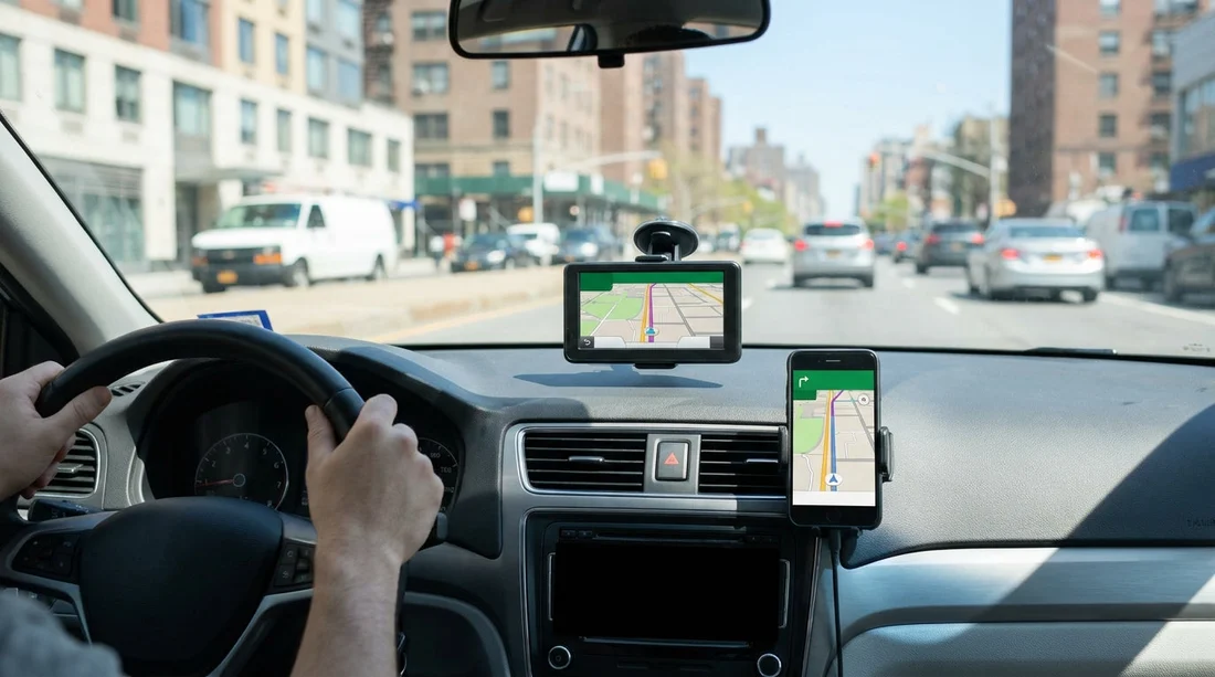
Quick Summary:
- Use your phone if you can download offline maps before pick-up.
- Choose a rental sat nav if you lack US data or roaming.
- Plan routes early, New York interchanges and tolls add pressure.
- Bring a reliable charger, mount, and cable to avoid battery drain.
When you arrange car hire in New York, navigation is one of the add-ons that can feel optional until you hit the first wrong turn, a toll road, or a one-way grid. The choice usually comes down to paying for a rental GPS sat nav, or relying on your smartphone with Google Maps, Apple Maps, Waze, or similar. Both work well in and around New York, but they fail in different ways, and the best pick depends on how comfortable you are managing data, battery, and offline maps before you collect the keys.
If you are collecting your vehicle at an airport, the first 15 minutes matter most, because you are typically leaving a multi-lane road network straight away. If you are comparing pick-up points such as car hire at Newark Airport (EWR) or car hire at New York JFK, plan your navigation approach before you arrive at the counter so you can drive out calmly and confidently.
What you get with a rental GPS sat nav
A rental sat nav is a dedicated device, usually mounted on the windscreen, that provides turn-by-turn directions using preloaded maps and satellite positioning. The main benefit is independence from mobile data. If you are travelling from the UK and do not want to rely on roaming, a sat nav can be reassuring, particularly if your trip includes areas where phone reception is patchy.
Sat navs are most worthwhile when you need predictable navigation for the whole trip without thinking about data plans, offline downloads, or battery management. They are also helpful if multiple drivers will use the car, because a separate device means everyone can keep their own phone available for calls and messages without disrupting navigation.
What you get with smartphone navigation
Using your phone is often the most capable option for New York, especially if you value live traffic, rapid rerouting, and detailed lane guidance. Apps like Google Maps and Waze tend to react quickly to congestion on the Van Wyck Expressway, the BQE, or approach roads to bridges and tunnels. That responsiveness can save time and stress.
The trade-off is dependence on power and connectivity. Navigation with the screen on, brightness high, and constant GPS use can drain a battery quickly. Heat can also become an issue in summer, particularly if the phone sits in direct sun on a windscreen mount. Finally, if your data coverage drops at the wrong moment, you can end up with a frozen map in a complicated interchange.
Offline maps and data needs, what to do before pick-up
If you want your phone to be as reliable as a sat nav, preparation matters. The simplest step is downloading offline maps for New York City and any regions you will drive through. With offline areas stored on your phone, you still get positioning and turn prompts even if mobile data is poor. You may lose live traffic and some dynamic rerouting features, but you will not lose the route entirely.
Confirm your data plan. If you are using roaming, verify whether navigation data is included and whether there is a fair use limit. If you are buying a US eSIM, activate it ahead of time so it works as soon as you land.
Cache key destinations. Search and save your hotel, parking garage, or drop-off point in the app while on Wi-Fi. This helps even if coverage is weak later.
Know what needs data. Offline maps handle base navigation, but live traffic, hazard reports, and many alternate-route suggestions depend on data. If you are aiming to avoid rush hour delays, data access is the difference between good and excellent guidance.
New York specific factors that influence your choice
1) Tolls and route choices. New York area driving includes toll bridges, tunnels, and express lanes. Phone apps are usually clearer at showing toll impacts and offering alternatives. If you are cost-sensitive, check that your chosen navigation app is set to avoid tolls when appropriate, but remember that avoiding tolls can add significant time and complexity.
2) Dense street grids and one-way patterns. Manhattan and parts of Brooklyn and Queens have frequent one-way streets and restricted turns. Phone navigation tends to provide more immediate, detailed instructions, and faster rerouting if you miss a turn.
3) Airport exits and fast lane changes. Leaving JFK or Newark can involve multi-lane exits and quick merges. Clear audio prompts and lane guidance matter here. If you are collecting a vehicle via Enterprise car hire at JFK, set the first destination before you leave the car park so the device can guide you from the first junction.
4) Parking and final approach. The last half-mile is often the hardest, due to bus lanes, loading zones, and entrances that are easy to miss. Smartphone apps with street-level context and up-to-date points of interest usually help more than older sat nav map databases.
Cost and value, when the add-on makes sense
A rental GPS fee can add up over a week, so the value depends on how much it reduces risk and stress for you. If you already have a solid data plan, a good phone mount, and the discipline to download offline maps, your phone is normally the better value.
Practical setup tips for either option
Bring the right charging kit. A USB-A or USB-C car charger with enough power for modern phones is essential. Use a quality cable that does not disconnect easily when you turn the wheel or adjust the mount.
Plan the first destination at standstill. Whether you use a sat nav or phone, set the initial route while parked at the rental location.
If you are picking up at Newark and want a larger vehicle for family luggage, options like SUV rental at Newark EWR can be practical. Larger vehicles can make tight turns and kerbside manoeuvres feel more demanding, so choose the navigation approach that gives you the clearest lane guidance and earliest prompts.
If you prefer to keep costs low, you can also compare providers at the airport, such as Thrifty car rental at Newark EWR, and confirm whether a sat nav add-on is available and priced per day or per rental.
FAQ
Is a rental GPS sat nav necessary for car hire in New York? It is not necessary for most travellers if your phone has reliable data or offline maps downloaded. A sat nav is most useful when you cannot depend on roaming or you want a dedicated device.
Will offline maps work in New York without mobile data? Yes, offline maps typically still provide GPS positioning and turn-by-turn directions. You may lose live traffic updates and some automatic rerouting options until you reconnect.
How much mobile data does phone navigation usually use? It varies by app and trip length, but continuous navigation with live traffic can use noticeable data over several days. Downloading offline maps and limiting background app activity helps reduce usage.
Do bridges and tunnels affect GPS accuracy? Briefly, yes. GPS can lag in tunnels or under dense structures, then recover quickly after. Keeping your route set in advance and following lane signs through the tunnel section helps.
What is the safest way to set up navigation when leaving JFK or Newark? Set your destination and confirm the first few turns while parked, then rely on voice guidance. Avoid handling the phone while driving, and ensure the device is securely mounted and charging.